Today it was up one side of Mount Sutro and down the other. I like to vary my excursions in the Forest Knolls 'hood and Mount Sutro Openspace Reserve (first two pix, taken from Mount Davidson Park). Sometimes I descend the long Oakhurst stairway (today got a count of 353 steps, Warren to Crestmont), and sometimes up it all the way, to then continue into the forest.
So off the bus at 7th Ave. & Lawton in the Inner Sunset to start the long trek up, crossing the street, passing the entrance to Garden for the Environment, and uphill to Warren (not Locksley: this is not through).
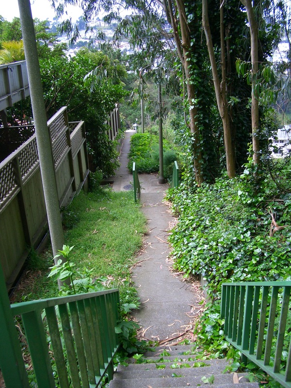
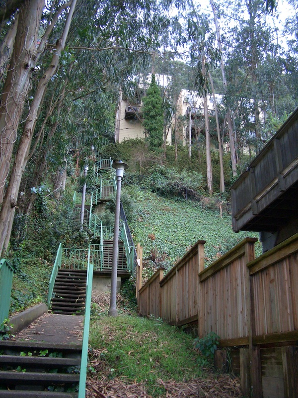
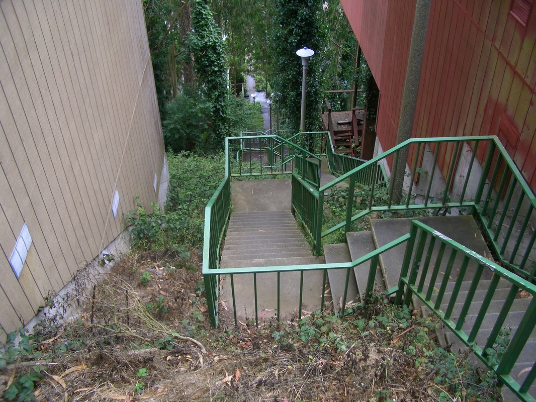
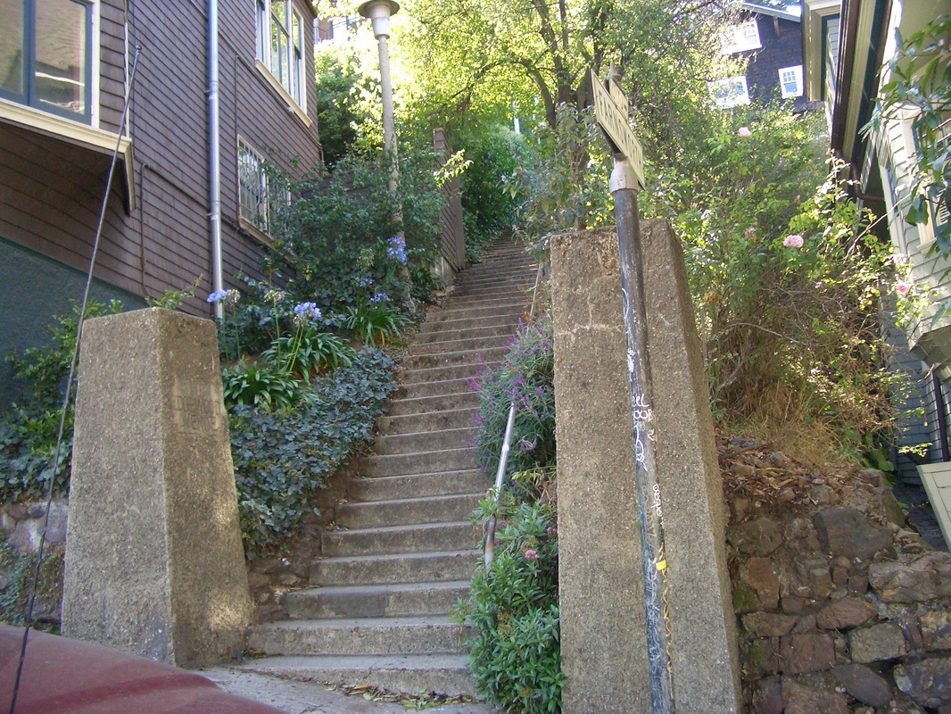
Several steepish blocks along winding Warren you'll see the foot of the Oakhurst stairway ascending to your left, set back slightly between two buildings. (Next four pix. First of these taken near a short sidewalk that connects with Oak Park's east end).
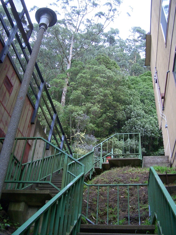
One trail into the forest from Crestmont starts up just to the west of the top of Oakhurst (seventh pic). These secondary trails don't have trailmarkers on Crestmont like they do higher up on the main forest trails.
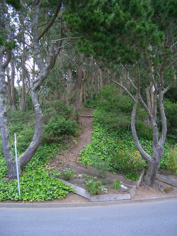
However, this time turned right to look for another short-but-steep minor trail up from Christopher. Several blocks east, curvaceous Crestmont meets Christopher.
The last time I took this particular one, a few years ago, kinda slid down part of it. I'd like to see some steps and a trailmarker here and where the other steepish trails climb up from Crestmont.
So curving around on Crestmont, past Devonshire, and just past the top of the Blairwood stairway, saw a trail and scrambled up, thinking this was the one. Turned out not to be the trail I'd been seeking, and one not taken before. Upon reaching the top of it, started down before I realized I wasn't quite on the main trail but on an offshoot just below it.
So back to the main trail and on a bit further, then there was the "Historic Trail" / "Christopher St." marker I'd been looking for (with homes seen below on Christopher). This trail is east of the top of the Glenhaven stairway.
From the Historic Trail, continued to the summit on the South Ridge Trail. An excellent map on the summit bulletin board near the meadow/benches very clearly depicts both these short-but-steep secondary trails up from Christopher and the one near the top of Oakhurst that I've taken most often into the forest. The map shows all the stairways, main and secondary trails, and streets in the area. Will ascend the other scrambler next time.
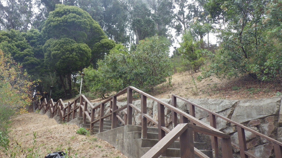
Down from the summit on the East Ridge Trail, crossing upper Medical Center Way, chose the Edgewood Trail out to the south dead-end (for vehicles) of Edgewood Ave. Cars can get up to Edgewood midway along the redbricked street via Belmont, a short street that turns onto Edgewood from Woodland or Willard, uphill from Parnassus. I'd take any of the (large) woodsy homes along Edgewood, but my favorite in the 'hood is the big brown one partway down the Farnsworth stairway (149 steps).
The next couple of pix seek to encourage hikers up from the north/northeast slopes: the two main stairways to access the forest trails. First, the "hidden" steps (135 or so) whose foot on lower Medical Center Way can be found a little way behind the UCSF hospital buildings that front on Parnassus. This one will take you up to a permits-only parking lot near the trails.
Second, the Farnsworth Lane stairway that climbs from Willard to Edgewood Ave. There are two trailheads into the park from Edgewood, one directly across from the top of the Farnsworth stairs at Edgewood's north end.
Last pic: Trailhead for the Edgewood Trail at Edgewood Avenue's south end, the one I took today.
If you choose to trek steeply up Stanyan to where it meets upper 17th Street, the newer trailhead for the (lower) Historic Trail is easily seen between homes on the west side of Stanyan. Today was looking down from the Edgewood Trail to the lower Historic.
Bicycles are allowed on all of Mount Sutro's trails.
So off the bus at 7th Ave. & Lawton in the Inner Sunset to start the long trek up, crossing the street, passing the entrance to Garden for the Environment, and uphill to Warren (not Locksley: this is not through).
Several steepish blocks along winding Warren you'll see the foot of the Oakhurst stairway ascending to your left, set back slightly between two buildings. (Next four pix. First of these taken near a short sidewalk that connects with Oak Park's east end).
One trail into the forest from Crestmont starts up just to the west of the top of Oakhurst (seventh pic). These secondary trails don't have trailmarkers on Crestmont like they do higher up on the main forest trails.
However, this time turned right to look for another short-but-steep minor trail up from Christopher. Several blocks east, curvaceous Crestmont meets Christopher.
The last time I took this particular one, a few years ago, kinda slid down part of it. I'd like to see some steps and a trailmarker here and where the other steepish trails climb up from Crestmont.
So curving around on Crestmont, past Devonshire, and just past the top of the Blairwood stairway, saw a trail and scrambled up, thinking this was the one. Turned out not to be the trail I'd been seeking, and one not taken before. Upon reaching the top of it, started down before I realized I wasn't quite on the main trail but on an offshoot just below it.
So back to the main trail and on a bit further, then there was the "Historic Trail" / "Christopher St." marker I'd been looking for (with homes seen below on Christopher). This trail is east of the top of the Glenhaven stairway.
From the Historic Trail, continued to the summit on the South Ridge Trail. An excellent map on the summit bulletin board near the meadow/benches very clearly depicts both these short-but-steep secondary trails up from Christopher and the one near the top of Oakhurst that I've taken most often into the forest. The map shows all the stairways, main and secondary trails, and streets in the area. Will ascend the other scrambler next time.
Down from the summit on the East Ridge Trail, crossing upper Medical Center Way, chose the Edgewood Trail out to the south dead-end (for vehicles) of Edgewood Ave. Cars can get up to Edgewood midway along the redbricked street via Belmont, a short street that turns onto Edgewood from Woodland or Willard, uphill from Parnassus. I'd take any of the (large) woodsy homes along Edgewood, but my favorite in the 'hood is the big brown one partway down the Farnsworth stairway (149 steps).
The next couple of pix seek to encourage hikers up from the north/northeast slopes: the two main stairways to access the forest trails. First, the "hidden" steps (135 or so) whose foot on lower Medical Center Way can be found a little way behind the UCSF hospital buildings that front on Parnassus. This one will take you up to a permits-only parking lot near the trails.
Second, the Farnsworth Lane stairway that climbs from Willard to Edgewood Ave. There are two trailheads into the park from Edgewood, one directly across from the top of the Farnsworth stairs at Edgewood's north end.
Last pic: Trailhead for the Edgewood Trail at Edgewood Avenue's south end, the one I took today.
If you choose to trek steeply up Stanyan to where it meets upper 17th Street, the newer trailhead for the (lower) Historic Trail is easily seen between homes on the west side of Stanyan. Today was looking down from the Edgewood Trail to the lower Historic.
Bicycles are allowed on all of Mount Sutro's trails.
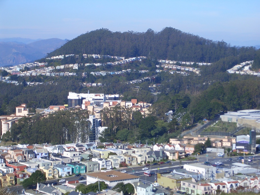
Mount Sutro/Forest Knolls from Mount Davidson Park
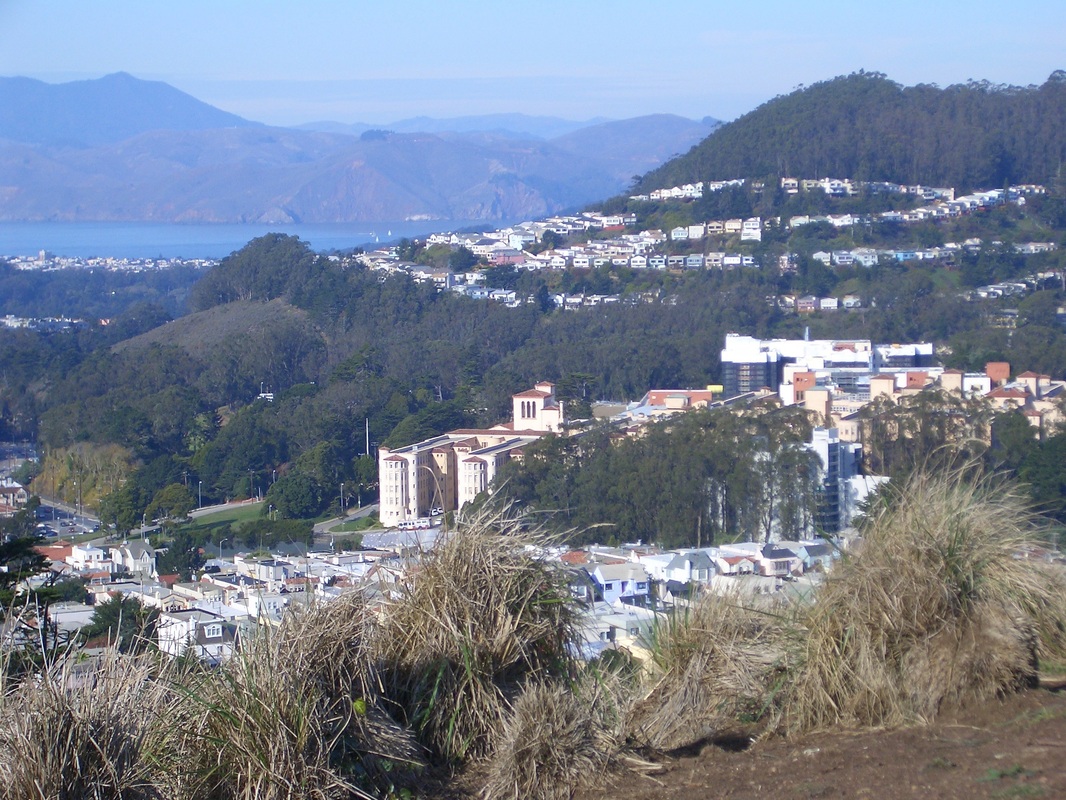
Mount Sutro / Forest Knolls from Mount Davidson Park
Partway up Oakhurst Lane stairway, Forest Knolls
Oakhurst stairway, Forest Knolls
Top of Oakhurst stairway
Top of Oakhurst stairway
Secondary trail up from Crestmont into Sutro Forest
Stairway up from lower Medical Center Way behind UCSF medical buildings
Foot of Farnsworth Lane stairway at Willard
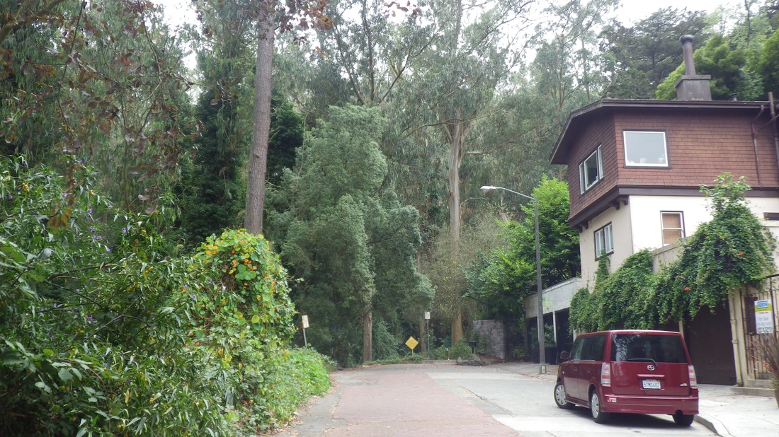
Trailhead for Edgewood Trail at south end of Edgewood Ave.
 RSS Feed
