Stairways are Heaven
  • Home
  • About Me
  • Stairways are Heaven

The Old Ranch Road

9/30/2011

0 Comments


Timed myself this afternoon to once again check how long it takes to walk from the Crocker-Amazon ‘hood bus stop where I disembark the #43 up to the Crocker Ave. trailhead for San Bruno Mountain Park: from 11:54 to 12:26 p.m., about the same as before. I’m a slow walker, however, and my knees were sore from yesterday’s long hike -- and this is all uphill as well.

Stayed on the paved Old Guadalupe Trail for once all the way to the Meadow/picnic area. One little snake crossed this trail in front of me today, and I saw three different kinds of butterflies. Sunny but not too hot, with a little breeze.

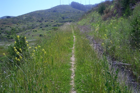
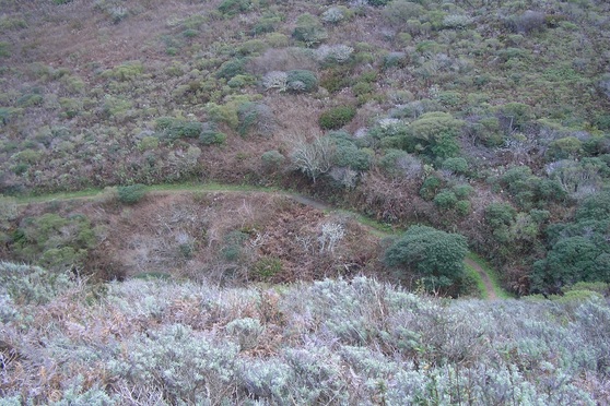
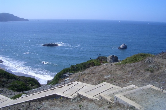
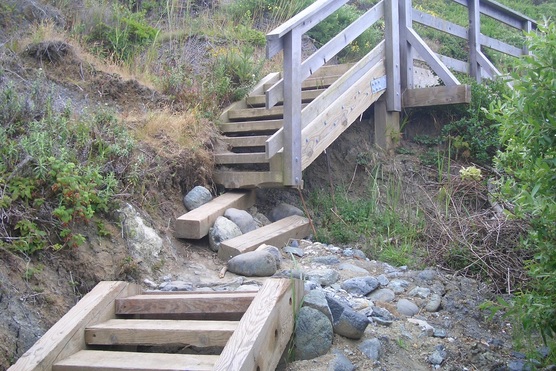
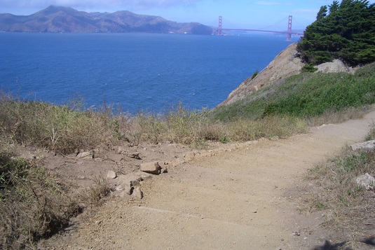
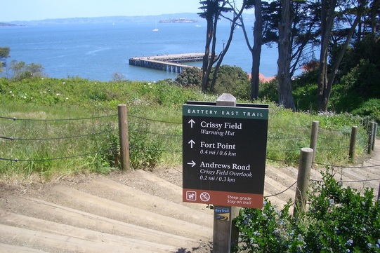
Hadn’t done the Old Ranch Road Trail in a while (first pic, near the trailhead). This is always an up ‘n back for me. The trail comes out at Carter & Guadalupe Canyon Parkway, but these are busy highways and I prefer to stay in the park.

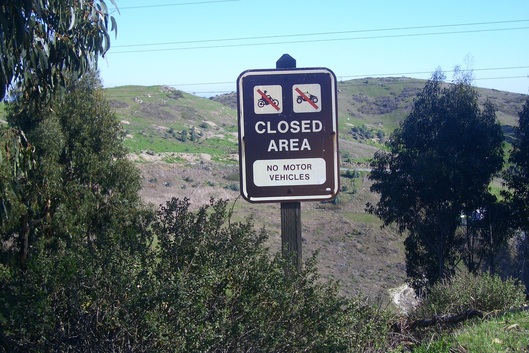
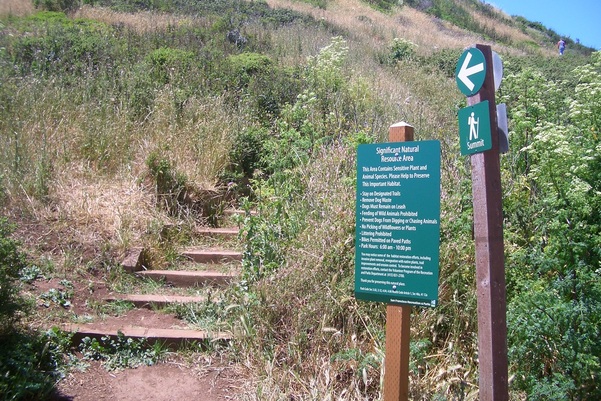
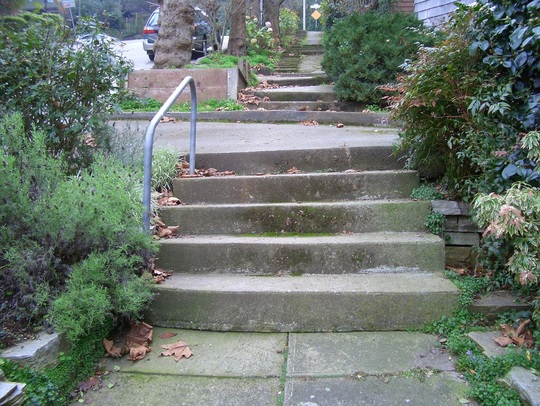
At the end of the trail is this sign (second photo). Does this look like from the 1930s?

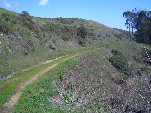
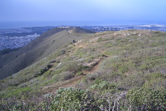
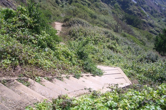
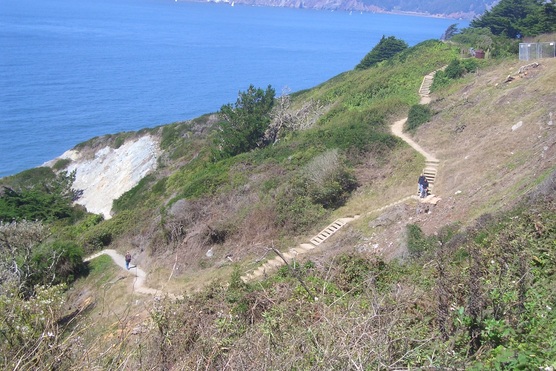
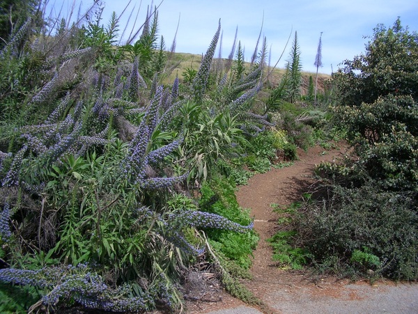
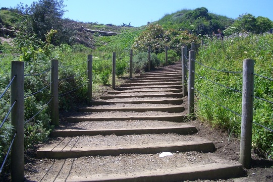
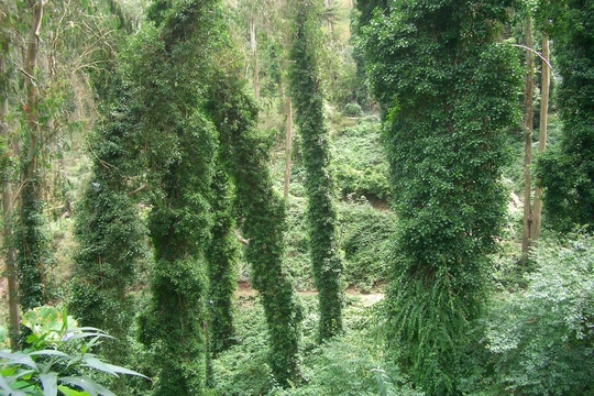
Part of the trail is sun-dappled below Eucalyptus trees, and part out in the open. The highway is not far above the trail (third pic).


Picture
Old Ranch Road Trail
Picture
Picture
Old Ranch Road Trail
0 Comments

Climbing, Winding and Slogging thru Sand

9/29/2011

0 Comments

 
Hadn’t hiked the westside Presidio trails above Baker Beach in a while, up to the trailhead for the Sand Ladder at Lincoln. 

Whatta change from yesterday’s heat, today being foggy and cool with a refreshing breeze. This started out as a vigorous uphill trek, guaranteed to warm one up quickly on a chilly day. 

Began the long hike at California & 25th Ave. A couple blocks north and a right turn will take you into the vast Presidio’s westside. Below Lincoln (and the north trailhead for the Lobos Creek Trail) is Gibson which will take you down to Baker Beach west.

Stayed on trails just above the beach until reaching the first beach stairway (first pic). Here chose a thick-sand trail that shortly ascended to a main trail. At Lincoln climbed over the auto barrier and crossed over to the Connector Trail. Headed up its 208 steps (second pic), pausing for a moment on the dedicated log bench with the inscription “Happy Trails Forever."

At Immigrant Point at the top of the stairway, crossed to climb the short Anza Trail stairway, then back down to head east on Compton, across from the residences. Passed the West Washington Neighborhood Community Garden which is out in the open for all to walk by and admire (next to a fenced kids’ playground and near the old wine bunker).

At the east end of these residences one of my favorite forested trails meanders along below Washington Blvd.

Out at Park Blvd. chose to continue east past one of the Amatury Loop stairways (third foto), now on the Bay Area Ridge Trail. Just above, on the south side, is another residential area and below is a beautiful wild forested area. This trail will take the hiker directly out to the Cemetery Overlook.

Continued curving round on Washington, then onto Arguello, past the Spire on my right and eventually Inspiration Point Overlook on my left, mostly walking in the bike lane. Back on the Bay Area Ridge Trail, shortly exited the park at the Arguello Gate.


Picture
Steps down to Baker Beach
Picture
Connector Trail, Immigrant Point to Lincoln
Picture
Amatury Loop upper stairway
0 Comments

Now Where was that Old Trail? -- Mount Sutro

9/28/2011

0 Comments

 
There was a steepish trail I used to scramble up from somewhere on Crestmont in the Forest Knolls ‘hood into Sutro Forest before the trails up here were as well maintained as they are now. Today upon reaching the top of the long Oakhurst stairway at Crestmont (first pic), turned left to look for it. It’s marked on the Sutro Stewards trails map as a steep grade and the Crestmont trailhead.

Yep, this is the one and I do have a 2007 photo of this trailhead up on Webshots. There are a few steps at the foot and now there’s a marker partway up. This is the now called the West Ridge Trail. It’s steep and a beauty. After this first trail marker it continues up. This upper part I’d ascended much more recently; you’ll squeeze by some big rocks. At the top of this the summit is very close.

On the way up the Oakhurst steps from Warren (second pic), upon reaching the dead-end of Oak Park partway up, could see and hear construction still ongoing nearby. Was something recently demolished here and a new home now being built? Don’t remember what was here before. Better just one new home than a bunch of ‘em though. Don’t be messin’ with our mountains, developers.

Hot today to be doing this. Took the East Ridge Trail down from the summit, then continuing to descend from Medical Center Way (first via the Fairy Gates Trail: third pic), continued on the lower Historic Trail out to Stanyan.

Picture
Top of Oakhurst Stairway, Forest Knolls
Picture
Foot of Oakhurst stairway at Warren, Forest Knolls
0 Comments

Summit-Time and the Fog Stayed Away

9/23/2011

0 Comments

 
After the usual Old Guadalupe and Bog Trails from the Crocker Ave. trailhead into San Bruno Mountain Park, I noticed that the west Summit Loop Trail was still closed. First and second pics: the Summit Loop west from earlier hikes.

This closure was from last rainy season and is at April Creek, about a mile in from the trailhead. And here it is nearly rainy season again. I have no idea what it looks like these days. Is this trail to stay permanently closed to hikers? Shame cuz it’s such a striking beauty, long and winding up to the summit on the west side of the mountain. One of my favorite trails. Wish they could build a sturdy footbridge here so heavy rains wouldn’t flood the trail. 

I therefore did the Summit Loop north. After sitting for a few moments admiring the view on a log beneath the towers up here, descended the same way I came up (third pic, down from the summit). On the way down, the Summit Loop connects with the Dairy Ravine Trail, then the Dairy Ravine connects with the Eucalyptus Loop Trail.

Beautiful view today and quite warm. The fog was approaching from the west/ocean, but slowly, and just starting to cover the Lake Merced area when I was up there. 

Picture
Summit Loop Trail west
Picture
Summit Loop West near the summit
Picture
North Summit Loop Trail meets the Ridge Trail near the summit.
0 Comments

Lobos Creek Overlook to the Bridge

9/18/2011

0 Comments

 
Commenced today’s Presidio hike at the 15th Ave. Gate and onto the Anza trail and Lobos Creek Valley Overlook where the difference around here from just a few months ago is amazing. 

The various plants along the trail, hillside, and into the Lobos Creek Valley are really looking good these days. Go check this area out if you haven’t seen it in a while. Give the Batteries to Bluffs Trail a few months and it’ll be just as gorgeous.

Continued uphill on Battery Caulfield Rd. to Immigrant Point Overlook and down the 208 Connector Trail steps to Lincoln, where I crossed over to the trail that descends to Battery Crosby and the west trailhead for the Batteries to Bluffs.

Today demanded a recount of myself and got the more usual 470-ish steps as the total for the BTB this time. Must’ve been overly distracted yesterday from the steady stream of people trekking up and down. 

Picture
East side, Sept. 17, 2011
Picture
Sept. 17, 2011
Picture
East side, Sept. 17, 2011
0 Comments

I Miss the Trees!

9/17/2011

0 Comments

 
My first impression was that there’s now way too much dry grass, brown earth, and tree stumps along the Batteries to Bluffs Trail after its several-week renovation. It looks so bare right now in some places. But we’ll see how it looks once rainy season has arrived and when the native plants they’re planning have taken hold.

A large number of trees have been removed from alongside the trail and on the hillsides above (see first two pix -- east and west sides respectively). Excellent view from above on Lincoln. They’ve cleared the trail of encroaching plants along the route, which was expected.

The alternate trail down from Lincoln I sometimes take was still closed off. Since my last visit west trailhead Battery Crosby’s walls have received some brightly colored graffiti.

Though adding some stair rails had been mentioned, none were in evidence today. Not that I care. I’d just as soon see it left the way it is so as not to disturb the lizards and other wildlife down here more than has been already.

Got a count of 482 steps this time but not sure just where these few extra steps have been added. My highest previous count was about 478. Will do recounts. Surprised that the footbridge steps on the west side didn’t get repaired during the trail’s renovation; there may still be plans to do so. As of this writing it still looks this way: see third photo.

Did the Marshall’s Beach Trail down and back up as well and still got around 48 steps as previously. It didn’t look like any changes had been made around there. But one of the most dramatic changes is where the main trail meets the Marshall’s Beach Trail -- a lot of tree removal around here. One can now see the little creek really well.

Picture
East side: September 17, 2011
Picture
West side: September 17, 2011
Picture
The Footbridge on the west side, summer 2011
0 Comments

Foggy-Windy-Chilly

9/16/2011

0 Comments

 
Hadn’t exited Twin Peaks Park at its south edge in a while, so for a change headed this way on the trail next to Twin Peaks Blvd. (on the other side of the auto barrier) after the usual climb up from the Crestline trailhead: first pic.

Second pic: Sutro Tower as seen from the park. Today was superfoggy up here and not a good viewday.

From this level of Twin Peaks Blvd. you can look below to a lower part of the circling Blvd. There are 40 steps down: wide, wooden, widely spaced, and coming out directly across the street from this south exit.

There’s now one of those green “Significant Natural Resources” signs at the top (a dead-end for vehicles) of Midcrest Way. The third photo is of this short trail up into the park. It can be seen on Google Maps. Steep Midcrest descends to Panorama,Twin Peaks Blvd. (again), and Portola. The first cross-street down is Cityview.

From Portola, down Woodside, and up Idora to Laguna Honda Blvd. to wait for the #43 to wind down from Mount Davidson.

The Presidio’s Batteries to Bluffs Trail is to reopen tomorrow (Saturday). An e-letter received today from http://www.parksconservancy.org describes improvements going on in this part of the park.

First, regarding the Batteries to Bluffs:

“… Trail work may occur in October. This work’s impact on trail access is still being determined. Invasive tree and cape ivy removal in the bluffs will continue into early October. The area will be replanted with local native plant species in the winter.”

And the ongoing construction on Lincoln:

“Improvements to Lincoln Boulevard, including the installation of new in-road bicycle lanes and two new crosswalks ... This work will entail a temporary pedestrian trail detour and intermittent one-way road closures through Spring 2012. As the roadside trail is closed, pedestrians are asked to use the marked detour through Fort Scott. Bicycle access on Lincoln will continue, with an alternative route marked through Fort Scott. Bicyclists should be aware of varying road surfaces through the area, particularly as they go downhill. Motorists are encouraged to “share the road” and slow down. Staff and signage with detour information will be on site to help visitors get around the park. You can also go to http://www.parksconservancy.org/assets/tf-assets/tf-pdfs-docs/2011_pct_p1_detour_map_824.pdf for a copy of the detour map. 

… Construction of the New Golden Gate Overlook and Multi-Use Trail from Merchant Road Parking Lot Continues Through Spring 2012. Construction of the new overlook … will require the closure of the area just south of Langdon Court. Fencing is in place and a pedestrian route is marked. A new trail will also be constructed. This portion of the project requires an extension of the Langdon Court parking area closure into a portion of the Merchant Road parking lot. … “ 


Picture
Crestline trailhead into the park
Picture
Sutro Tower from Twin Peaks Park
Picture
Short trail at top of Midcrest Way into Twin Peaks Park
0 Comments

Lands End: Always a Good Workout

9/14/2011

0 Comments

 
Near the east trailhead for the Coastal Trail just beyond the Eagle’s Point viewspot, a couple of steps have been added to the trail.

Headed up the east stairway (first pic) with its various steps of wood, logs, and concrete. Descended the Painted Rock stairway, then up the connector stairway to the El Camino del Mar Trail and to its end at the upper parking lot Overlook.

Retraced my steps on the El Camino all the way to its end at the park’s uppermost stairway (second pic) that will take you up to the end of the Legion of Honor parking lot.

Up the short Battle of the Bulge trail (third photo) that ascends to the VA Hospital parking lot. They’re shoring up the north cliffedge here; there’s this huge retaining wall with construction still ongoing. However, the Battle of the Bulge (19 steps total) is still perfectly walkable, part of the trail still surrounded by a scaffolding. This is a convenient way to get from the VA Hospital parking lot down to the Legion of Honor area.

Always find more berries along winding 34th Ave. in Lincoln Park than in other spots because the walkers’ trail (N-S, from the museum down to Clement) is on the opposite side of the street from the berry bushes. There’s no sidewalk or trail on the berry-bush side, just the curvy street and the golf course, so I need to be careful of vehicles (and golfers) when walking on this side.


Picture
Eastside stairway
Picture
Uppermost trail up from the El Camino del Mar Trail to the Legion of Honor parking lot
Picture
Battle of the Bulge Trail
0 Comments

East of the Bridge: Battery East Trail

9/8/2011

0 Comments

 
Since I can’t do my favorite Presidio trail of all, the Batteries to Bluffs, until it reopens in mid-September, thought I’d see how the Battery East Trail is looking these days, including the view-stairway (first two pix) that descends to Crissy Field and the Warming Hut.

So from the bridge area bus stop headed east along the bike lane (Presidio Promenade) and over to the trailhead for a short trail, mostly covered with small rocks, that runs between two vehicle streets, one above and one below. It comes out at the Battery East Trail near the top of the curvy wooden stairway (153 or so steps).

Took the stairway down (water’s edge), then back up, noting nothing different from the last time I was here (no construction or trail closures), and continued on the main Battery East Trail (third pic). The short low overhead walkers’ tunnel that will take you to the picnic area also remains unmolested. 

Picture
Battery East Trail's stairway up from Crissy Field
Picture
Crissy Field and Warming Hut at the foot of the stairs
Picture
Battery East Trail
0 Comments

Up the East Side, down the SW

9/7/2011

0 Comments

 
I sometimes consider looking for old trails or semi-trails hiked before serious trailwork began some years ago on Mount Sutro.

One was where I’d climb up from Crestmont rather steeply in one instance, being obliged to sometimes hold onto tree branches while slipping and sliding on damp eucalyptus leaves. Now I’m not sure exactly where this one was. It seems to have disappeared … or I was mistaken as to its location.

A fellow hiker mentioned a rough trail leading to the right from the Inner Greenbelt trailhead at Belgrave which eventually connects with the recently renovated Lower Historic Trail.

I’d noticed this unmarked trail from the Inner Greenbelt Trail but never explored it; instead always climbed the ziggy IG all the way up. So thought I’d check it out in its entirety. Climbed all the way up steep Stanyan to Belgrave for the IG trailhead (first pic: upper Stanyan sidewalk steps).

Like the way this "secret" trail winds around a respectful distance above the Stanyan houses instead of alongside their backyard fences. I’d like to see it opened up as another main trail as it does connect the Lower Historic with the Inner Greenbelt Trail. Through the trees one can look across to Tank Hill and below to Stanyan homes and other houses in the 'hood.

Coming out onto the Lower Historic Trail, continued up to Medical Center Way (second pic: Edgewood Trail from Lower Historic Trail; third pic: Lower Historic Trail from Edgewood Trail).

Remember seeing abandoned homeless encampments and opened cans of catfood for feeding feral cats in the immediate Inner Greenbelt Trail area on previous visits. Once saw an older woman sitting on a log feeding some.

And once I lost a faint trail down from the Aldea residences that led me only into thick ivy as I slowly made my way down with an eye out for the Inner Greenbelt Trail (rather than climb back up). Not sure now exactly where this was either.

These days you can’t get “lost” up here if you try since so many attractive trail markers have been added. I keep discovering new ones.

Missed the recent grand opening of the Aldea Community Center so this was a must-visit. The Center itself wasn’t open but I climbed the steps to the upper deck and peeked inside: absolutely gorgeous place! The restroom was unlocked –- nice to be able to splash some cool water on your face on a scorcher like today with the fog only coming in way off in the distance to the north. 

Directly across the street from the Center is the trailhead for the East Ridge Trail that will take you up to the summit.

From the summit headed down the South Ridge Trail. What’s with all the squishy mud around here?

Soon noticed a trail marker for Christopher St. One stretch of the minor trail down to this Forest Knolls ‘hood street could use a stairway as it’s quite steep here.

On Christopher, continued past the dead-end sign on Crestmont and down the superlong green-twisty Oakhurst stairway to Warren, down to Garden for the Environment, then across Seventh Ave. where there’s a bus stop for the #44 and #43. 

Picture
Sidewalk steps on upper Stanyan
Picture
Edgewood Trail from Lower Historic Trail
Picture
Lower Historic Trail from Edgewood Trail
0 Comments
<<Previous

    Author

    I like meandering around on San Francisco's park trails and public stairways, sometimes taking photos, and enjoying nature and the outdoors.

    Archives

    March 2020
    February 2020
    January 2020
    December 2019
    November 2019
    October 2019
    September 2019
    August 2019
    July 2019
    June 2019
    May 2019
    April 2019
    March 2019
    February 2019
    January 2019
    December 2018
    November 2018
    October 2018
    September 2018
    August 2018
    July 2018
    June 2018
    May 2018
    April 2018
    March 2018
    February 2018
    January 2018
    December 2017
    November 2017
    October 2017
    September 2017
    August 2017
    July 2017
    June 2017
    May 2017
    April 2017
    March 2017
    February 2017
    January 2017
    December 2016
    November 2016
    October 2016
    September 2016
    August 2016
    June 2016
    May 2016
    April 2016
    March 2016
    February 2016
    January 2016
    December 2015
    November 2015
    October 2015
    September 2015
    August 2015
    July 2015
    June 2015
    May 2015
    April 2015
    March 2015
    February 2015
    January 2015
    December 2014
    November 2014
    October 2014
    September 2014
    August 2014
    July 2014
    June 2014
    May 2014
    April 2014
    March 2014
    February 2014
    January 2014
    December 2013
    November 2013
    October 2013
    September 2013
    August 2013
    July 2013
    June 2013
    May 2013
    April 2013
    March 2013
    February 2013
    January 2013
    December 2012
    November 2012
    October 2012
    September 2012
    August 2012
    July 2012
    June 2012
    May 2012
    April 2012
    March 2012
    February 2012
    January 2012
    December 2011
    November 2011
    October 2011
    September 2011
    August 2011
    July 2011
    June 2011
    May 2011


    RSS Feed

Powered by Create your own unique website with customizable templates.