Stairways are Heaven
  • Home
  • About Me
  • Stairways are Heaven

Presidio Attractions

6/23/2013

0 Comments

 
I'm all over favorite parts of the Presidio lately, including more Batteries to Bluffs Trail ups 'n downs than usual.

Photos from a couple of recent hikes:

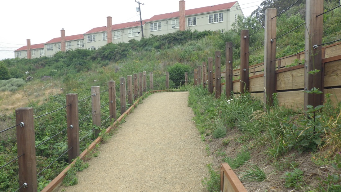
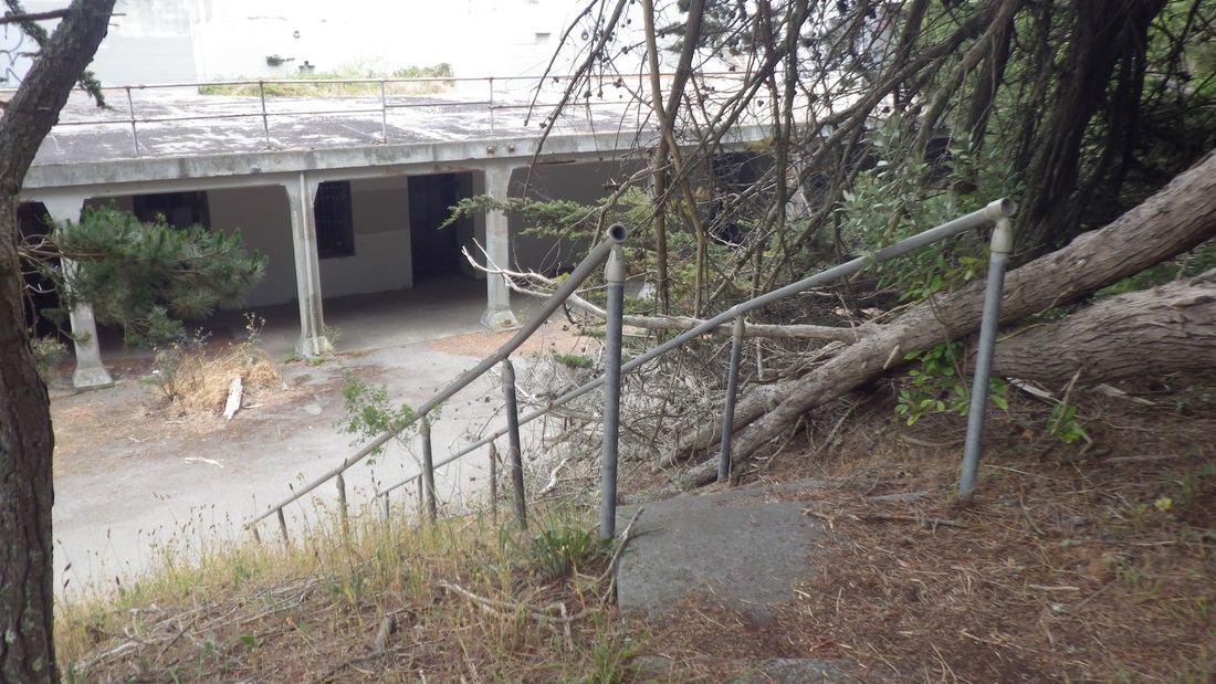
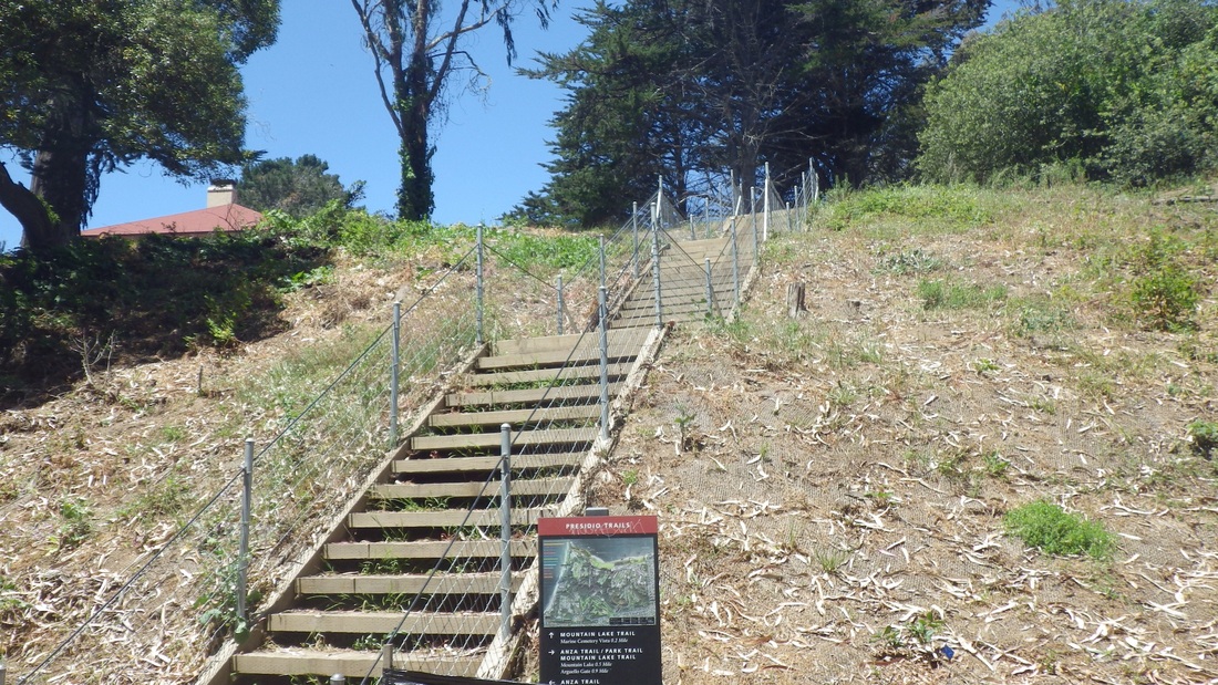
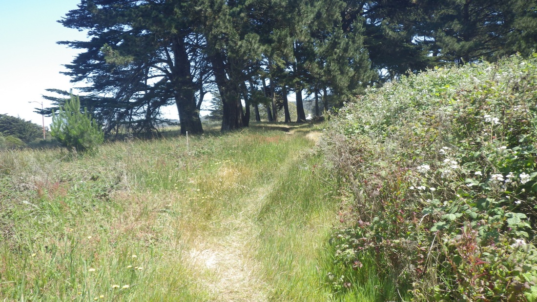
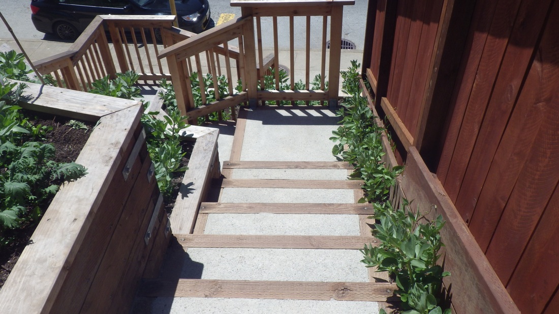
First pic: Moving east to west down to El Polin Springs on the new Mountain Lake Trail extension, an accessible ramp that replaced the old stairway down to the little valley with its birds, ponds, and boardwalk. 

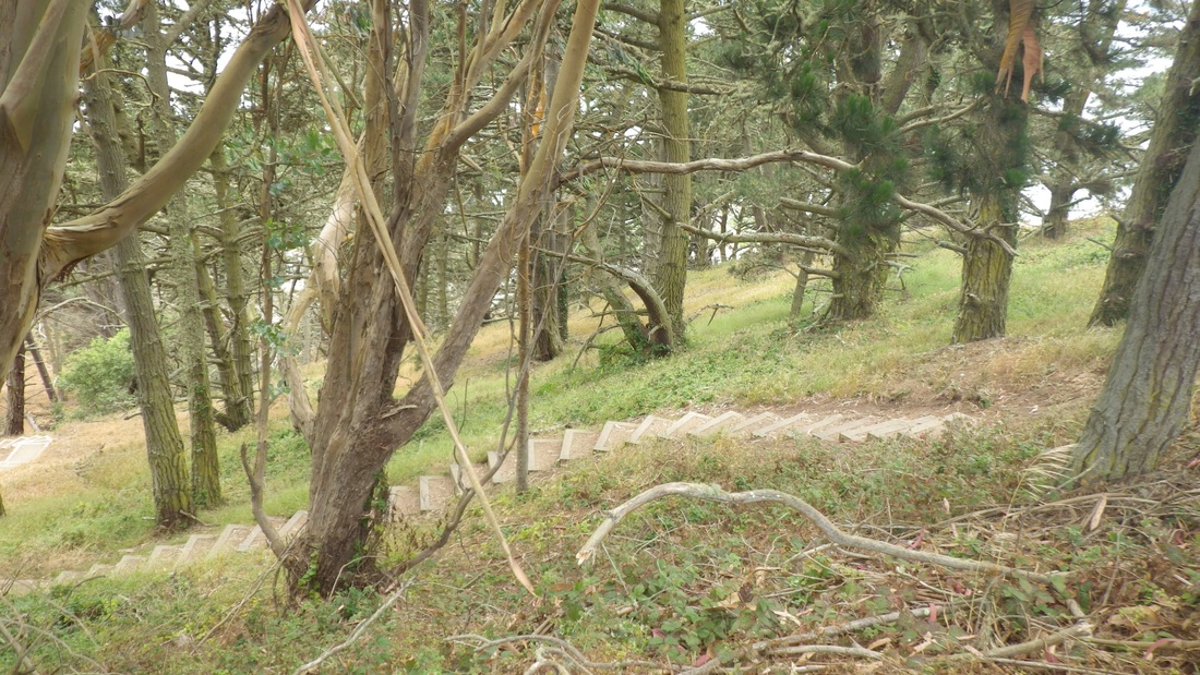
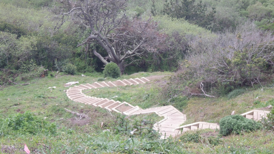
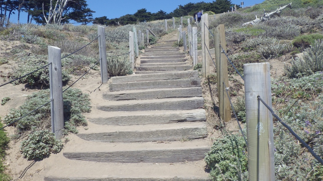
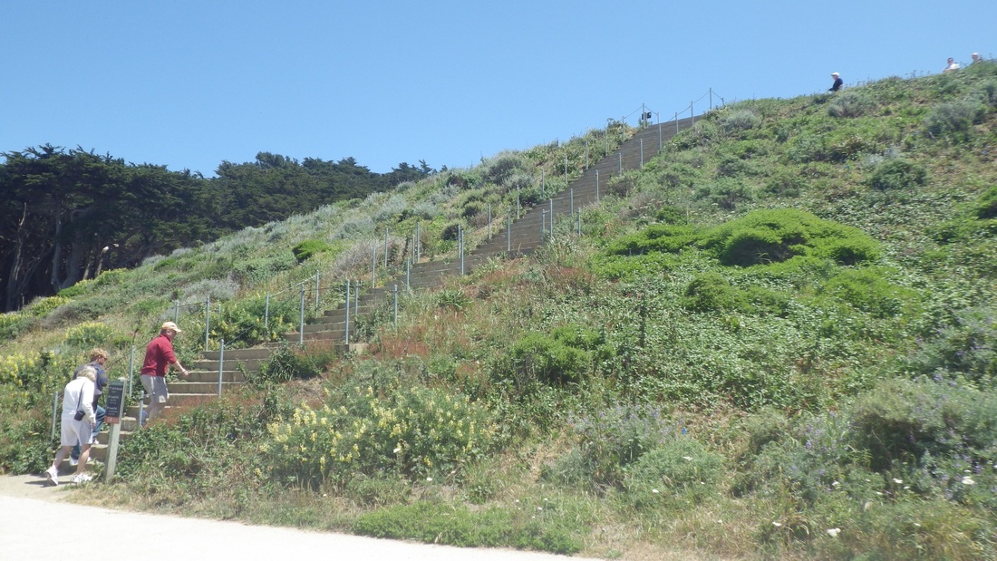
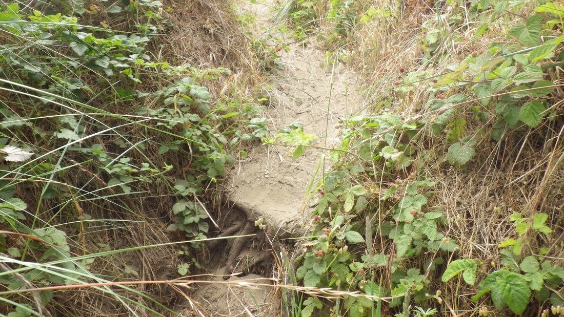
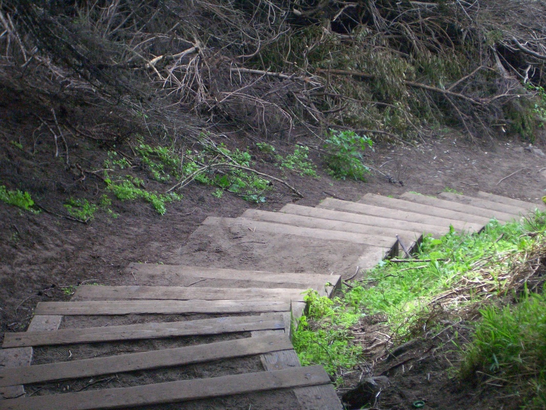
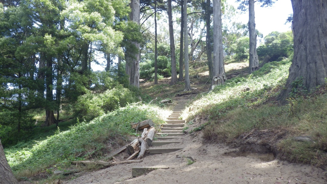
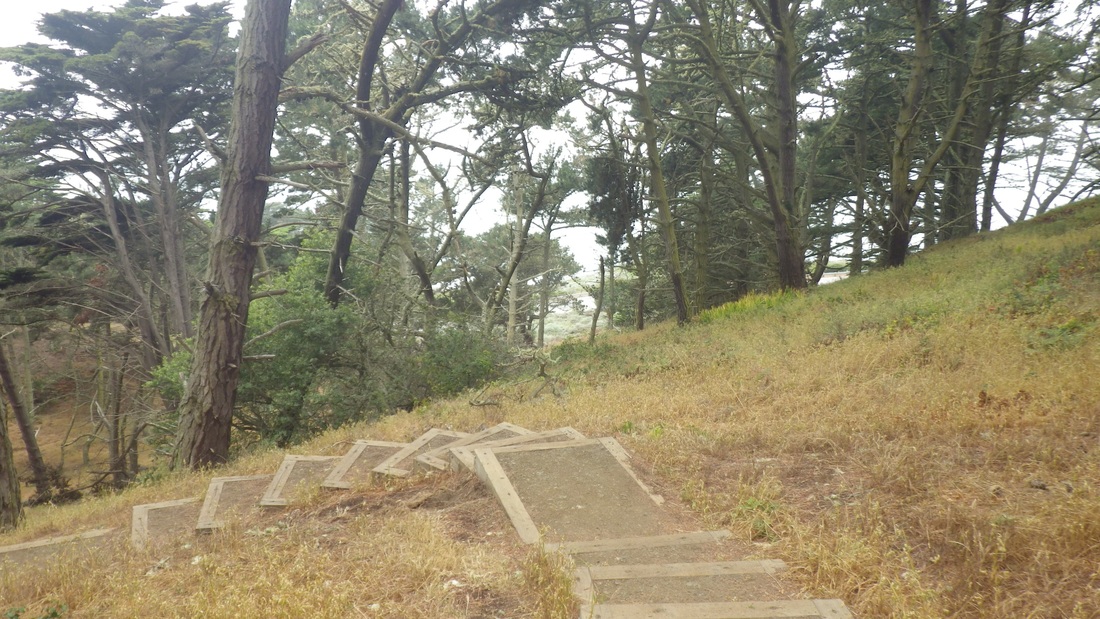
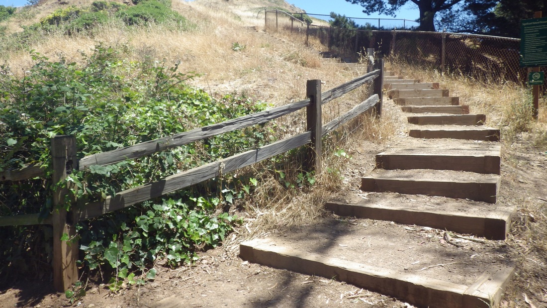
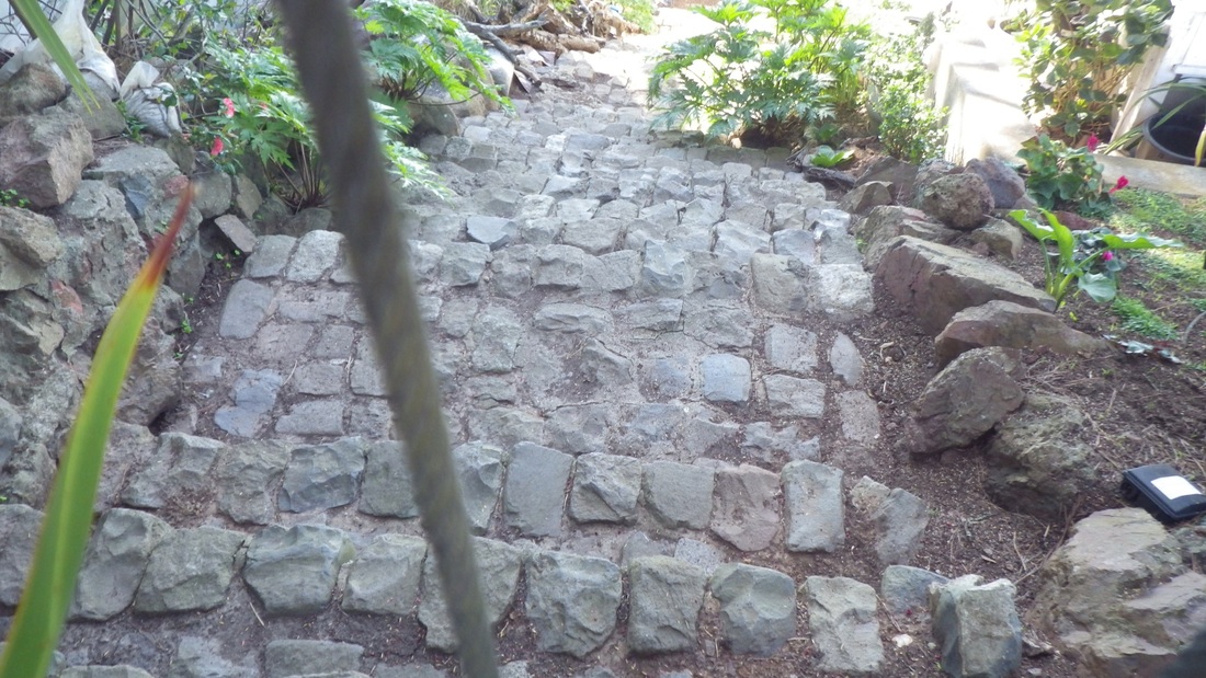
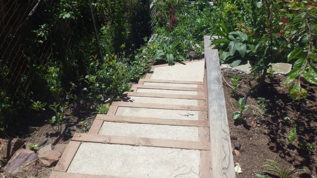
Second pic: Top of the newer steps on the west side from El Polin up to the Ecology Trail (69 steps).

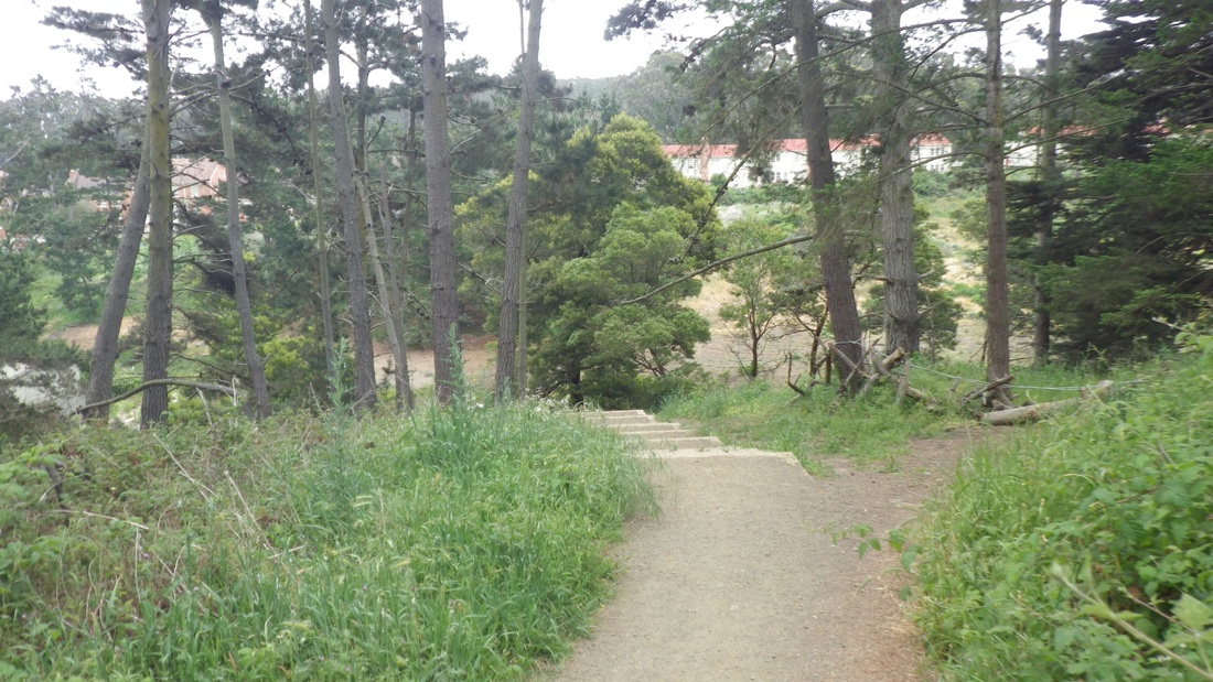
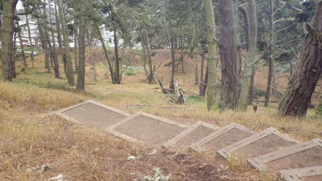
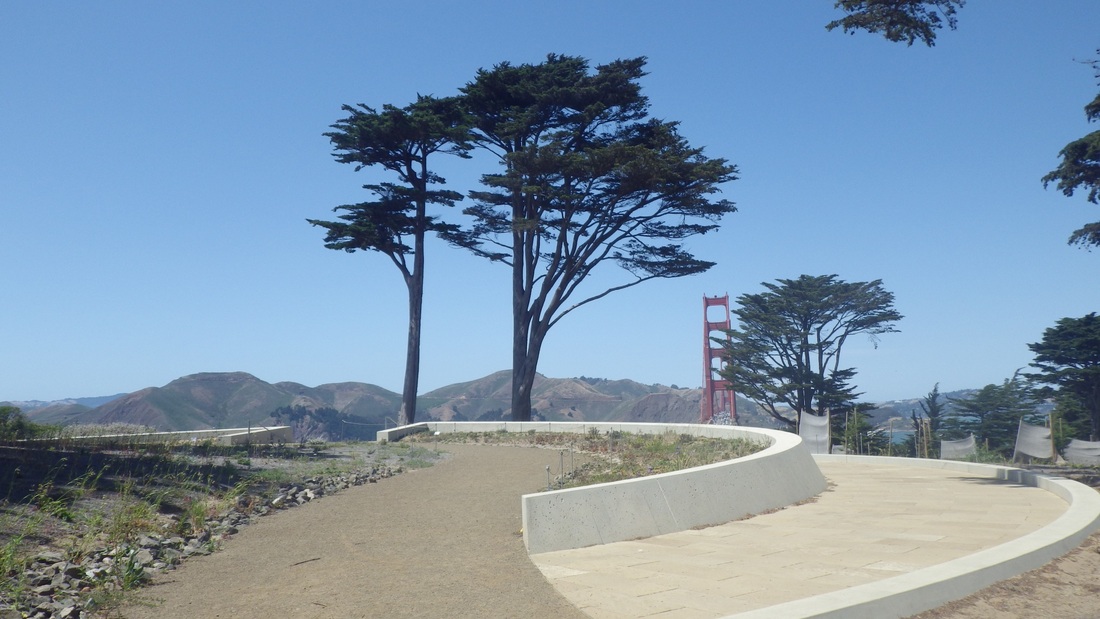
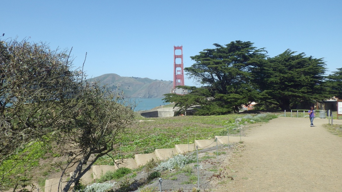
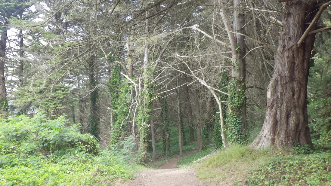
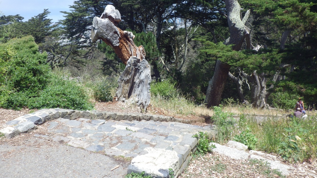
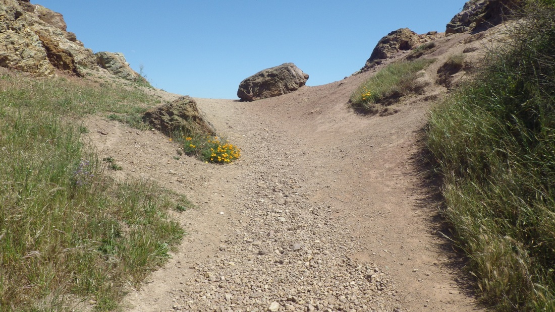
Third pic: Ecology Trail climbing to Inspiration Point Overlook. 

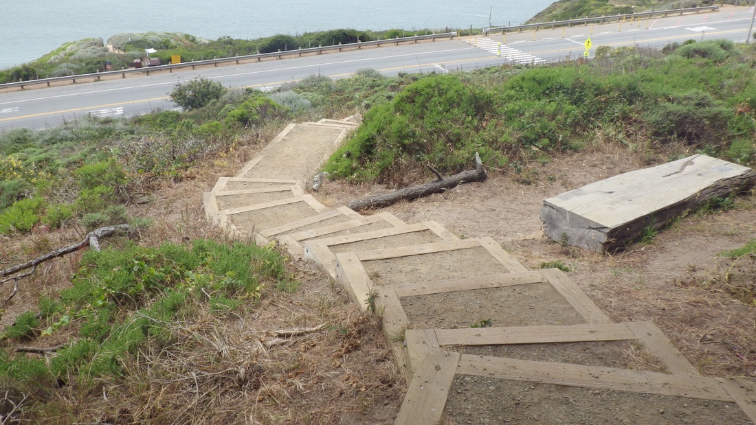
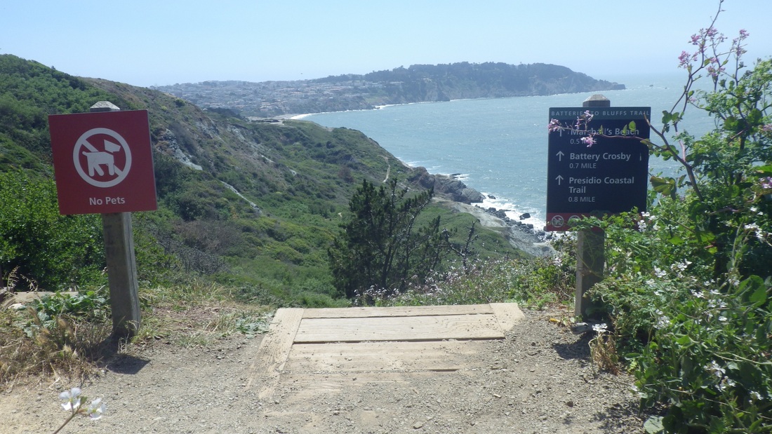
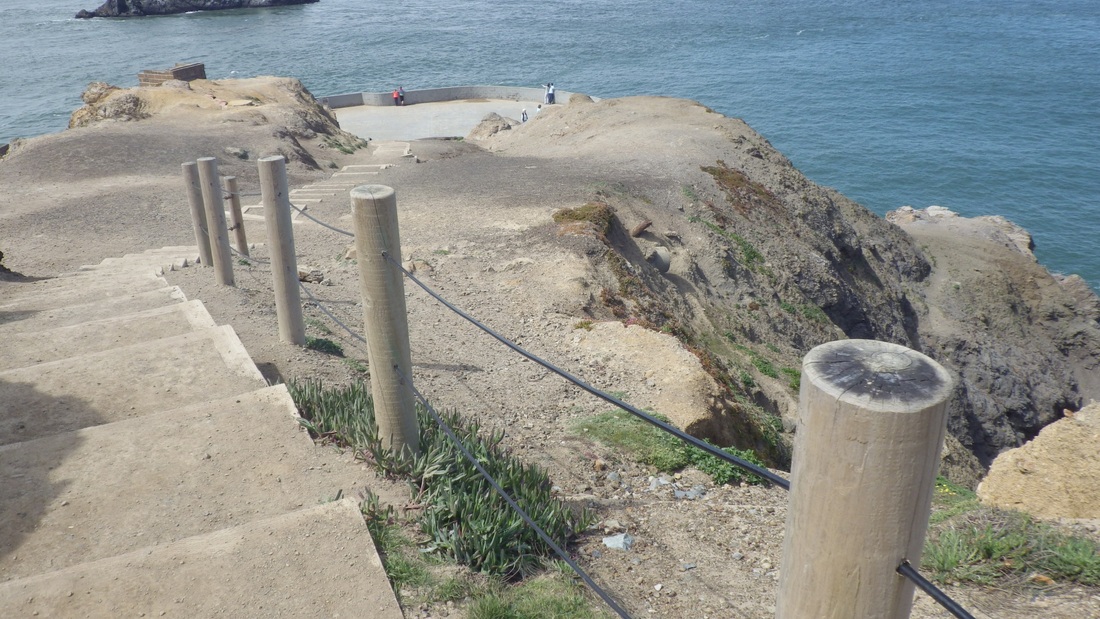
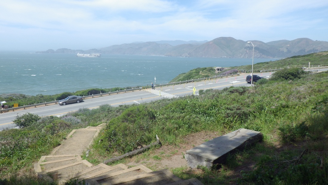
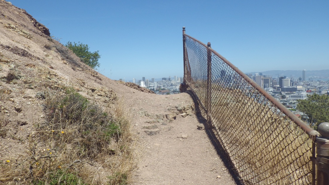
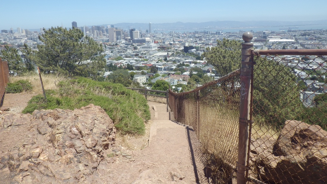
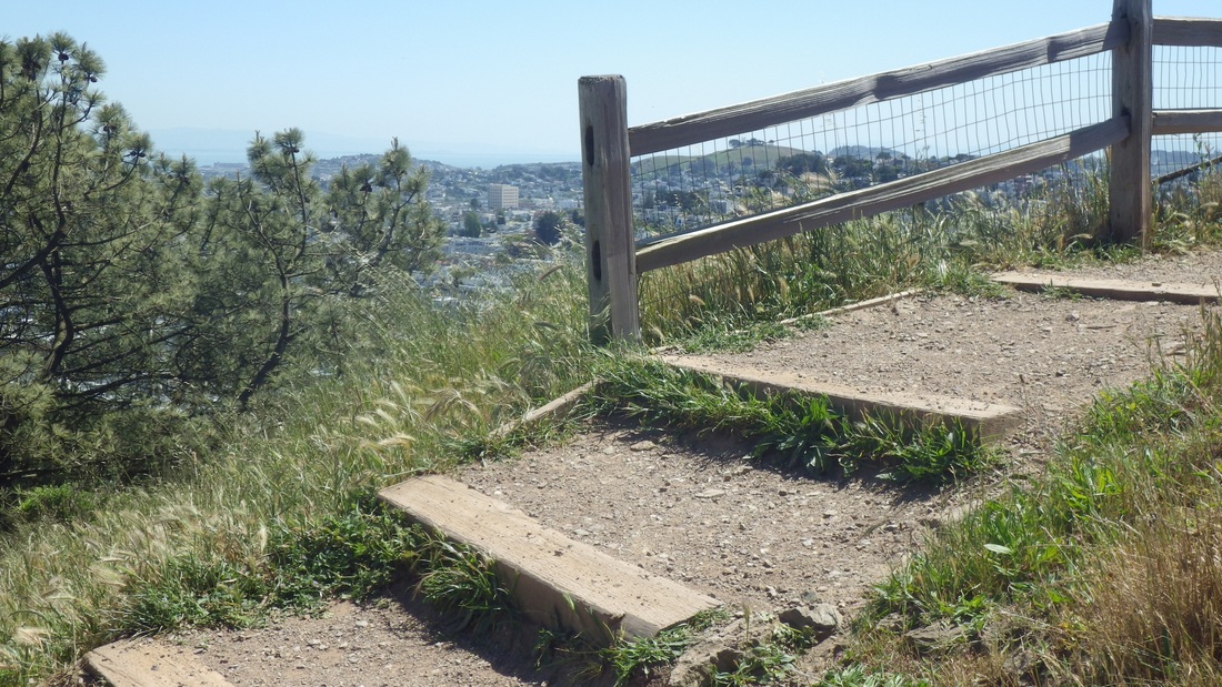
Pics 4 and 5: Top of Immigrant Point Overlook. To the left is the top of the Sand Ladder; to the right is Battery Crosby and the Batteries to Bluffs west trailhead. In the center, starting down from Lincoln, is the top of the short trail leading to Battery Crosby. 

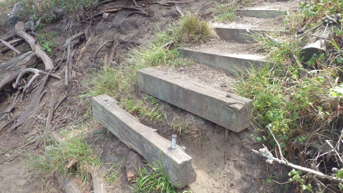
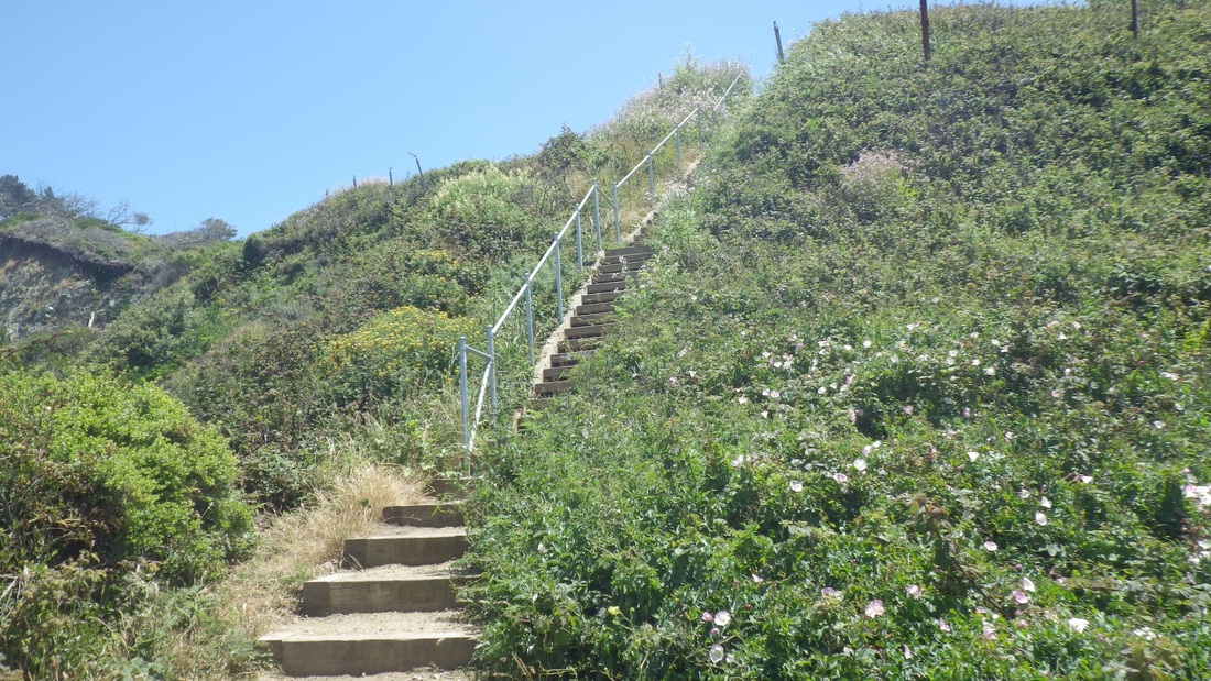
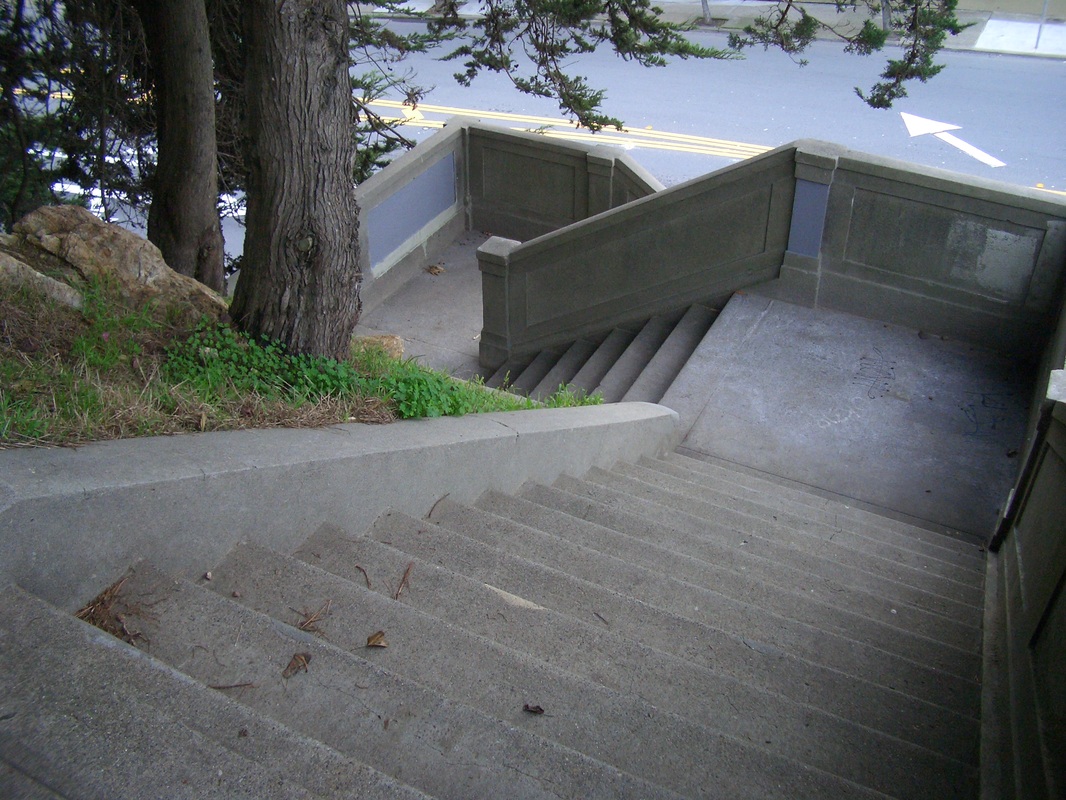
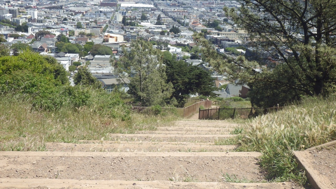
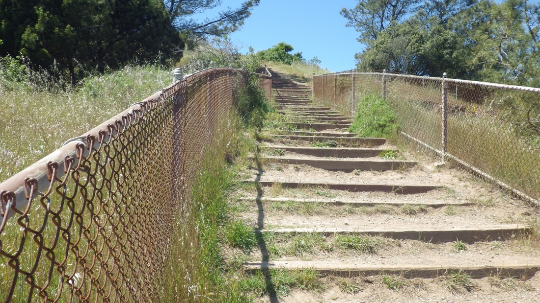
From here, down the Connector Trail (208 steps) descending from the left of the overlook to Lincoln (pics 6, 7, 8, 9). 

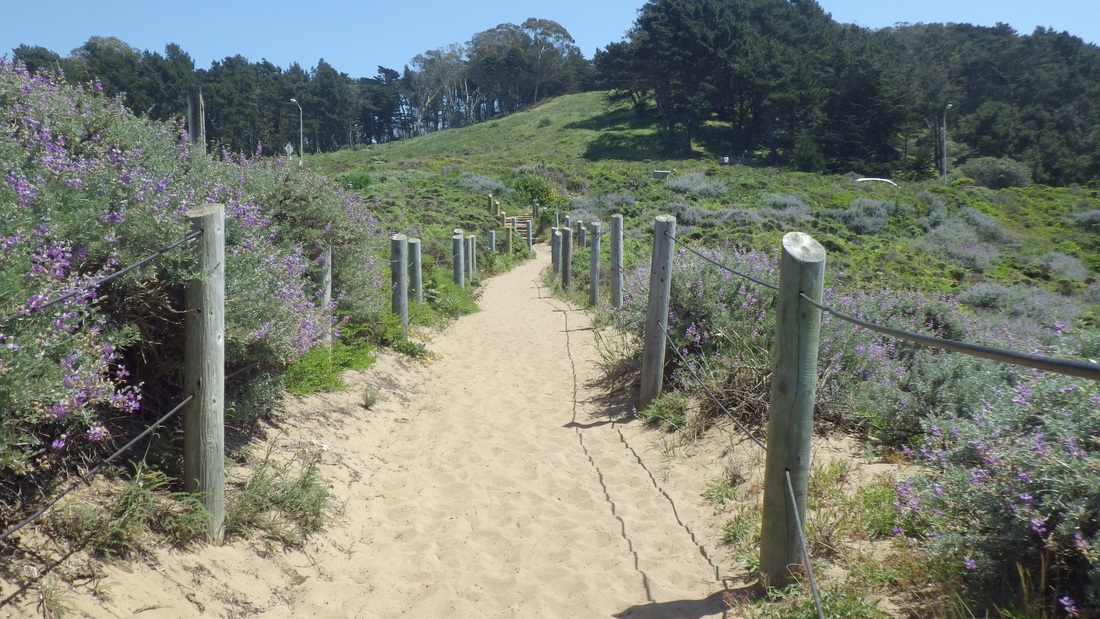
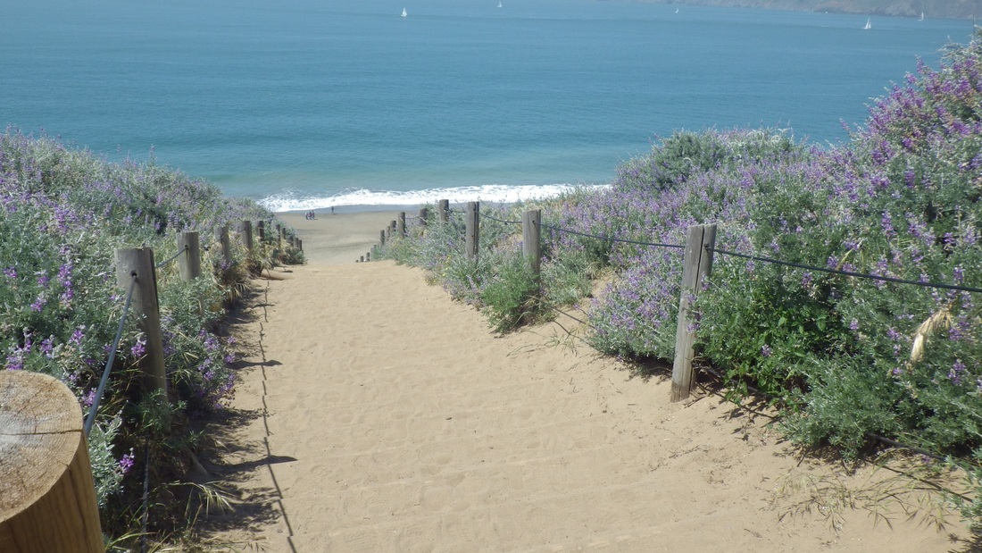
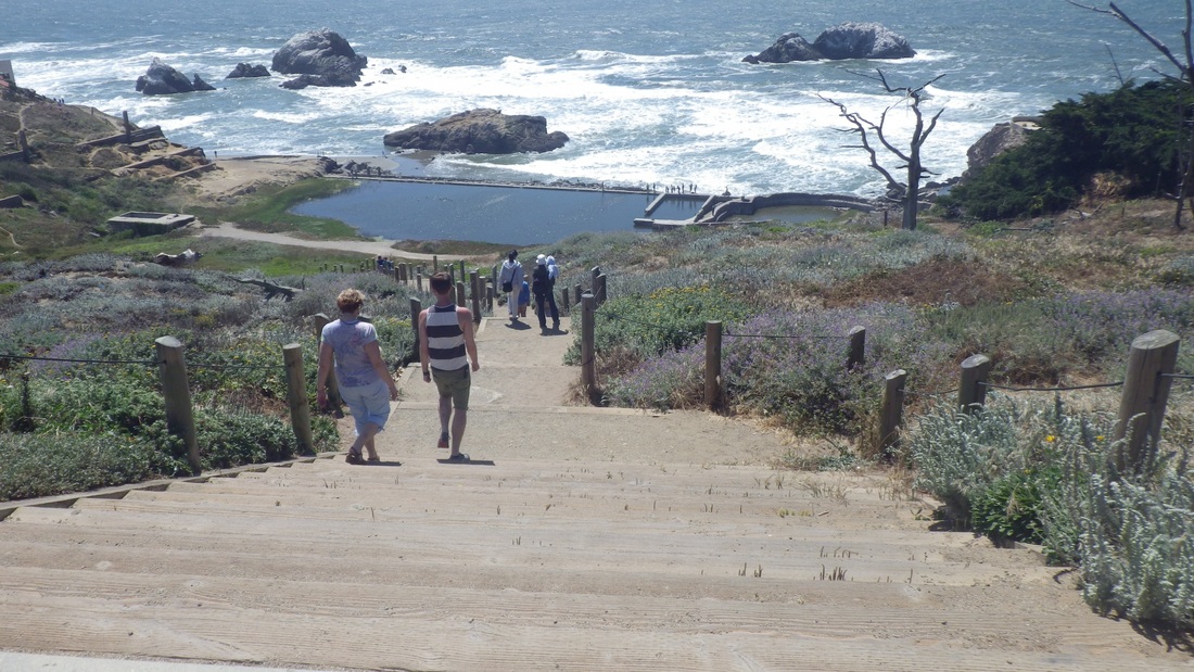
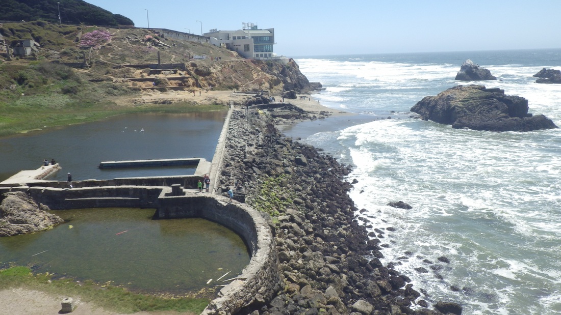
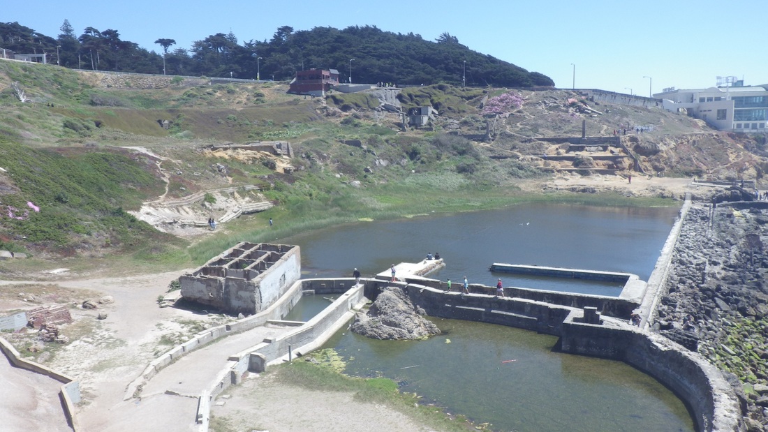
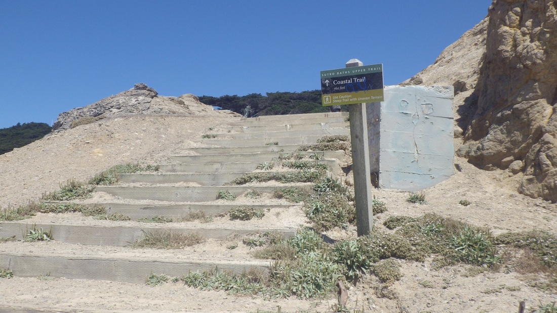
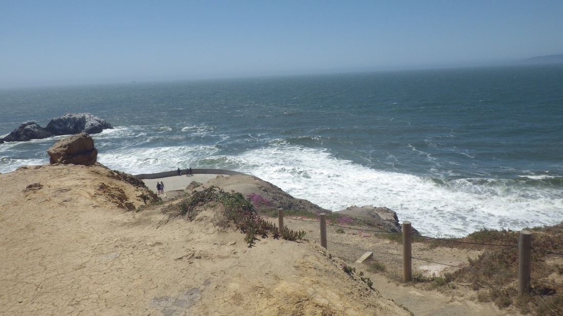
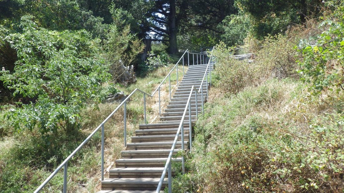
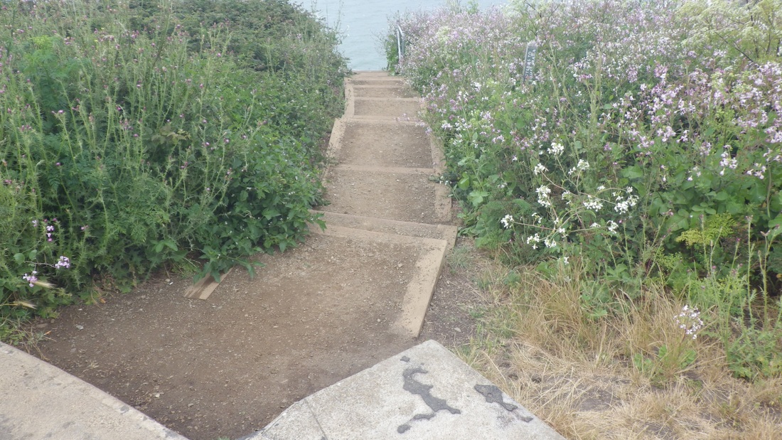
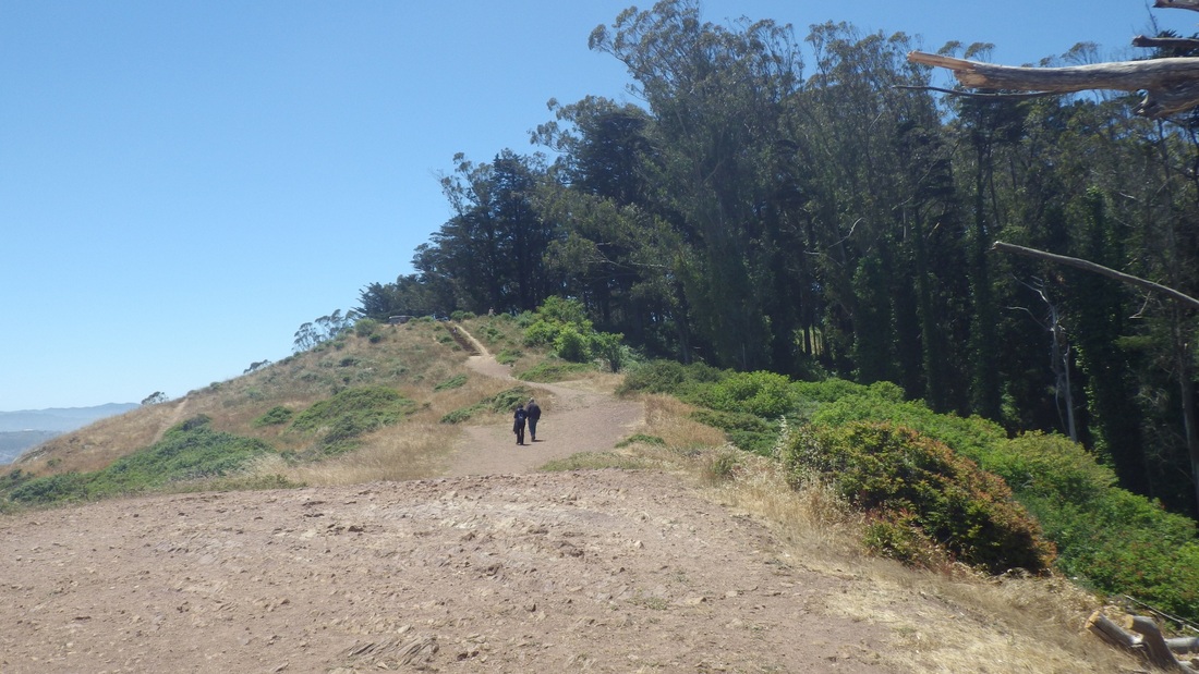
At Lincoln, down to Baker Beach then back up via the Sand Ladder (250+ steps), pics 10, 11. Ya wanna really good workout, this one's highly recommended.

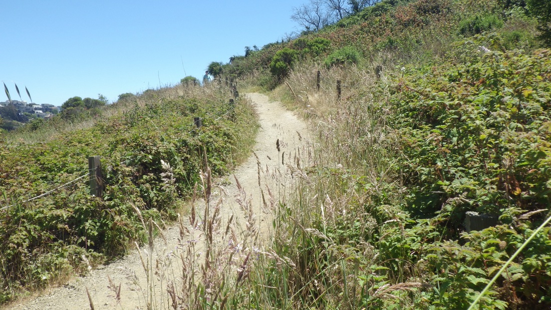
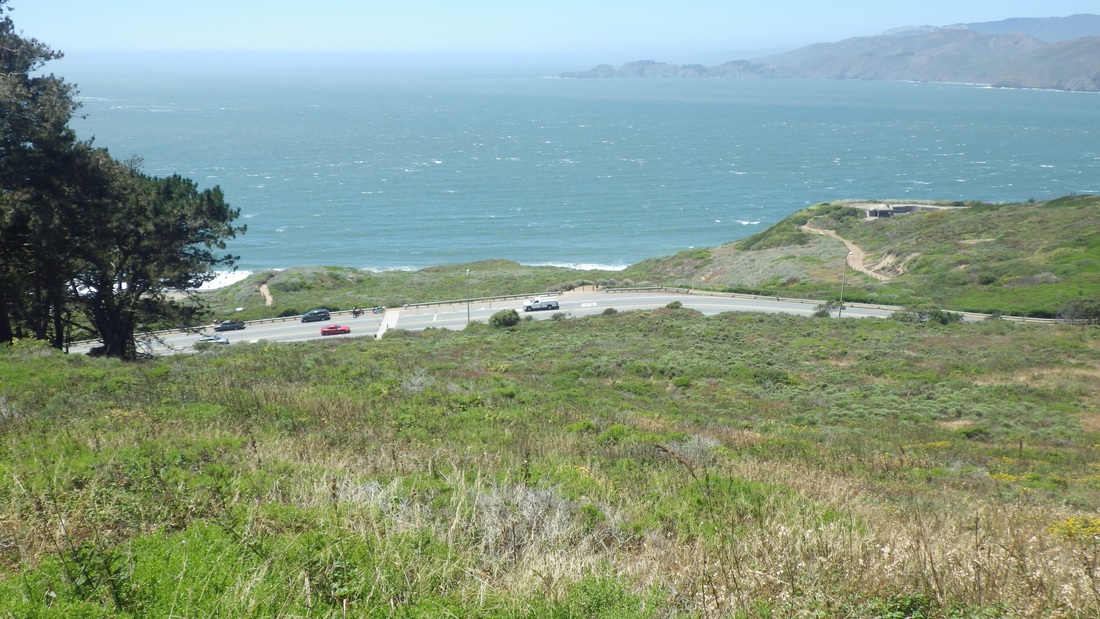
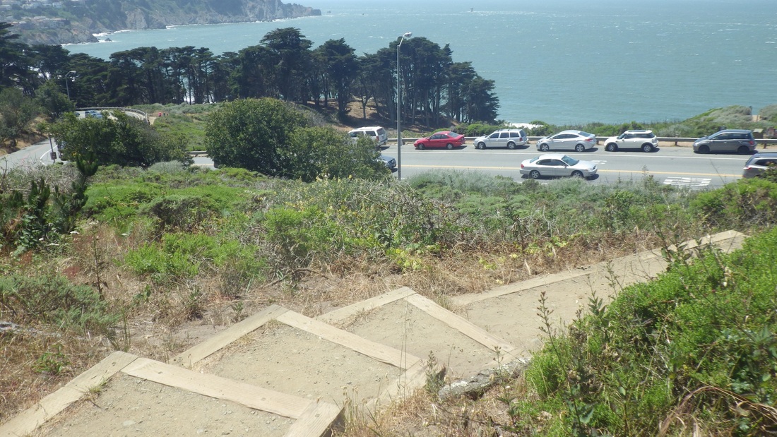
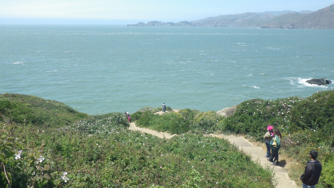
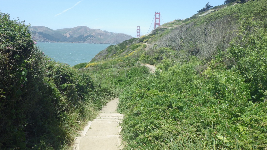
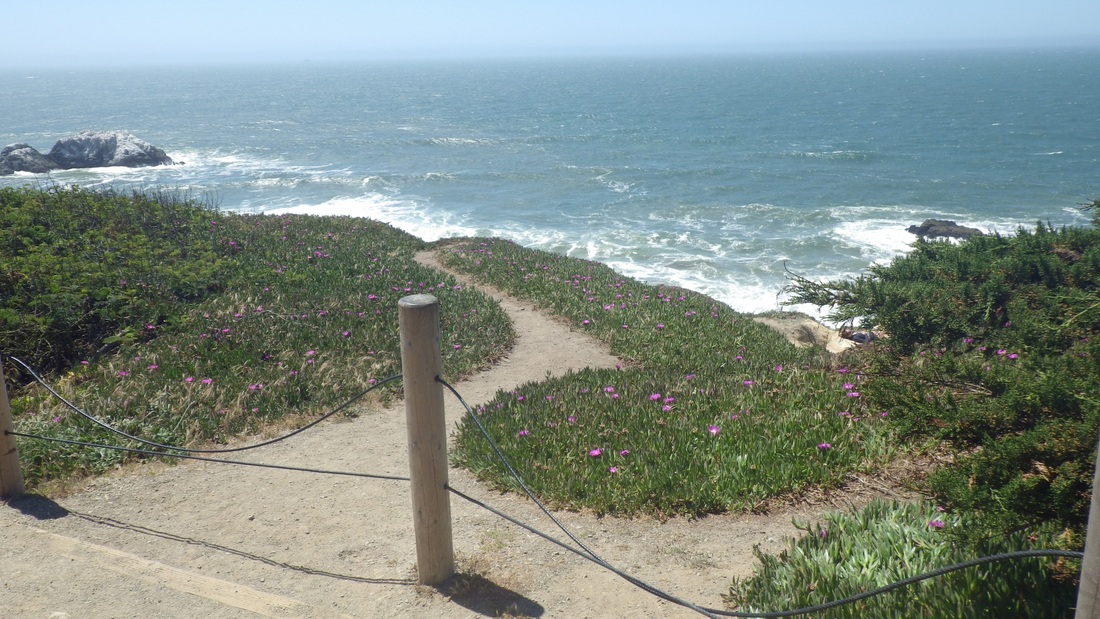
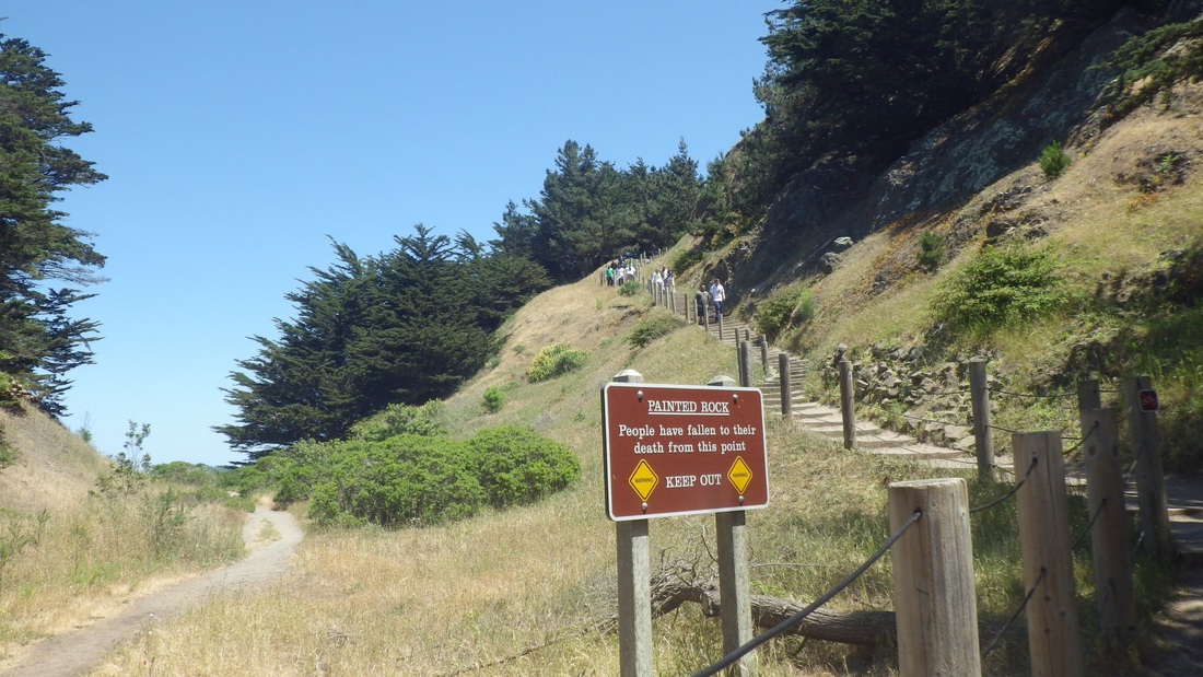
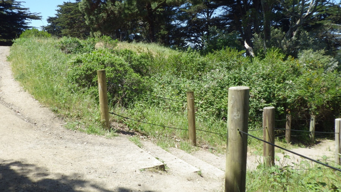
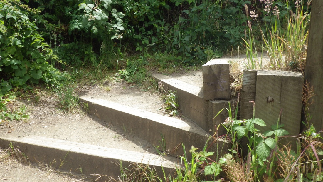
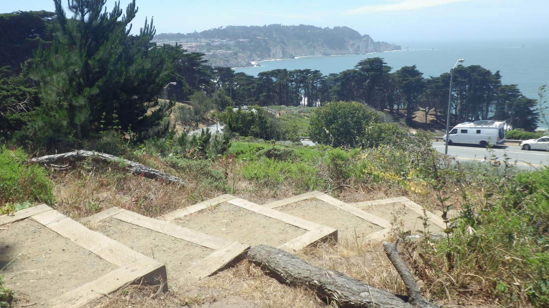
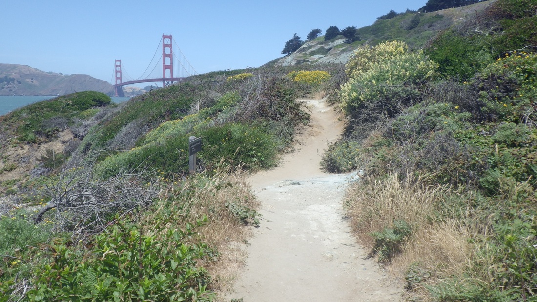
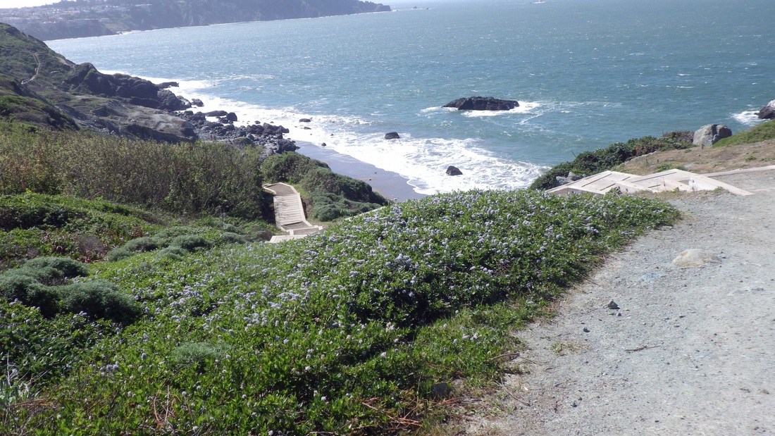
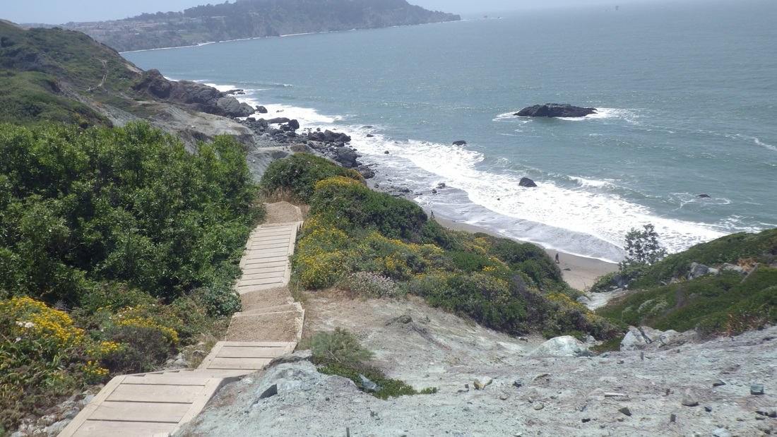
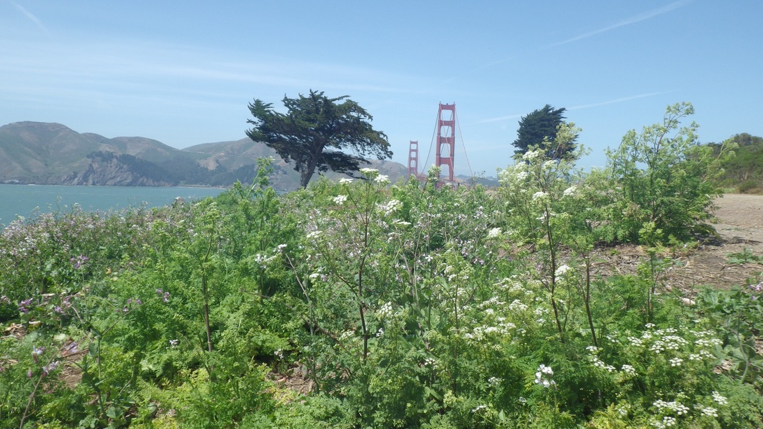
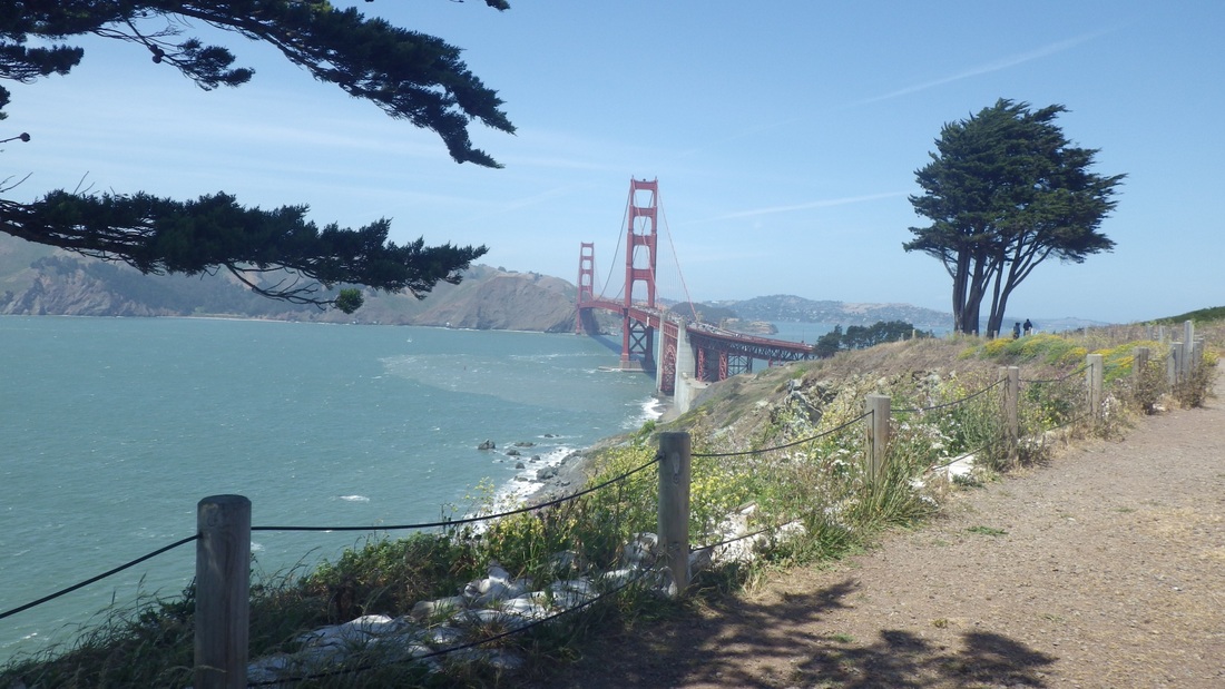
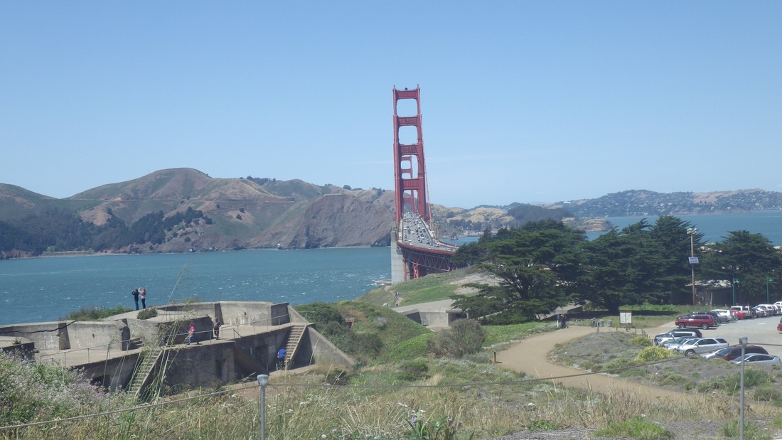
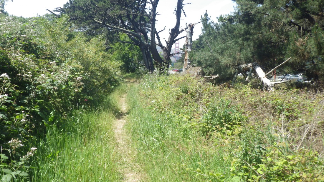
The good ol' Batteries to Bluffs up 'n downer is next, moving west to east (pics 12, 13, 14, 15, 16:  473 steps), then past the Golden Gate Overlook (pics 16, 17). Finally onto "Tony's Trail" with a view of the bridge's toll plaza (last one). 

Picture
1. Mountain Lake Trail extension down to El Polin Springs
Picture
2. Top of the newer westside steps from Ecology Trail to El Polin Springs
Picture
3. Ecology Trail climbs to Inspiration Point Overlook
Picture
4. From Immigrant Point Overlook. To left, top of Sand Ladder; right, trail to Battery Crosby
Picture
5. Immigrant Point Overlook. Top of Connector Trail to left.
Picture
6. Connector Trail down from Immigrant Point Overlook
Picture
7. Connector Trail down from Immigrant Point Overlook
Picture
8. Connector Trail descends to Lincoln
Picture
9. Top of Sand Ladder across Lincoln from Connector Trail
Picture
10. Near top of Sand Ladder
Picture
11. Partway down the Sand Ladder
Picture
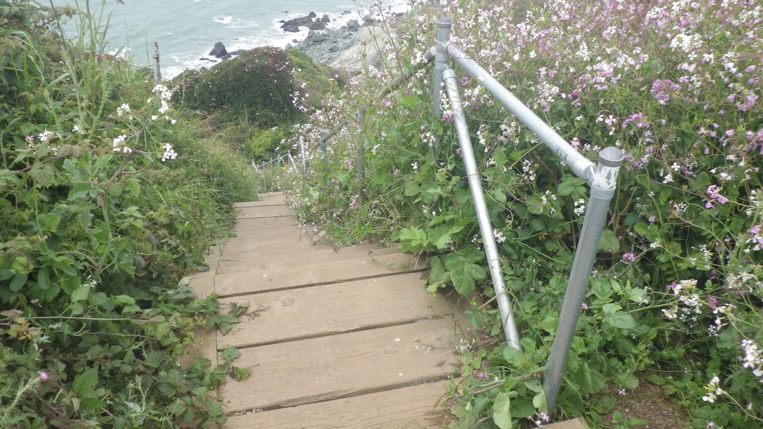
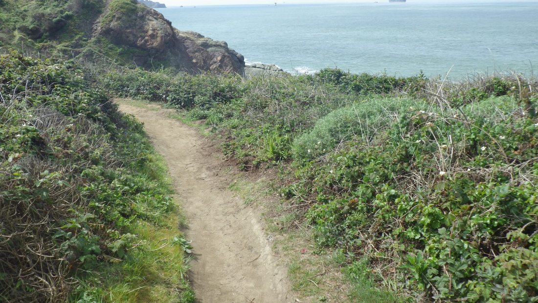
12. Westside down, Batteries to Bluffs Trail
Picture
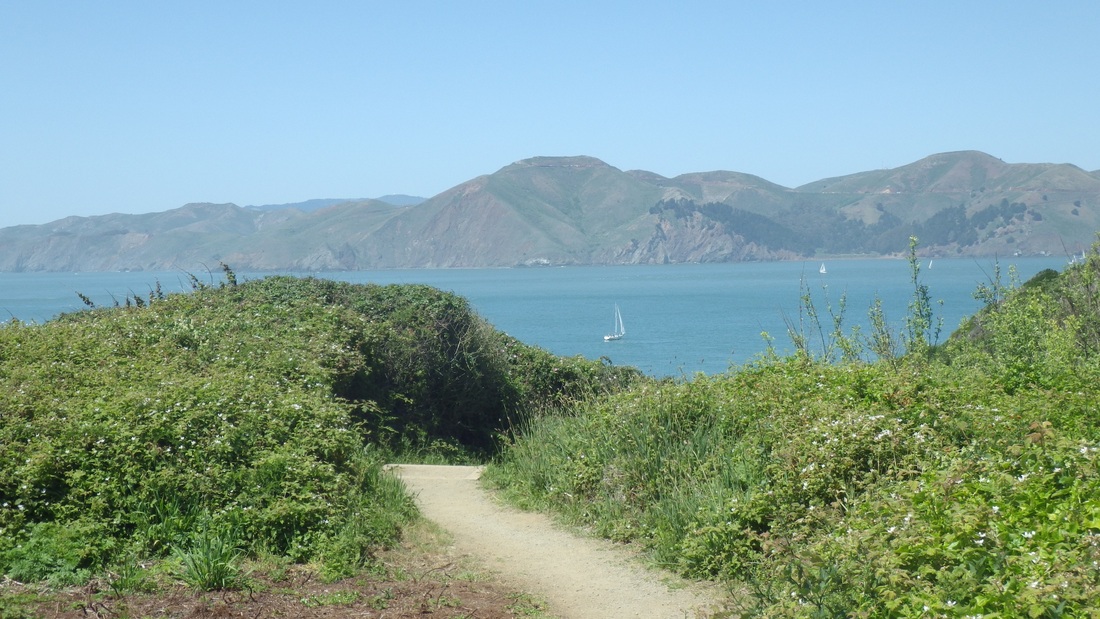
13. Midtrail, Batteries to Bluffs
Picture
14. Midtrail, Batteries to Bluffs
Picture
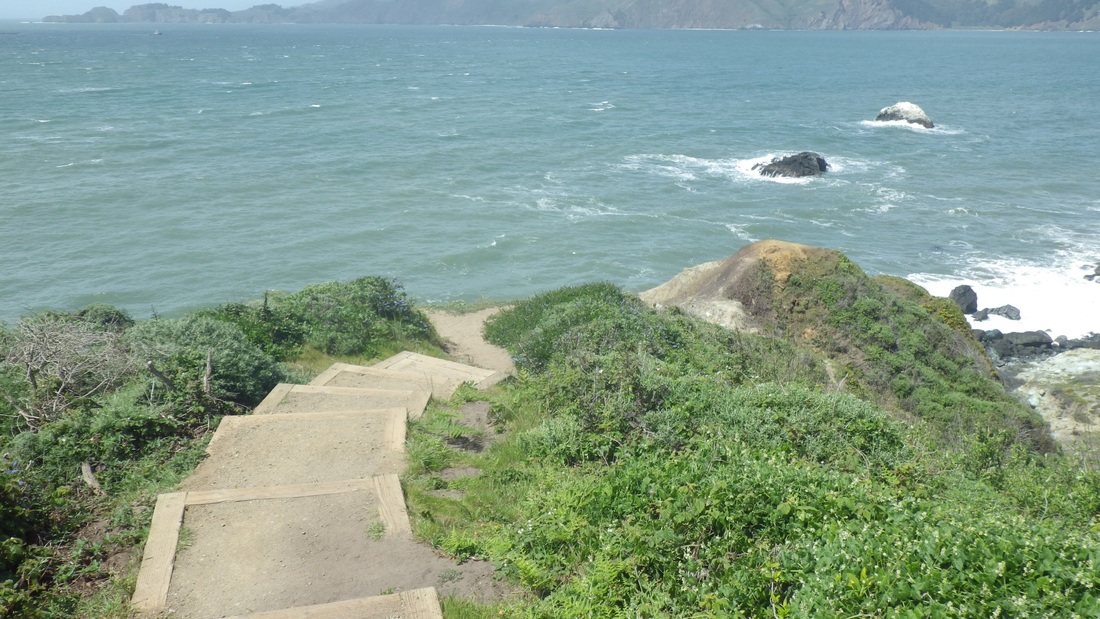
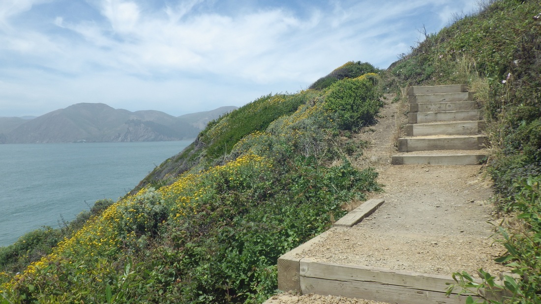
15. Eastside up, Batteries to Bluffs Trail
Picture
16. East trailhead, Batteries to Bluffs
Picture
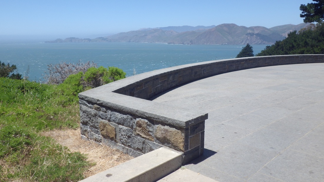
17. Golden Gate Overlook
Picture
18. Steps near Golden Gate Overlook
Picture
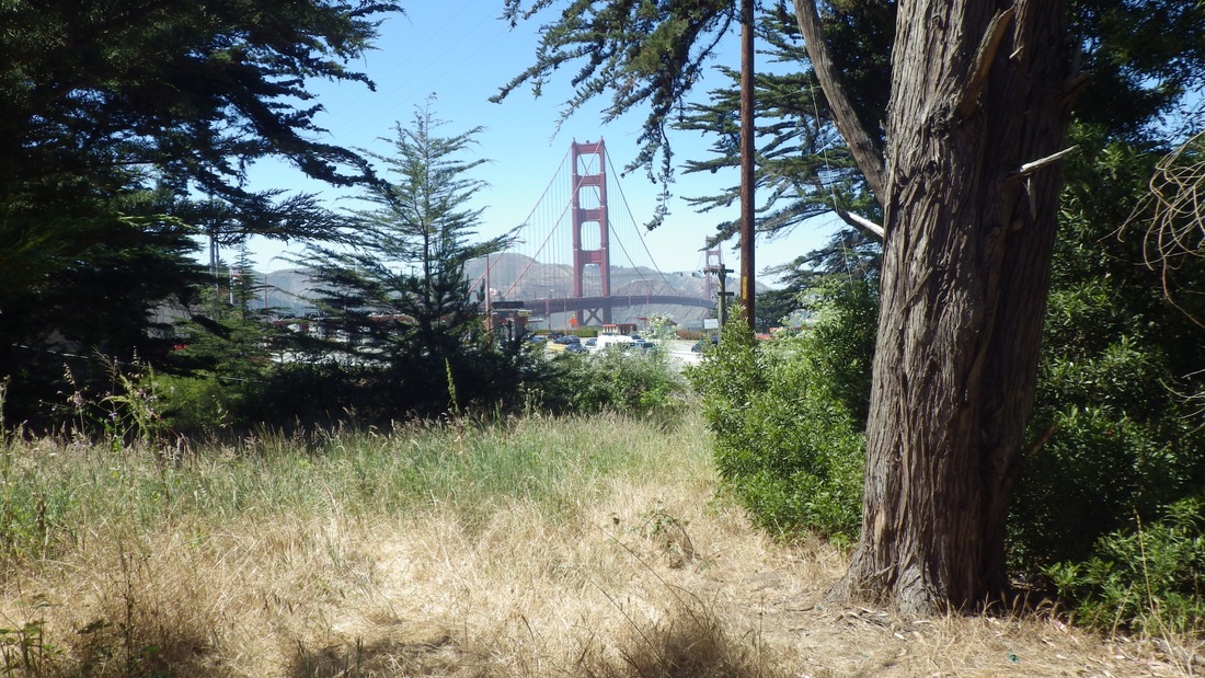
19. Toll Plaza area from "Tony's Trail"
0 Comments

Steps n Trails

6/21/2013

0 Comments

 
Wherever you go in Lands End there's no avoiding stairways, some having been constructed or extended in the last several years, making this viewpark highly recommended for fans of public stairs: shorts, mediums, and longs. (There are more stairways in this park than these mentioned today.)

Two good long ones to start with on the west side: The stairway down from the lower parking lot overlook that I call the "Merrie Way" has about 127 steps (pics 1, 2). 

Continuing up from the top of the cave, a view of Sutro Baths ruins below (pics 3, 4), the Sutro Baths Upper Trail (Coastal Trail's west trailhead) has 141 steps (pics 5, 6, 7, 8). 

From the top of this, around on the curvy walkway and up the 57 steps (ninth pic) to the upper parking lot overlook, the El Camino del Mar trailhead to the east.

Up through the forest from here to the old Fort Miley ruins: 22 steps up the first flight (this one visible to anyone in the area: 10th pic), where I hang a left for the zigzag/sand part of "Tony's Trail" (pic 11). Tony's Trail never disappoints, but there are other short, secluded trails off the main ones. 

Another I like is a short N-S between the El Camino del Mar and Coastal/Lands End Trail. Could've easily continued down to the Coastal Trail if I'd wanted to. There's excellent shelter for birds and other critters, perfectly walkable for those who seek out wilder, offshoot trails (pics 12, 13). 


The longest stairway in the park is down to Mile Rock Beach from the main Lands End Trail, with 272 or so steps (14th pic). 


A little further along the main trail is the "Painted Rock" stairway (15th pic), about 138 to the top, then about 117 down the east side. 


Before doing much of the east side, however, detoured up a short but steep trail that comes out at the golf course. Took the paved walkway here out to the end of the Legion of Honor Museum's parking lot and down the 47 steps to the El Camino del Mar, the less traveled, upper, main trail, across the wood footbridge and down the connector stairs (last two pics: 89 steps) back to the main Coastal/Lands End Trail.

Picture
1. Steps up to the lower parking lot overlook
Picture
2. Sutro Baths Ruins below
Picture
3. Sutro Baths Ruins from trail above. Cliff House in distance.
Picture
4. Sutro Baths Ruins. Louis' Restaurant center distance, Cliff House to right.
Picture
5. Up from the cavetop viewplace. Sutro Baths Upper Trail AKA west trailhead for Coastal Trail
Picture
6. Sutro Baths Upper Trail continues up
Picture
7. Sutro Baths Upper Trail
Picture
8. Sutro Baths Upper Trail
Picture
9. First Coastal Trail overlook up to upper parking lot overlook
Picture
10. Fort Miley Ruins and first flight of steps to "Tony's Trail"
Picture
11. Sand, roots and berries. "Tony's Trail" down to El Camino del Mar Trail
Picture
12. Between El Camino del Mar and main Lands End/Coastal Trails
Picture
13. Between El Camino del Mar and main Lands End/Coastal Trails
Picture
14. Mile Rock Beach stairway
Picture
15. "Painted Rock" stairway, Coastal/Lands End Trail
Picture
16. Connecting El Camino del Mar Trail with Coastal Trail
Picture
17. Connecting El Camino del Mar with Lands End main Trail
0 Comments

Slickenslide

6/20/2013

0 Comments

 
Buena Vista Park's northside entrance is just east of Central off Haight. There are paved trails, numerous older wood stairways of varying lengths, and an old stone flight. A walkway circles the park just above the street. 

Up from the north side soon came to my first flight of older stairs: 20-something to a playground and another main paved trail. A few yards over another stairway continued up. Didn't include the first flight with the second, longer one, but this could be considered one continuous stairway as the flights connect well. Started counting at this second flight for 152 older wood steps (first pic). 

So a nice long one to the summit area, the viewbench below. Climbed a little higher for the stone stairway (41 steps, second pic) up to the summit view-lawn.

Down from the summit on the southwest side, not counting some other stairs on the way, including a few that were more like obstacles to step around or over than steps to help you up (third pic). 

The main south stairway (171 steps, fourth pic), with its boardwalks and improved trails crossing the stairs E-W across the south slope, starts from a paved upper trail and descends to Buena Vista East. There are plenty of places to sit on your way up or down. It got a huge remake several years ago, including lots of new plantings. 

Corona Heights Park is a few blocks south from Buena Vista Park, but not a direct route from the foot of the main stairway. Headed east on Buena Vista East, then downhill on Park Hill to Roosevelt where 15th begins, near Corona's north tennis courts. This was to check out the new "Challenging" trail I'd noticed 
on the trail infosign at the foot of the long eastside stairway (fifth pic) during a previous hike. 

The map included the words "the Slickenside." From "Your Dictionary" online: "Geol. a smooth, polished rock surface produced by friction, pressure, or cleavage." Learn something new every day. So they're describing this side of the park geologically, not naming the trail itself. 

It can be seen on Google Maps: "New Corona Heights Trail." There's a sidewalk at the side of the tennis courts; at the end you can't miss the new trail. You'll see some steps to start, and one of those green universal hiker signs indicating "Summit" (sixth pic).

I think if they ever start naming Corona's trails, they should call this one "the SlickensLide." It's switchbacked, narrow, steepish, and on the non-stairway parts of the trail some slippery dirt and rocks. Counted 42 steps, regular wood and a set of log ones, including a couple of rocks at perfect spots on the trail to be considered steps (pics 7 through 11).

It comes out between the dog play area and the lone bench at the top of the long eastside stairway. Up here is another of those hiking trail signs that depict a stick figure with backpack/walking stick (pics 12, 13, 14). Yep, I'd definitely call this one "Challenging." 

Down the 130 steps on the east side (pics 15, 16, 17) to its foot to then continue down the steepish east trail to exit the park, the top of De Forest (18 steps) across the street (last pic). There's a colorful little garden at the dead-end guardrail at the end of Flint where De Forest starts. De Forest conveniently takes the walker down to Beaver from the park instead of having to go around to 16th St. At the foot of the narrow, enclosed stairs, it's a steep block down to Castro. 

Picture
1. 152 steps to summit from here, Buena Vista Park
Picture
2. Top of stone stairway to summit lawn
Picture
3. Old steps near summit
Picture
4. Main south stairway, Buena Vista Park
Picture
5. Park infomap at foot of east stairway, Corona Heights Park
Picture
6. Foot of new trail up the north slope, Corona Heights Park
Picture
7. Corona's new trail
Picture
8. New trail, Corona Heights Park
Picture
9. Rocks as steps
Picture
10. Continuing up
Picture
11. Nearly to the top
Picture
12. Top of the new trail
Picture
13. Top of the new trail
Picture
14. New trail below
Picture
15. Upper bench at top of long eastside stairway
Picture
16. East stairway
Picture
17. Lower bench on the east stairway
Picture
18. Top of De Forest steps, Flint to Beaver
0 Comments

Old Trail Still Unmolested

6/6/2013

0 Comments

 
Started out at 12th Ave. to circle the Presidio's Mountain Lake where a few ripe berries were found (yep, blackberry season's officially started), then up the 103 or so Marine Cemetery Vista steps (first pic). "Home is the sailor, home from the sea" is etched on the plaque between the overlook's benches. 

Yeah, same old route oft remarked upon, but all excellent hiking trails and long stairways that get me out in the fresh air for a good workout. 

Out to Battery Caulfield Rd. and up to Immigrant Point Overlook to take the Connector Trail (208 steps, pics 2, 3, 4) down to Lincoln. Down the trail that leads to Battery Crosby, sometimes new graffiti adorning the battery for us all to view. 

Some park trails are really summer-dry now, but not this trail and the entire Batteries to Bluffs Trail. Wildflowers and greenery all over, with damselflies, bees, birds, and a ladybug spotted as I meandered along. Found the earliest berries of the season on the BTB (pics 5 through 14), 473-ish steps. Especially loved the wild radish flowers leaning over the stairway as I started down the west side. 

Strong winds up here as I continued east from the BTB along the Coastal Trail next to the cliffedge (pics 15, 16), with pic 17 taken near Golden Gate Overlook. 


Over to the Fort Scott neighborhood, grateful for the crosswalks here as lots of vehicle traffic in the area as usual.  

Next to the old steepled wood church starts a short trail where a few years ago found some ripe berries as late as October. Pleasantly surprised this year to find the trail still unspoiled and secluded, with unmolested old trees, wild roses, bees, and tall blackberry bushes lining it between me and Fort Scott. On the other side of the trail is a busy highway. Ahhh -- here we have another "hidden" Tony's Trail. After several times this year have only seen one person 'sides me on it, a jogger.

This sun-dappled beauty (pics 18, 19) curls around to come out at the Log Cabin (available to rent for events) with a pleasing view of downtown and Fort Scott residences at this end. Very short, but such a difference when compared to walking along a main street. I fervently hope this trail is left as is. Hoping park people won't get too carried away and overly "manicure" and widen all the trails; please leave some of 'em on the "wild" side!

The equally short trail directly across from it, on the north side of the aforementioned highway, its trailhead across the street from the Golden Gate Overlook's main stairway, has already been given a noticeable overhaul with tree-thinning and blackberry bushes and other plants uprooted and pushed back. There's a striking difference now between these two trails that are separated by the endless vehicles below, with stacked wood from the downed trees, bare dirt, and plants cut back so this northernmost one isn't as comforting and cozy as before. 


But they did leave some blackberry bushes and other plants at the trailhead and it's still a walkers' trail between the forbidding traffic below and the other vehicle street. Definitely beats walking on a sidewalk or at the side of a street. I read someplace that car usage is down lately -- but apparently not in this park, especially on weekends or holidays.

Picture
1. Marine Cemetery Vista steps up from 14th Ave./Mountain Lake Trail
Picture
2. Connector Trail down to Lincoln from Immigrant Point Overlook
Picture
3. Connector Trail's bench. Lincoln below. Sand Ladder to the left.
Picture
4. View of Lands End in distance from the Connector Trail
Picture
5. West trailhead for Batteries to Bluffs at Battery Crosby
Picture
6. Down amongst the wild radishes
Picture
7. Curving down the west side
Picture
8. Steep westside steps up to Battery Crosby
Picture
9. Midtrail-ish
Picture
10. Midtrail, Batteries to Bluffs
Picture
11. Batteries to Bluffs Trail, 0.7 mile
Picture
12. Batteries to Bluffs = Beauty
Picture
13. Nearly up to View Point overlook and the bench
Picture
14. Up to the east trailhead, Batteries to Bluffs Trail
Picture
15. Coastal Trail between Batteries to Bluffs and Golden Gate Overlook
Picture
16. Windy Coastal Trail at the cliffedge
Picture
17. Near Golden Gate Overlook
Picture
18. "Tony's Trail" with Golden Gate Bridge in distance
Picture
19. "Tony's Trail" coming out to Log Cabin. Highway below, Fort Scott to right.
0 Comments

Mount Olympus to Corona Heights

6/4/2013

0 Comments

 
It's a steep trek up 17th Street to tiny Mount Olympus Park from the Eureka Valley/Castro Metro stop. Was reminded of my too-long absence by a couple of Facebook posts about recent hikes up here. 

Thought if the #37 Corbett/Twin Peaks bus was coming within a few minutes I'd take it partway up, but "16 minutes" on the readout persuaded me to hoof it. 

Monument stairway, its foot at 17th, is nearly up to Clayton, just past the corner grocery (first pic: 17th & Roosevelt) and the "17% grade" sign. Wish all the steeper streets had this kind of grade infosign; is this the only one of its kind in the city? The 82 concrete steps ascend to Upper Terrace (pics 2, 3, 4). 

Continued to the park on "Back Alley Way" (fifth pic). Never knew the name of this before Google Maps (no street sign). At the end is the east-facing railed view-walk. Across is the little park, 30 steps to the top layer, concrete benches on all sides (pics 6, 7). The west side has a view through the trees to Mount Sutro. Other good views include Tank Hill and Twin Peaks. 


 Some pix of the Triumph of Light statue in 1947, 1950, and 1955, still intact back then, courtesy of FoundSF:  

http://www.foundsf.org
 

http://www.foundsf.org/index.php?title=Mt._Olympus

On the way down, another stairway (88 steps, eighth pic) across from the park (east side) will take you to (again) Upper Terrace (pic 9). Upper Terrace is another of those streets that curves around. When on Stanyan and Edgewood Ave. to/from hikes on that side of Mount Sutro, I never fail to admire Mount Oly from a distance. The Ashbury Heights neighborhood is also close to parks Buena Vista and Corona Heights. 

From the foot of these stairs at (lower) Upper Terrace continued north to Clifford Terrace and down this steep street to Roosevelt. Across the street is a stairway that descends from Roosevelt to Lower Terrace (pics 10, 11). Had I wanted to go down Vulcan Stairway, this would've be a good one to take. Instead counted the stairs down (42) and back up to continue on Roosevelt. 

Roosevelt curves to the east and continues past the top of Masonic and the top of the Roosevelt-to-States/Levant stairs (pic 12), a short distance from Corona Heights Park's west entrance at Museum Way & Roosevelt. 

The park's main west stairway has around 99 steps (pic 13). 14th pic: The rocky summit area. This time turned right partway up to follow a shorter stairway (61 steps) and trail around the south side (15th, 16th pics). Twenty more steps will take you to the upper bench at the top of the main eastside steps (17th pic). This long one (130 steps, pics 18, 19) is wood, steep and uneven. At the foot there's now another of those newer park trail infosigns. 

The foot of the stairs is near the Randall nature museum's east entrance, so passed through the animal room to murmur a greeting to the quails, chickens, and ravens, and out the front door to see if the steep switchbacked ramp (down to the park's playground, community garden, and tennis courts) had reopened. It's walkable again, the new restroom building down there completed. So to the States St. entrance via the ramp and continuing downhill to Castro where the #24 Divisadero runs. 

Picture
1. 17th & Roosevelt
Picture
2. Foot of Monument stairway to Upper Terrace
Picture
3. Monument steps to Upper Terrace
Picture
4. Monument stairway to Upper Terrace
Picture
5. Back Alley Way to Mount Olympus Park
Picture
6. Mount Olympus Park steps
Picture
7. Mount Olympus Park today
Picture
8. Doorway art off the east stairway
Picture
9. East stairway from Mount Olympus Park to Upper Terrace
Picture
10. Clifford Terr. & Roosevelt down to Lower Terrace
Picture
11. Clifford Terrace & Roosevelt down to Lower Terrace
Picture
12. Roosevelt to States/Levant
Picture
13. Main westside steps, Corona Heights Park
Picture
14. Summit rocks area
Picture
15. South trail below summit rocks
Picture
16. Steps around the south side
Picture
17. Down to main eastside stairway
Picture
18. Down the main eastside steps
Picture
19. Eastside stairs
0 Comments

Amazing Transformation

6/2/2013

0 Comments

 
The #36 Teresita bus stops at Mount Davidson Park's main south entrance at Dalewood. Love this trail up. Butterflies, bees, birds, beauty! 

Ascended the short north stairway (22 steps, first foto) to the top of the openspace area (pics 2, 3). Another short stairway descends to a trail on the east side. Enjoyed the view-of-the-whole-world openspace, then onto a trail that starts down near the iconic cross (pics 4, 5). 

Meandered downhill through the forest that comes out at steep Dalewood on the mountain's west side (pic 6). 

From Dalewood, downhilled a few blocks to the north, then uphill on Lansdale for the top of the Bengal Street Park, now a gorgeous greenway-stairway-minipark (109 steps). Some old stone steps (7th pic) descend from the attractive gate at the top. Partway down starts the newer part. There's a built-in wood bench alongside the stairs and lots of planters. The chainlink fence that used to be at the foot is finally gone. 

This whole transformation is amazing, with a lot more plants having been added since my last visit in February, and they're doing beautifully (pics 8, 9, 10, 11, 12, 13). This magical makeover should win numerous awards and writeups as one of the most uniquely awesome renovations ever. A must-see, especially if you remember how it used to look when the stairway was nearly buried and fenced off. Renovation started in 2009. See: 

http://bengalalley.org 

and

http://www.westsideobserver.com/news/bengal.html

And here are two THEN pics, 14 and 15, from 2005: Compare these with the way it looks now.

It's conveniently located on the #43 bus line; the stop is right there at the stairway's foot on Miraloma. While waiting on the bus had several minutes to take a few from down here (pics 16, 17, 18).


Picture
1. North openspace stairway, Mount Davidson Park
Picture
2. View from left: Mount Sutro, Sutro Tower, Twin Peaks
Picture
3. Viewbench, Mount Davidson Park. From left: Mount Sutro, Sutro Tower.
Picture
4. Mount Davidson Park
Picture
5. Starting down a forest trail
Picture
6. Out from the park on the west side at Dalewood
Picture
7. Bengal Alley's old stone steps down from Lansdale
Picture
8. Bengal Alley Street Park, June 2013
Picture
9. Bengal, 2013
Picture
10. Down to Miraloma, Bengal Alley Street Park
Picture
11. Bengal Alley now
Picture
12. Bengal Alley now
Picture
13. Bengal's foot at Miraloma
Picture
14. THEN: Bengal Alley, 2005
Picture
15. THEN: Bengal Alley, 2005
Picture
16. Bengal's foot at Miraloma
Picture
17. Bengal at Miraloma
Picture
18. Bengal Street Park at Miraloma
0 Comments

    Author

    I like meandering around on San Francisco's park trails and public stairways, sometimes taking photos, and enjoying nature and the outdoors.

    Archives

    March 2020
    February 2020
    January 2020
    December 2019
    November 2019
    October 2019
    September 2019
    August 2019
    July 2019
    June 2019
    May 2019
    April 2019
    March 2019
    February 2019
    January 2019
    December 2018
    November 2018
    October 2018
    September 2018
    August 2018
    July 2018
    June 2018
    May 2018
    April 2018
    March 2018
    February 2018
    January 2018
    December 2017
    November 2017
    October 2017
    September 2017
    August 2017
    July 2017
    June 2017
    May 2017
    April 2017
    March 2017
    February 2017
    January 2017
    December 2016
    November 2016
    October 2016
    September 2016
    August 2016
    June 2016
    May 2016
    April 2016
    March 2016
    February 2016
    January 2016
    December 2015
    November 2015
    October 2015
    September 2015
    August 2015
    July 2015
    June 2015
    May 2015
    April 2015
    March 2015
    February 2015
    January 2015
    December 2014
    November 2014
    October 2014
    September 2014
    August 2014
    July 2014
    June 2014
    May 2014
    April 2014
    March 2014
    February 2014
    January 2014
    December 2013
    November 2013
    October 2013
    September 2013
    August 2013
    July 2013
    June 2013
    May 2013
    April 2013
    March 2013
    February 2013
    January 2013
    December 2012
    November 2012
    October 2012
    September 2012
    August 2012
    July 2012
    June 2012
    May 2012
    April 2012
    March 2012
    February 2012
    January 2012
    December 2011
    November 2011
    October 2011
    September 2011
    August 2011
    July 2011
    June 2011
    May 2011


    RSS Feed

Powered by Create your own unique website with customizable templates.