The whole Twin Peaks East/Upper Market/Eureka Valley area is one vast gardenspot. A walk anywhere in this area will take you past beautiful frontyard gardens, including huge roses.
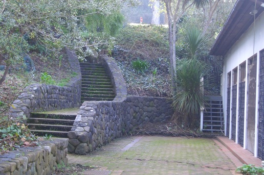
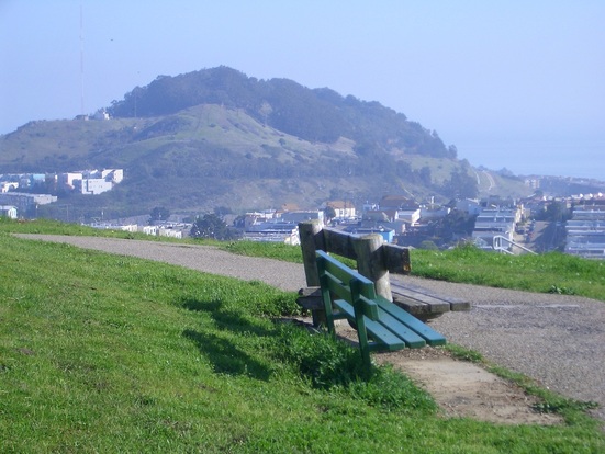
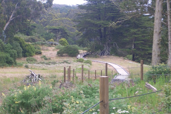
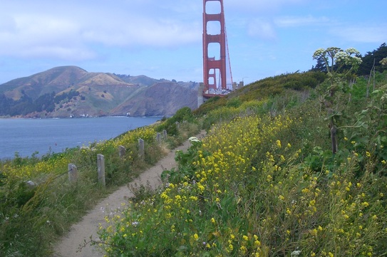
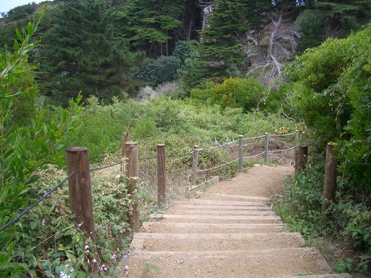
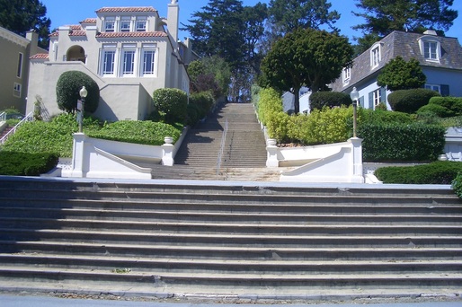
From the Castro Metro stop, headed up Castro to 19th, a few blocks west to Douglass, then steeply up to where the Douglass stairway begins at 20th (first pic).
The main Douglass stairway has 94 steps. Continuing directly across Corwin to the upper Douglass walk are 15 more, so a total of 109 here.
Turned on Corwin and into the Corwin Community Garden: http://foundsf.org/index.php?title=Corwin_Community_Garden_and_Seward_Mini-Park
Just below this little native plant garden is the Seward minipark with its double slide. Continued west on winding Seward, a short street I’m quite fond of, to 19th.
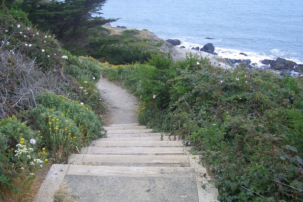
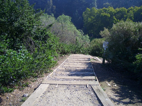
During a visit last year sometime I’d found the short, uneven stairway up (the top part of Clover Lane) between buildings here to be overgrown, so much so that the parks people felt obliged to post temporary signs advising a detour along the trail in the eastern part of park that leads to the stairway.
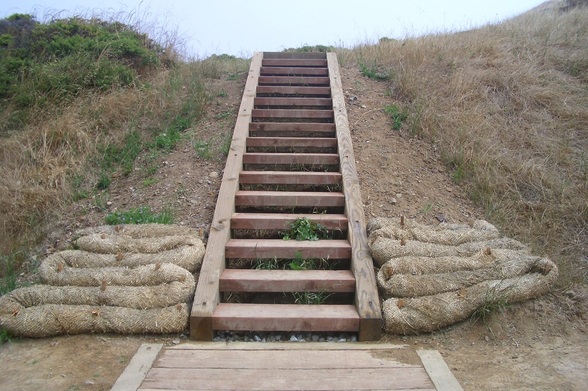
However, today, I found these steps (38 or so – second pic) up to the east side of Kite Hill Park to be cleaned up and perfectly walkable. The trail at the top of the stairs has also had the grass trimmed around it: steeply up to the welcoming bench.
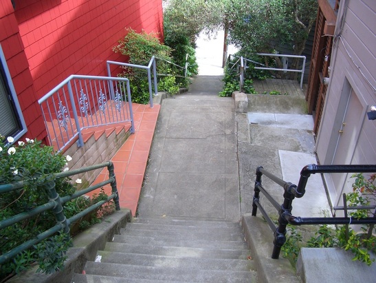
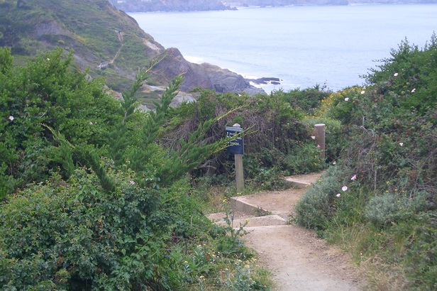
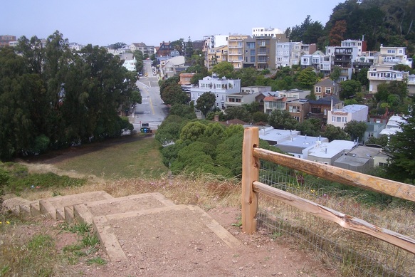
At the top of the park is the exit out to Grand View Terrace. Turning on Grand View Ave. I came to another non-city-made stairway. You can’t really see this one on Google Maps. On the north side of Grand View Ave. here is a non-city sign that says “Acme Alley.” At the top of this VERY attractive stairway between two residences, another sign says “Neighborhood Play Garden.”
The delightful stairway, the upper part of Acme Alley, is brick and wood and has been extended some since my last visit (about 55 steps). Looks like there may be plans to extend it even more all the way down the slippery-dirt trail that descends to Corwin (just across from the entrance to Corwin Garden). But in the meantime, watch that last step – it’s a doozy.
I’ve got some Webshots pix of it from earlier dates in my “Twin Peaks-Upper Market Neighborhoods: Kite Hill Park” album (close enough to the park to include it within).
From here, a short distance to the west is the dead-end of Corwin where I once again entered the park, then headed south on the trail that leads to the dead-end of Stanton Street (off busy upper Market). When you get to the little white concrete bench at Stanton’s gravel-end part, just continue on the trail into the park.
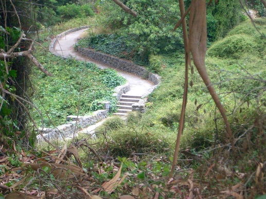
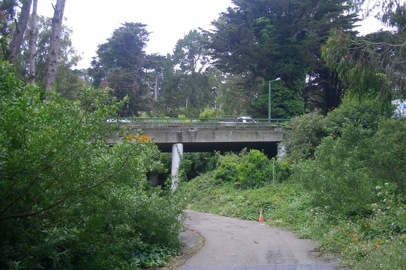
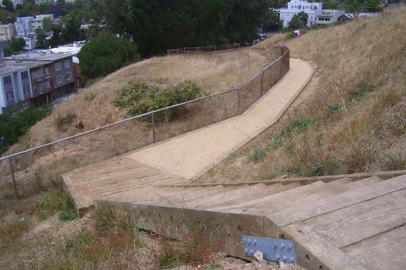
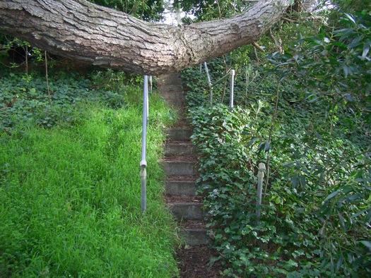
After Kite Hill it was a brief stroll to the top of the Mono stairway (66 steps: third pic) which descends to Eagle. At Eagle, Mono continues another block but as a narrow bricked walkers’ pathway to 19th.
Crossing 19th and Castro to the bus stop, the nekkid-guy-with-backpack seen before was talking to some (clothed) guys in front of the natural foods store. If you happen to pass by this particular bus stop on the south side of 19th at Castro, look up at the windows of the building here where are displayed an extensive collection of Barbie/Ken-sized dolls in an assortment of Gay costumes.
As the #24 passed the outdoor public sitting area near the Twin Peaks bar at 18th and Castro, there was yet another nude dude lounging in the sun.
From the Castro Metro stop, headed up Castro to 19th, a few blocks west to Douglass, then steeply up to where the Douglass stairway begins at 20th (first pic).
The main Douglass stairway has 94 steps. Continuing directly across Corwin to the upper Douglass walk are 15 more, so a total of 109 here.
Turned on Corwin and into the Corwin Community Garden: http://foundsf.org/index.php?title=Corwin_Community_Garden_and_Seward_Mini-Park
Just below this little native plant garden is the Seward minipark with its double slide. Continued west on winding Seward, a short street I’m quite fond of, to 19th.
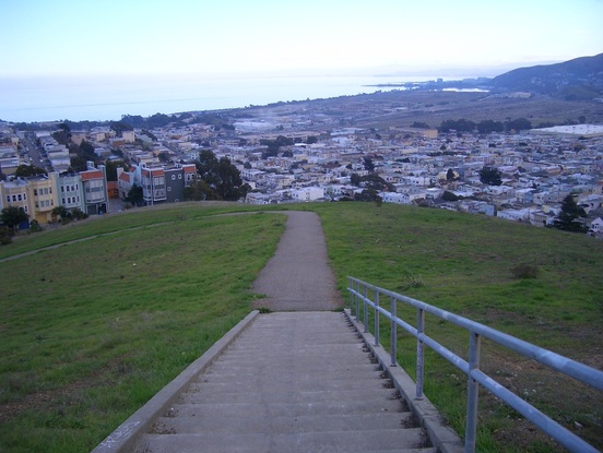
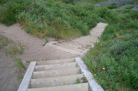
During a visit last year sometime I’d found the short, uneven stairway up (the top part of Clover Lane) between buildings here to be overgrown, so much so that the parks people felt obliged to post temporary signs advising a detour along the trail in the eastern part of park that leads to the stairway.
However, today, I found these steps (38 or so – second pic) up to the east side of Kite Hill Park to be cleaned up and perfectly walkable. The trail at the top of the stairs has also had the grass trimmed around it: steeply up to the welcoming bench.
At the top of the park is the exit out to Grand View Terrace. Turning on Grand View Ave. I came to another non-city-made stairway. You can’t really see this one on Google Maps. On the north side of Grand View Ave. here is a non-city sign that says “Acme Alley.” At the top of this VERY attractive stairway between two residences, another sign says “Neighborhood Play Garden.”
The delightful stairway, the upper part of Acme Alley, is brick and wood and has been extended some since my last visit (about 55 steps). Looks like there may be plans to extend it even more all the way down the slippery-dirt trail that descends to Corwin (just across from the entrance to Corwin Garden). But in the meantime, watch that last step – it’s a doozy.
I’ve got some Webshots pix of it from earlier dates in my “Twin Peaks-Upper Market Neighborhoods: Kite Hill Park” album (close enough to the park to include it within).
From here, a short distance to the west is the dead-end of Corwin where I once again entered the park, then headed south on the trail that leads to the dead-end of Stanton Street (off busy upper Market). When you get to the little white concrete bench at Stanton’s gravel-end part, just continue on the trail into the park.
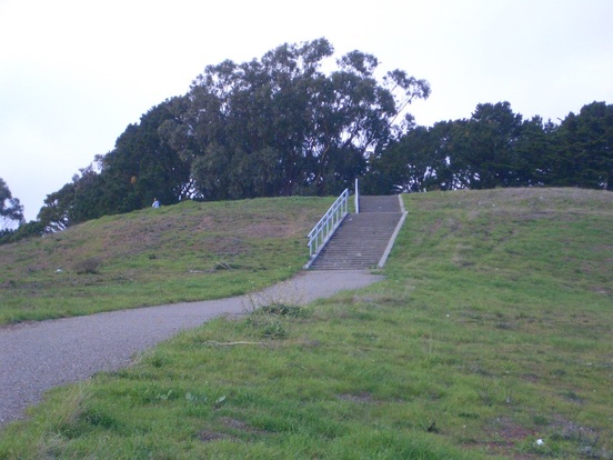
After Kite Hill it was a brief stroll to the top of the Mono stairway (66 steps: third pic) which descends to Eagle. At Eagle, Mono continues another block but as a narrow bricked walkers’ pathway to 19th.
Crossing 19th and Castro to the bus stop, the nekkid-guy-with-backpack seen before was talking to some (clothed) guys in front of the natural foods store. If you happen to pass by this particular bus stop on the south side of 19th at Castro, look up at the windows of the building here where are displayed an extensive collection of Barbie/Ken-sized dolls in an assortment of Gay costumes.
As the #24 passed the outdoor public sitting area near the Twin Peaks bar at 18th and Castro, there was yet another nude dude lounging in the sun.
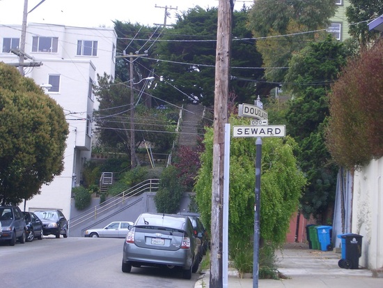
Douglass stairway up from 20th to Corwin
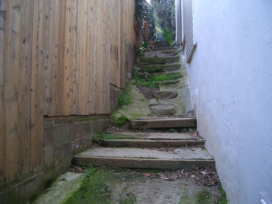
Top of Clover Lane up to Kite Hill Park
Mono stairway, Market down to Eagle

 RSS Feed
