Stairways are Heaven
  • Home
  • About Me
  • Stairways are Heaven

Westside Beautyspot: Stern Grove

5/28/2011

0 Comments

 
Picture
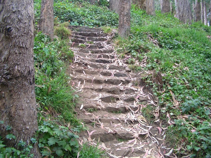
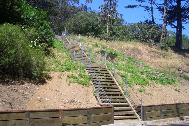
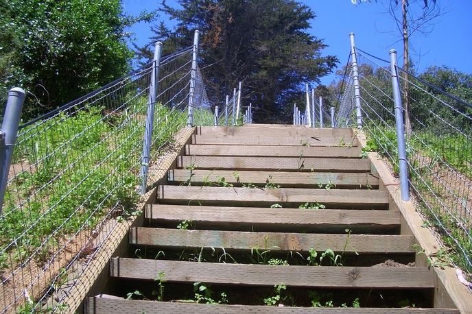
141 stone steps next to the Trocadero Clubhouse
Sigmund Stern Grove’s main entrance is at 19th Ave. and Sloat. This big park (63 or so acres) is a ravine/valley with steep eucalyptus-forested slopes. Multiple other entrances include along Wawona around 23rd and 24th Avenues.

The original landscaping and facilities were built by the Works Progress Administration. The park has plenty of trails and WPA-built stone walls.

Pine Lake is one of three natural lakes left in San Francisco out of 10 originals. Homes above look down on the lake and park from their back windows. There’s a delightful trail around the lake. Some of it is cozily enclosed by greenery; you might see ducks on the trail as well as in the water.

“Rabbinoid,” a lifesize sculpture of a rabbit in jogging clothes, used to lean against a rock near the lake with a cellphone to his ear, but he’s gone now.

The Trocadero Clubhouse (formerly Trocadero Inn) can be rented for day or evening events. This Queen Anne roadhouse was restored around 1930 under the direction of Bernard Maybeck.

The stairways are of rough, uneven stone. The foot of the park’s longest stairway (141 steps) begins immediately to the right of the Trocadero.

Unfortunately this whole stairway has always been strewn with trash during my visits, especially bits of paper and broken glass. The rest of the park looks fine; it’s just this one stairway that appears to get more than its share of drinkers and litterers. If it looks like this now, what’s it gonna look like during the upcoming concerts?

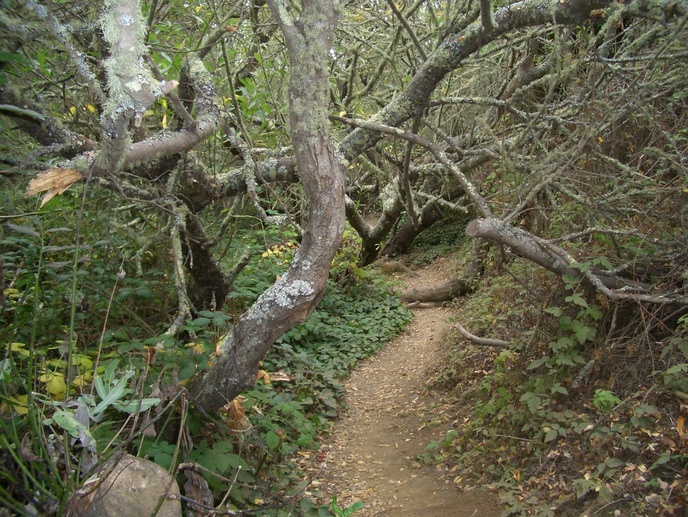
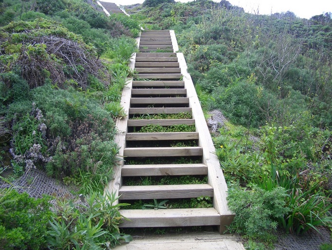
Down the stairway from the top, found a connecting trail partway up and headed towards the direction of Pine Lake, climbing over a fallen tree and enjoying the aroma of eucalyptus, descending just before the parking lot and dog play area.

Lots of places to sit -– low walls, benches, tree trunks, logs, and picnic tables. You’ll see ducks, birds, and squirrels.

City Guides hosts free Stern Grove guided tours every third Saturday at 11 a.m.

What this park is most famous for is their free summer concerts and performances in the outdoor amphitheater. These concerts are supported entirely by contributions. Established in 1938, it’s the oldest admission-free summer performing arts festival of its kind in the U.S.

This year Stern Grove Festival presents its 74th consecutive season: Sunday concerts from June 19 through August 21 at 2 p.m. 

In 2005 the park underwent a $15 million renovation.

The site was donated to the city in 1931 by Rosalie Meyer Stern who named the park for her late husband Sigmund Stern, a philanthropist and nephew of Levi Strauss. In 1932 Stern Grove was dedicated and two weeks later the San Francisco Symphony played the first concert there. Mrs. Stern, then President of the San Francisco Recreation Commission, formed the Stern Grove Festival Association in 1938, stipulating that all concerts were to be free to the public.

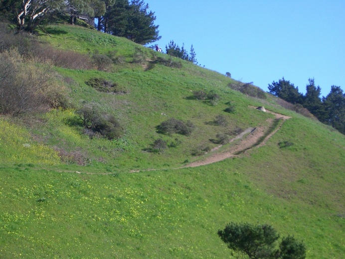
After my stroll round the lake, did a few trails on the opposite side of the park.

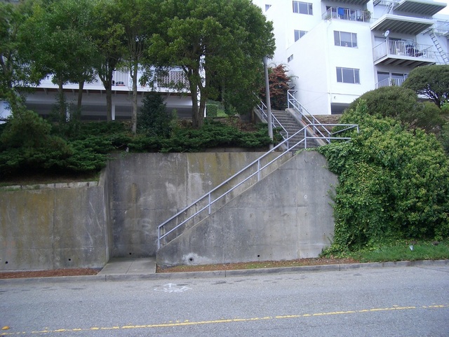
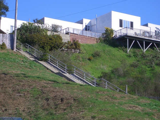
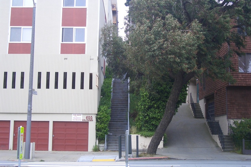
Not fond of the heavy trafficked wide streets and long traffic lights in this area, still felt like walking around the ‘hood a bit after leaving the park. This included a stairway that descends from Ocean and San Leandro to Moncada in the Ingleside (45 steps) and along the edge of St. Francis Wood (with its fountains and distinctive sidewalks) a few blocks before heading back to West Portal to catch a Metro.

0 Comments

Vista Lane: Take the Stairs to Twin Peaks Park

5/26/2011

0 Comments

 
Off the #37 at the Hopkins stop on Burnett, looked up steep Hopkins at the first of two short stairways that begin at Burnett. You can take this one to start, or the one a few yards over to the south.

Started up the south set of steps this time, 40 to the first driveway (foto below). Directly ahead are 102 more steps up to the next actual street, Gardenside Dr. 

Climbing Vista Lane’s series of stairways can be confusing because 
between each of the streets, the stairways also cross over driveways. There are multiple apartment buildings in this area of narrow, curving streets, and the driveways and carports here are a necessity.

From Gardenside to the second driveway is 35 steps, then 90 more steps up to the next street, Parkridge.

When you reach Parkridge there are 20 steps to the next driveway, then 69 more to Crestline. So 261 Vista Lane steps from Burnett up to Crestline at Twin Peaks Park if you only count one of the short starting stairways on Burnett. Only one of these is shown as Vista Lane on Google Maps; the other is not shown.

At the top of Crestline (bus stop for the #37 Corbett/Twin Peaks bus here) is a trailhead for Twin Peaks Park directly across the street; the summit marker is very visible. Continue up into the park. There are 93 wood steps to Twin Peaks Blvd. 

Descended from the park on winding Twin Peaks Blvd. (hikers need to be careful of cars here) to take my usual route: Twin Peaks Blvd. to Raccoon; Raccoon to Crown Court and the short path out to Crown Terrace; Crown Terrace to the top of Pemberton stairway and down 211 steps from Crown Terrace to Clayton/Corbett. Had lunch on the welcoming bench at the first landing up from the foot.

Be careful when crossing Clayton from the foot of Pemberton -- if you want to continue to descend through the Clayton/Corbett Neighborhood Garden (36 steps) across the street -- as the cars just keep on coming.

Continued to the Clayton-to-Market stairway (44 steps) that starts directly below the foot of Iron Alley (135 steps). This route took me beneath the oldest house on Twin Peaks (the pink one, the Miller-Joost house, 3224 Market, Landmark 79) next to the “Hills Mural.” 

Upon reaching the Storrie Ord Neighborhood Group gardensite, strolled through this shady little oasis to the top of the Ord stairway (34 steps to 18th). Garden lovers will appreciate what they’ve done with this small space. 


PictureBurnett starts the long Vista Lane series of steps up to Twin Peaks Park

0 Comments

Damselfly Heaven and a Trail Extension

5/21/2011

0 Comments

 
Picture
A North Trail
Picture
An East Canyon Trail up to Christopher Park
Glen Canyon, about 70 acres and a ravine of Twin Peaks, is an amazing midcity wildspot. Today’s Canyontrek began at the Glen Park BART station. Headed west five or six blocks to Elk and one of the park’s entrances.

If you need to stop for groceries after your hike, you can climb all the way up the Diamond Heights side (plenty of trails and short stairways) and visit the Safeway in the Diamond Heights Shopping Center.

The northernmost trail in the Canyon depths used to dead-end at the locked gate of a school playing field. The trail has been extended a bit to the end of another, smaller, also fenced and locked area just to the north of this field, behind the San Francisco School of the Arts High School. It’s still a dead-end, though; you can’t go through to Portola just yet. 

This whole north Canyon-bottom part will have you stepping over muddy sections and climbing over tree limbs (top pic). You can also sit on the tree limbs in the dappled sunlight on this secluded trail; looks like this coming blackberry season is gonna be a good one.

Lots of damselflies down here near Islais Creek. The little wood footbridge at the end of the boardwalk is once again missing one of its sides.

From a Canyon trail up to Turquoise, crossing Turquoise and continuing to Amber, is a stairway/walk with 65 steps, It’s shown but unnamed on Google Maps; I’ve been calling it the Turquoise stairway.

Where the foot of the Turquoise stairway/railed walk meets the Canyon trail, there’s a drainhole and a sign stating that the park is closed from 10 p.m. to 6 a.m. At the top at Turquoise is a sign saying dogs should be leashed in this part of the park.

Wondering if Coralino Lane was supposed to be an extension of this lower, unnamed stairway up from the park.

Coralino from Amber up to Cameo has 132 steps. If you add the lower Turquoise stairway, this comes to 197 total. However, from the top of the Turquoise stairway you do need to walk a block or so uphill on Amber to connect with Coralino and continue up. Coralino’s name is shown on Google Maps.

Passed by a new SF Police Academy community garden in a lot next door to the St. Nicholas Orthodox Christian Church at Amber and Duncan near Diamond Heights Blvd.

Descended steeply into Noe Valley via Duncan to Douglass. The top, dead-end, of Douglass here meets the top of 28th where walkers can use a convenient short walkway to take them through to Diamond Heights Blvd. at Gold Mine and the shopping center.

Continued to the top of the Valley stairway on Diamond. The main Valley stairway has 69 steps. At the foot Valley is a divided street with the upper (north) part continuing after a few yards as a shady sidewalk stairway (52 steps) alongside homes nearly down to Castro; so total for the Valley main and sidewalk stairway: 121 steps.

0 Comments

Arguello Gate to Lobos Creek Boardwalk North Trailhead

5/20/2011

0 Comments

 
Picture
14th Ave. up to the Dunes Boardwalk and Viewdeck
When I walk up the hill to the Presidio’s Arguello Gate from the bus stop, there's only a short distance to Inspiration Point Overlook. 

A brief glance at the little valley below, the El Polin Springs area that is hopefully nearing completion of its huge renovation -- including the removal of tons of army landfill -- didn’t really show me anything new today. 

Continued north on Arguello down to the west end of the Main Post and up the 56 steps to the Post Chapel. At the top of the steps a couple of hummingbirds were darting about. The sitting area at the top of the steps with the chairs and bench is undergoing improvements and clearing so that one now has more of a view down. Someone was gardening here. 

Continued up the curvy trail to the Cemetery Overlook. Took the stairway down after a short rest on one of the benches overlooking the cemetery, watching a guy on a ride-em mower cutting the grass between the headstones. Not many other people on the various trails today: why I like weekdays most for hiking.

The 98 wood steps down from the Overlook (a trail marker at the top) wind through the forest to the delightful Park Trail, where there are a couple of Presidio Habitats exhibits. These installations have been extended throughout the summer – I’d like to see them all made permanent fixtures in the park.

From the Park Trail, wanted to connect with the new trail up from near the 14th Ave. gate. Headed downhill on the paved trail with the golf course on both sides, a route used frequently by non-golfers and bicyclists. 


This will eventually take you to the foot of the newest connector wood stairway that climbs to the recently completed boardwalk, viewdeck/benches, and trail out to Battery Caulfield Rd. From the foot of the stairs you can see the traffic down on Park Presidio Blvd. in the distance to the south. When you reach the boardwalk at the top, the residences (former public health hospital buildings) are below on the south side.

Climb the stairway, walk the boardwalk, and sit on one of the wood viewdeck’s benches. When you can force yourself to get up and move on, you can continue by crossing Battery Caulfield Road and descending through the forest to the Lobos Creek Boardwalk's east trailhead.


You’ll step over roots and climb over a fallen tree as you make your way down to the Lobos Creek Trail.

On your way down the sandy trail, bordered by a zigzagging trailmarker fence, you’ll spot a lone bench in the distance. This is the bench at the top of the short stairway (19 wood steps) that descends to the Lobos Creek Boardwalk Trail.

This curving boardwalk is said to be about a half mile long. It's especially beautiful right now with all the wildflowers, and I was in the good company of bumblebees, damselflies, birds, and a tiny lizard. It ends at Lincoln Blvd. (its north trailhead). A bus stop for the #29 is directly across the street from the infosign.

0 Comments

Excelsior Stairways

5/20/2011

0 Comments

 
Picture
Athens & Avalon stairway up to Valmar Terr.
The Excelsior is a vast, hilly Outer Mission ‘hood with its south boundary McLaren Park.

Last time I took the #49 bus to get to Mission and Silver, I went the other way, east via the #44, into the Portola neighborhood. This time started uphill from Mission on Avalon several blocks to Athens. 100 Athens steps climb from Avalon to Valmar Terrace. See above photo.

From the top of the steps it was downhill to Athens and Peru about a block where another stairway, this one wood, has approximately 77 steps with a bench at the top at Valmar.

Circled around and soon reached the foot of the Munich to Ina stairway up from Excelsior, around 56 steps. Up ahead at Excelsior’s dead-end (there’s a sign) is a short stairway into McLaren Park.

After this it was several blocks over to the west side and downhill to London, between France and Italy, for the last stairway, Kenney Alley: 47 steps. There’s a bus stop directly across the street from the foot of this one. I sometimes spend more time on the bus than actually hiking, and today was one of those times on the crosstown #29.

0 Comments

Main Post Stroll

5/14/2011

0 Comments

 
Picture
West trailhead of Batteries to Bluffs Trail down from Battery Crosby
The Presidio Officers’ Club on Moraga is in the process of being restored.

The temporary Visitor Center, with free maps and other info, is at 106 Montgomery in a beautiful old building next door to the Disney Museum.

As I walked further to the north edge of the Main Post, noticed one of the old stairways from the Crissy Field area up to the Main Post is still there and walkable.

Strolled on to the Tennessee Hollow Trail (a trail marker here now) where the “daylighted” area is.

In the 1870s soldiers grew vegetables along the banks of a creek here that supplied water to a salt marsh where Crissy Field is now.

Various buildings were later built over the site and when they were demolished in the 1970s became part of the army’s landfill.

Tons of this landfill were removed by volunteers in 2005, and these days more than 300 native plant species provide shelter for various animals. Sat for a while on one of the benches listening to birds.

A 2010 film about this by Melissa Peabody, presented as an online video, showing how the landfill was removed and the creek restored: 


http://www.facebook.com/video/video.php?v=136032029778139

The foto: the west trailhead of the Batteries to Bluffs Trail down from Battery Crosby.

0 Comments

Viz Valley Greenways up to the Park

5/13/2011

2 Comments

 
Picture
195 Steps from the end of Campbell in Visitacion Valley to Visitacion Ave. in McLaren Park
The Greenways are six miniparks in the Visitacion Valley neighborhood that stairstep up the hill.

Usually take the T-Third Metro to the Sunnydale (last) stop and walk up to Leland and Peabody to the first of them: the Hans Schiller Plaza Greenway.

Walking directly north through this first one and crossing the street takes you to Greenway 2, the Community Garden Greenway. The garden itself is usually locked, but you can still walk through the park and look through the fence bars at the garden alongside.

The third is the Herb Garden Greenway, my second favorite. There are picnic tables, a short stairway, and a tiered herb garden.

The fourth is the Children’s Play Garden with a playground at the foot.

The fifth is also rarely open to visitors, and with this one, the Agriculture Lot Greenway, corner of Rutland and Campbell, you’ll be looking into the garden from the sidewalk on the other side of the fence.

Uphill from this on Tucker is my favorite, the sixth, the Native Plant Garden Greenway, with its winding paved pathways, benches, and view of San Bruno Mountain.

From the top of this last Greenway, needed to go back downhill a little way in order to access the long stairway from the west dead-end of Campbell up into McLaren Park. Turned left at Delta at the “mural house” to descend the steep paved walkers’ pathway here (several steps at the foot).

To walk this stairway -- 195 steps from Campbell up to Visitacion Ave. in the park -- look for the opening for a person to pass through at the end of Campbell. The stairway’s foot is set back from the street a few yards.

At the top of the steps is Visitacion Ave. See above. From here it was a short but steep trek up to Mansell with the lookout area and picnic tables, and the rest of the park down the other side.

John McLaren Park, over 300 acres, is part of San Bruno Mountain with Visitacion Valley between. The south slope is already really dry and it can get superwindy in this openspace grassland, my favorite part of the park.

Mansell is a divided E-W street, the upper part east and the lower part west. This street runs all the way through the park so you have a pleasant green view from both sides.

At University and Mansell, at the top of the Portola neighborhood and at the east edge of the park, is one of the stops for the crosstown #29. The bus comes out at the west end of the park at Persia and Dublin in the upper Excelsior neighborhood and heads downhill to Mission St. 

2 Comments

14th Ave. Dunes Stairway/Boardwalk Now Walkable: Presidio

5/12/2011

0 Comments

 
Picture
Connector Trail from 14th Ave. to Dunes Boardwalk: Presidio National Park
The Presidio’s latest stairway has 90 steps that will take you up to a long wood boardwalk. 

Partway along the new boardwalk is an elevated wood deck with a couple of built-in benches. Looking out at the peaceful dunes and green rolling hills to the north, it wasn’t easy to leave. How lucky are those in the residences below to have this beauyspot nearby.

To get here, walked through the 14th Ave. gate and turned right on the paved walkers’ trail, passing below the Wyman Ave. residences, across busy Park Presidio from Mountain Lake.

The wood stairway (the lower part has railings) ascends to the left just before you reach the south trailheads/infosign for the Park and Mountain Lake trails.

This is a major connector trail. On the west side you’ll come out at Battery Caulfield Road where there’s a trail continuing down through the forest that connects with the Lobos Creek boardwalk trail.

Today, however, continued up the hill to Immigrant Point Overlook, then down the Connector Trail from there to Lincoln: 208 winding steps. There’s now a new trailhead sign at the top of this stairway.

From here continued on to Fort Scott for lunch at one of the picnic tables, then onto the Coastal Trail to the bridgeviewing area as yesterday. 


0 Comments

Batteries to Bluffs: 470 Steps

5/11/2011

0 Comments

 
Picture
Batteries to Bluffs Trail: Steep west side

San Francisco’s longest public stairway is the Batteries to Bluffs Trail in Presidio National Park: 470 steps.

Started off at the bridgeviewing area on the Coastal Trail. Now’s an especially good time for walking this and other trails with all the wildflowers around -- wild mustard, wild radish, thistle, etc.  

The east trailhead is just off Lincoln Blvd. a short distance from Langdon. The west trailhead is at the top of Battery Crosby, about 0.7 mile away. A short trail leads up to Lincoln from the battery. You can now see more of the BTB as you look down from Lincoln as they’ve trimmed and removed several trees up here.

There’s an alternate trail down from Lincoln that will also take you directly to the Batteries to Bluffs west trailhead. Did this today; tree roots to walk over and one steep spot. Go slowly here. A rather flimsy fence zigs along one side of the trail.  

The Batteries to Bluffs consists mostly of wood stairs (no railings  except for one side of the short footbridge) with a few short trails in between. Presently the last step down from the footbridge is rather steep; wouldn’t be surprised if a couple more steps are added here in the future.

The view has to be seen to be believed, especially on a sunny, fogless day. Bring your camera, but the signs say no dogs allowed on this particular trail.

Today counted 339 steps from the west trailhead to the viewplace with a bench called View Point. 


From the main Batteries to Bluffs
there’s a separate trail (about 48 steps included) that will take you down to secluded Marshall’s Beach. 

The west trailhead is above Baker Beach, close to the top of the Sand Ladder (approximately 253 steps from Lincoln to Baker Beach). From Lincoln you can also access another long wood stairway called the Connector Trail that curves up to Immigrant Point Overlook and Rob Hill Campground (about 208 steps). You can easily see the foot of the Connector Trail as it ascends from the crosswalk on the south side of Lincoln; there are excellent infosigns and trail markers throughout the park.

Looks like summer’s already here: chilly, windy, and foggy. Better for hiking than it being overly hot. Walking back to the bridgeviewing area to catch the #28 bus, took an alternate route behind one of the batteries: a cliffside trail here where I emerged atop the battery instead of walking along at the foot/front of it. 


0 Comments

Sunnyside Up

5/7/2011

5 Comments

 
The Detroit stairway is Mount Davidson’s longest; its foot just up from Hearst.

At the 70th step up from Hearst is a major street, Monterey Blvd. Cross Monterey at the crosswalk and continue up the steps alongside the apartment building (foto) for 185 steps total up to Joost. There’s a lot of wild fennel and you’ll walk past the back doors of residences.

Sunnyside’s south border begins around City College/Judson; its east side borders Glen Park. North of Sunnyside Playground is the Miraloma Park neighborhood, and to the west is Westwood Highlands.

The #43 is a good bus to take you up and over from the north side; winding down the west side and through part of the Sunnyside out past City College. When visiting Mount Davidson Park, sometimes get off at the Juanita/Marne stop, walk a couple blocks uphill, and ascend the brick Juanita stairway, the north trailhead for the zigzag trail through the forest to the summit.

PictureThe Sunnyside's Detroit stairway as it continues its climb from Monterey Blvd. 185 steps total, Hearst to Joost.

5 Comments
<<Previous

    Author

    I like meandering around on San Francisco's park trails and public stairways, sometimes taking photos, and enjoying nature and the outdoors.

    Archives

    March 2020
    February 2020
    January 2020
    December 2019
    November 2019
    October 2019
    September 2019
    August 2019
    July 2019
    June 2019
    May 2019
    April 2019
    March 2019
    February 2019
    January 2019
    December 2018
    November 2018
    October 2018
    September 2018
    August 2018
    July 2018
    June 2018
    May 2018
    April 2018
    March 2018
    February 2018
    January 2018
    December 2017
    November 2017
    October 2017
    September 2017
    August 2017
    July 2017
    June 2017
    May 2017
    April 2017
    March 2017
    February 2017
    January 2017
    December 2016
    November 2016
    October 2016
    September 2016
    August 2016
    June 2016
    May 2016
    April 2016
    March 2016
    February 2016
    January 2016
    December 2015
    November 2015
    October 2015
    September 2015
    August 2015
    July 2015
    June 2015
    May 2015
    April 2015
    March 2015
    February 2015
    January 2015
    December 2014
    November 2014
    October 2014
    September 2014
    August 2014
    July 2014
    June 2014
    May 2014
    April 2014
    March 2014
    February 2014
    January 2014
    December 2013
    November 2013
    October 2013
    September 2013
    August 2013
    July 2013
    June 2013
    May 2013
    April 2013
    March 2013
    February 2013
    January 2013
    December 2012
    November 2012
    October 2012
    September 2012
    August 2012
    July 2012
    June 2012
    May 2012
    April 2012
    March 2012
    February 2012
    January 2012
    December 2011
    November 2011
    October 2011
    September 2011
    August 2011
    July 2011
    June 2011
    May 2011


    RSS Feed

Powered by Create your own unique website with customizable templates.