Stairways are Heaven
  • Home
  • About Me
  • Stairways are Heaven

Strawberry Hill Forever

6/28/2012

1 Comment

 
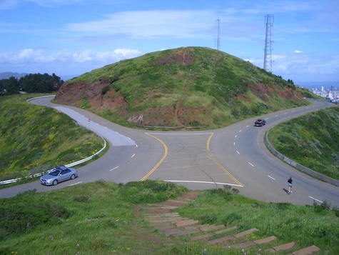
It'd been about a year since I visited Strawberry Hill/Stow Lake, my favorite part of Golden Gate Park and the park's highest elevation. This area is a little way into the park from 19th Ave. and Lincoln. The hilly island that's Strawberry Hill has three stairways in the Huntington Falls area.

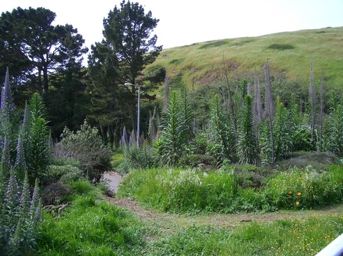
I like it that I can see more birds, gulls, ducks, lots of geese (LOVE geese), and squirrels closer-up than in other parks. Love the many, many meandering forest trails. 

What I really don't care for is the traffic on so many streets in this park. I'd like to see a lot more pedestrian overpasses on streets that allow vehicles. There are crosswalks but far too many cars that go too fast inside the park's boundaries. Even better, I'd like to see all cars banned from the park except maybe on just one or two important streets, and those with the aforementioned walkers' bridges added.

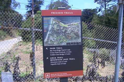
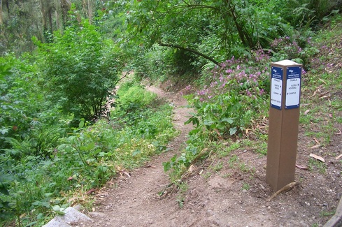
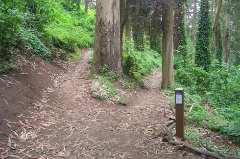
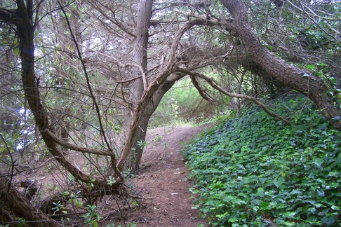
One can get turned around easily in this park, especially on the wilder west side, as there are so many surrounding trees that it's difficult to see landmarks. So more infosigns would be appreciated: like the Presidio's. 

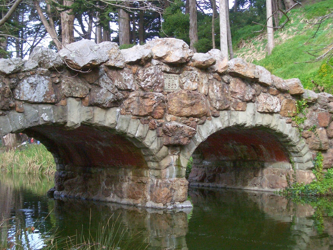
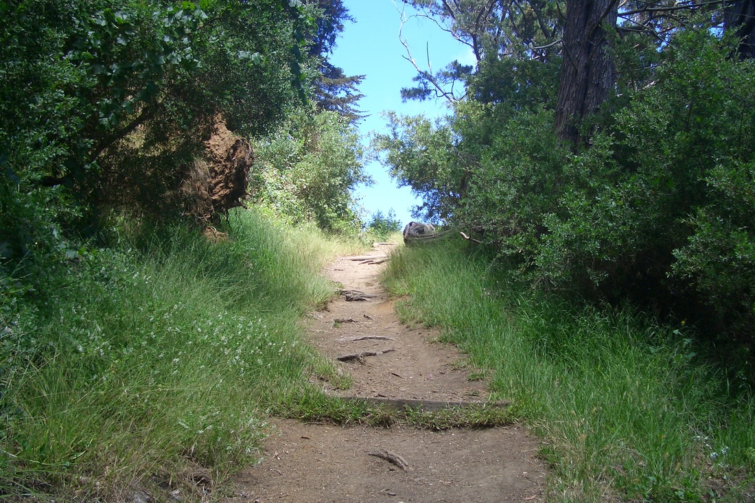
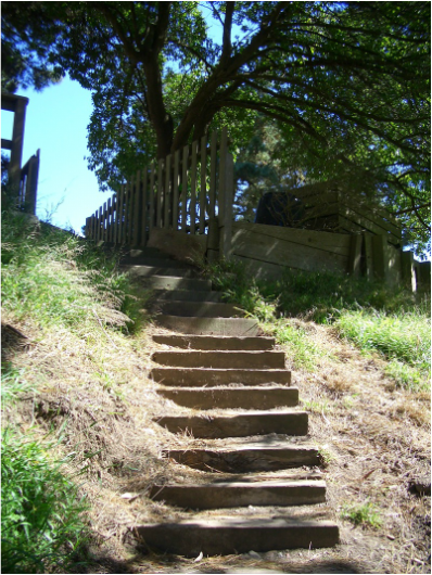
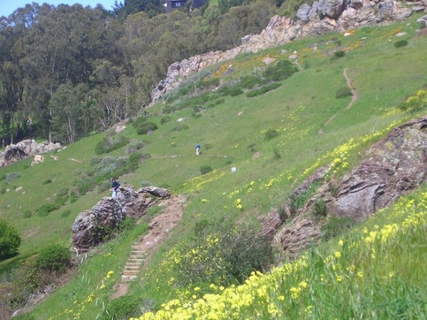
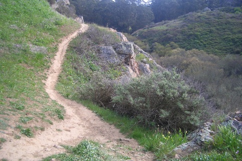
From the 19th Ave. & Lincoln entrance, a short walk to the north, then over the 1893 stone Roman bridge (first pic), and up a few steps to ascend Strawberry Hill's east side (second pic).

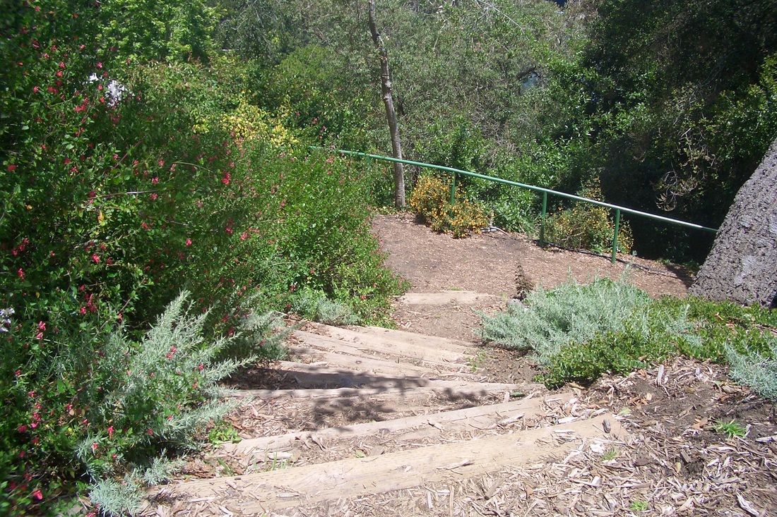
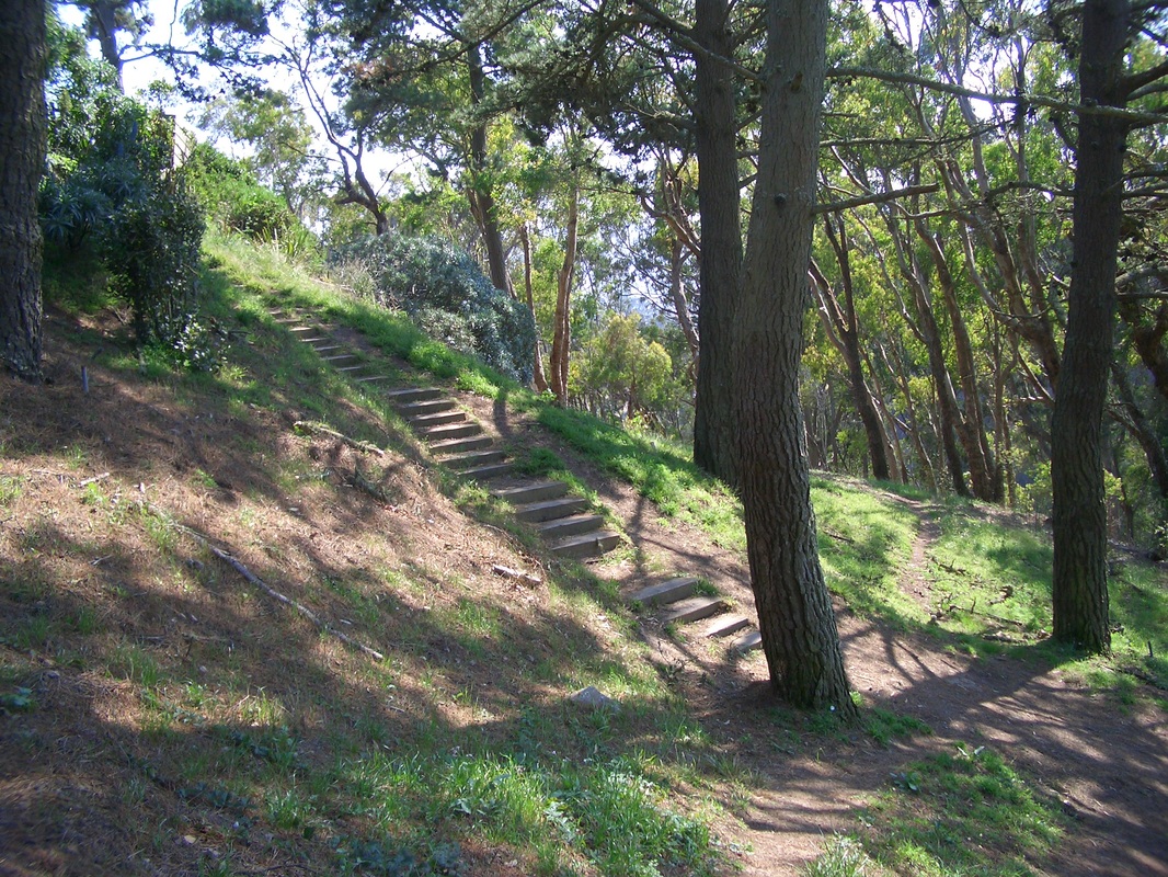
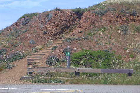
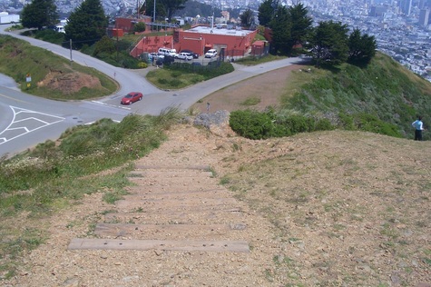
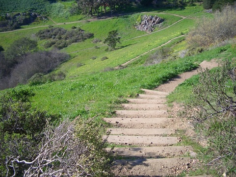
Thirteen old wood steps from the top of the hill (south side, third pic) near the reservoir descend to the highest of the three footbridges over Huntington Falls (fourth pic).

On the north side of the falls/footbridge are 21 wood steps down from the summit, these with a green railing. 

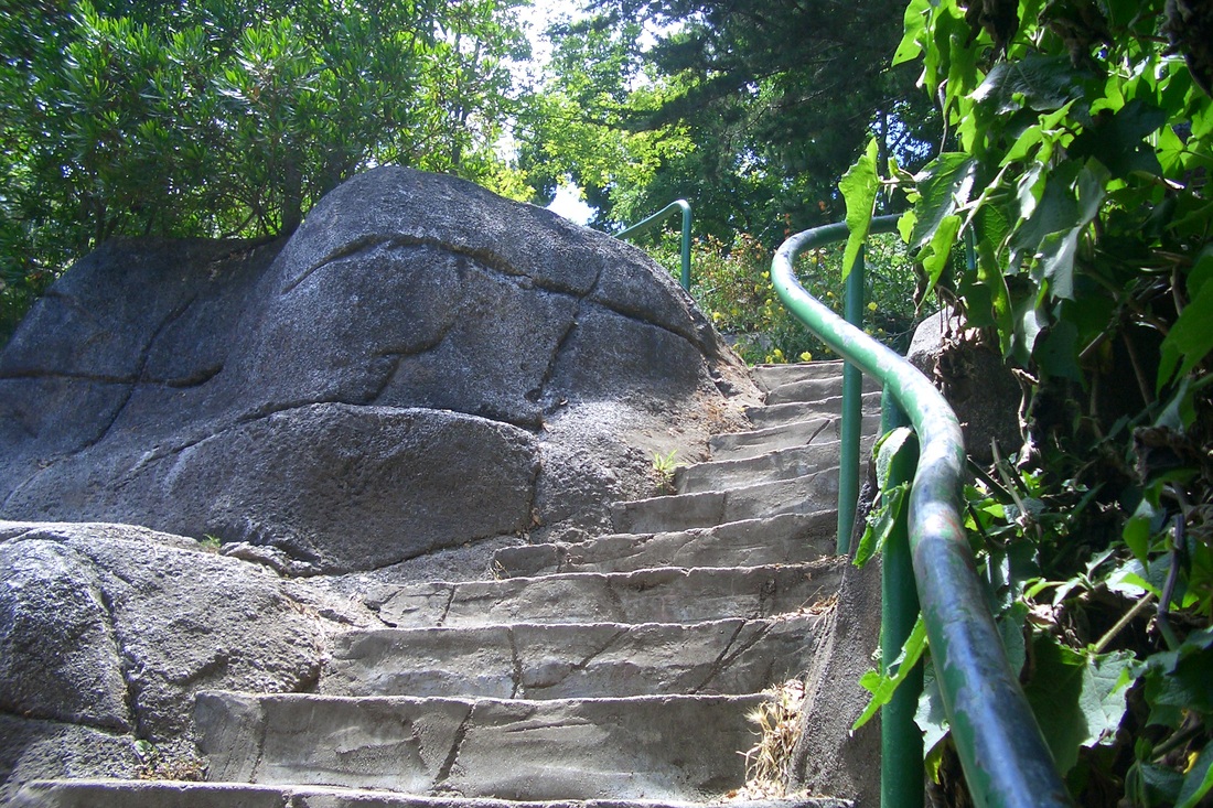
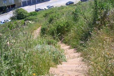
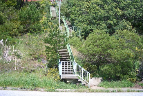
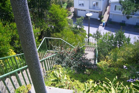
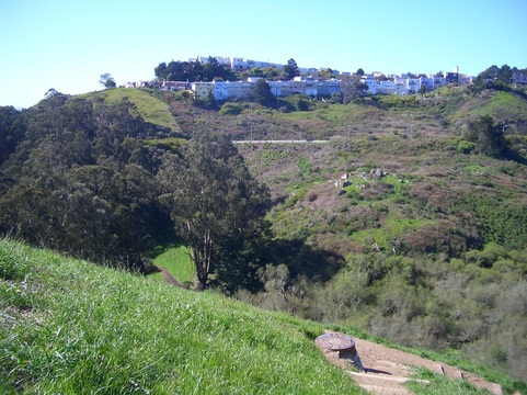
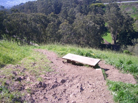
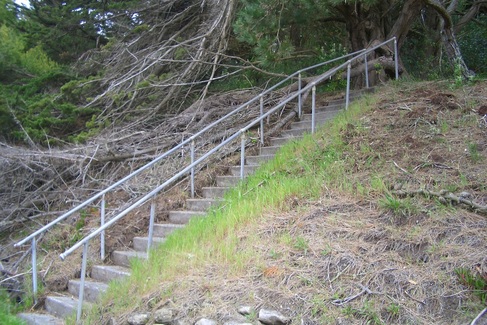
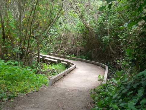
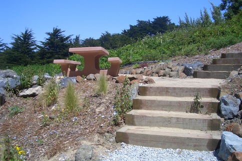
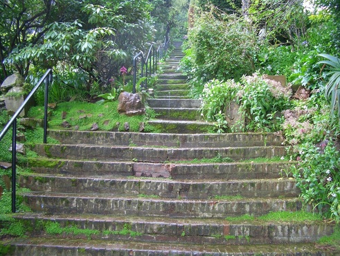
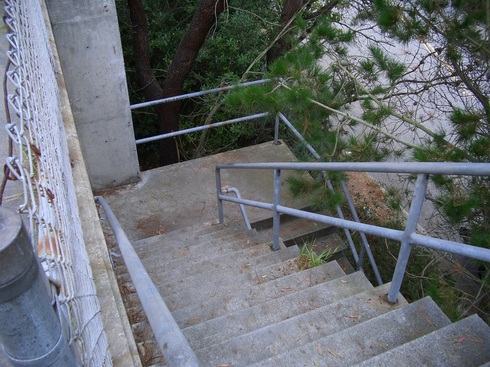
Continuing, there are 90 wood and concrete steps with curvy green rails alongside sweet-smelling flowers (fifth and sixth pix) down to the east side of the lake, where you'll find benches, a picnic table, and the Chinese Pavilion (seventh pic). You can walk all the way around the lake on this lower trail. 

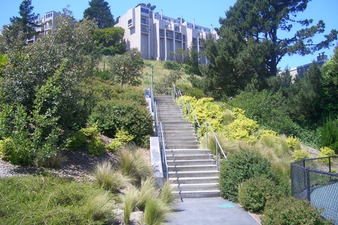
From the steppingstones at the foot of the falls, 39 steps climb up on the south side of the falls to the first footbridge. On the other side of the scenic footbridge, the steps that continue up from here are the same ones descended earlier. There are 104 steps to the highest footbridge. If you add the 21 formerly counted down from the summit reservoir area: 125 total for the longest set of continuing steps. 

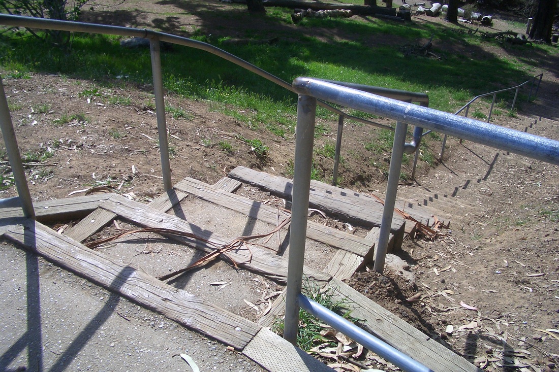
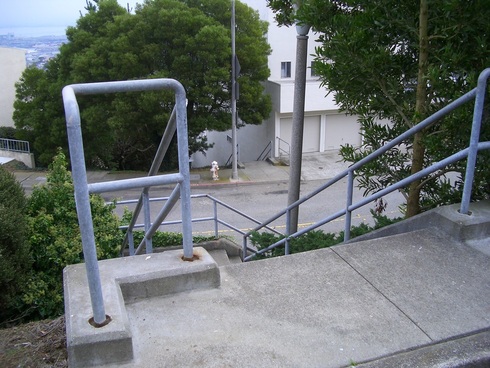
At the north side a third stairway, this one down to the other Stow Lake footbridge, starts off as 23 ordinary concrete steps, then a short trail, with the rest wood and wide-spaced, for a total of 61 steps. The boathouse is on this side of the hill. 

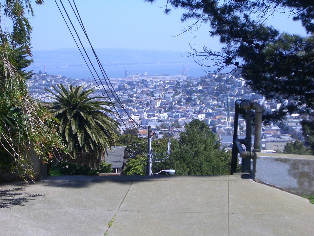
Since I was now on the north side, curved around on some trails to soon fin
d myself on a trail at the side of busy Crossover & Park Presidio Bypass. The #29 bus goes through the park here S-N but doesn't stop in the park. Had to circle all the way back around again to Lincoln & 19th to the bus stop just out of the park. 
Picture
Picture
East on Strawberry Hill Trail
Picture
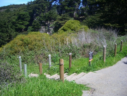
13 steps down from the Summit to start
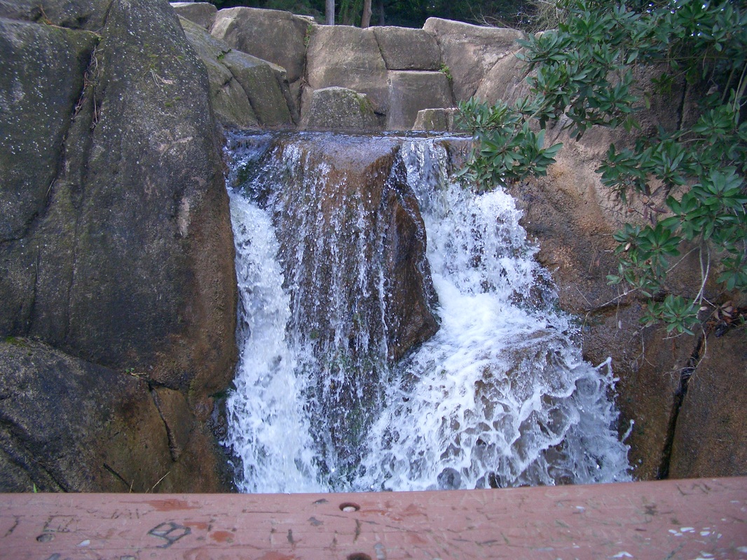
Picture
Huntington Falls
Picture
Alongside the Falls
Picture
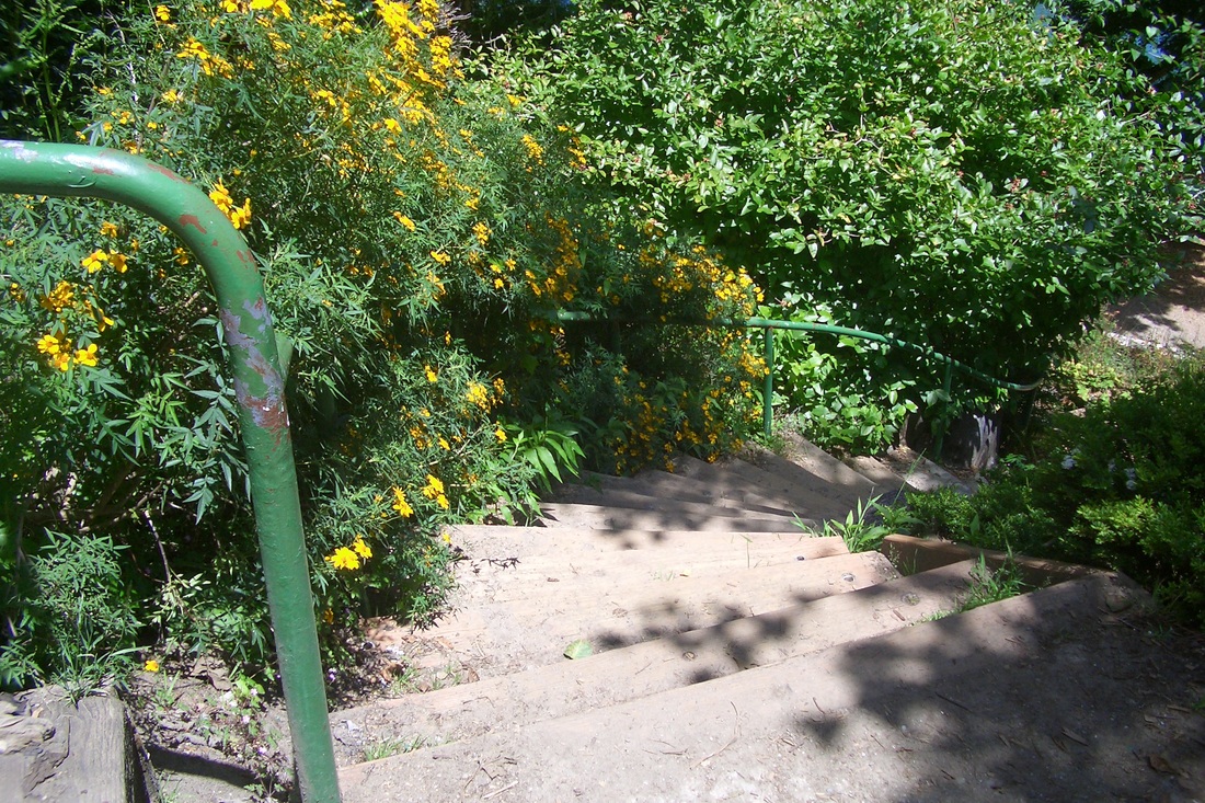
Steep steps down to the Lake
Picture
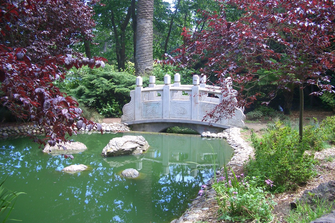
Chinese Pavilion Footbridge
1 Comment

Stairways Valley Onique Crags

6/26/2012

0 Comments

 
From the #24 bus stop at Noe & Valley, headed west on Valley on the north sidewalk just past Castro that turns into a sidewalk stairway on the upper side of the divided westernmost dead-end of Valley. The first set of stairs (52) is shady, alongside homes. At the top of the steps, continued on the sidewalk a few yards to the main Valley stairway (69 steps) for a total of 121 steps for Valley between Castro & Diamond. First pic: Top of the main Valley stairway at Diamond St. 

28th St. uphill from Diamond is a supersteep block, but this was the quickest way to the Safeway. 

At the top of 28th is the south dead-end of Douglass. Just below that is a short enclosed walkway with a few steps that leads to Diamond Heights Blvd./Gold Mine across from the Diamond Heights Shopping Center (the #52 Excelsior bus stops here). 

After the Safeway it was up Gold Mine at the corner to Topaz. The stairway just behind the shopping center also goes up to Gold Mine: second pic. 

Such a view from Topaz along a fence between homes. This highspot is the top layer of Diamond Heights homes.

Continued on curvy Topaz to just past Ora Way where the long Onique stairway starts its descent to Gold Mine (108 steps: first flight); to Berkeley Way (122: second flight); and again to Berkeley Way (116: third flight), for a total of 346 steps for Onique, coming out at the top of Glen Canyon. 

Turned right, trudging uphill on Berkeley Way to Crags Court, past the huge rocks at the Canyontop and to the dead-end of Crags where the community garden is. 

The gate has always been unlocked when I've been here so I could walk around in the garden. This is a gorgeous place with a jawdropping view thru the trees to the Canyon below. 

At the garden's north end there's another gate, and next to it 31 old wooden steps (next two pix) that descend into the Canyon a short distance. When you get to the foot, you have a choice of skinny dirt trails south, north, or down.  

I chose south and up a very steep trail that took me right back to the rocks area where Berkeley Way meets Crags Court. 

From here it was down Diamond Heights Blvd. on the Canyon side of the guardrail (fifth pic) to just past the top of the Elk stairway (sixth pic). At Elk, turned east into the Glen Park 'hood. Every street down from here is steep. Chose Lippard down to Chenery. 

The next pic shows the Canyon on the left side along Elk, up past the stairway to where Diamond Heights Blvd. begins, taken from Bosworth and Elk. The last pic shows Onique stairway's foot at lower Berkeley Way (right side). Taken from the  rocks openspace just below Marietta on Mount Davidson across the Canyon. 


Picture
Top of main Valley stairway at Diamond
Picture
Behind the Safeway up to Gold Mine
Picture
Down from Crags Court Garden
Picture
Up to Crags Court Garden in Diamond Heights
Picture
Mt. Davidson across the Canyon
Picture
Elk into the Canyon
Picture
Elk merges into Diamond Hts. Blvd. near the curve
Picture
Onique's foot at Berkeley from Mt. Davidson
0 Comments

Hiking Instead

6/24/2012

1 Comment

 
This Pride weekend was the first time I didn't attend both Pride Celebration and Parade since they first started back in the '70s. 

It was nice to read that either all or some of the Celebration area was supposed to be smoke-free this year. However, along the parade route on Sunday one couldn't hope to escape all that air pollution in such a huge crowd. And I was too broke again this year to pay $8.00-ish for a drink. One year was walking up Polk St. and saw that a restaurant was offering drinks I could better afford, and was not hassled about having to drink it right there or anything, so that was a pleasant surprise. 

But this year decided to hike instead. Yesterday: Up 19 steps at the north end of 8th Ave. at Lake into the Presidio's Mountain Lake Park and 17 down to the lake to pass close to the birds (first pic). 

Winding around the lake to the left and under the overpass, looking for berries along the paved Mountain Lake Trail. Uphill to the left at the trailsign for the Park/Anza Trail (second pic), the golf course soon on both sides. 

From the Park Trail, left onto the Bay Area Ridge Trail, enclosed by greenery on both its curvy sides. Veered off the main trail to mosey down through the forest. Various short offshoot trails wind out to the west side of Fort Scott, where I slid down from the trail over a low wall at Wright Loop, then along the west edge of the Fort Scott 'hood to the Golden Gate Overlook. 

Today: Up from Crestline (94 steps: third pic) into Twin Peaks Park, then 117 steps up the south side of Eureka Peak (fourth pic: the foot; fifth pic: looking across at the north side of Noe Peak from here). Down the north side of Eureka Peak are 83 steps. Part of this one is rocky with some steep steps (sixth pic). 

Down the steps to Crestline again to descend Vista Lane from the top: 261 steps to Burnett. Then several blox over to Twin Peaks Blvd. (seventh pic: view between homes on Twin Peaks Blvd.) and down to the foot of Tank Hill at Villa Terrace where the lower part of the long Pemberton stairway can be accessed about halfway along Villa. Between Villa and Clayton is a bench across from the human/dog water fountains where I stopped for a bite. Eighth pic: Pemberton stairway as seen from Clayton. 

Just past Al's Park on Corbett, at the corner of Mars and 300 Corbett, today's discovery: yet another new neighborhood garden/minipark! There's a chainlink fence and locked gate with Market St. below, and now on this slope wooden steps curve up to the top where just inside the fence is an area that has been cleared and roped off. Must revisit later.

Descending to Market, across the street is the other delightful mini/gardenpark (Storrie and Market) with its east edge at the top of the stairway-with-wall-mural that descends from Market to 18th. Finally down to Castro and Market to catch the bus, was energized by the sight and sound of a trad-jazz band and people dancing at the entrance to the Castro Metro Station. 
Picture
Mountain Lake
Picture
Picture
Crestline to Twin Peaks Blvd. in the Park
Picture
Foot of Eureka Peak's South Stairway
Picture
Southside Eureka slope looking across at Noe Peak's north side
Picture
Eureka Peak's northside steps
Picture
A view from Twin Peaks Blvd.
Picture
Pemberton stairway up from Clayton
1 Comment

Forest Knolls and the Forest

6/15/2012

4 Comments

 
From the Forest Hill Metro stop, headed north on Laguna Honda to Clarendon, then uphill on Clarendon for the Ashwood stairway into Mount Sutro's Forest Knolls 'hood (first pic: Forest Knolls from afar). A longish trek but in the mood to enter the neighborhood from the east end for a change. Ashwood has 109 steps and a fenced sidewalk between the top of the stairs and the street (second pic).

Upon reaching the top of Ashwood, the foot of Blairwood was directly across the street. Blairwood is in three sections: 116 steps for the first flight, 103 for the second, and 118 for the highest: 337 steps total (next two pix). 

To continue into Sutro Forest, west on Crestmont (past the retaining wall and top of the Oakhurst stairway) to the steepish West Ridge Trail. There's no trail marker on Crestmont for this end. 

Since my last visit, someone had tied a rope to a tree limb to make it easier to pull one's self up. Tested it; seemed sturdy enough. At the top of this part was now a trail marker for the Historic Trail with the West Ridge continuing up. 

For a change, turned left on the Historic (love all the ferns), descending to curvy Medical Center Way with its sidewalk between the guardrail and sturdy rope-and-wood fencing where one can get glimpses of the lower trails: Fairy Gates, Edgewood, and (lower) Historic. Next pic: Fairy Gates trailhead at Medical Center Way. 

Down the Fairy Gates and onto the lower Historic trail (next pic) to come out at the Stanyan trailhead (at 17th: last pic).  
Picture
Forest Knolls/Sutro Forest
Picture
Ashwood at Clarendon
Picture
Blairwood stairway
Picture
Blairwood stairway
Picture
Fairy Gates Trailhead
Picture
Lower Historic Trail, right
Picture
Trailhead at Stanyan & 17th
4 Comments

Two NW Russian Hill Parks

6/14/2012

1 Comment

 
The 192 Taylor sidewalk steps from Pine to California, Nob Hill, was the starting stairway for today's hike. Randomly around Jones, Leavenworth, and Hyde on Russian Hill where across from Greenwich, 27 steps took me into George Sterling Park. The top of the park's longest stairway (113 or so steps, first two pix) is next to the Alice Marble Tennis Courts. The stairway descends to Larkin. Back up again partway from Larkin onto a park trail and the tiled benches (third pic).

A few wood steps, then some brick-with-wood, then regular concrete stairs took me back down to Larkin again on the north side of the park: 92 steps (fourth pic). George Sterling Park's boundaries are Larkin-Hyde and Greenwich-Lombard. 

One more block to Chestnut with the top of the Chestnut stairway to my left. Larkin here is divided. Cars and bicycles can continue to Francisco on the lower part. The upper part is redbricked with the top of the Larkin stairway at its vehicle dead-end: first part 26 steps. 


From here, directly ahead across Francisco (2800) is the second part: 59 steps down alongside the covered reservoir (next two pics: the first taken several years ago during the Blue Angels airshow).

The area just above the reservoir is called Russian Hill Open Space; the area below it is Russian Hill Park. The reservoir is covered with rotting wood (holes and No Trespassing signs seen from the stairway: seventh pic). 

At the north edge of the reservoir is a trail that will take you out to Hyde (last pic: a view from Hyde and Francisco at the end of this trail). 

Continuing down from here are 79 more concrete steps through Russian Hill Park to Bay Street, making this one 159 steps in all. 


Picture
Top of Sterling Park steps. Alice Marble Tennis Courts to left.
Picture
Top of George Sterling Park
Picture
George Sterling Park
Picture
George Sterling Park, Larkin NW steps
Picture
Watching Blue Angels airshow along the Larkin stairway (several years ago)
Picture
Larkin stairway continues
Picture
Reservoir at right
Picture
A view from Hyde & Francisco
1 Comment

Canyon Bottom to Top

6/12/2012

0 Comments


Off at the Glen Park BART station heading west to Glen Canyon (about six blocks), my first stairway was Burnside, Bosworth down to Paradise, 69 steps. Out to Elk, crossed over into the park at the foot of the Canyon, at the "Glen Park Recreation Center" sign. Followed the trail around to the right as the Canyon walls got steeper above me (first pic). 

Headed towards the tree-canopied foot of the Canyon. First you'll walk across a short boardwalk (second pic), then a little footbridge with Islais Creek flowing along below. 

If you like damselflies and lots of birdsong, the Canyon bottom is the place to go. 

When you get to a certain point on the trail, it's necessary to ascend to walk a little way on an upper trail if you want to continue north, Diamond Heights stilthouses towering above to the right. Soon there's a trail back down again. This starts the northernmost part of the trail that I hope someday will meander all the way out to Portola. When I last visited, found it had been extended. But it still ends at the end of a fenced playing field (there's a school here) where last time I saw a single sunflower. Today in the little clearing there were several old chairs, an old school desk and an upside-down metal garbage can. Homeless encampment or kids?

This trail is a kind of obstacle course with tree limbs to climb over and under and lots of blackberry branches reaching out to grab you as you pass. Don't wear shorts if you do this trail. 

Retraced my steps until reaching some wood steps (19) to start up, then a steep trail (third pic: one of the upper trails). A little snake zigged to the other side just in front of me. This trail was enclosed with tall grasses but I could see the stairway/trail I wanted to take just to my right, so continued up to where the trail I was on connected with this main one.

This is the longest of the Canyon stairways with 86 wood steps (next four pix) up to the bench that's just below Christopher Park and a short distance from the back of the Diamond Heights Safeway.

After leaving the Safeway, just beyond Diamond on Diamond Heights Blvd is Walter Haas Playground with 35 steps down (last pic): a small green-lawn-with-white-daisies openspace viewpark with a playground, dog run, and benches. 

Out of the park at Addison and Digby, on my steep route back down to Glen Park were gardens, decks, and sweet flower aromas. The winding street finally came out at the Bemis elevated sidewalk 

(14 steps down the west side).
Picture
Canyon Slope
Picture
The Boardwalk
Picture
An Upper Trail on the East Side
Picture
Eastside Trail, 86 steps
Picture
The trail as seen from O'Shaughnessy
Picture
Mt. Davidson's Miraloma Park 'hood across
Picture
Bench just below Christopher Park
Picture
Down from Diamond Hts. Blvd. to Walter Haas Park
0 Comments

Help Tile the California Street Steps

6/5/2012

1 Comment

 
Wandered through the new Lands End Lookout today. Since it was packed on opening day, went back to explore. It's got lots of souvenirs, shirts, books, one of Sutro's statues, and some archaeological artifacts under glass. Especially liked the pic of some Ohlone descendants and their examples of crafts produced by these first settlers. 

Outside was another Sutro statue and another thing I really liked:  some native plants with their names and what the Native Americans used them for.

Headed up the first stairway that's near the SE entrance to the park, 42 steps, the top of which is across from the "El Camino del Mar" street sign. Up another 20 of these newer wood westside steps to the vehicle street that dead-ends at the upper parking lot overlook. A third set of stairs that's longer is near the USS San Francisco Memorial.

However, this time crossed to the paved trail that leads up to the Fort Miley ruins and picnic area. Up the first stairway from the ruins (first pic, 22 steps) and left on the trail (second pic) to the sandy trail I like (third pic) that zigs down to the El Camino del Mar Trail to see if I could find any earlyberries. Found a few here but nowhere else. Mainly lots of white blackberry blossoms right now. 

Continued on the El Camino in the good company of birds, bumblebees, a butterfly, and a dragonfly, warm and sunny up here with whitecaps far below. Passed the connector stairway (fourth pic) that descends to the main Coastal Trail and the footbridge (fifth pic). Ascended the uppermost stairway to the west edge of the Legion of Honor parking lot, then up the improved Battle of the Bulge Memorial Trail. This has 10 steps and a railing at the foot now, a short gravel midtrail, and 13 more steps to the northern edge of the VA Hospital parking lot. A short distance from the picnic tables here can be seen the newest picnic area (sixth photo). 

Today, however, went back down so as to walk east alongside the vehicle street past the Legion of Honor. There's a paved sidewalk on the north side with white concrete benches and a beautiful view, so a very pleasant walk despite all the cars parked along here. The golf course was then on both sides. Nearly out of the park, crossed over to the trail that's just below the golf course. When I reached what I call the Lincoln Park steps, also called the California Street steps (52 steps, 32nd Avenue, built in the early 1900s), noticed  some sheets of paper in one of those holders for brochures. Couldn't find this online so quoting part of it here:

"Lincoln Park Steps Project-Summary/Talking Points

. Steps are a City landmark and the gateway to Land's End and the Legion of Honor in addition to sitting at the threshold of the Presidio, one of SF's most unique and treasured natural resources.

. Were neglected for years resulting in decay and disrepair, making them a neighborhood blight attracting litter, dumped appliances, graffiti and loitering.

. Goal was to renovate the original stair and bench structure incorporating an artistic tile application to enhance the beauty and visibility of the site.

. In planning process many existing defects and violations of current building code were identified, requiring additional funds and resources to repair, but ensuring soundness and longevity of the project. 

. Upper retaining wall was completed in 2010 with the aid of a Community Challenge Grant and hundreds of hours of pro-bono services and in-kind structural improvements from Rec & Park.

. Have raised almost $200k to date including private donations and $180,000 Community Fund grant.

. Need to raise remaining $250k or forfeit grant and abandon the project… "


Their website is 

friendsoflincolnpark.weebly.com

Good article and pix with names of those who've donated so far. 

Last two pix: The California/Lincoln Park steps with the top part completed. Can you imagine the whole stairway like this… 
Picture
Steps across from Fort Miley ruins
Picture
Trail just above Fort Miley
Picture
Top of sandy trail down to El Camino del Mar Trail
Picture
Stairway connecting El Camino del Mar Trail with Coastal Trail
Picture
El Camino del Mar footbridge
Picture
Newer picnic area and stairways below the VA Hospital parking lot
Picture
Bench and wall at top of Lincoln Park / California Street steps
Picture
Lincoln Park / California Street steps with tilework completed in 2010
1 Comment

Pemberton and Vista

6/1/2012

1 Comment


Today's hike to ascend both Pemberton and Vista Lane stairways up to Twin Peaks Park started from the foot of Clayton and Corbett on Pemberton (first pic) to the top at Crown Terrace (210 steps). Second pic: the upper, older part of Pemberton. From the top of the stairs, turn left. 

Some plants have been trimmed around the short steppingstones pathway, from dead-end Crown Terrace out to Crown Court/Raccoon, and it's easy to see. At the end of the path, climb up the hill to the right on Raccoon to Twin Peaks Blvd. (across from Mountain Spring). From here, uphill left to the house that resembles an airplane hangar where a street sign says "Burnett 000." Take another left (third pic) on Burnett for a pleasant several-block walk over to the Hopkins street sign. Fourth pic: A view from Burnett down to where I came from (upper left). 

There are two short stairways leading up from Burnett here, a few yards apart. Took the first one that's somewhat hidden under trees (fifth pic). If you take the next one, the next stairway up is directly above it. Vista Lane crosses streets and driveways (sixth pic) but there are no street signs for it. 

The first set up from Burnett is 30 steps; the next set 62. The count for the next is 35; next 55. Here you will see a Crestline street sign to your right. Turn left to take the rest of the stairs. The next set is 20; the final set is 49 up to Crestline: 251 steps total for Vista Lane (not counting the other short stairway that starts up from Burnett). Directly across the street on Crestline is the trailhead sign for Twin Peaks Park. Continue up.

This stairway up from Crestline is old, wood, steep, uneven, and 94 steps. At Twin Peaks Blvd. a skinny trail on the other side of the guardrail will take you north or south. A short distance to the south took me to another stairway. This too is old, wooden, and steep, with about 39 widely spaced steps down to Twin Peaks Blvd. (again). Directly across the street from the foot of this stairway there's a short trail down to the top of Midcrest Way: seventh pic. 

Descended steep Midcrest to Panorama, turning left downhill to Twin Peaks Blvd. (again), where beyond the guardrail Glen Canyon is suddenly and awesomely visible. Mount Davidson's NE side is to the right.  

Picture
Pemberton's Foot at Clayton/Corbett
Picture
Pemberton's older, upper part
Picture
Burnett near Twin Peaks Blvd.
Picture
View down from Burnett
Picture
Vista Lane up from Burnett near Hopkins
Picture
Vista Lane continues up
Picture
Down from the park to the top of Midcrest Way
1 Comment

Several Southside Stairways

6/1/2012

1 Comment


Andover has 60 steps from its dead-end for vehicles at Powhattan up to Bernal Heights Park: first two pix. There's a new backyard treehouse here at the top of the stairs since my last visit. Turn right to descend the next stairway over, Moultrie. 

Moultrie from the park down to Powhattan has 23 steps but could use them all the way instead of just the bottom part (third pic). Descending from the park, the dirt trail here is steepish (fourth pic). 

Continued on Moultrie down to Cortland. At the east side of the library on Cortland, Jarboe is one street to the south. The newer stairway and wall at the top, completed Fall 2010, is several blocks to the east (fifth and sixth pix). 

At Jarboe's east dead-end is the top of the Bradford steps. There are about 78 steps for the main zigzag stairs. Now it's only got grass and grow-everywheres like California poppies. Maybe the stairway is in transition and the residents have more planned for it. I did see that the dry grass around here had recently been cut. I'd think maybe some drought-resistant native plants would be great here if not an actual community garden or minipark. Seems a shame to have all that potential planting area on either side of this stairway and not use it for some kind of garden. The addition of the stairs would make it easier to garden on the slope now. 

At the foot of the main stairway, there are 34 more sidewalk steps (east side only) partway down to Tompkins. Why they stopped at only 34 is beyond me. It is supersteep here down to Tompkins and it would've been good to continue them all the way down (seventh photo). Go slowly if you walk this. The sidewalk steps, across from residences, do have attractive plantings along their length now. 

Bronte is the next street over from Tompkins. There are dead-end signs (for vehicles) now at Bradford and Bronte on Tompkins. Bronte's short stairway is at the top of the steep street. The next stairway over, Tompkins (Putnam to Nevada) has seen improvements over the last several years with attractive plantings: the Tompkins Steps Beautification Project. Today, though, had to step around two piles of dogpoop when starting up. 

At Nevada and Jarboe is a marine mural on the side of a house and on Nevada as I headed towards Cortland is the Nevada Sun (eighth pic).

Picture
Andover from Powhattan into the park
Picture
Andover steps from Bernal Hts. Park to Powhattan
Picture
Moultrie steps from Powhattan to the park
Picture
Top of Moultrie trail/steps from the park to Powhattan
Picture
Wall at end of Jarboe. Top of the stairway upper left side.
Picture
Top of the Bradford stairway at Jarboe
Picture
Foot of the Bradford sidewalk steps
Picture
"Nevada Sun" -- Nevada near Jarboe
1 Comment

    Author

    I like meandering around on San Francisco's park trails and public stairways, sometimes taking photos, and enjoying nature and the outdoors.

    Archives

    March 2020
    February 2020
    January 2020
    December 2019
    November 2019
    October 2019
    September 2019
    August 2019
    July 2019
    June 2019
    May 2019
    April 2019
    March 2019
    February 2019
    January 2019
    December 2018
    November 2018
    October 2018
    September 2018
    August 2018
    July 2018
    June 2018
    May 2018
    April 2018
    March 2018
    February 2018
    January 2018
    December 2017
    November 2017
    October 2017
    September 2017
    August 2017
    July 2017
    June 2017
    May 2017
    April 2017
    March 2017
    February 2017
    January 2017
    December 2016
    November 2016
    October 2016
    September 2016
    August 2016
    June 2016
    May 2016
    April 2016
    March 2016
    February 2016
    January 2016
    December 2015
    November 2015
    October 2015
    September 2015
    August 2015
    July 2015
    June 2015
    May 2015
    April 2015
    March 2015
    February 2015
    January 2015
    December 2014
    November 2014
    October 2014
    September 2014
    August 2014
    July 2014
    June 2014
    May 2014
    April 2014
    March 2014
    February 2014
    January 2014
    December 2013
    November 2013
    October 2013
    September 2013
    August 2013
    July 2013
    June 2013
    May 2013
    April 2013
    March 2013
    February 2013
    January 2013
    December 2012
    November 2012
    October 2012
    September 2012
    August 2012
    July 2012
    June 2012
    May 2012
    April 2012
    March 2012
    February 2012
    January 2012
    December 2011
    November 2011
    October 2011
    September 2011
    August 2011
    July 2011
    June 2011
    May 2011


    RSS Feed

Powered by Create your own unique website with customizable templates.