Stairways are Heaven
  • Home
  • About Me
  • Stairways are Heaven

Inner Sunset Fogtrek

1/26/2012

0 Comments


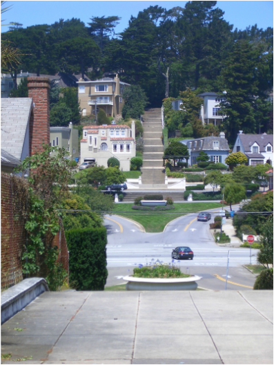
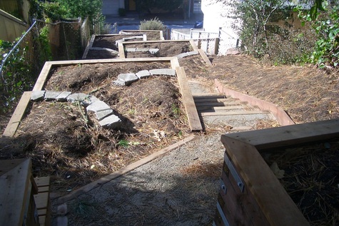
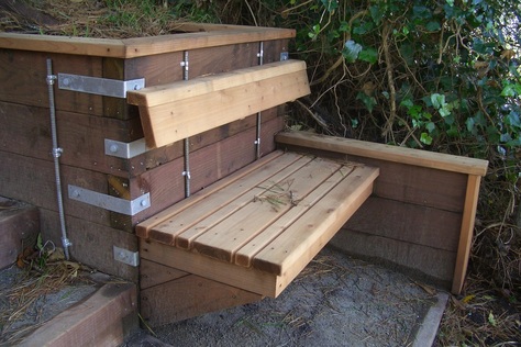
Thought I’d check out the Hidden Garden Steps project planned for the 16th Ave. (Kirkham to Lawton) stairway (148 steps) to see what, if anything, might have been accomplished since my last visit. Uphill a short distance from the 16th Ave. and Judah Metro stop, a colorful mural now decorates the low walls at the foot of the steps. There’ve also been some new plantings alongside since my last visit. See these sites for more info and a drawing of how the stairway is to look when completed:

http://www.hiddengardensteps.org

http://hiddengardensteps.org/AbouUs.html

http://www.kickstarter.com/projects/2143716381/tile-the-hidden-garden-steps-and-honor-glbts

The Golden Gate Heights neighborhood is a public stairway enthusiast’s heaven. Take your choice of superlong ones.

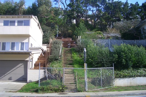
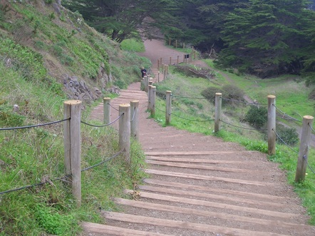
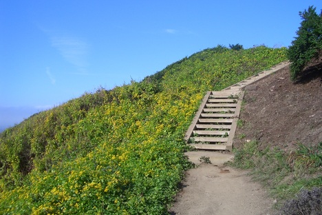
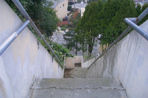
Only climbed two of these today, however; the second the Moraga/16th Ave. tiled stairway, 163 steps, artwork completed in 2005: First pic.

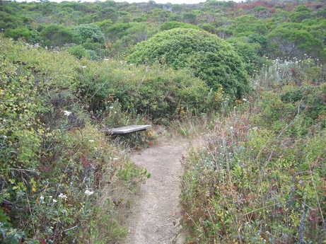
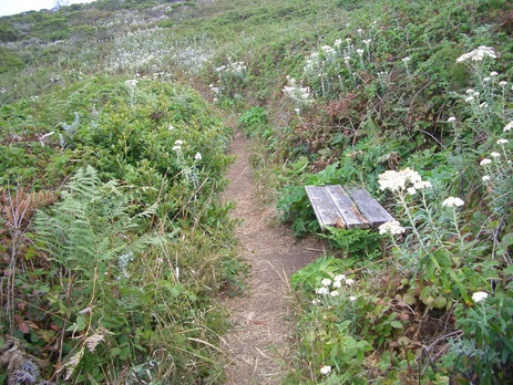
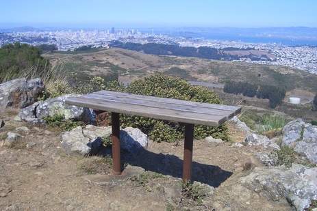
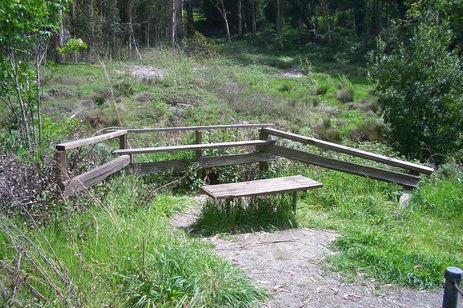
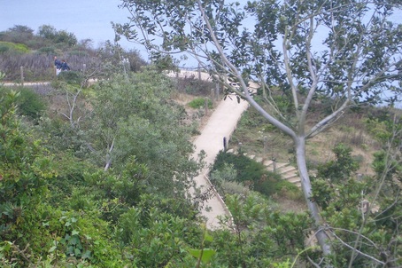
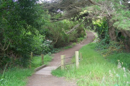
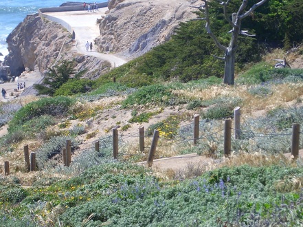
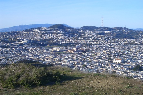
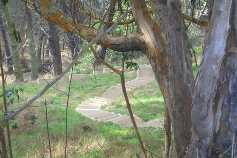
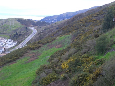
At the top is a retaining wall and short stairway, then the long zigzag stairway up into Grandview Park (144 steps. Second foto: a Grandview Park trail).

The fog up here was so thick I had to keep wiping my glasses, and whenever I passed beneath trees fat drops would plop on my head. Not a good day to take pix but definitely a good workout.

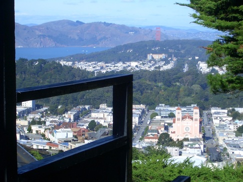
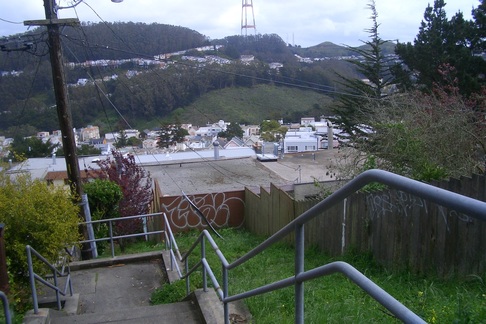
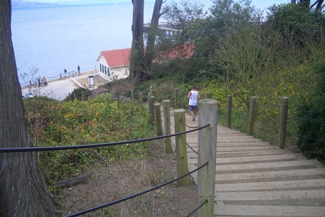
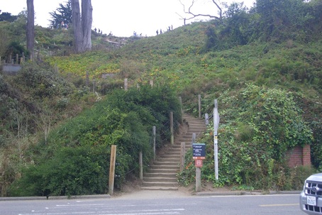
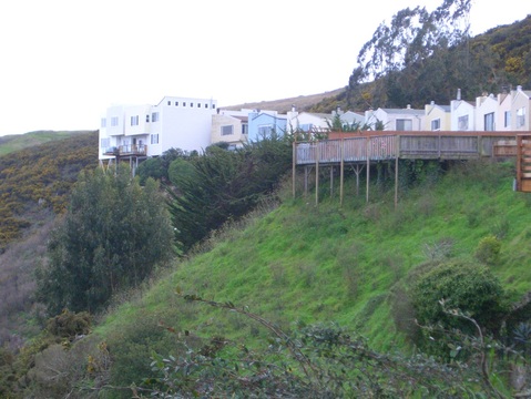
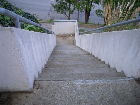
Passed by the fog-ghostly feet of stairways Cascade Walk (131 steps, third pic: this the top at Pacheco), Aerial East (116, fourth pic: Looking across to Mount Sutro’s west side), and Oriole (90-something steps).

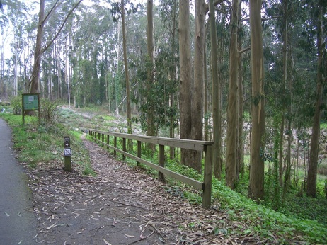
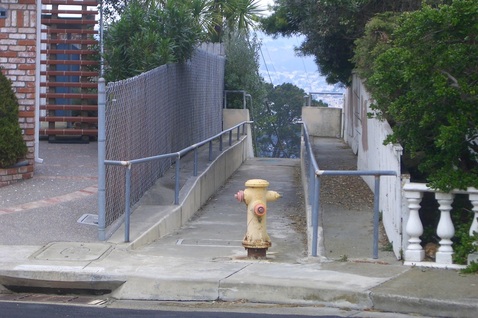
At the dead-end of Quintara just past 10th Ave. is a very short fenced pathway out to the Forest Hill neighborhood. There’ve been some new plantings here too since last visit.

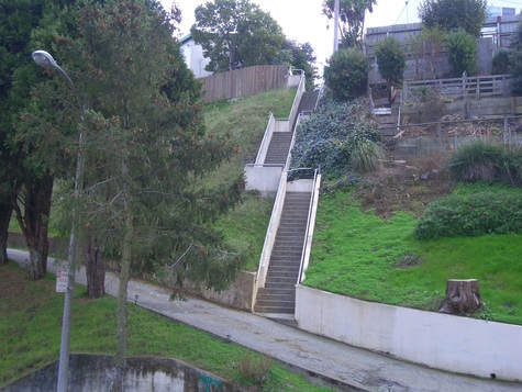
You’ll come out onto shady Mendosa on the lower slope of the hill called Forest Hill (one source says about 775’ elevation). A long, winding hike to the east finally took me down to the Forest Hill Metro Station on 7th Ave. Curved past the foot of the Alton stairway (92 steps) and the top of the grand Pacheco stairway. Fifth pic: the Pacheco stairway as seen from the shorter Pacheco stairway in the Edgehill Heights neighborhood.

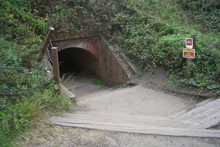
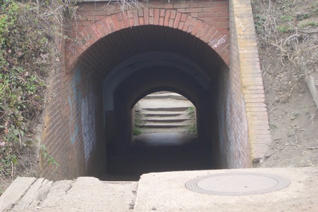
I get plenty of stairwalking in the Metro/BART stations as well, sometimes taking the long stairway down to catch the train from the Forest Hill station instead of the elevator. This long, gloomy, in-between passageway could use some color. Inspired by the new mural at the foot of the 16th Ave. stairway, I’m seeing these wall tiles transformed into bright solid colors and designs.

Picture
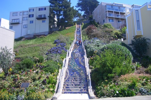
16th Ave. & Moraga Tiled Stairway
Picture
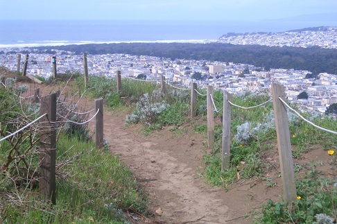
A trail in Grandview Park
Picture
Top of Cascade Walk stairway at Pacheco
Picture
Descending Aerial stairway east. Mount Sutro's west side in distance. Twin Peaks right.
Picture
Pacheco stairway into Forest Hill 'hood from Pacheco steps into Edgehill Heights
0 Comments

The New Bengal

1/24/2012

2 Comments


Bengal Alley, a convenient stairway on Mount Davidson’s west side in the Sherwood Forest neighborhood, is on private property. It descends from Lansdale to Miraloma directly to a #43 bus stop.

It was closed for several years, blocked off, evidently because of some safety concerns. The street sign for the stairway stayed in place at the bus stop, though there was a chainlink fence there – and still is, though there’s been an opening out to the sidewalk for a while. Hopefully the fence will be removed once the renovations are fully completed.

Neighbors had a change of heart a few years ago and started to improve the stairway. I walked it in 2009 when they were just getting started on the renovation project and counted about 73 steps. Now in its latest incarnation there are 107.

Just the other day, looking out the window of the #43 as it climbed Miraloma, I noticed the striking middle section of attractive redwood planters, steps, and retaining walls (first foto). The whole stairway is clear of debris and obviously greatly improved from last time I saw it.

So today got off at my usual stop at Juanita & Marne, but instead of heading up to the park, turned the other way to ascend curvy Lansdale.

At the top of the stairs is a wooden gate (second pic) and the first section of steps of old, rough stone.

The latest, all-wood, addition starts in the middle (third and fourth pics). I can imagine what this will look like when all the new plantings get growing. There’s a built-in wood bench as well (fifth photo). Reminds me of the impressive job neighbors did in 2004 on Bernal Heights’ Franconia stairway.

The third section is regular, older concrete stairs, fully walkable right out to the bus stop. 


See
www.bengalstairs.org
for a good explanatory article, “Bengal Stairs, A San Francisco Street Park.”


Picture
Bengal Alley up from Miraloma
Picture
Top of Bengal Alley at Lansdale
Picture
Bengal's new middle section
Picture
Bengal's new planters
Picture
Bengal's new bench
2 Comments

Summit Loopin'

1/22/2012

0 Comments


I
t’d been too long since I last trekked San Bruno Mountain’s Summit Loop Trail (3.1 miles) in its entirety. There was a Trail Closed sign for a while at both trailheads for its long, winding westside part due to one of the creek footbridges being washed out last rainy season. When I reached the shallow depression Saturday, it was a simple matter to cross it and continue on. There are two welcoming little benches partway up (first two pix). At the summit one just crosses Radio Road and heads down the north side (third pic – the north side’s viewbench). Experienced two short showers during the hike. 

On the way down the north side, enjoyed first the Dairy Ravine Trail and then the Eucalyptus Trail back out to my beginning. 

Had just stepped onto the inner Bog Trail (where the benches are) from the Meadow and there was the same aggressive pheasant from last time, just a little way from where I first encountered him. “Hi, how are you today?” said I. He proceeded to rush at me and attack my pants legs as before. Only this time he continued to chase me for the whole length of this part of the trail. I’d look back and he’d start sprinting after me. Then I’d look down and there he was flapping up and pecking again.

He finally got distracted at the side of the footbridge (fourth pic) where the Bog Trail starts uphill to the wider, paved Old Guadalupe Trail (fifth foto.) Otherwise he probably would’ve followed me up there too. Looked back down the Old Guadalupe and saw him a few yards away crossing the trail. Is this normal pheasant behavior, the birds attacking something far bigger than they are and chasing it a while?

I had this vision of him continuing to follow me out of the park, all that way downhill I have to go, then hopping up the steps of the #43 bus with me.

As the #43 climbed over Mount Davidson curving round the west side, saw that the Bengal stairway now has a very attractive new look. Gotta get out there soon, walk it, take pix.

Picture
First bench on the Summit Loop West
Picture
Second bench, Summit Loop West
Picture
Viewbench, Summit Loop North
Picture
Bog Trail
Picture
Down to Bog Trail from Old Guadalupe Trail
0 Comments

Battery East to Arguello Gate

1/11/2012

0 Comments


Braved the four buses that I take to get me up to the bridgeviewing area; fortunately short waits for all today.

Turned to the east where a sign says "Steep Slope" for the trail to the picnic tables, but this is currently closed out to the other end of the short low-overhead walkers'  tunnel (first two pix).

However, the main, scenic, curvy, paved Battery East Trail is walkable as is the stairway down to Crissy Field (last three pics).

Continued on the rocky trail below the Presidio Promenade. Out at the other end noticed the sidewalk ahead was closed up to and beyond Crissy Field Overlook due to construction.

Had to head downhill all the way to Crissy Field, then started back up. Couldn't go via the uphill route east as that was blocked off as well (used to take this around to the Main Post before the Disney Museum existed). Paused to gaze up at the old and new bridge approaches that are now side by side, then continued south up to the Park Trail.

Up the Cemetery Overlook steps through the peaceful forest. Out to Washington from the Overlook area, but crossed the street this time at Deems for the Bay Area Ridge Trail on the Spire side. It's much nicer walking through the forest above the vehicle street. This way it seemed a shorter distance out past the east edge of the golf course to the Arguello Gate. 

Picture
Low overhead walkers' tunnel
Picture
Walkers' tunnel out to the picnic area
Picture
Battery East Trail from above
Picture
Battery East Trail steps to Crissy Field
Picture
Foot of the Battery East Trail stairway up from Crissy Field
0 Comments

Lands End Stairways

1/10/2012

1 Comment


Today’s was a multi-stairway trek with a clear and sunny oceanview.

Started at the east edge of the park this time and up the Lincoln Park steps. Two people were using this stairway as a Stairmaster (as in over and over) as I ascended to the trail alongside the Lincoln Park Golf Course. 

Across the street onto the Lands End Coastal Trail. The next stairway has around 116 steps (first pic). This connects at the top with the Painted Rock steps (about 138 steps, second pic).

The connector trail in the third photo connects the Coastal Trail with the El Camino del Mar Trail. The El Camino comes out at the upper parking lot Overlook. 

Down from here on one of the newer stairways (49 or so) from the upper parking lot Overlook to the curly paved trail. Continued to the Sutro Baths Upper Trail, the westernmost part of the Coastal Trail, about 141 steps (fourth foto).

From here 'twas up the Merrie Way steps (approximately 127, fifth pic), and out of the park past the new Overlook building to be completed sometime this spring. Crossed the street for a pleasant stroll through Sutro Heights Park since I had to go uphill to catch the bus anyway.

Passing on a good read about the upcoming Golden Gate Bridge 75th Anniversary Celebrations this Memorial Day weekend (May 26/27):

Read more: http://www.sfgate.com/cgi-bin/article.cgi?f=/c/a/2012/01/09/BAKT1MMTVC.DTL#ixzz1j59i2MON

(Michael Cabanatuan, Chronicle Staff Writer, Tuesday, January 10)

Picture
East Coastal Trail, Lands End
Picture
Painted Rock steps, Coastal Trail
Picture
Connecting the Coastal Trail with the El Camino del Mar Trail
Picture
Upper Sutro Baths Trail part of Coastal Trail
Picture
Merrie Way steps up to the Overlook
1 Comment

Attacked!

1/7/2012

0 Comments

 
By a pheasant!

Had started out on the outer Bog Trail in San Bruno Mountain Park and was fairly close to the Meadow (picnic area) when this big gorgeous bird appeared out of nowhere at my feet (first pix). It was nibbling at plants along the trail at first.

Spoke to it and took a few pix. Started to move along the trail again when it sorta flew at me and pecked at my leg. Guess it didn’t want its picture taken. Fortunately I wear long pants when hiking and not shorts.

It stayed with me the several yards to the end of the Bog Trail, then crossed with me over the paved Old Guadalupe Trail, flapping its wings and aggressively pecking away the whole time. Sometimes it was in front of me like it was trying to lead me forward.  We continued partway into the Meadow this way.

Then it stopped and looked around the Meadow, like maybe it had gone too far, then wandered back into the bushes. Was beginning to wonder if it might want to accompany me on other trails as well. Maybe it was protecting hidden chicks and wanted to escort me well out of the area. Are these guys endangered?

From the Meadow it was onto the Saddle Trail that loops back to the Old Guadalupe Trail close to the Crocker trailhead. There’s a comfy new viewbench at the east edge of this trail (next two pics).

Last foto – from Saddle Trail looking north.


From the SF Museum & Historical Society’s January 6 e-letter: The Second Annual San Francisco History Expo will take place at the Old Mint on Saturday and Sunday, March 3 and 4, 11 to 4 each day. Admission is free (donations welcome). Attended last year’s; maybe again this year to check out what’s going on with the different ‘hoods.


Picture
Pheasant on the Bog Trail
Picture
Bog Trail surprise
Picture
Saddle Trail's new viewbench. McLaren Park in distance.
Picture
New Saddle Trail viewbench
Picture
From Saddle Trail. L to R: Mt. Davidson, Mt. Sutro, Twin Peaks.
0 Comments

First Batteries to Bluffs Hike of 2012

1/5/2012

0 Comments


Today’s excursion was meant to mosey through the Presidio and say “Happy New Year” to my favorite trail, the Batteries to Bluffs.

Up Rob Hill’s Battery Caulfield Rd. to wind round to Immigrant Point Overlook, then down the Connector Trail to Lincoln (first pic). Where the sandy trail leads down to Battery Crosby, the trail east along Lincoln is now blocked with a trail detour sign due to construction along this part of Lincoln.

First thing noticed when I got to Battery Crosby was that all the graffiti has been painted over.

After doing the Batteries to Bluffs (next three photos), crossed over into the Fort Scott neighborhood and continued around the east side to cross under the Fort Scott bridge. Hadn’t done this in a while as I knew there was lots of construction around here, but figured there’d be a way to access the Park Trail for walkers as before.

Saw no easy way to the Park Trail over all the obstacles, but having already come this far kept slowly picking my way across piles of dirt and gravel to get to the short wood pedestrian bridge near the stables. This little bridge did have detour signs on it, but they were facing west, where I was coming from. I’m lucky that none of the workers came up and directed me back the other way.

When climbing the Cemetery Overlook steps from the Park Trail, was finally alone in the forest. Exited out the Overlook area’s south end to the Nauman and Washington street signs where the trailsign notes Inspiration Point .6 mile and Arguello Gate .7 mile.  This pleasant walk is part trail and part bike lane along the curvy street, passing the Spire and opening to the Overlook parking area.

Picture
Connector Trail down from Immigrant Point Overlook
Picture
Batteries to Bluffs Trail
Picture
Batteries to Bluffs Trail
Picture
Batteries to Bluffs East Trailhead
0 Comments

Southern Hills Trek

1/4/2012

0 Comments


For my first hike of the New Year, took the #43 to Chicago Way and South Hill near the end of the line in the Crocker-Amazon neighborhood. Started uphill past the low wall that says “Southern Hills” and headed west on Canyon, a divided street (upper and lower).

At Polaris, uphill to Bolero and onto a more easterly part of Ardendale than I usually find myself trudging up when on my way to San Bruno Mountain Park’s Crocker Ave. trailhead. Stayed on curvy Ardendale until I came out an open gate from a small playground onto Oakridge, a favorite viewspot.

There’s a gap up here between homes with a view down (first photo). Oakridge dead-ends at the edge of the park (second pic), only there’s no trail up into the park there.

Downhill onto Mira Vista, a short street. At its east dead-end for vehicles is a stairway down that’s among my all-time favorites (last four pix).

The foot of the Mira Vista stairway is at the Daly City "line." It ascends from an elevated sidewalk on South Hill, just above Canyon (S.F.)

Continued down South Hill, past the house on the corner of South Hill and Canyon with the “easter basket” sculpture in the yard, and back to the bus stop at Chicago Way.

Picture
A View from Oakridge, Daly City
Picture
Oakridge dead-end, San Bruno Mountain
Picture
This way to the stairway at Mira Vista's east end
Picture
Partway down the Mira Vista stairway to South Hill
Picture
Down to the foot of the Mira Vista stairway
Picture
Stairway up to Mira Vista, Daly City
0 Comments

    Author

    I like meandering around on San Francisco's park trails and public stairways, sometimes taking photos, and enjoying nature and the outdoors.

    Archives

    March 2020
    February 2020
    January 2020
    December 2019
    November 2019
    October 2019
    September 2019
    August 2019
    July 2019
    June 2019
    May 2019
    April 2019
    March 2019
    February 2019
    January 2019
    December 2018
    November 2018
    October 2018
    September 2018
    August 2018
    July 2018
    June 2018
    May 2018
    April 2018
    March 2018
    February 2018
    January 2018
    December 2017
    November 2017
    October 2017
    September 2017
    August 2017
    July 2017
    June 2017
    May 2017
    April 2017
    March 2017
    February 2017
    January 2017
    December 2016
    November 2016
    October 2016
    September 2016
    August 2016
    June 2016
    May 2016
    April 2016
    March 2016
    February 2016
    January 2016
    December 2015
    November 2015
    October 2015
    September 2015
    August 2015
    July 2015
    June 2015
    May 2015
    April 2015
    March 2015
    February 2015
    January 2015
    December 2014
    November 2014
    October 2014
    September 2014
    August 2014
    July 2014
    June 2014
    May 2014
    April 2014
    March 2014
    February 2014
    January 2014
    December 2013
    November 2013
    October 2013
    September 2013
    August 2013
    July 2013
    June 2013
    May 2013
    April 2013
    March 2013
    February 2013
    January 2013
    December 2012
    November 2012
    October 2012
    September 2012
    August 2012
    July 2012
    June 2012
    May 2012
    April 2012
    March 2012
    February 2012
    January 2012
    December 2011
    November 2011
    October 2011
    September 2011
    August 2011
    July 2011
    June 2011
    May 2011


    RSS Feed

Powered by Create your own unique website with customizable templates.