Stairways are Heaven
  • Home
  • About Me
  • Stairways are Heaven

Trailin McLaren

9/27/2012

0 Comments

 
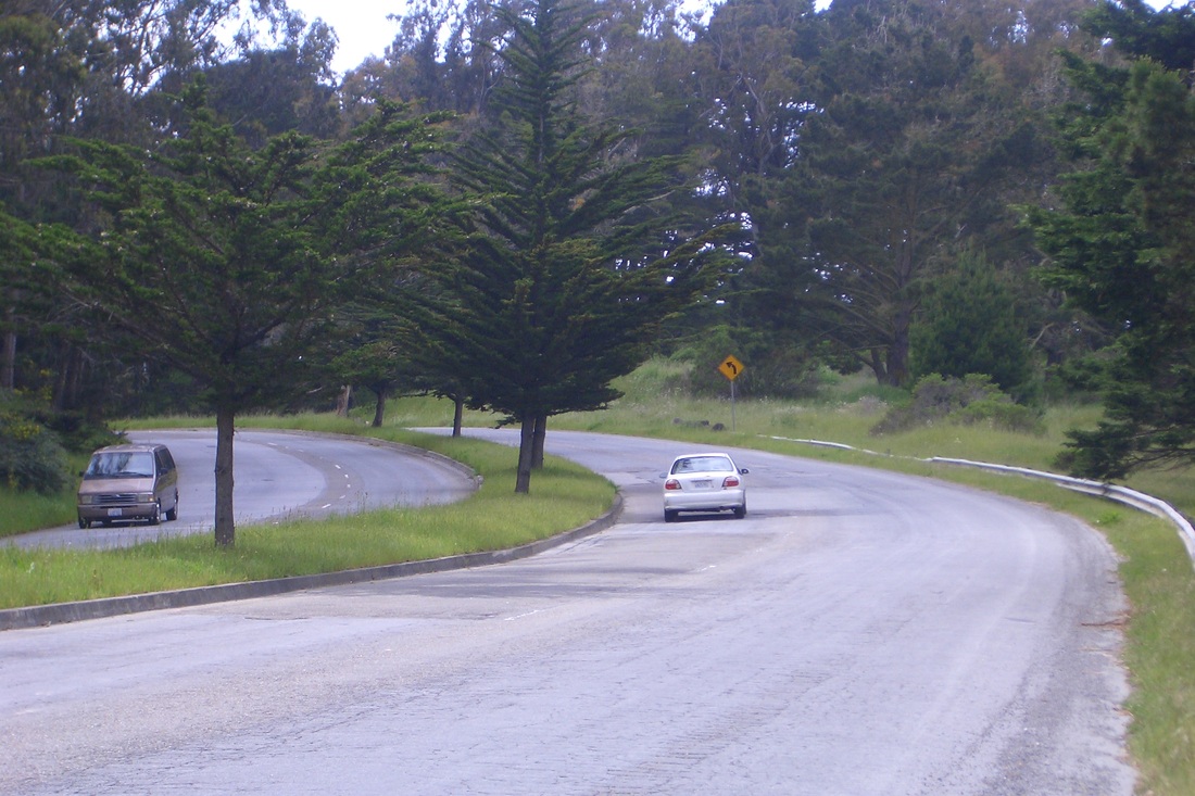
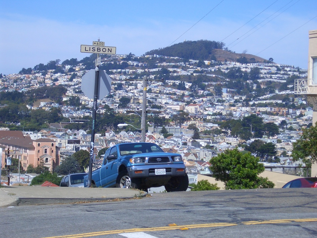
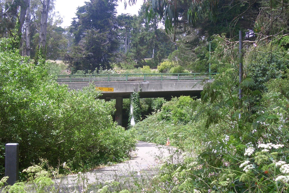
The quickest way for me to get directly to San Francisco's third largest park, McLaren, is to take BART to the Balboa Park station then catch the #29 across the street on Geneva. The bus goes right through the park on divided Mansell with green highviews from both sides (first pic). The park's eastern boundary is the Portola 'hood where a bus stop is at the top of University. When the bus reaches the west end, it swoops downhill on Persia through the Excelsior neighborhood. 

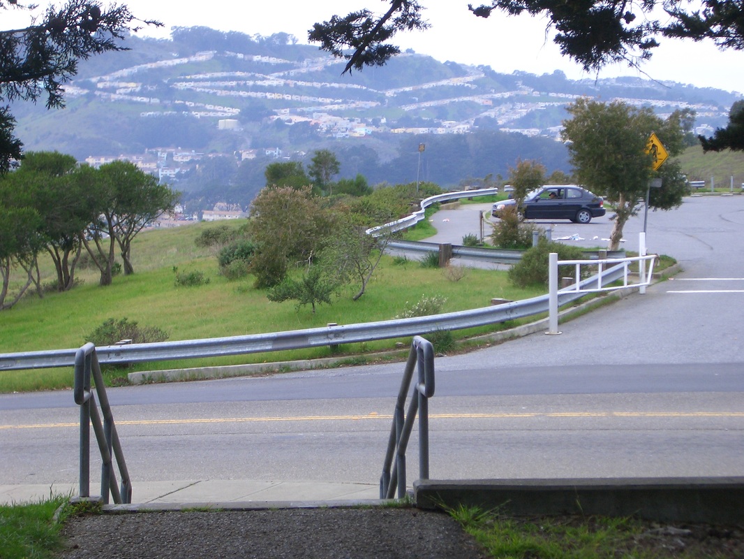
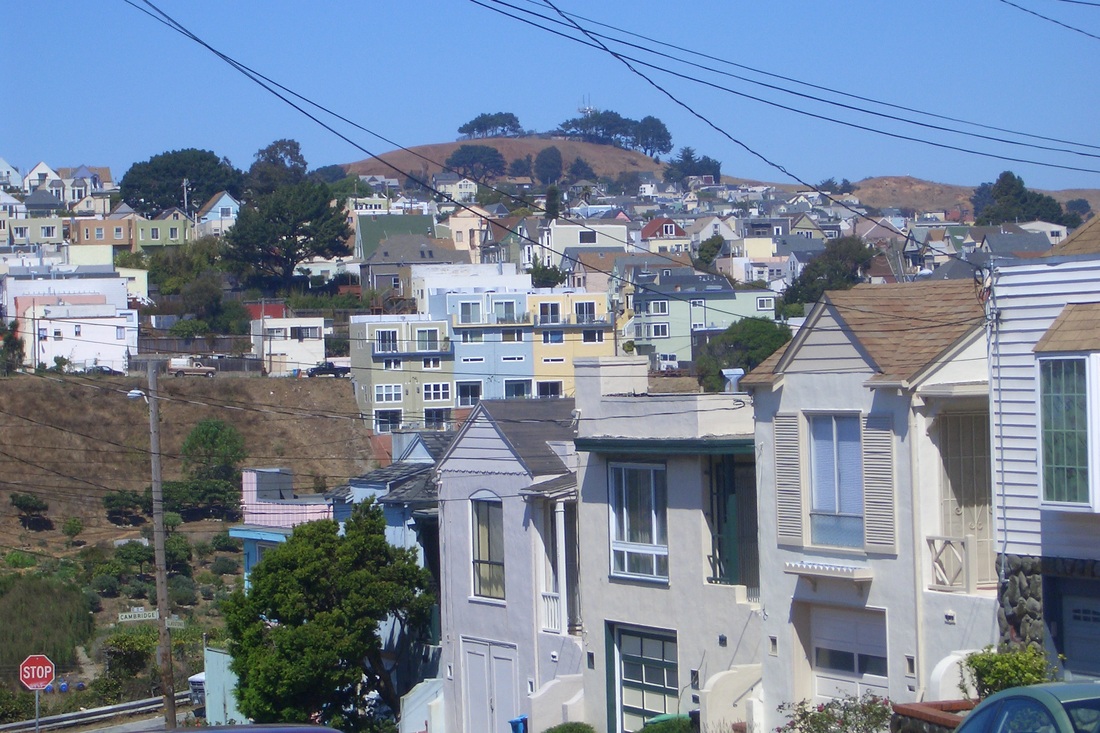
Not the best view to the south this time of McLaren's big sister, San Bruno Mountain: hazy out there. Second pic: the small parking place off Mansell across the street from the tennis courts. 

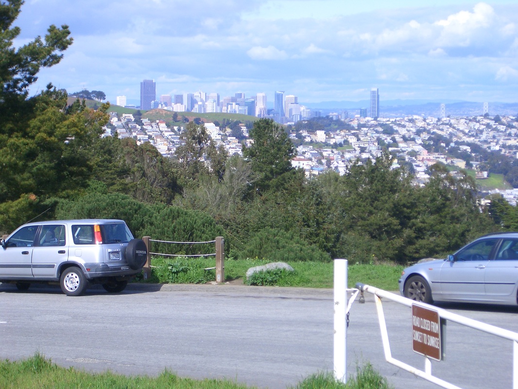
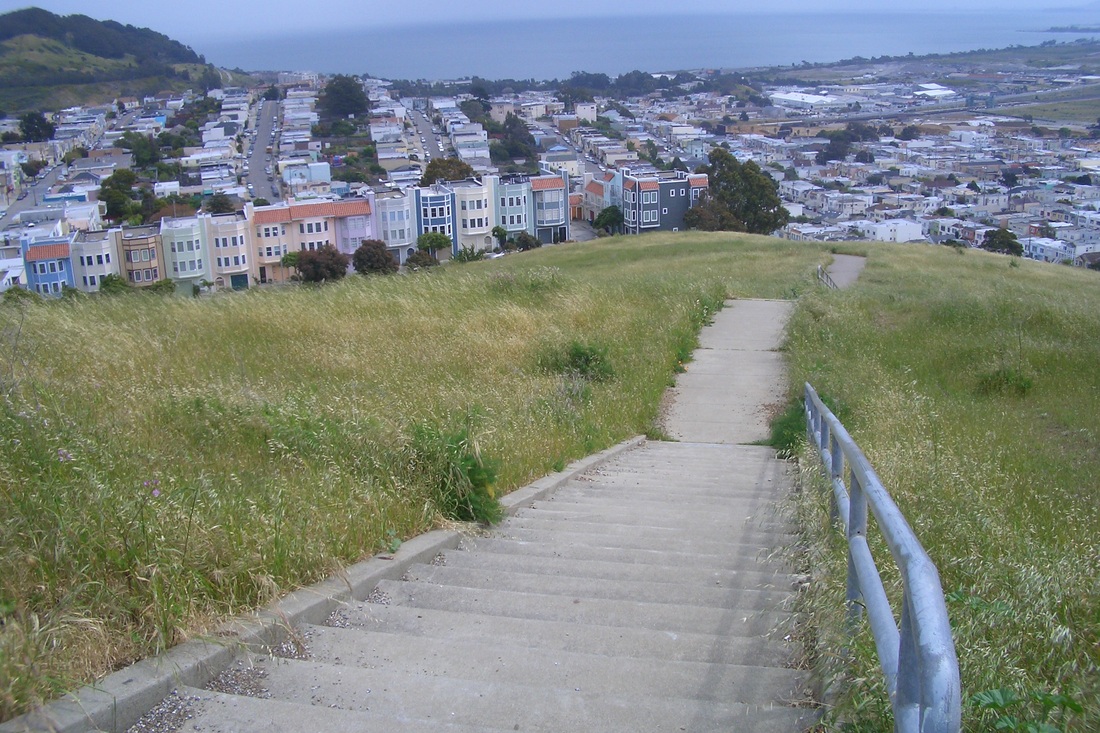
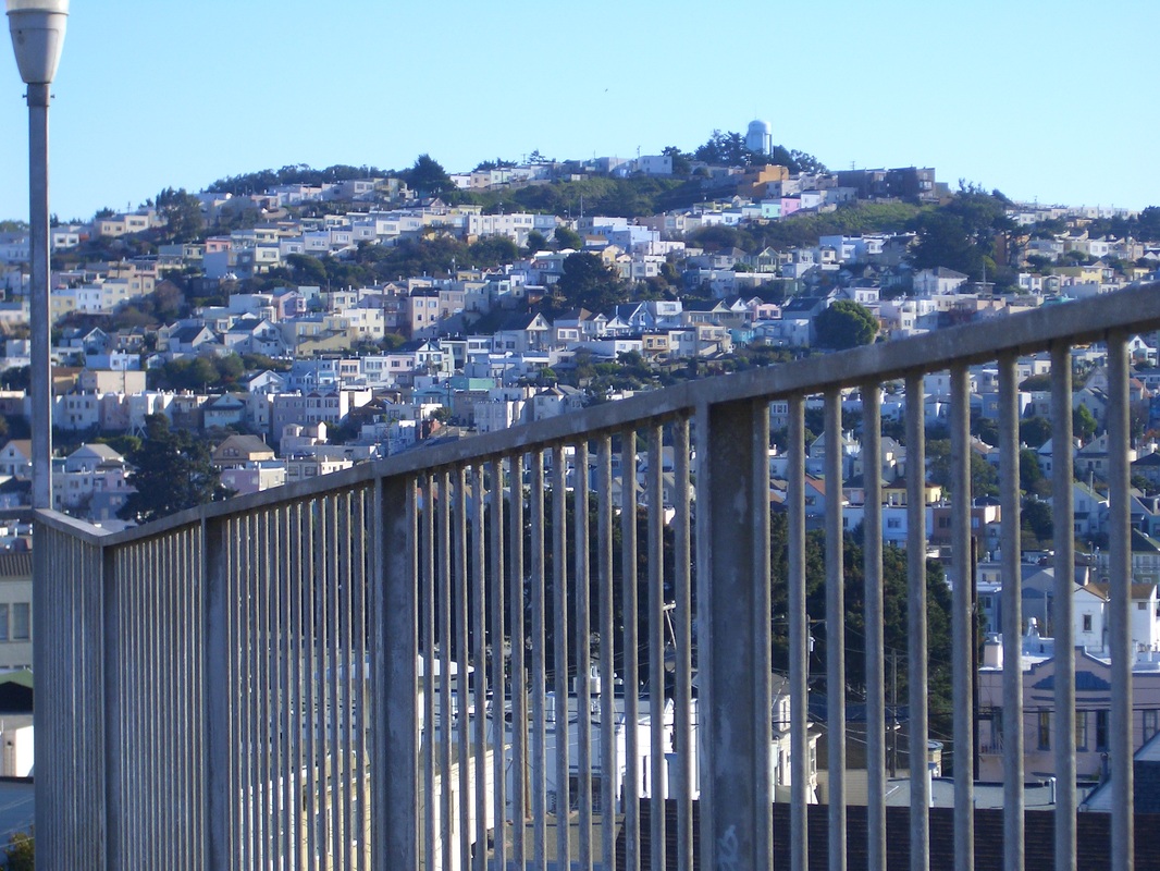
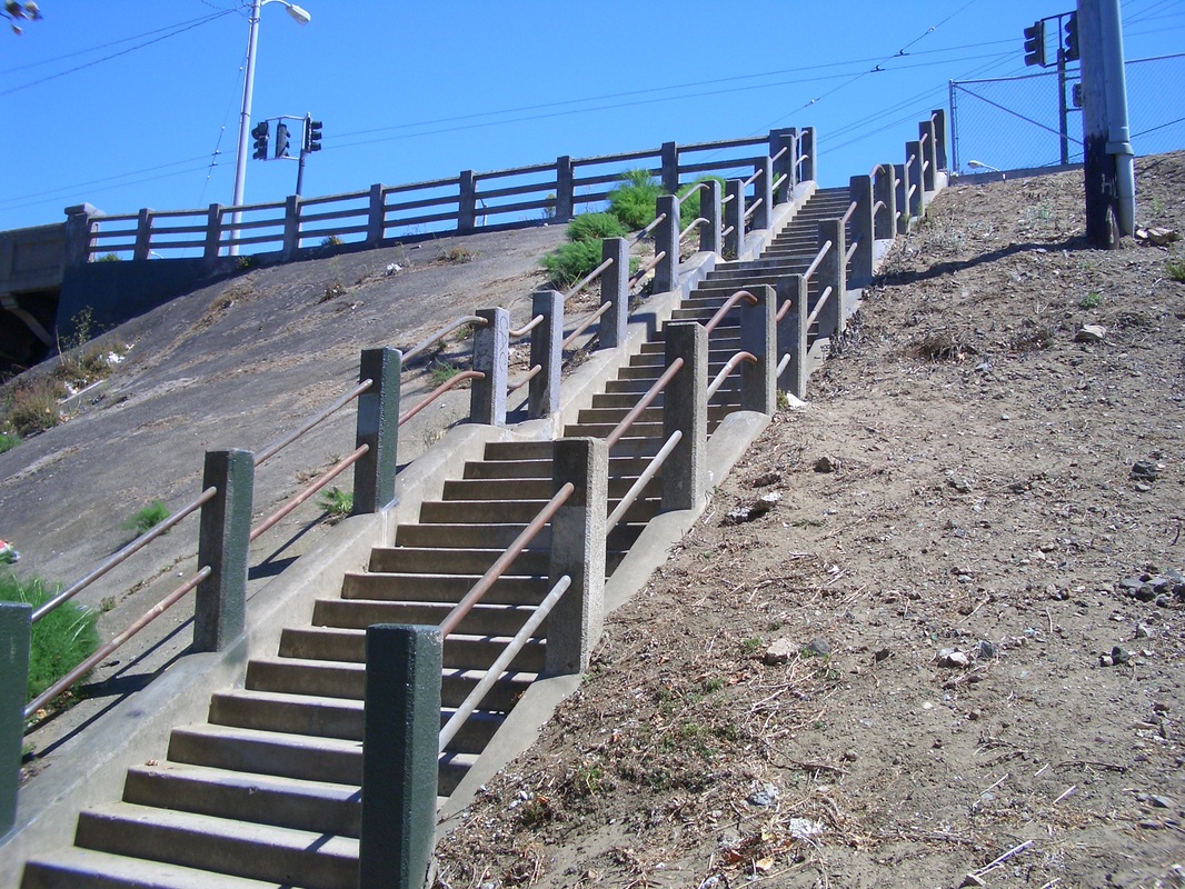
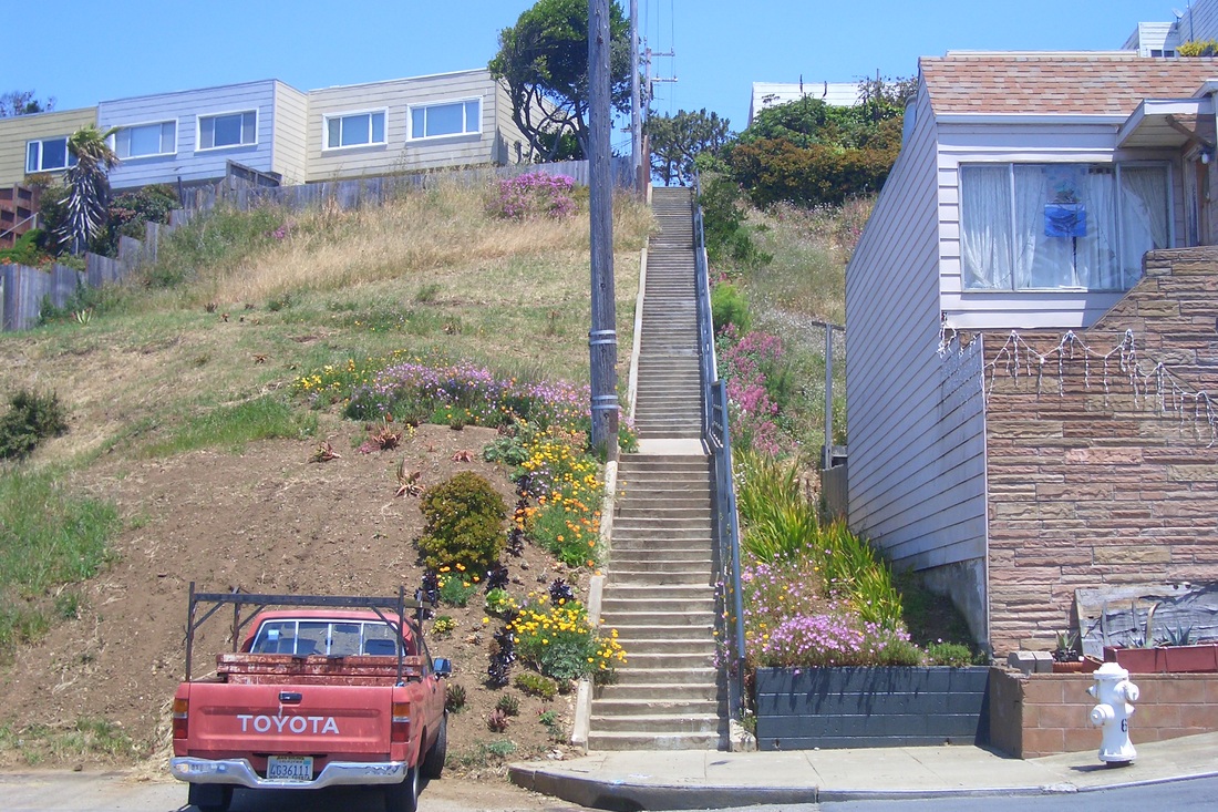
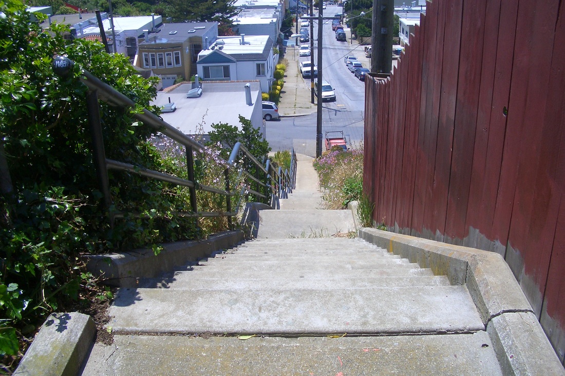
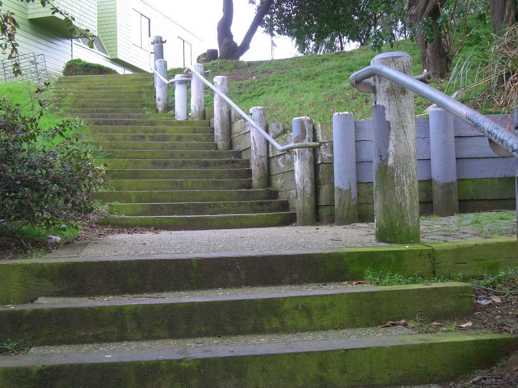
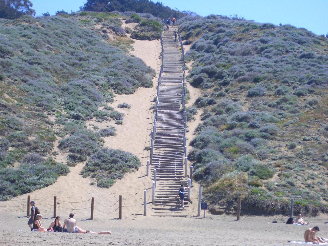
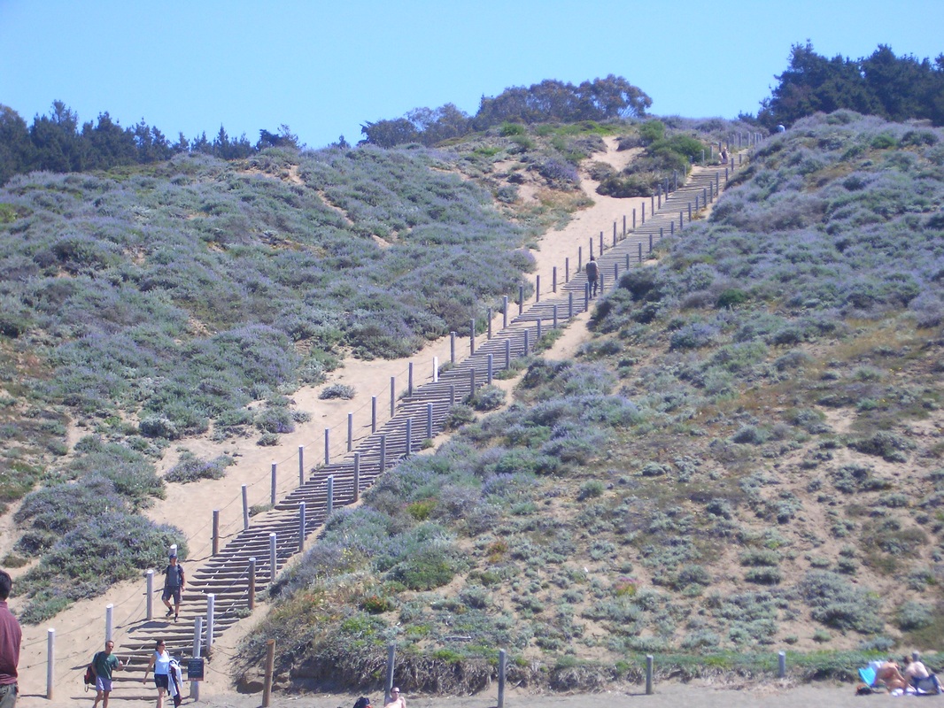
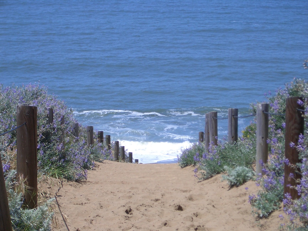
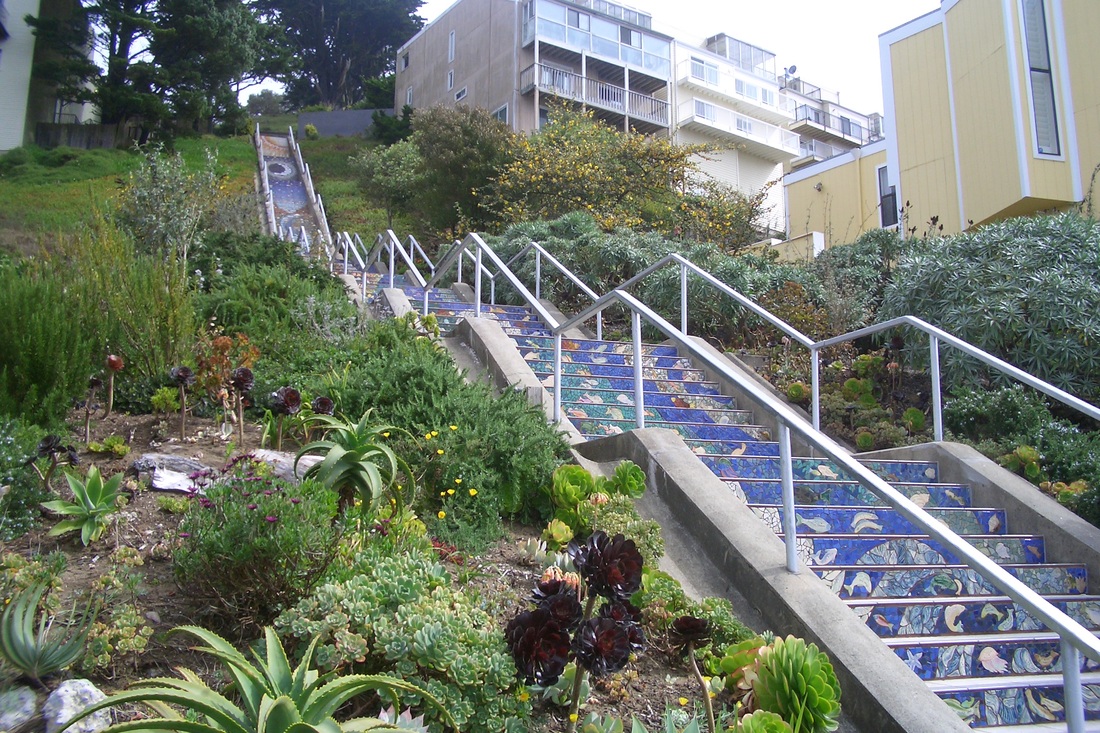
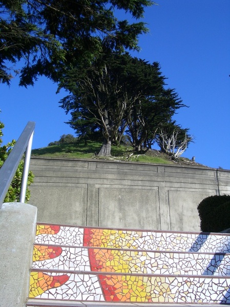
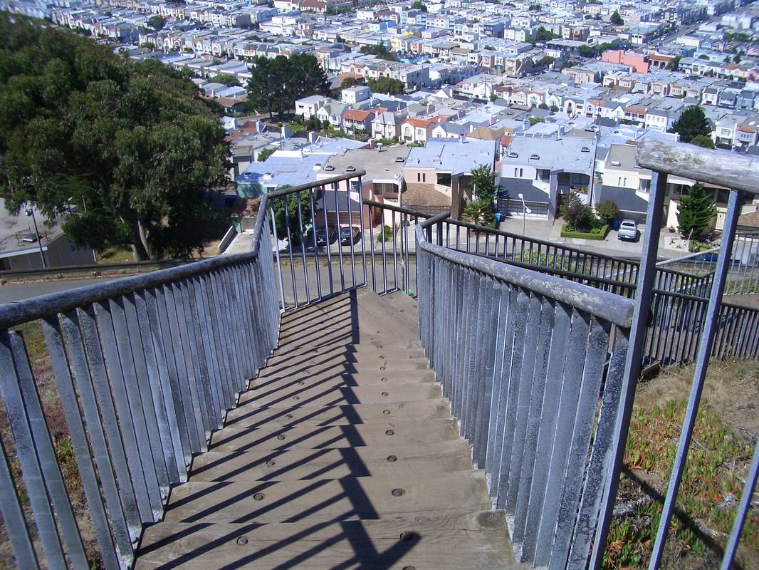
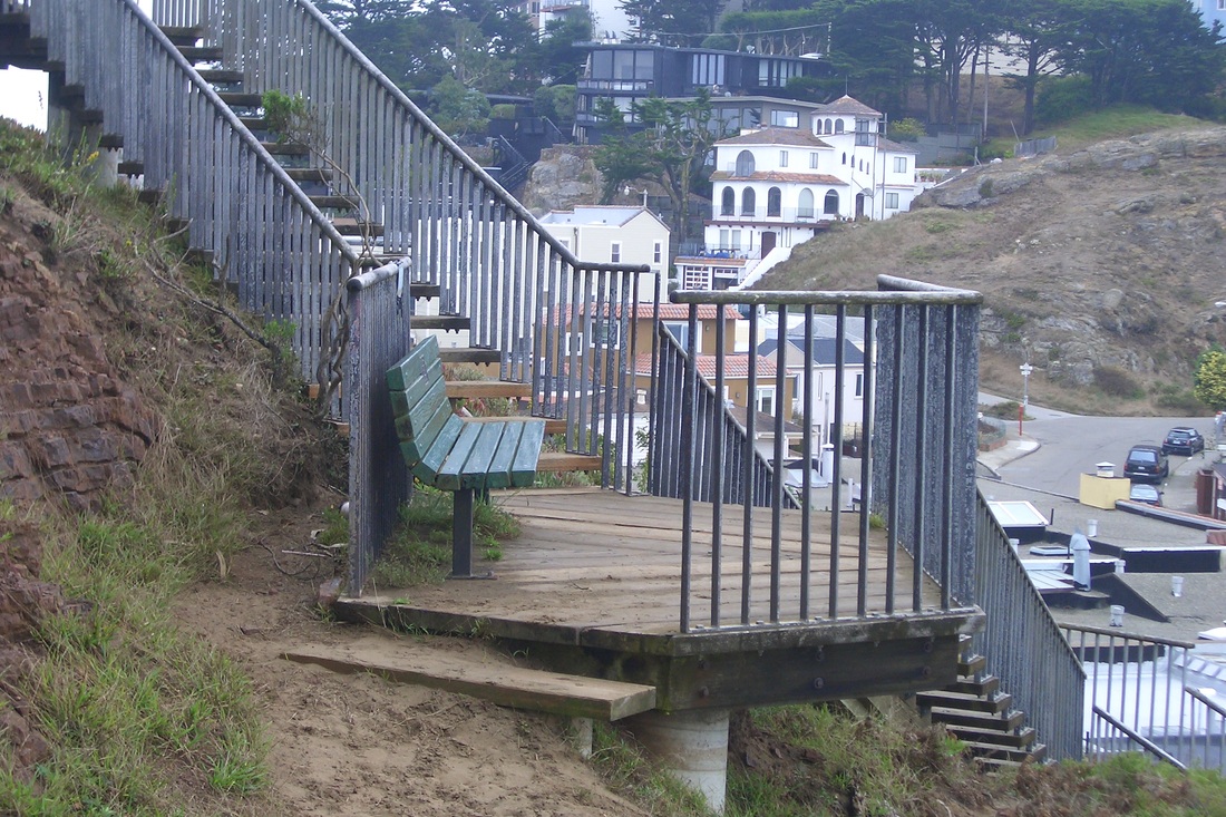
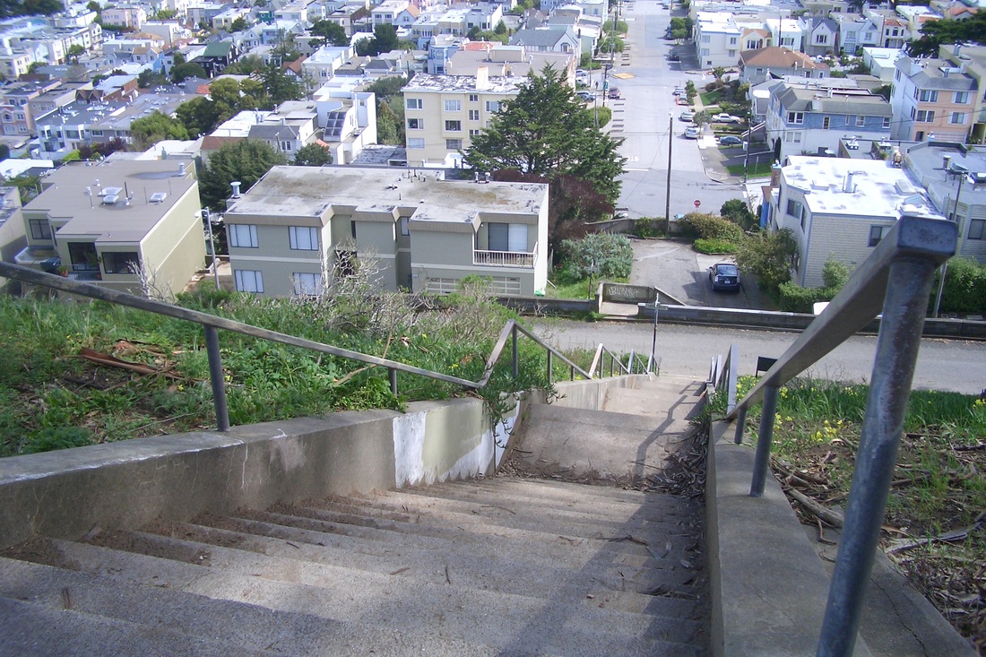
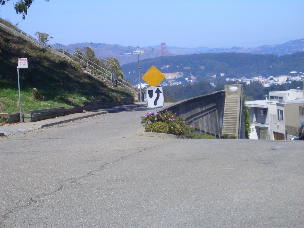
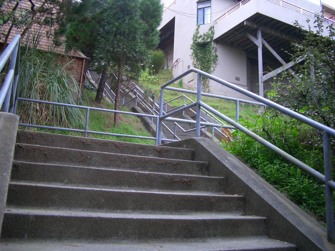
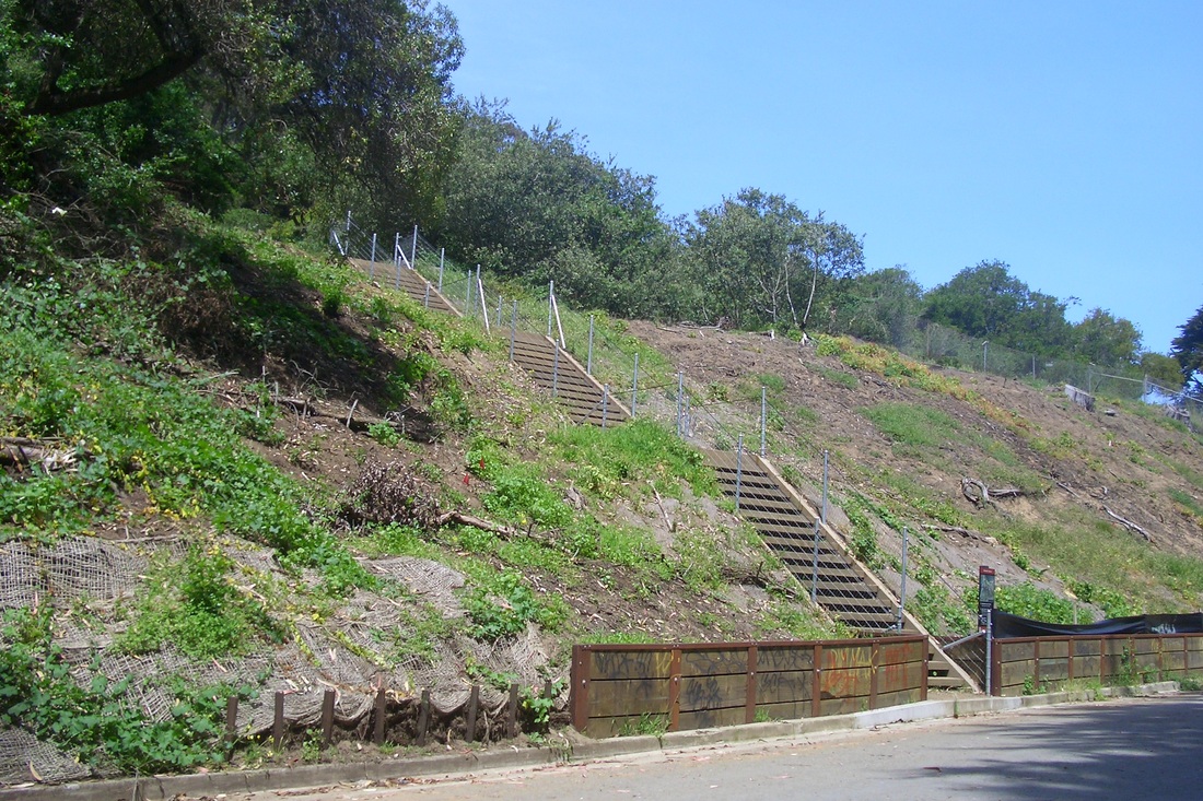
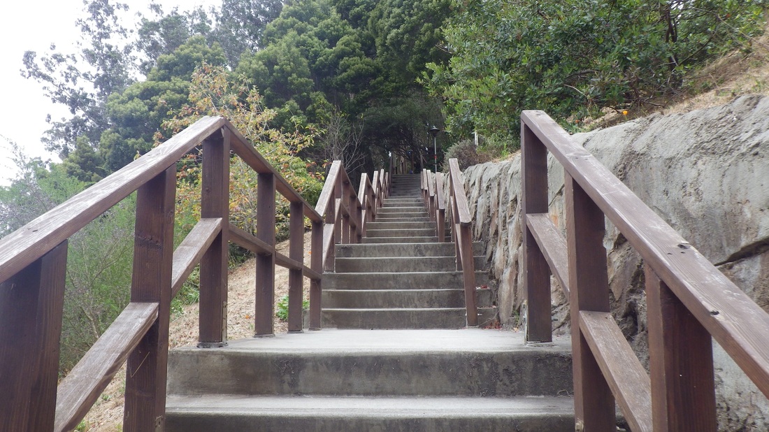
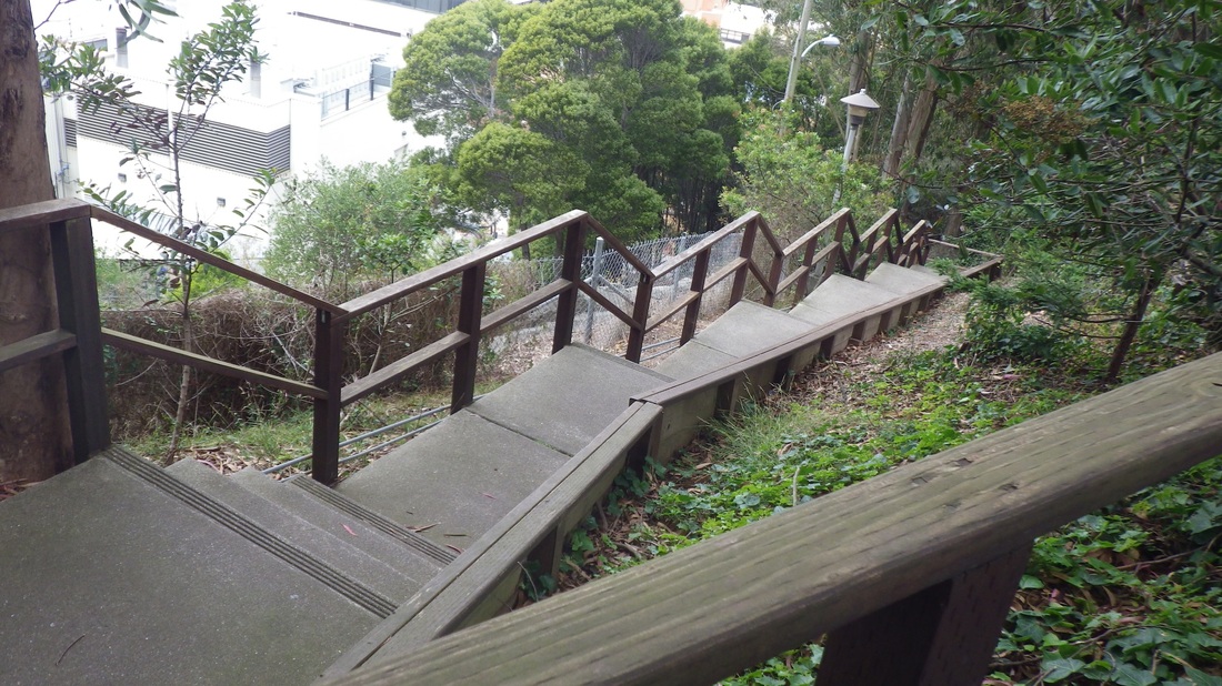
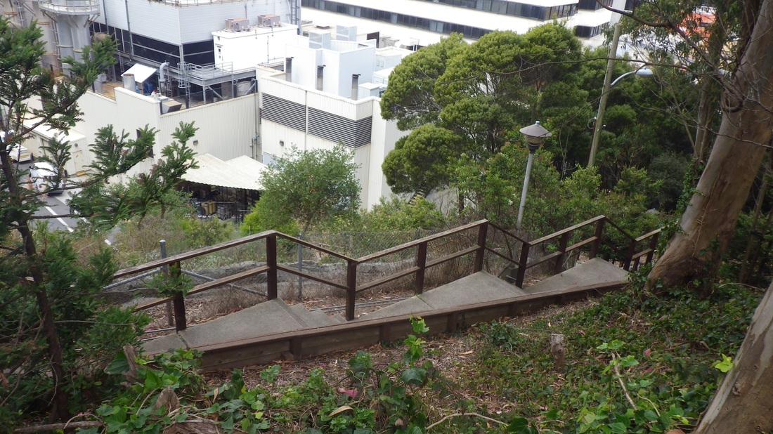
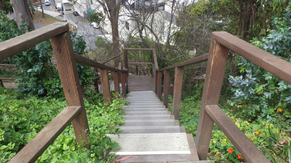
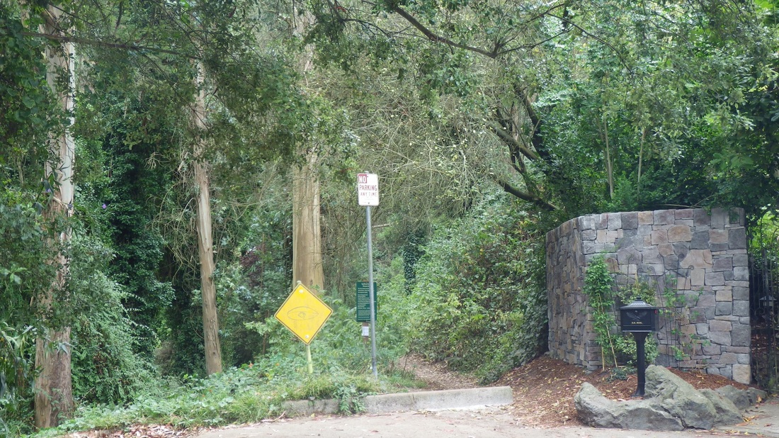
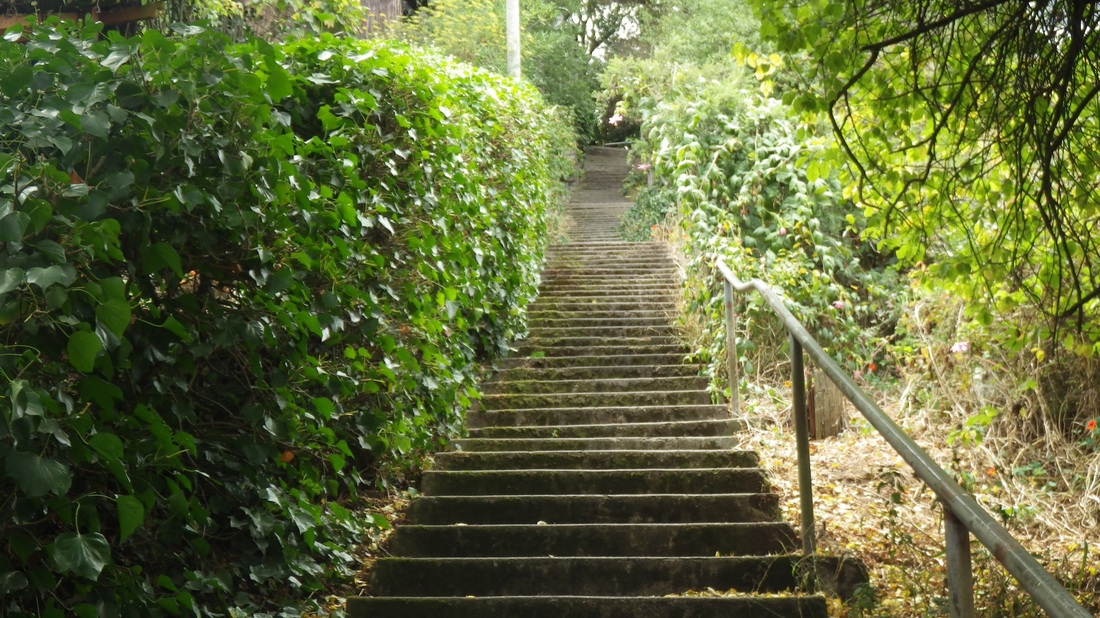
One of the bus stops is at Mansell and John F. Shelley (third pic), where I exited for trails both south and north of Mansell. Looking down at both southeast stairways (up from Visitacion Valley) today. Fourth pic is the top of the longer stairway at Visitacion Ave. (195 steps up from the dead-end of Campbell). At the top of the shorter trail (down to Ervine: fifth pic) are benches, picnic tables and the observation tower. 

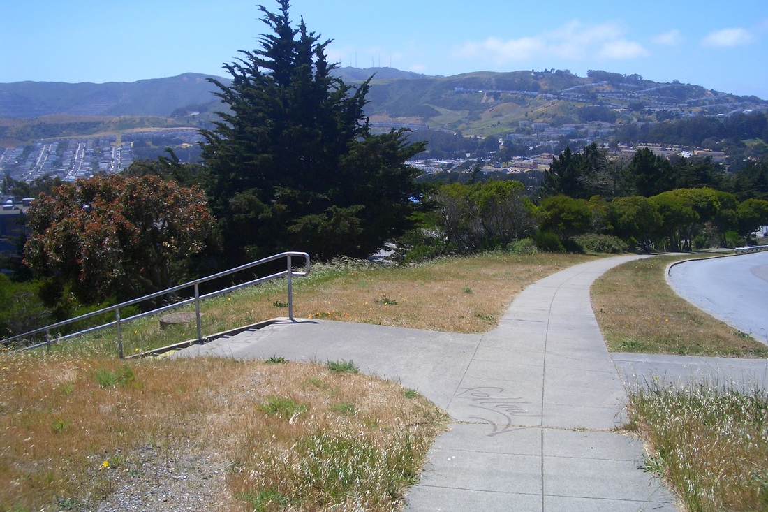
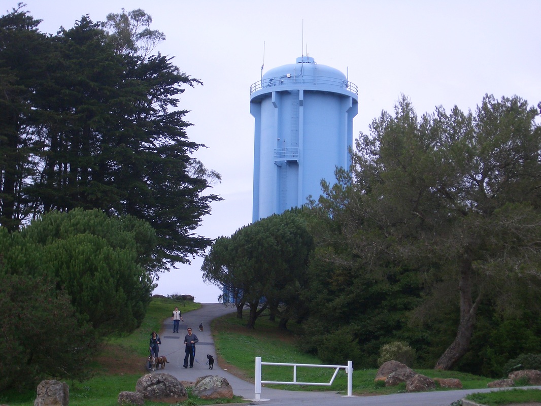
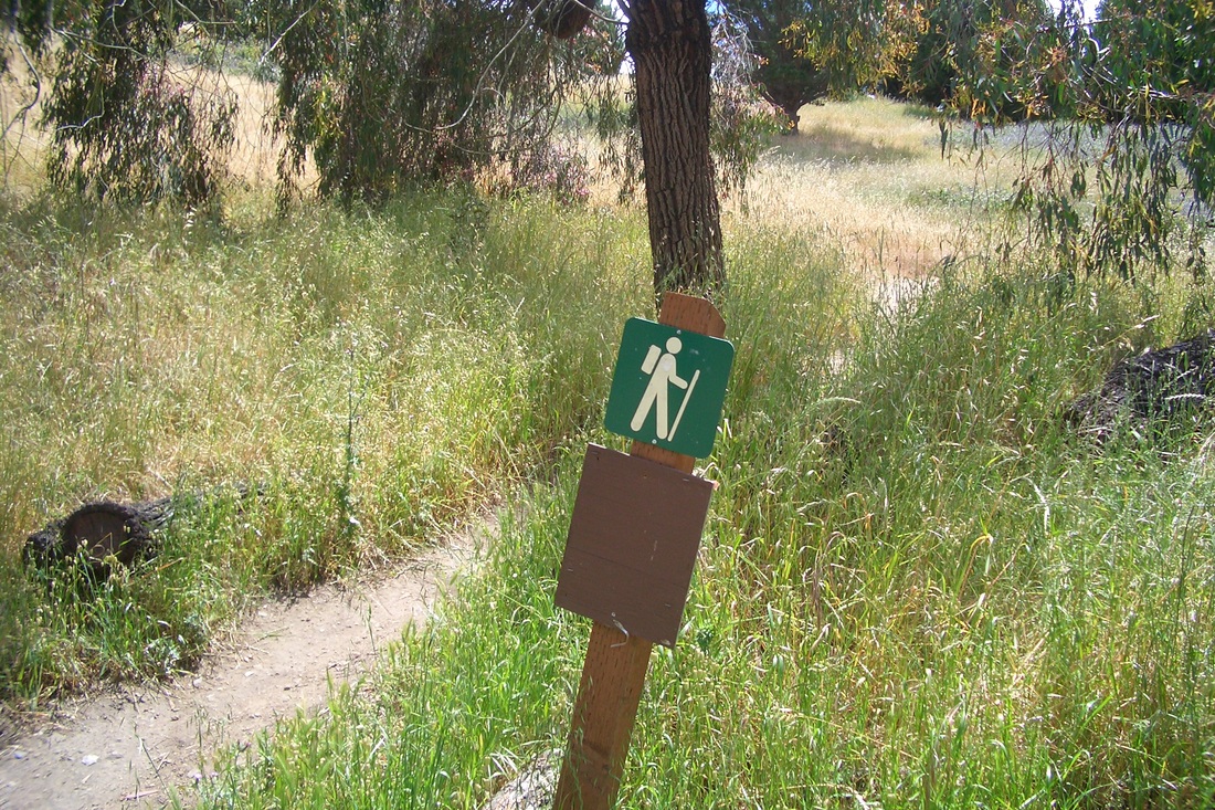
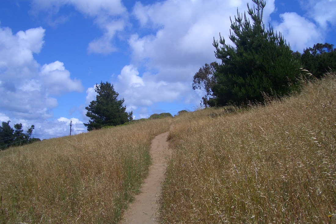
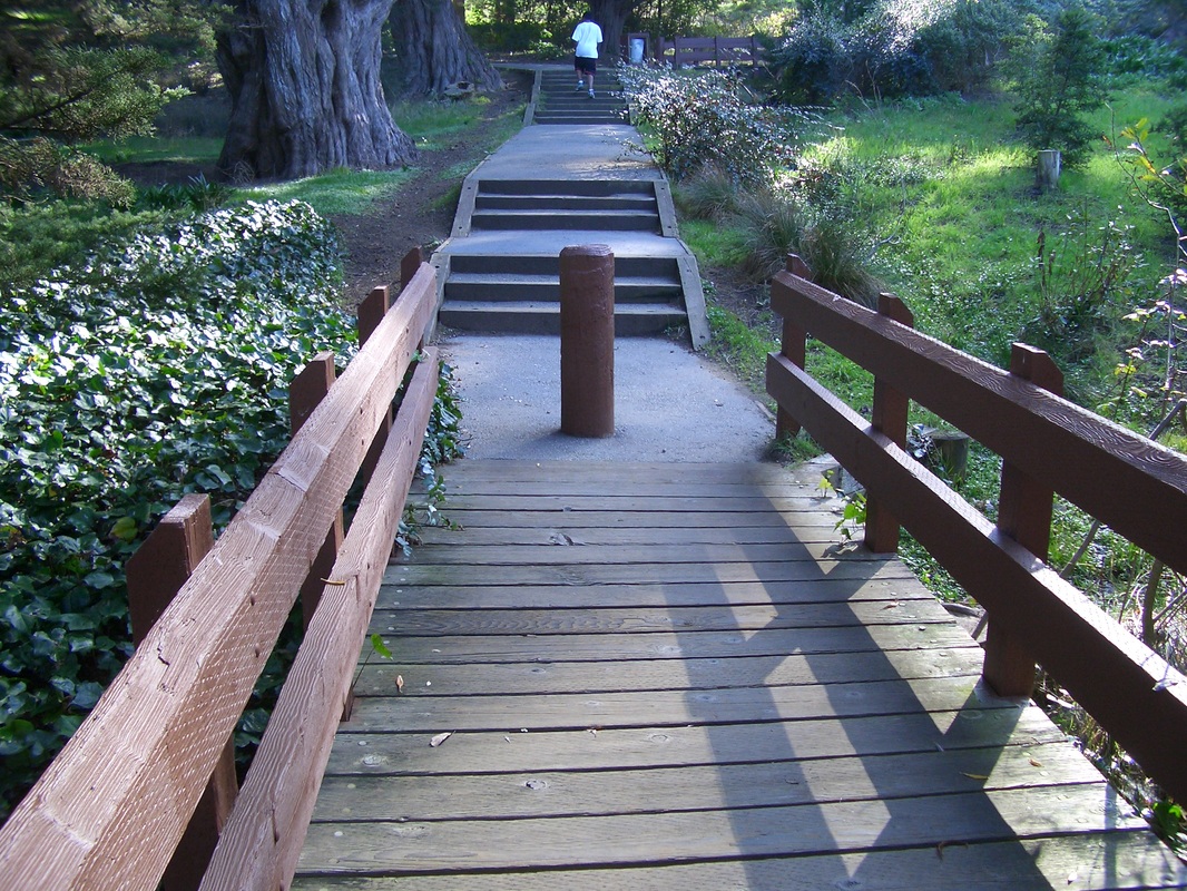
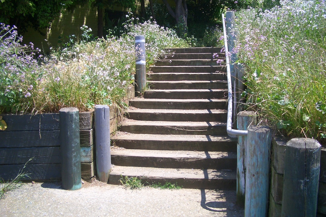
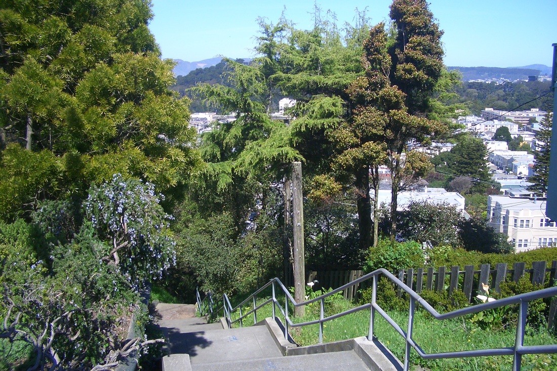
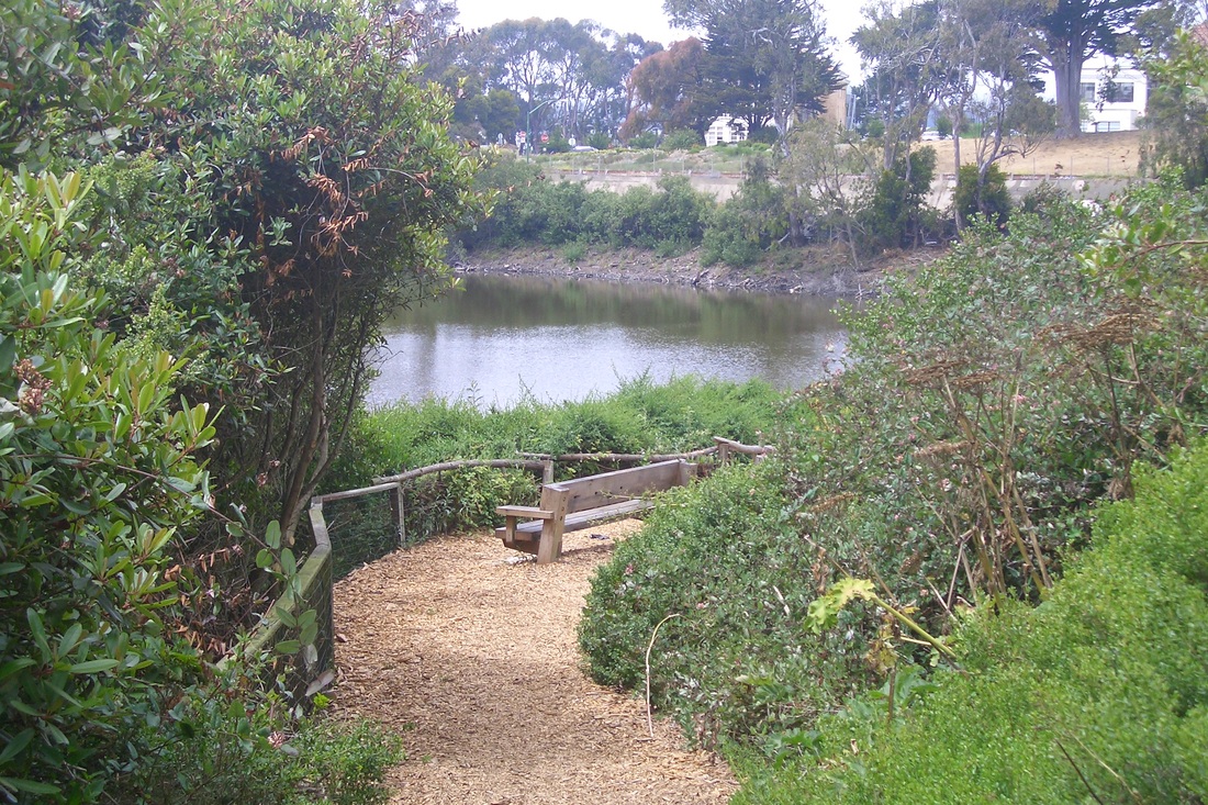
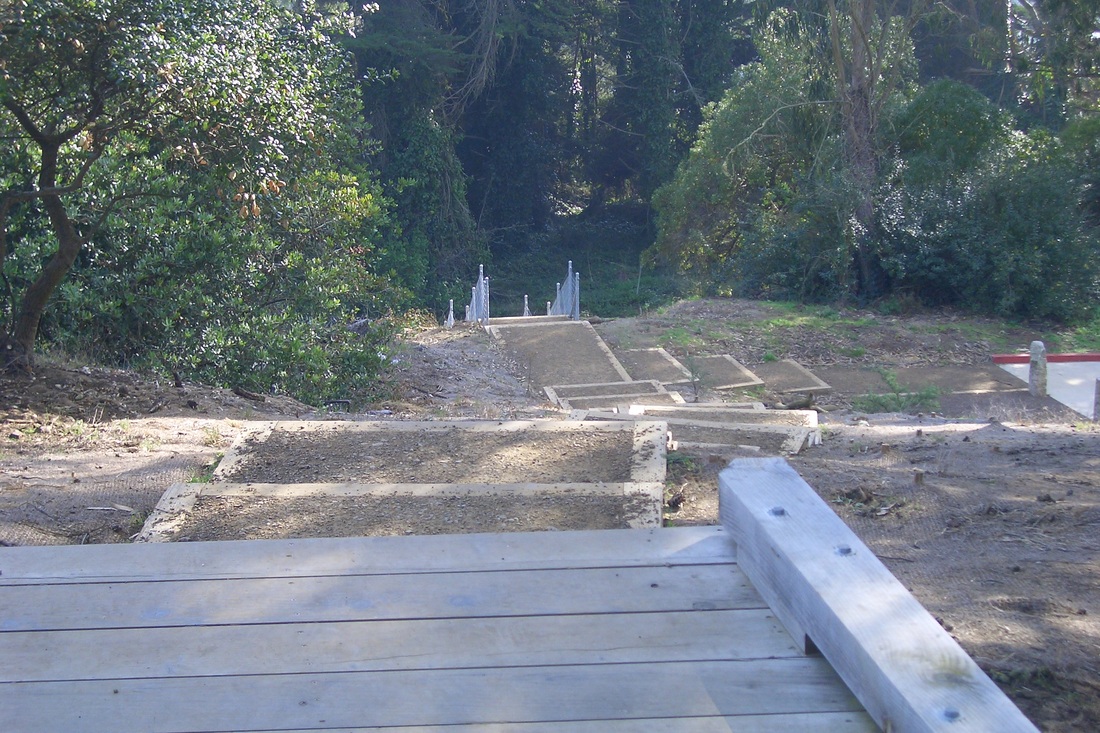
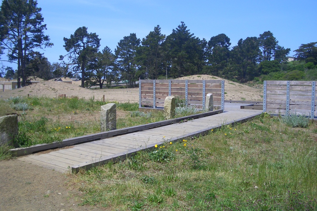
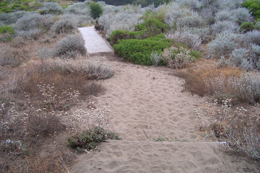
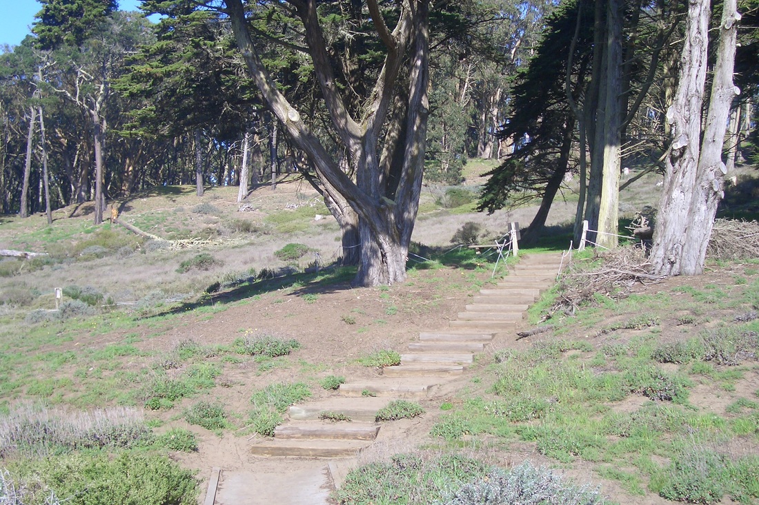
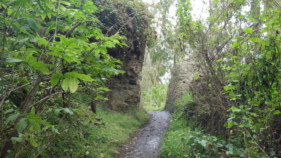
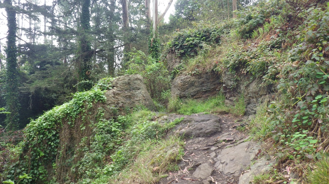
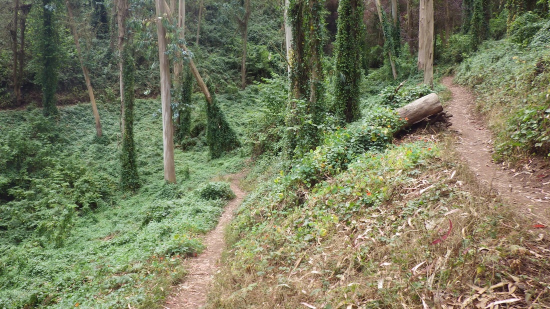
The blue water tower is in another part of this big park (sixth pic) as are the two lakes. Lots of good trails to wander off on (next two pics), including some paved and some with short stairways (last pic). 


Picture
Picture
Picture
Picture
Picture
Picture
Picture
Picture
Picture
0 Comments

Excelsior Trek

9/26/2012

0 Comments

 
One can easily take BART to the Glen Park station, but you can't stroll just any old way from there to the next neighborhoods to the south (Mission Terrace and the Excelsior). A noisy tangle of freeways divides the 'hoods. Short streets dead-end on both sides for vehicles and pedestrians. 

First pic - Excelsior 'hood, showing McLaren Park's blue water tower, from a walkway near the Glen Park BART. 

Lyell is the main under-freeway sidewalk access for walkers between the neighborhoods. There you can turn to the east to trek up the Portola (second pic: lower Portola on Gladstone just above Cambridge; Bernal Heights in distance) or west for the Excelsior. The Excelsior begins at Mission Street, at the top of which 'hood is McLaren Park, over 300 acres. 

The enclosed pedestrian overpass that will take you from south Bernal Heights to the lower Portola is further to the east. Before that is a stairway leading up to Mission from Alemany (third pic). 

Continuing steeply uphill from Mission on Avalon to Athens: London, Paris, Lisbon, Madrid, Edinburgh, Naples, Vienna, Athens (fourth pic: view from Lisbon & France: Mount Davidson in distance).

Today's hike was a combination of leisurely, exploratory wandering and checking out the ongoing remake of the slope on the north side of the Athens stairway (99 steps) in the upper Excelsior 'hood called the Athens/Avalon GreenSpace Project: 

athensavalongreenspace.org

http://athensavalon.blogspot.com

There are only a few plants showing up now but the curved concrete retaining walls look great and there's a concrete wall at the bottom with a low sit-on top. The next two pics are THENs that show this hillside as it looked several years ago before work was started. 

When you get to the top of the stairway you're at Valmar Terrace & Athens. There's a short enclosed sidewalk from the top of the steps out to the street. The next street steeply downhill from here is Peru. The Peru/Valmar stairway starts to your right (south). It climbs from Athens & Peru to Valmar Terrace (last two pics, 77 or so steps). 

Heading back downhill, at Cayuga & Lamartine is a benched minipark down to Alemany with a ramp, no steps. 

Finally, from Tingley to San Jose between Theresa and Cotter where a long, steep ramp (can be seen on Google Maps) over the John F. Foran Freeway took me to Circular and Monterey in the Sunnyside 'hood where I was a couple blocks west of the Glen Park BART and my beginning. 


Picture
Picture
Picture
Picture
Picture
Picture
Picture
Picture
0 Comments

Three Superlongs

9/13/2012

1 Comment

 
Now and then I get the urge to further encourage hikers/trail joggers/stairway enthusiasts to trek the Presidio's Batteries to Bluffs Trail. 

It's got 473 or so steps, which makes it San Francisco's longest stairway (and my own favorite stairway in a park). If you haven't yet experienced this trail, GO! 

You can see part of it when you look down from the new Pacific Overlook along Lincoln Blvd. The east trailhead is nearby (first pic). An added treat is the View Point Overlook with its bench and bridgeview (130 steps along from the east trailhead). Second pic: view down to Marshall's Beach from View Point. A bit further along is a separate trail that descends to this secluded beach (49 or so additional steps: third pic) - and back up again to continue your workout. 

This 0.7-mile up-n-downer climbs steeply on the west side to the top of Battery Crosby (next two: westside). Down from the battery are 16 or so steps to a sandy trail that curls up to Lincoln. 

At Lincoln you've got a choice of two more long stairways. Cross the street at the crosswalk to the trailhead for the Connector Trail (208 steps) that winds to Immigrant Point Overlook and the Rob Hill Campground area, the park's highest point. Next pic: the trail to the left (west) will take you out to the Baker Beach Apartments; the steps continue up. The next one is of the trailhead sign at Immigrant Point Overlook. 

The other nearby stairway swoops steeply down from Lincoln: the infamous Sand Ladder with somewhere between 200 and 300 steps (a very rough estimate). It's difficult to get an exact count because the shifting sands blow over the log steps partially/completely. I'll feel around with a foot for buried steps, sometimes finding them, but sometimes just rocks or more sand. This one will take you to Baker Beach: last three pics. Trudged back from the beach in order to continue on to the Connector Trail. As I climbed back to Lincoln saw a large group hiking down the Connector.

While sitting on the bench (with the dedication plaque that says "Happy Trails") a little way up from Lincoln on the Connector Trail, saw the same group standing atop Battery Crosby in the distance. By the time I'd reached Immigrant Point Overlook, they'd evidently gone on to the Batteries to Bluffs.

Down from Rob Hill Campground onto a short trail that leads to the Fort Scott 'hood, decided this time to circle around back to my starting place at Golden Gate Overlook.  


Picture
Picture
Picture
Picture
Picture
Picture
Picture
Picture
Picture
Picture
1 Comment

Grandview Park Improvements

9/6/2012

0 Comments

 
Today's first Golden Gate Heights stairway was the 16th Ave. "Hidden Garden Steps" (149 steps, Kirkham to Lawton: first pic), waiting to be tiled like the 16th & Moraga beauty a few blocks away. A blue bench has been added at the foot in front of one of the murals since my last visit. 

At the top of the Moraga tiled stairway (163 steps: second and third pics), 28 steps divide lower and upper 14th Avenue. From the top of these, cross the street and start up the main Grandview Park stairway (144 steps, fourth and fifth pics). There are 68 steps to the first bench and 116 to the second.

Immediately noticed upon reaching the summit was the addition of attractive rustic wood-and-wire fencing; sometimes on one side of the trail, sometimes both. This has replaced flimsy ropes-and-posts that used to be here. 

When I got to the east side of the park at the top of the Moraga east stairway (Mount Sutro directly across in the distance), found that there are a couple of big logs to sit on now. There used to be a bench up here but it was removed a few years ago. Also added have been three new wide wood steps so that now you can more easily step down to the trail from the top of the stairway.  

In addition, there are new wood retaining walls on both east and west sides at the foot of the park's two main stairways, replacing low concrete walls. The new ones have flat sit-on tops (reminded of Buena Vista Park's renovations several years ago). On both sides also are some straw wattles and plantings, including up near the summit where all those roots used to be. 

Started to descend the Moraga east but didn't want to go all the way to the foot of the whole stairway (at Funston, next pic) so turned at the 110th step, out of the park and before the divider steps at 14th Ave. (next two pics). Wanted to take a Forest Hill route from here, climbing to the south and east. 

Curved around to 12th Ave. and Noriega where Selma stairway (153 steps: last pic) climbs to Ortega. Then past the foot of Aerial East stairway on upper Ortega to 11th, and up 10th to Quintara. Turned left at Quintara onto what looks like a dead-end street. It is for vehicles. But there's a very short dirt and concrete walkway out to the Forest Hill neighborhood at 44 Mendosa. 

Continuing down to 9th Avenue, Mesa, Santa Rita, Castenada, Pacheco past the top of the Grand Pacheco stairway, to Magellan, Marcela, and finally down Sola to the top of the short stairway leading to the Forest Hill Metro Station at 7th Ave./Laguna Honda. 

Picture
Picture
Picture
Picture
Picture
Picture
Picture
Picture
Picture
0 Comments

Pinecones and Sand

9/5/2012

0 Comments


From 8th Ave. into Mountain Lake Park, circling to the west (first pix: eastside benches), detoured off the main Mountain Lake trail for a better berry selection around an old building foundation near the golf course.

Under the highway overpass (second pic) and 'round the horn to one of the park's newer stairways that ascends to the boardwalk (about 104 steps, counting several on the boardwalk itself): third and fourth pics. 

Now I finally know the official name for what I've been calling the "dunes boardwalk" (thanx to a new trailsign at Battery Caulfied). This part of the Presidio's Mountain Lake Trail and stairway is called the Marine Cemetery Vista (fifth pic: the explanatory plaque between the benches). Next pic: the benches up here. 

Crossed Battery Caulfield Road directly over to the Presidio Forest where a bunch of trees have been removed. There's a trail from Battery Caulfield between the dunes to the north and the forest. 

I'm sure the rough-ish trails I was on (and off) in the forest will eventually be improved upon. Slogging through thick sand and ground covered with pinecones, found myself just above the Lobos Creek Boardwalk. Last two pics: From the forest down to the boardwalk. 

Back out of the forest on the south side and along the Lobos Valley Overlook trail, out of the park to the bus stop at 16th Ave. & California.

Picture
Picture
Picture
Picture
Picture
Picture
Picture
Picture
0 Comments

Fogdrops

9/1/2012

0 Comments

 
Not only does the Mount Sutro Open Space Reserve have great trails, but there are two long stairways to get you up to them (not counting the several long ones in the Forest Knolls 'hood on the south slope). 

First up were the 135 or so steps from Medical Center Way (first four pics), behind the hospital buildings and up to a permits-only parking lot. There's a second stairway alongside one of the buildings that will get you a bit higher. 

Took the pedestrian walkway alongside curvy Medical Center Way's guardrail to the East Ridge trailhead (across from the Aldea Community Center) and up to the summit. Cool and refreshing with occasional fat fogdrops and a slight breeze. 


From the summit benches downhilled above the Quarry Road Trail and nursery, past some of the Aldea residences, to Behr & Johnstone where there's a trailhead for the Fairy Gates Trail (next two pics).

Followed the Fairy Gates down to where it meets the delightfully switchbacked Edgewood Trail (next pic). This took me out to the south dead-end for vehicles of bricked Edgewood (next pic). Two blocks or so north on Edgewood, another dead-end for vehicles is the top of the Farnsworth Lane stairway: 149 steps (last pic). This will take you down to Willard, a few yards above the bus stop on Parnassus.


Picture
Picture
Picture
Picture
Picture
Picture
Picture
Picture
Picture
0 Comments

    Author

    I like meandering around on San Francisco's park trails and public stairways, sometimes taking photos, and enjoying nature and the outdoors.

    Archives

    March 2020
    February 2020
    January 2020
    December 2019
    November 2019
    October 2019
    September 2019
    August 2019
    July 2019
    June 2019
    May 2019
    April 2019
    March 2019
    February 2019
    January 2019
    December 2018
    November 2018
    October 2018
    September 2018
    August 2018
    July 2018
    June 2018
    May 2018
    April 2018
    March 2018
    February 2018
    January 2018
    December 2017
    November 2017
    October 2017
    September 2017
    August 2017
    July 2017
    June 2017
    May 2017
    April 2017
    March 2017
    February 2017
    January 2017
    December 2016
    November 2016
    October 2016
    September 2016
    August 2016
    June 2016
    May 2016
    April 2016
    March 2016
    February 2016
    January 2016
    December 2015
    November 2015
    October 2015
    September 2015
    August 2015
    July 2015
    June 2015
    May 2015
    April 2015
    March 2015
    February 2015
    January 2015
    December 2014
    November 2014
    October 2014
    September 2014
    August 2014
    July 2014
    June 2014
    May 2014
    April 2014
    March 2014
    February 2014
    January 2014
    December 2013
    November 2013
    October 2013
    September 2013
    August 2013
    July 2013
    June 2013
    May 2013
    April 2013
    March 2013
    February 2013
    January 2013
    December 2012
    November 2012
    October 2012
    September 2012
    August 2012
    July 2012
    June 2012
    May 2012
    April 2012
    March 2012
    February 2012
    January 2012
    December 2011
    November 2011
    October 2011
    September 2011
    August 2011
    July 2011
    June 2011
    May 2011


    RSS Feed

Powered by Create your own unique website with customizable templates.