Stairways are Heaven
  • Home
  • About Me
  • Stairways are Heaven

Two New Railings for the BTB

10/28/2011

5 Comments

 
Being addicted to the Batteries to Bluffs Trail, can’t stay away very long and it’d been a few weeks. 

Along the Coastal Trail two overlooks are being constructed, one at the bridgeview parking lot area and one a little farther on.

Getting used to the lack of trees along the Batteries to Bluffs now. Along one steep hillside down from Lincoln to the trail are several of those long erosion control straw wattles that weren’t there when I last visited.

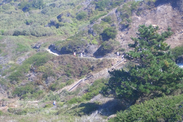
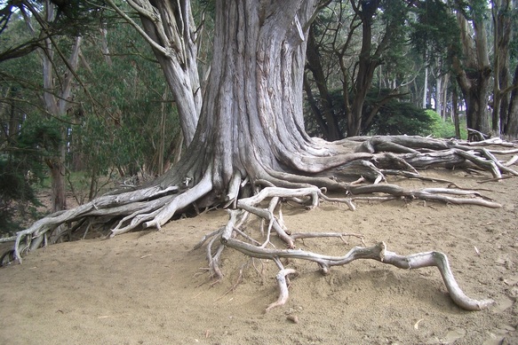
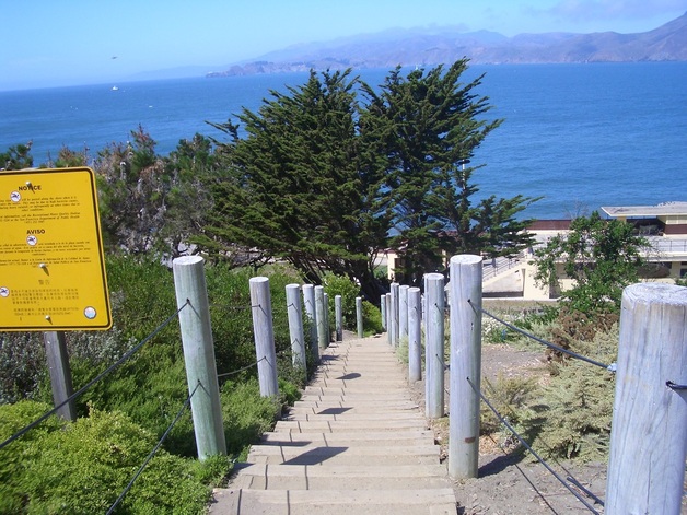
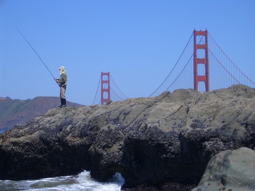
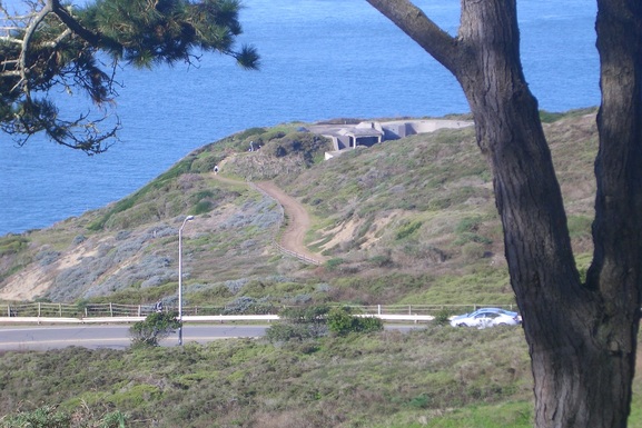
This up, down ‘n curvy trail has around 470 steps (first pic). Noticed the first new railing after crossing the short footbridge on the west side.

The second section of railing is near the top (Battery Crosby trailhead). Wonder if they’re gonna stop at these two.

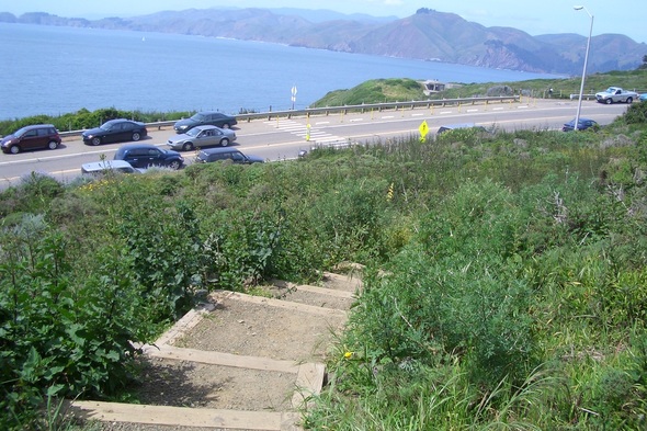
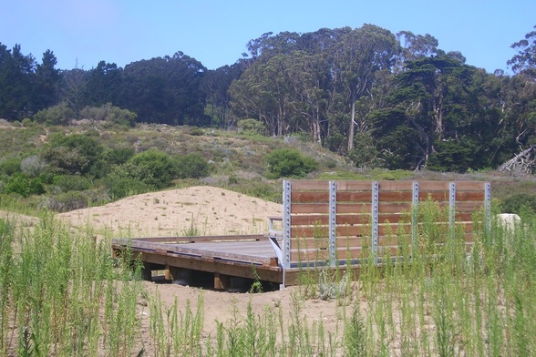
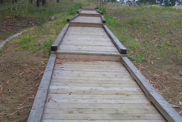
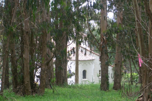
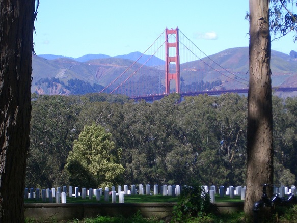
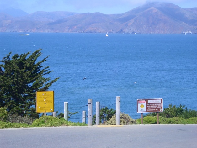
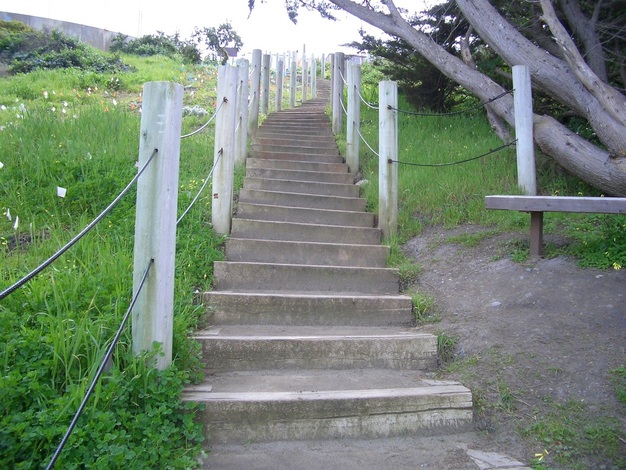
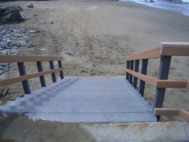
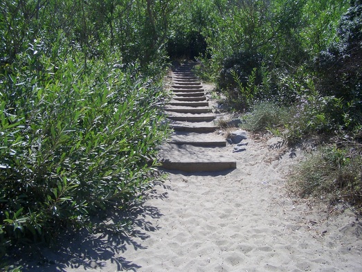
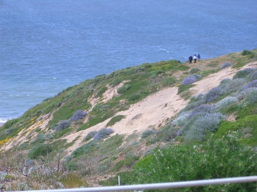
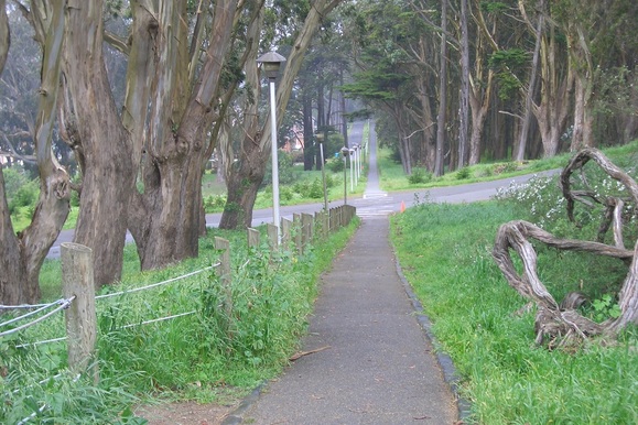
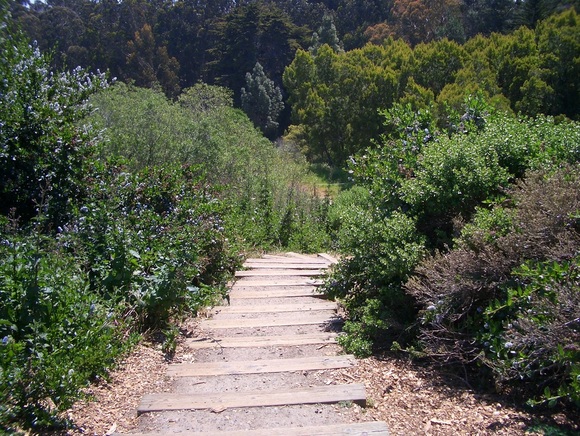
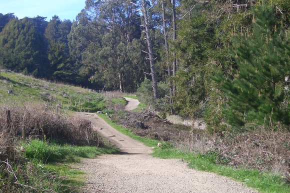
Crossed Lincoln and headed up the Connector Trail (208 steps – second pic) to Immigrant Point Overlook, then downhill on Battery Caulfield, crossing the street to the dunes boardwalk trail (last two pix).

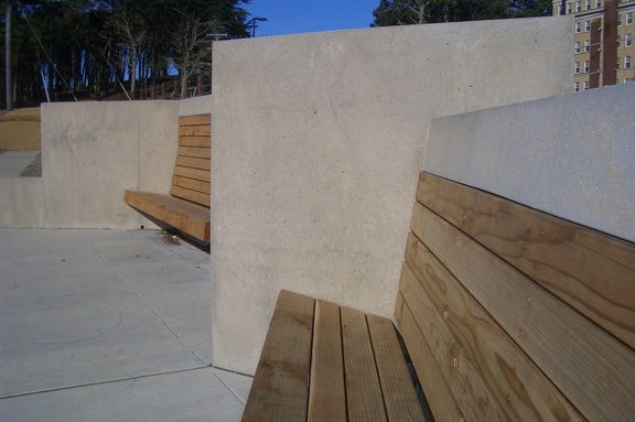
Today’s second surprise: Centered between and in front of the two built-in wood benches on the viewdeck is now a sunken (maybe 1-1/2 feet deep?) wood-walled square enclosure with an inscribed plaque:

“
United States Marine Hospital Cemetery
1881-1912
Home is the sailor,
home from the sea – A.E. Houseman
In memory of the merchant mariners
from around the world who rest here
”

Having read something about this, was wondering where they were gonna put it.


Picture
Batteries to Bluffs Trail
Picture
Connector Trail up to Immigrant Point/Rob Hill Campground
Picture
Bench and viewdeck
Picture
The boardwalk trail behind the former public health hospital buildings
5 Comments

Presidio Blvd. Gate to 16th Ave.

10/27/2011

6 Comments

 
Today’s hike was with no specific goal in mind, just a winding, meandering stroll starting at Presidio Blvd. and Lover’s Lane on the east side.

From Lover’s Lane, Andy Goldsworthy’s Wood Line was easily visible in the forest to my right. Veered off into one of the eastside residential ‘hoods, enjoying the warm sun on my back and neck. Discovered a new neighborhood garden at the corner of Portola & Rodriguez (first pic). Second pic: tree roots on the east side.

Up the stairs to the Main Post area to pass by Pershing Hall and the Officers’ Club, both still undergoing extensive renovations, on my way to the stairway that climbs to the Post Chapel.

At the top of these steps are woodsy, sun-dappled trails that will take you to the Cemetery Overlook (third photo – the Post Chapel from a trail above). This time took an alternate trail not taken in a while, climbing over several fallen trees and enjoying being alone in the forest on such a perfect day.

Came out of the forest at the south entrance to the Overlook. The view was especially clear today of the mountains in the distance beyond the bridge (fourth pic).

Descended the forested wood stairway from the Overlook to the Park Trail. It was sad not to see the recently removed Presidio Habitats exhibits down here. I was so used to ‘em.

From the Park Trail, crossed the street to the Bay Area Ridge Trail. Following this curvy beauty took me out (far too soon) to the West Washington Neighborhood Garden, then down Battery Caulfield Road and past the Lobos Creek Valley Overlook out of the park.


Picture
Neighborhood garden at Portola & Rodriguez
Picture
East side
Picture
Post Chapel from a trail above
Picture
A view from the Cemetery Overlook
6 Comments

China Beach

10/22/2011

1 Comment

 
China Beach and the beautiful, upscale, sweet-smelling Sea Cliff neighborhood are in between Lands End on the west side and the vast Presidio to the east.

There’s a long stairway down to China Beach and the beach itself is very pleasant, so one would think I’d go there more often. But I constantly get distracted by the huge viewparks on either side of this little beach with their many trails, stairways, overlooks ‘n beaches. It was named for Chinese fishermen who used to camp at the beach, but also used to be called Phelan Beach. The waves are noticeably calmer than those at Beaches Ocean and Baker.  

Got off at 30th Ave. and walked into the Sea Cliff ‘hood. There’s a sign that says “Public Beach” and a few steps. Turn left. The main long (mostly wood) stairway is 105 or so steps (first three pix).

There are a few other, shorter, stairways with about the same number of steps that descend to the beach itself. My favorite shorter one is over on the west side (last photo). This starts off as wood but the last several are rough concrete, from the last step to the beach being a steep enough drop so that I was obliged to sit and ease myself down to the sand. Unique, this.

There are picnic tables, showers and restrooms. Several people were sunbathing at the top of this building (21 steps up). Another 20 steps back down to the walkway at the foot of the long stairway.

After I ascended the long one again, walked east along El Camino del Mar and then Sea Cliff Blvd. to reach the stairway that will take you down to west Baker Beach (about 49 wood steps) from the dead-end at 25th Avenue North and Sea Cliff Blvd. (Note that this is a different street from 25th Avenue.) There’s a fence with an open gate and a sign that says “Baker Beach.” Noticed the foot of these sandy steps last time I was at Baker Beach, and felt another stroll around here was long overdue.

But then after this, what a bummer of an experience today on the #1 California bus. Had to wait 31 minutes for it and then there was another five minutes behind it. Got on at 25th Ave. and already the bus was nearly full.

Got a seat and stayed there until my stop. The driver kept letting people on even though the bus was packed solid, so that there were several people in front of the yellow line and standing right next to the driver most of the time. They’re not supposed to let them stand there.

He should have told people to wait for the bus that was right behind, but he just suggested that one time the whole long trip.

When it came time to get off at my stop, I was packed in and had to squeeze by several people in order to get to the front door. That’s when my pocket got picked and my wallet stolen. I couldn’t feel anything as I made my way to the exit because of the squashed conditions as everyone was pushed up against everyone else.

I’ve already complained about the unsafe, crowded conditions on this bus to MUNI and on my Facebook page.

So when I got home I ran to the bank to cancel my debit card. I barely made it in time. They had just closed, this being Saturday afternoon, but I banged on the door and was let in to change my info. My CA I.D. was taken as well, so now have to go to the DMV to get another. I think MUNI owes me $20 or so for having to get a new I.D. because of the overcrowded conditions, but good luck with that I guess. 


Picture
Top of the long China Beach stairway
Picture
China Beach long stairway
Picture
Foot of the long China Beach steps
Picture
Down to China Beach, wood and concrete
1 Comment

Beachday

10/14/2011

1 Comment

 
Today was my first ”real” beachday this year, as in actually getting wet. 

What I hate most about going to the beach is having to leave it. I can walk, stand, and sit for hours hypnotized by the look and feel/pull of the waves.

Add to this the warm day, the refreshing ocean air, the sun shining on the water, the bluffs above, and view of the Marin Headlands and the bridge.

The trails down to west Baker Beach are a very short distance from the #29 bus stop (the Baker Beach bus).

Was gonna move closer to the Sea Cliff homes and the stairway down to the beach from this ‘hood (first photo), but along west Baker Beach there are a lot of little rocks that hurt my feet, so I don’t like to wade around here as much as mid-beach or the east end.

The mid-beach stairway has a few of those caution cones on its lower end like it might be in need of repairs, but it was constantly in use.

The eastside rocks (second and third pics) were too crowded today so didn’t sit there this time. Enjoyed watching a few people toss floating toys into the waves for their dogs to fetch.

Things I don’t want to get wet I stuff in plastic bags in my backpack, like shoes, sox, outer trousers, iPod, wallet. Wasn’t totally drenched all over like last year, just below the waist, so when I got on the bus was just damp, not noticeably dripping and sand-coated.

For last Saturday’s Blue Angels show, finally settled on an ideal spot where I’ll probably end up next year: the top of Battery Crosby (west trailhead for the Batteries to Bluffs Trail). Fourth pic: hikers on the slope near this old battery. Baker Beach is below. There weren’t many people atop the battery and one could step off onto litttle trails, with an unobstructed view of the bridge and water.

Fiesta on the Hill, Bernal Heights’ annual street fair, is this coming Sunday, October 16. Live music included, 10 to 6 on Cortland.


Picture
Sea Cliff to Baker Beach
Picture
East Baker Beach
Picture
East Baker Beach
Picture
Near top of Battery Crosby
1 Comment

Angels Flight - Practice 2

10/7/2011

1 Comment

 
On today’s hike saw a bunch of redtailed hawks, orangey butterflies, and a dragonfly.

Got up to Immigrant Point Overlook far too early as the Angels started later than they did yesterday. Tired of waiting around, meandered over to the back of Rob Hill Campground where two unmarked minor trails off a street called Central Magazine lead to the back of the Fort Scott neighborhood.

The trail I took down is forested. The one I took back to the Campground again starts with a few concrete steps, is more out in the open, and passes by a tire swing (first photo). A yellow fire hydrant is at its west trailhead near the Campground.

These short trails are a few yards apart and come out near the Fort Scott Community Garden (off Wisser Court) behind residences. Spent a few moments in this "hidden" garden before heading back.

Immigrant Point Overlook's a good place to view the airshow and not that many people were there; who knows how packed it’ll be for the weekend shows. My perch gave me a great view of the tops of Battery Crosby (second photo: Battery Crosby, down from Lincoln, the west trailhead for the Batteries to Bluffs Trail) and the Sand Ladder, and all the traffic on Lincoln.

It took about 20 minutes for me to make my way back down Rob Hill from Immigrant Point Overlook out of the park to California & Park Presidio to catch the bus.

On the way, it’s a pleasure to take the part of the Anza Trail that passes alongside the Lobos Valley Overlook (third photo: the unique benches).

If you remember what this hillside looked like before the Overlook and the extensive planting around here, you’ll definitely appreciate how it looks today. I always have to slow down to admire it all.

Enter the park at the 15th Ave. Gate, where the former public health hospital buildings are now residences, and turn left at the trailmarker for the Anza Trail.

I’d like to see the sidewalk continue ALL the way to Immigrant Point Overlook from the beginning of the Presidio Forest, as a part of this route, most of it on Battery Caulfield Road, forces walkers out into the street and the cars pass far too close. Or maybe a trail at the edge of the road. 

Picture
Unmarked trail from Fort Scott to Rob Hill Campground
Picture
Battery Crosby (and Lincoln Blvd.) from Immigrant Point Overlook
Picture
Lobos Creek Valley Overlook Benches
1 Comment

Unexpected Treat

10/6/2011

0 Comments

 
There’s a trailhead sign up now for Lover’s Lane near the Presidio Blvd. Gate (first pic). Turned off this onto a muddy minor trail alongside some evergreens that I remember schoolkids planting several years ago on Arbor Day. 

As I picked a few late berries near the Mountain Lake Trail, a couple of pooches dropped balls at my feet so threw a few for 'em to chase.

Gazing down at the El Polin Springs site where extensive landfill removal and other major improvements have been going on for the longest time, was mainly walking below the trail and above the fenced construction area over damp eucalyptus leaves and twigs. My hikes are leisurely and unhurried and I often pause to appreciate the views.

An unexpected treat today was the Blue Angels’ practice flight. I wasn’t even thinking about it being that time of year, just poking along, and then there was that familiar sound and this unobstructed view. Almost anywhere in the Presidio is a good place to watch the airshow. Continued up to Inspiration Point Overlook, ascending the wooden stairway (45 steps, second photo) from the Ecology Trail (third pic), finding this to be an excellent place to view the planes.

There weren’t all that many people either, though when the main weekend shows begin I’m sure the area will be packed with people sitting on the wall here. Thinking of trying this spot for a change Saturday or Sunday, though I might also get a bit closer and higher by continuing to Immigrant Point Overlook. There are several excellent possibilities I can think of as long as I’m willing to walk out of the park to catch the bus this year.

Last year was an awesome view from the Battery East Trail (near the Bridge), but it took me around two hours to get home.

This year will walk out of the park and down the hill several blocks to California St. where the buses run a lot more frequently. Of course, people driving in and out of the park won’t have an easy time of it either, as in bumper-to-bumper and good luck finding a parking place.

Inspiration Point Overlook is close to the Arguello Gate. Immigrant Point Overlook is more of a hike to and from but with an even better view. But I don’t mind such a trek now that I’ve already decided not to depend on the bus to exit the park. If it gets too crowded at one of the overlooks, I can just descend to a lower trail.

It started to rain as the Angels seemed to be finishing up and everyone hightailed it off the overlook, but then they continued to buzz the city later while I was on the bus and at home. 


Picture
Trailhead for Lover's Lane near Presidio Blvd. Gate
Picture
Trailhead at Inspiration Point for Ecology Trail
Picture
Ecology Trail below Inspiration Point Overlook
0 Comments

    Author

    I like meandering around on San Francisco's park trails and public stairways, sometimes taking photos, and enjoying nature and the outdoors.

    Archives

    March 2020
    February 2020
    January 2020
    December 2019
    November 2019
    October 2019
    September 2019
    August 2019
    July 2019
    June 2019
    May 2019
    April 2019
    March 2019
    February 2019
    January 2019
    December 2018
    November 2018
    October 2018
    September 2018
    August 2018
    July 2018
    June 2018
    May 2018
    April 2018
    March 2018
    February 2018
    January 2018
    December 2017
    November 2017
    October 2017
    September 2017
    August 2017
    July 2017
    June 2017
    May 2017
    April 2017
    March 2017
    February 2017
    January 2017
    December 2016
    November 2016
    October 2016
    September 2016
    August 2016
    June 2016
    May 2016
    April 2016
    March 2016
    February 2016
    January 2016
    December 2015
    November 2015
    October 2015
    September 2015
    August 2015
    July 2015
    June 2015
    May 2015
    April 2015
    March 2015
    February 2015
    January 2015
    December 2014
    November 2014
    October 2014
    September 2014
    August 2014
    July 2014
    June 2014
    May 2014
    April 2014
    March 2014
    February 2014
    January 2014
    December 2013
    November 2013
    October 2013
    September 2013
    August 2013
    July 2013
    June 2013
    May 2013
    April 2013
    March 2013
    February 2013
    January 2013
    December 2012
    November 2012
    October 2012
    September 2012
    August 2012
    July 2012
    June 2012
    May 2012
    April 2012
    March 2012
    February 2012
    January 2012
    December 2011
    November 2011
    October 2011
    September 2011
    August 2011
    July 2011
    June 2011
    May 2011


    RSS Feed

Powered by Create your own unique website with customizable templates.