Stairways are Heaven
  • Home
  • About Me
  • Stairways are Heaven

New Canyon Stairway

4/24/2013

0 Comments

 
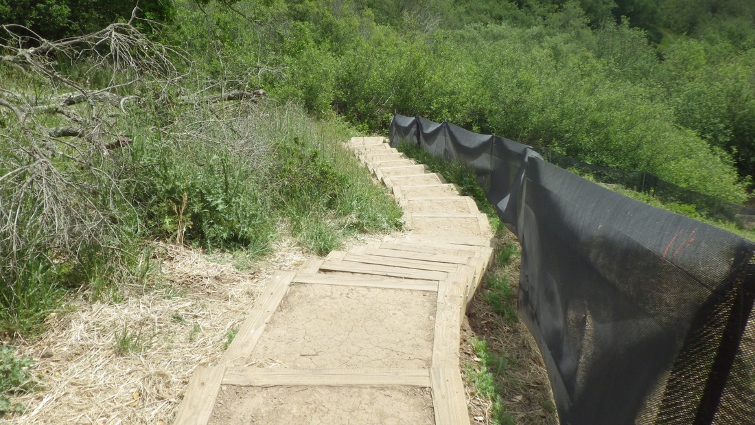
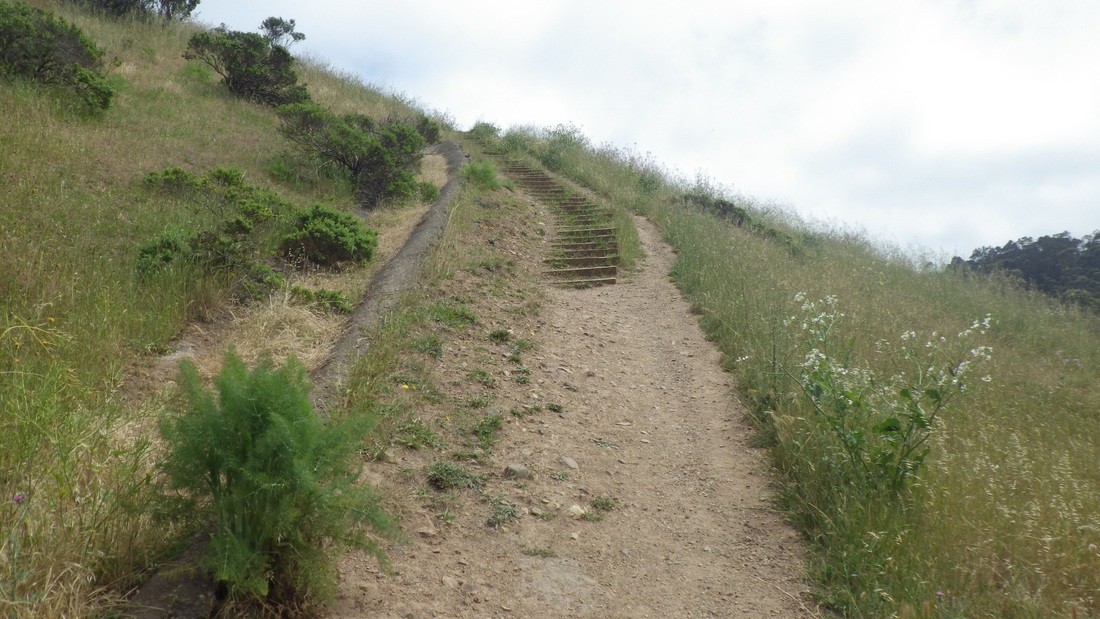
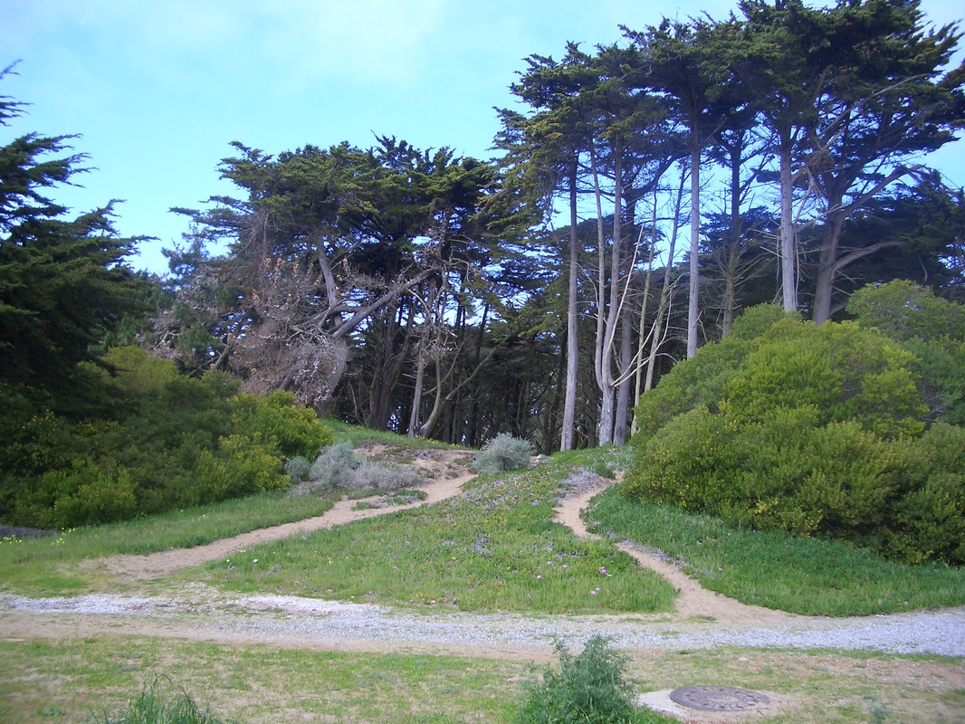
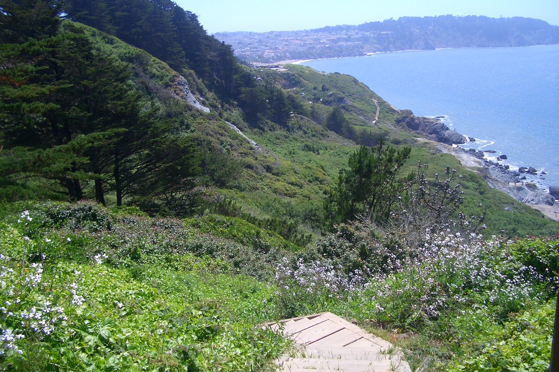
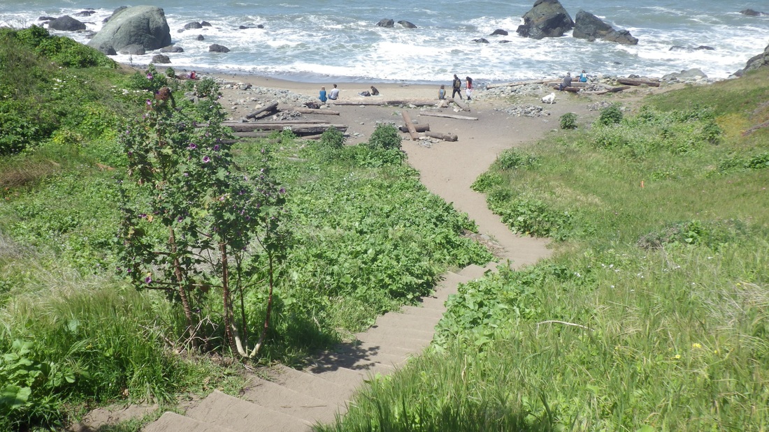
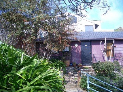
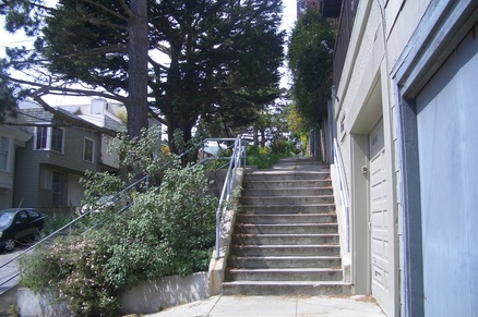
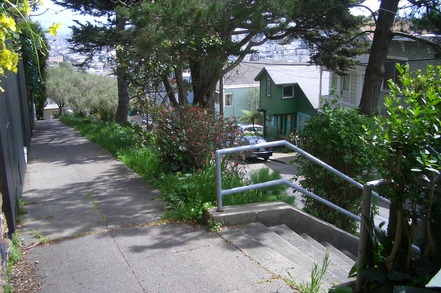
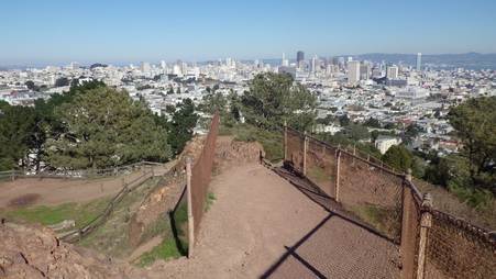
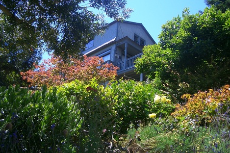
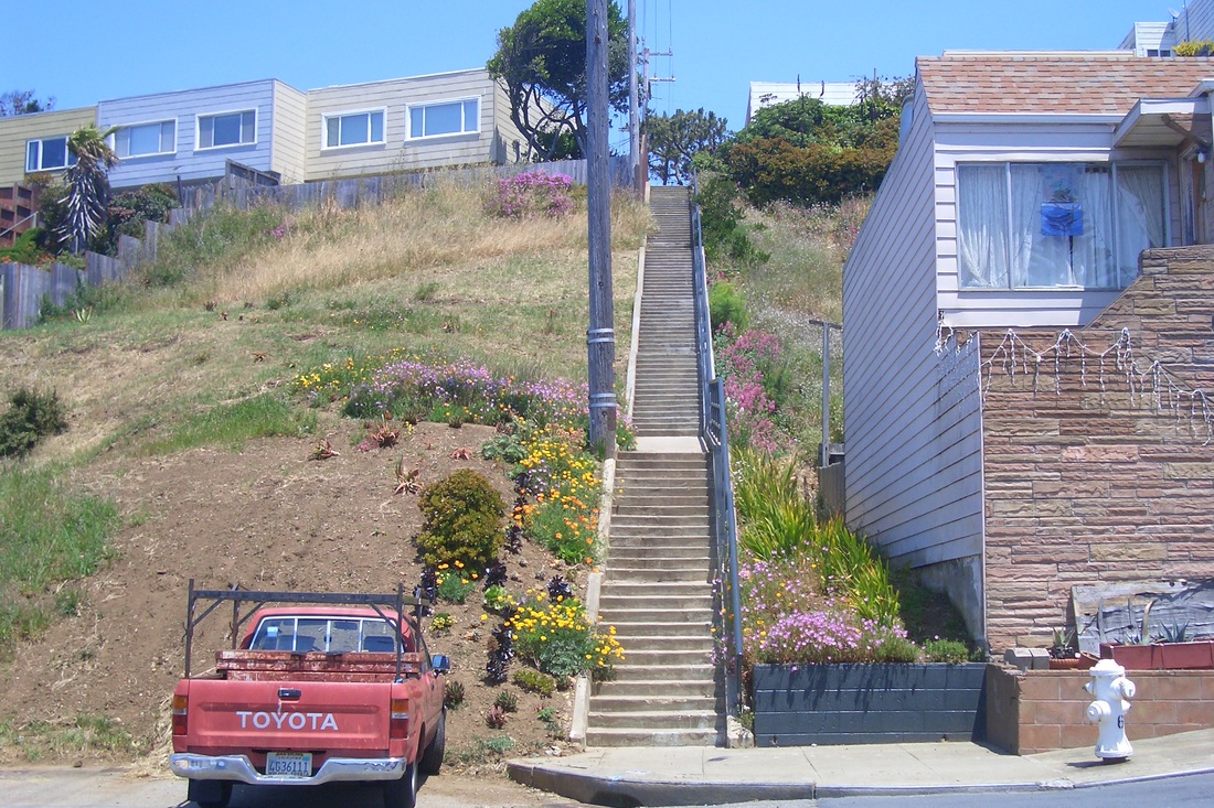
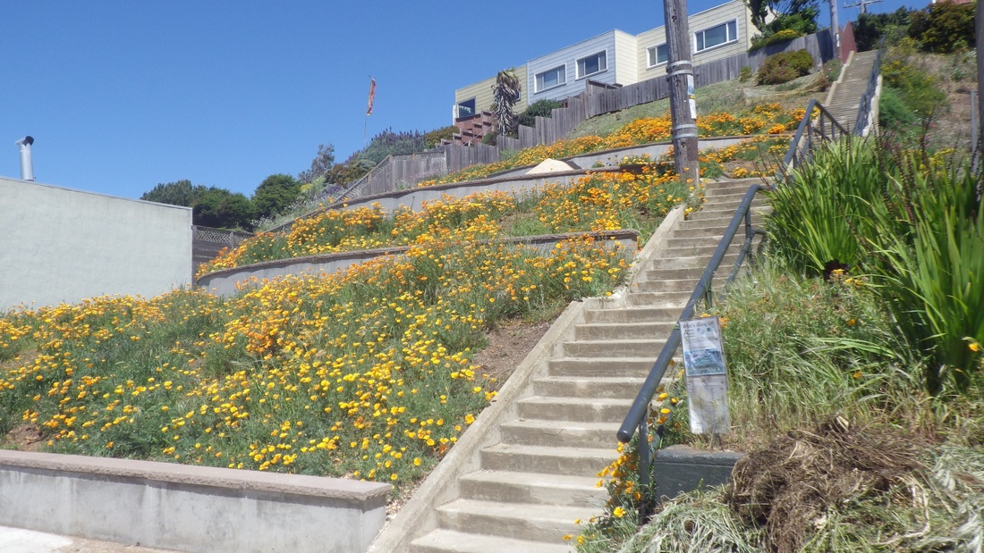
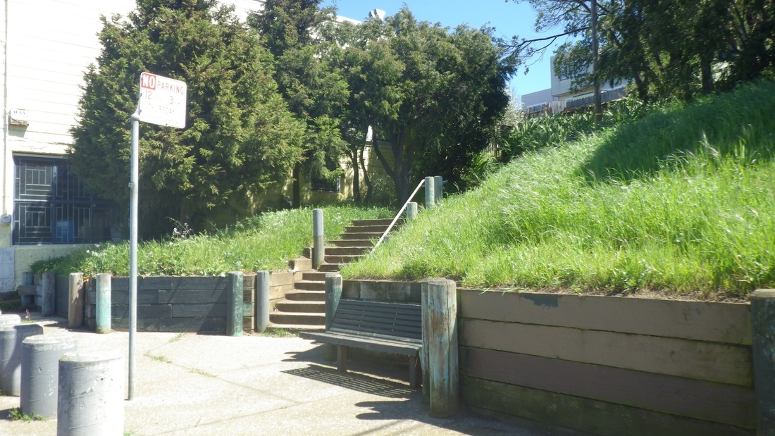
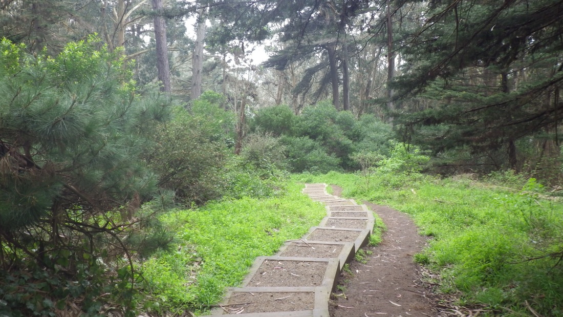
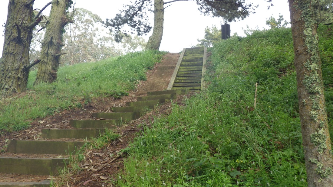
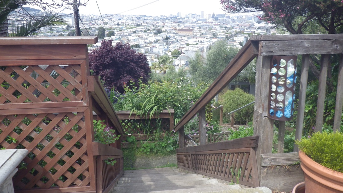
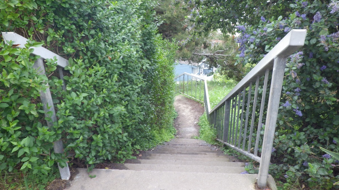
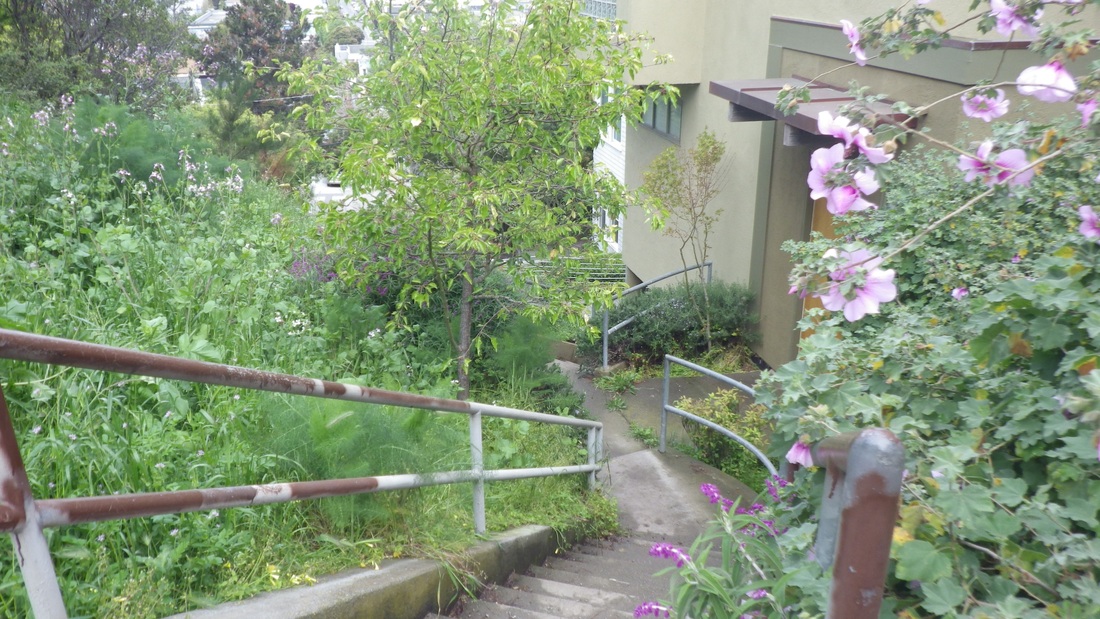
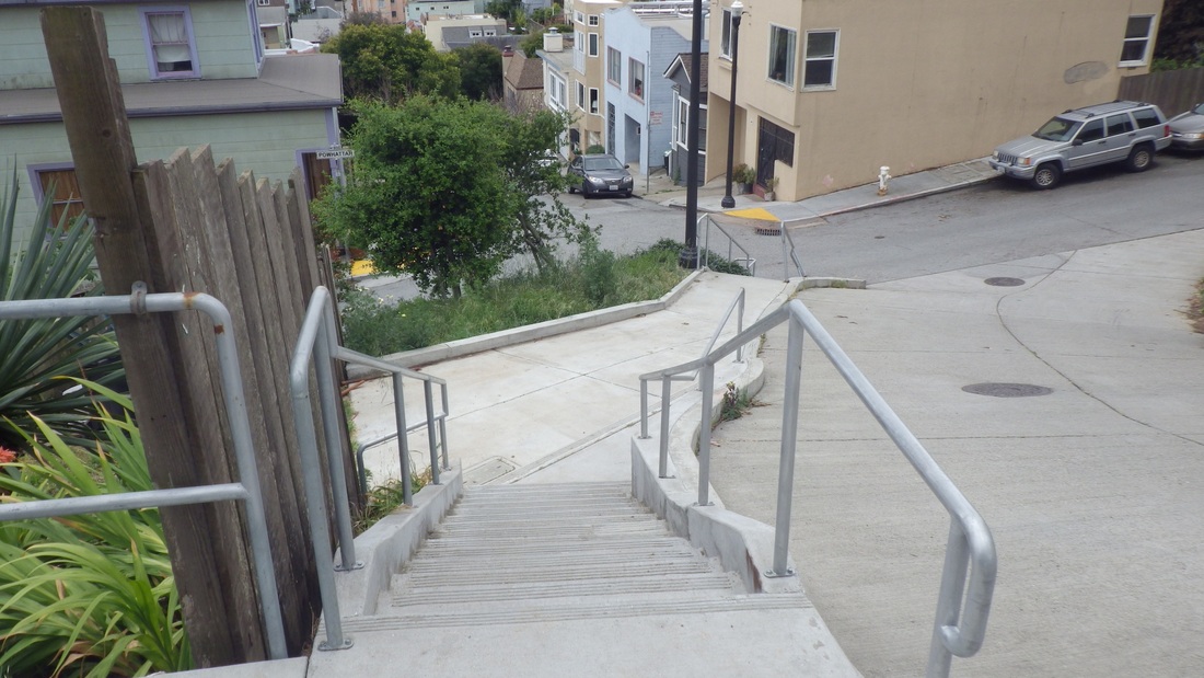
Glen Canyon's longest stairway (86 steps, a favorite, pix 1, 2, 3) drops precipitously from the west edge of Christopher Park near the Diamond Heights Shopping Center. 

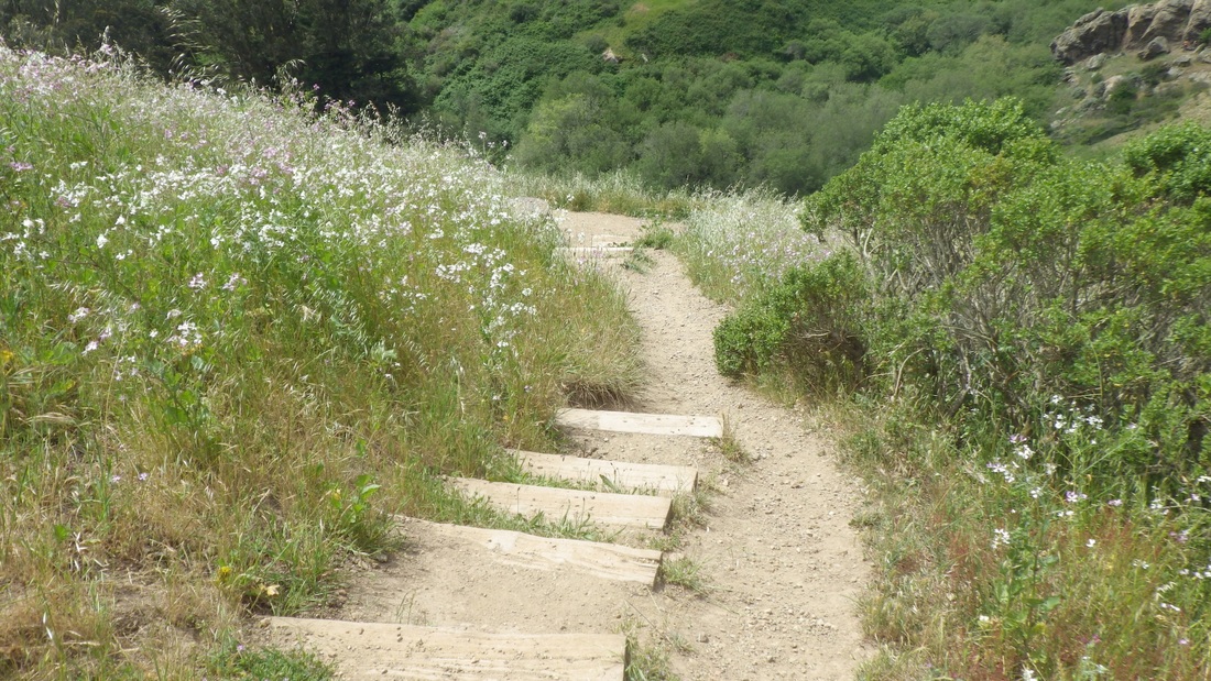
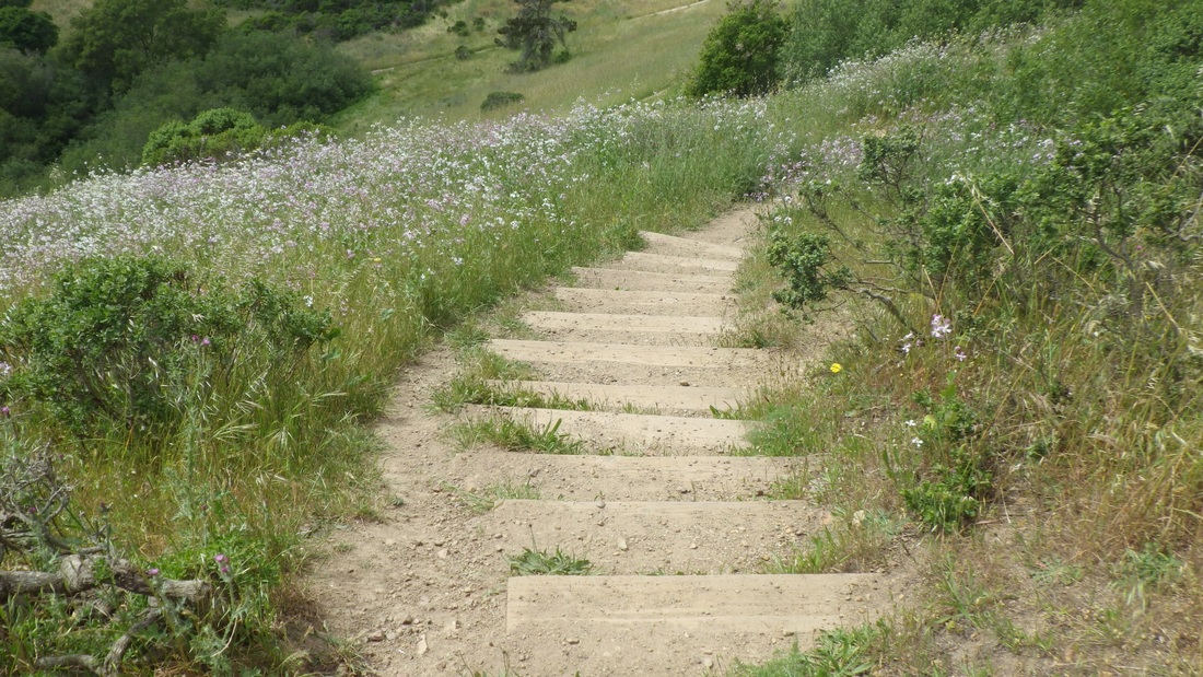
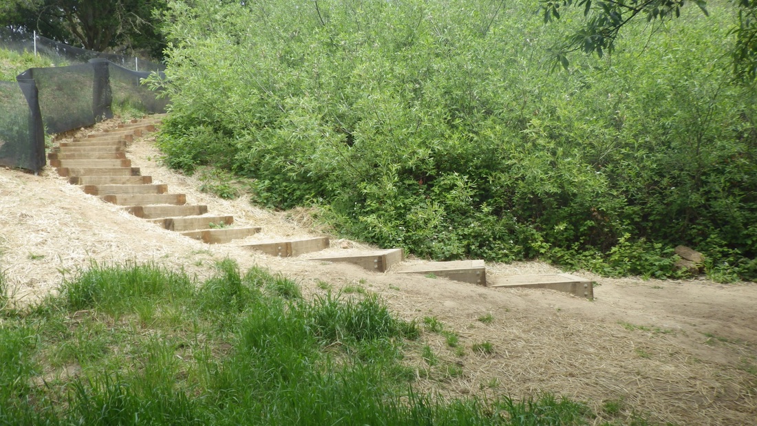
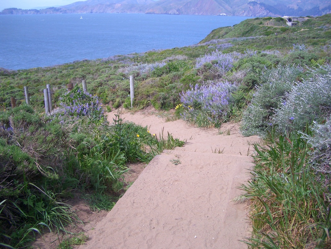
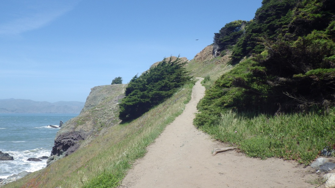
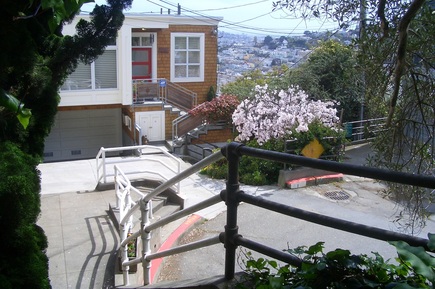
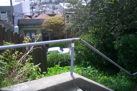
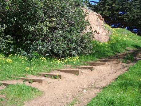
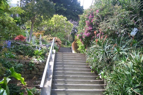
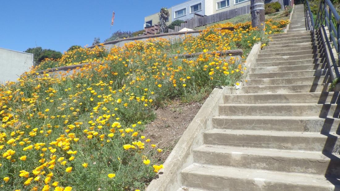
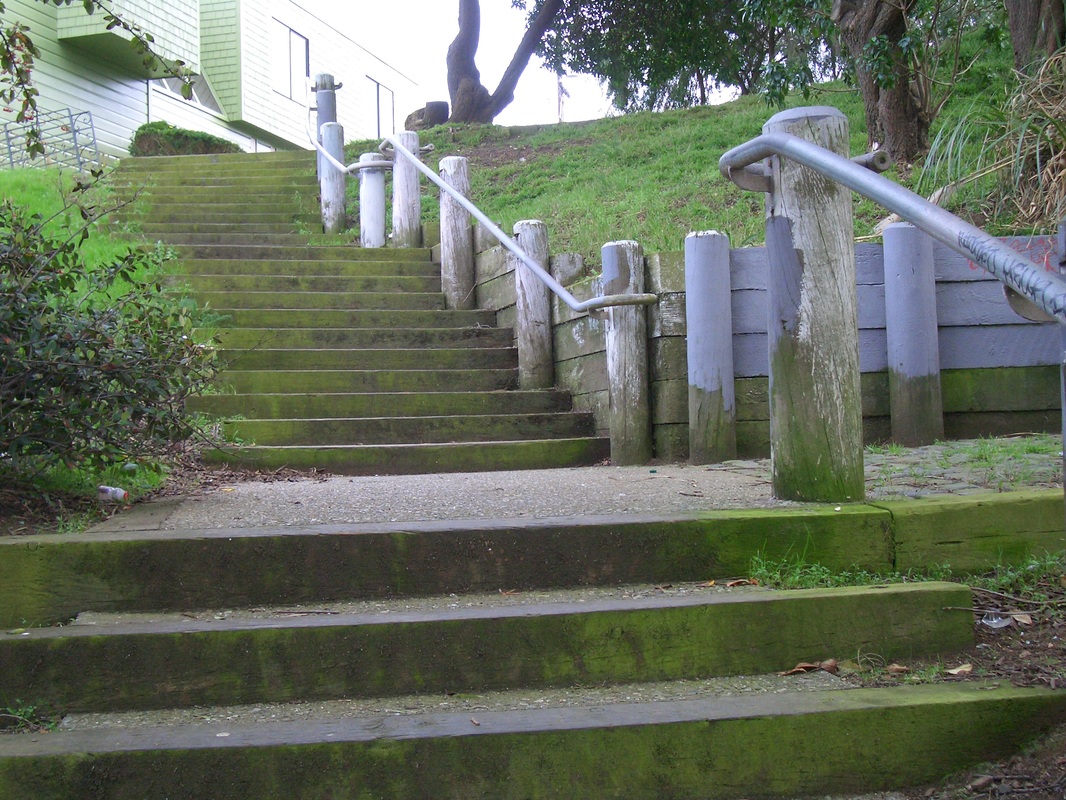
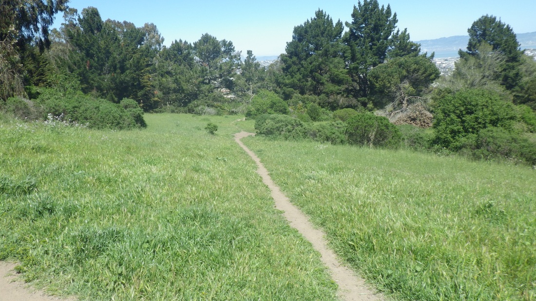
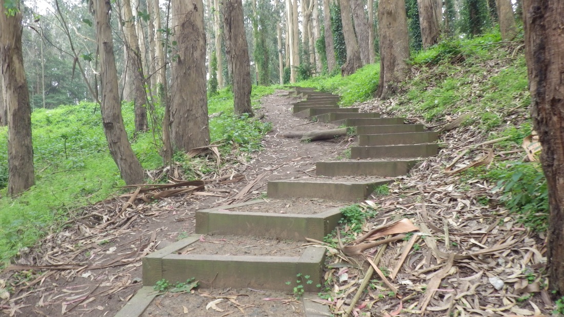
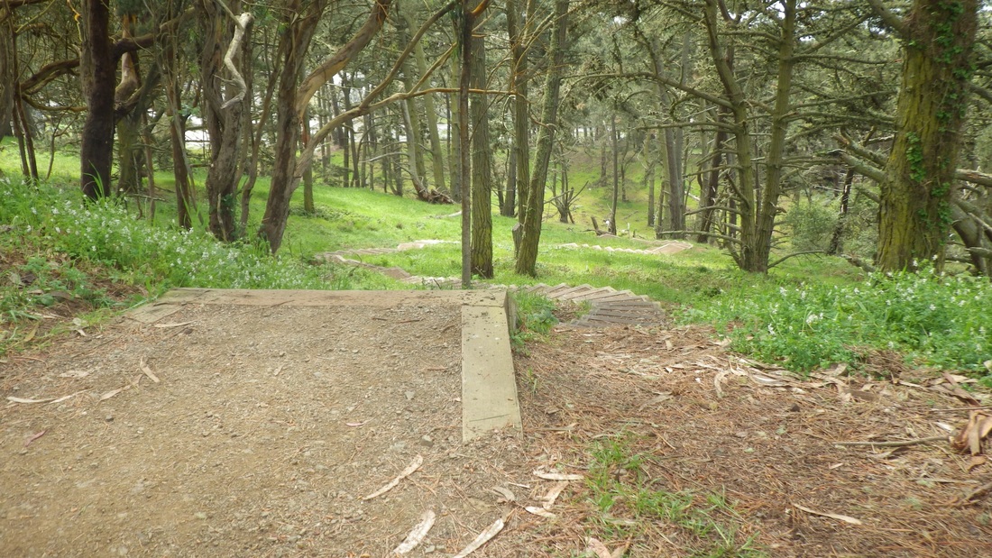
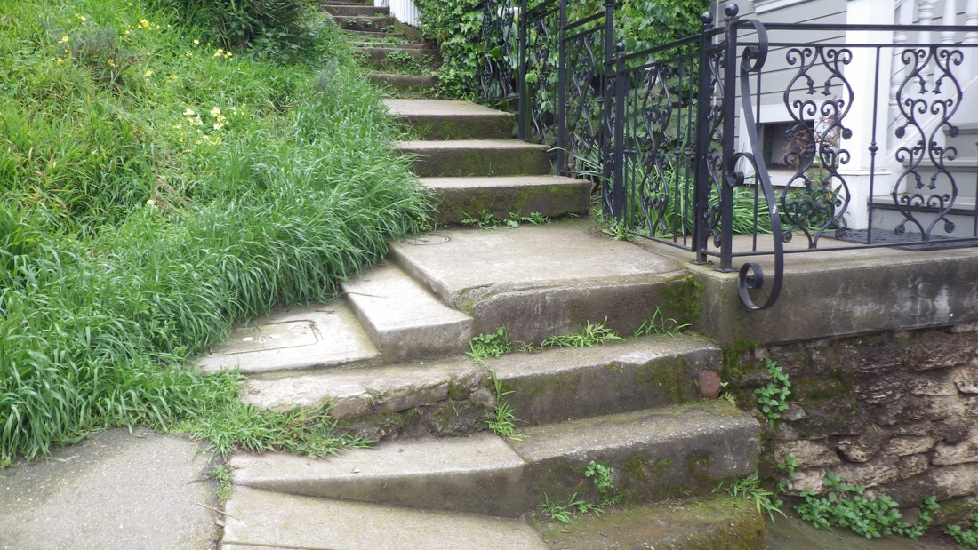
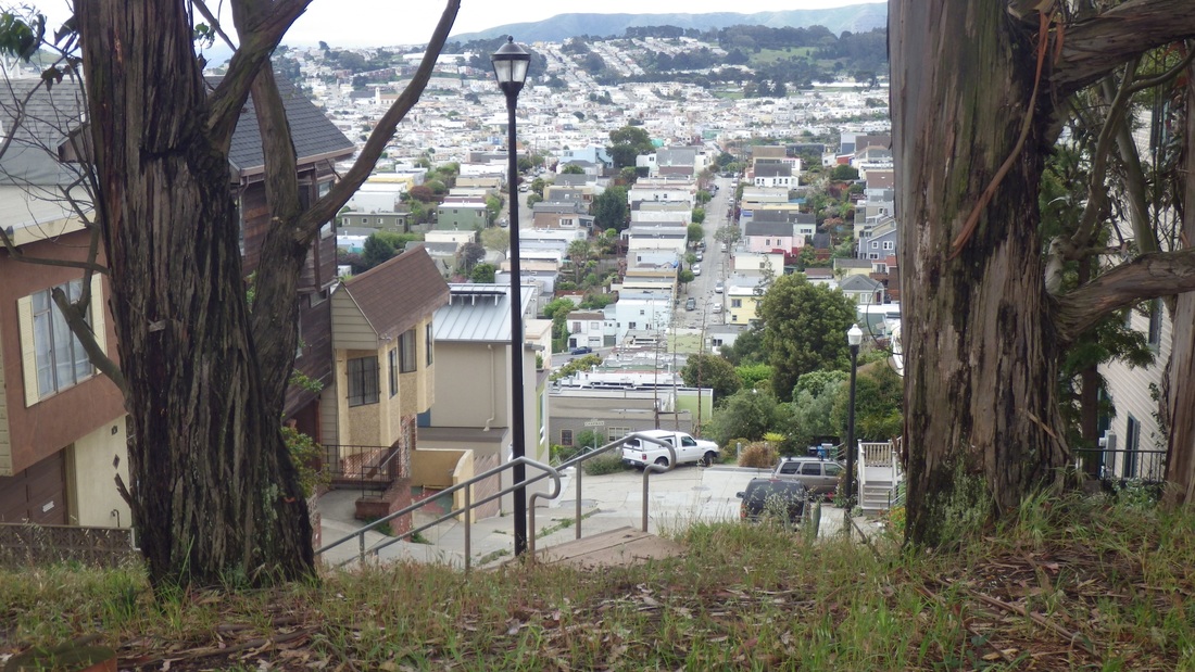
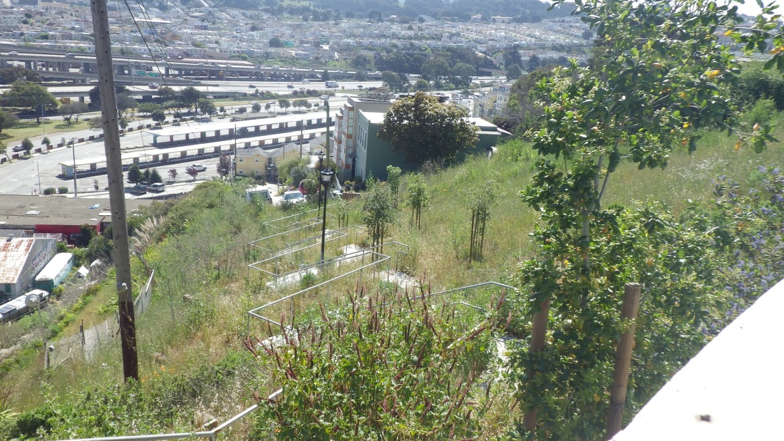
At the end of the steps onto a regular trail, this beauty turns and continues down (fourth pic). When partway along, however, noticed that an older, shorter stairway had been extended up one side of the rocks here that are often occupied by rock climbers (as today). There are now 61 steps (pics 5, 6).  

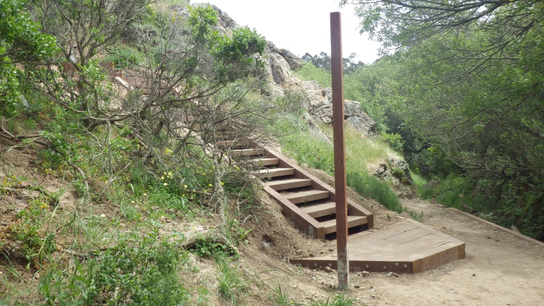
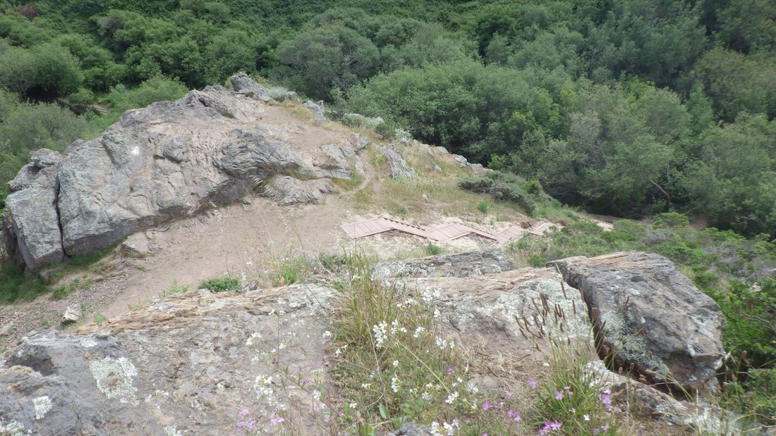
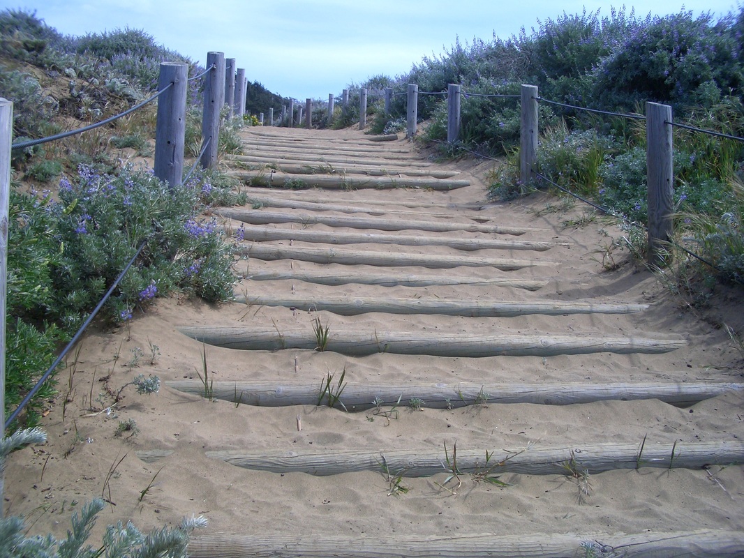
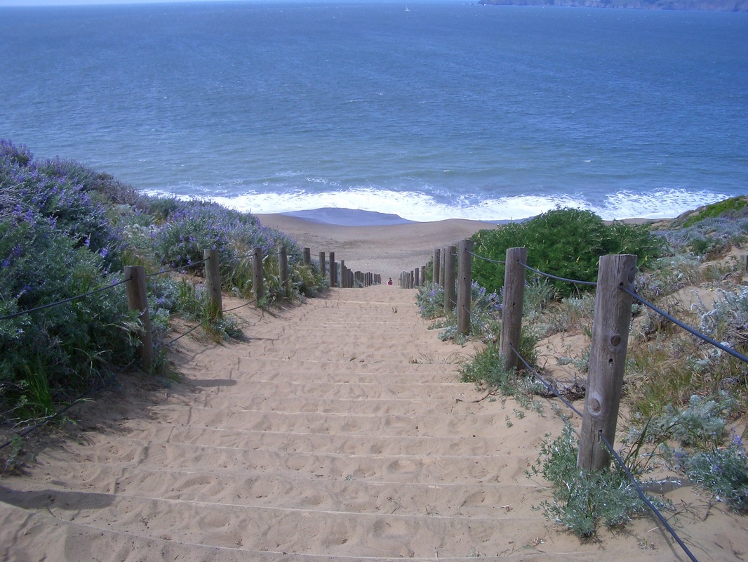
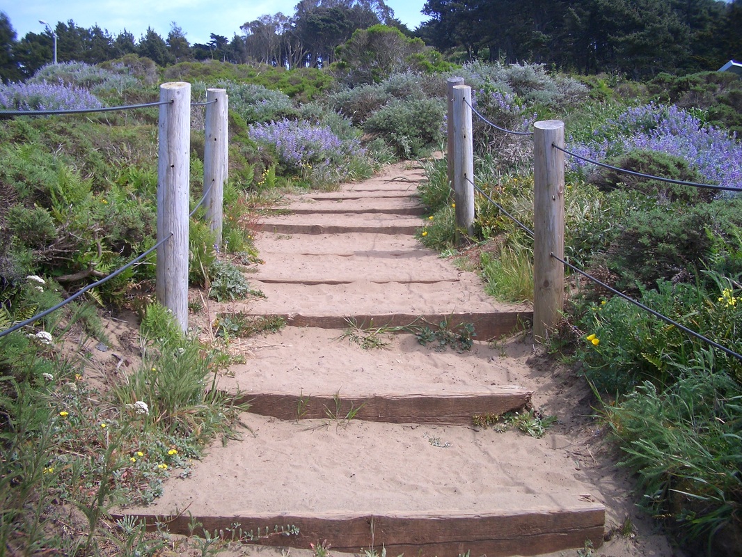
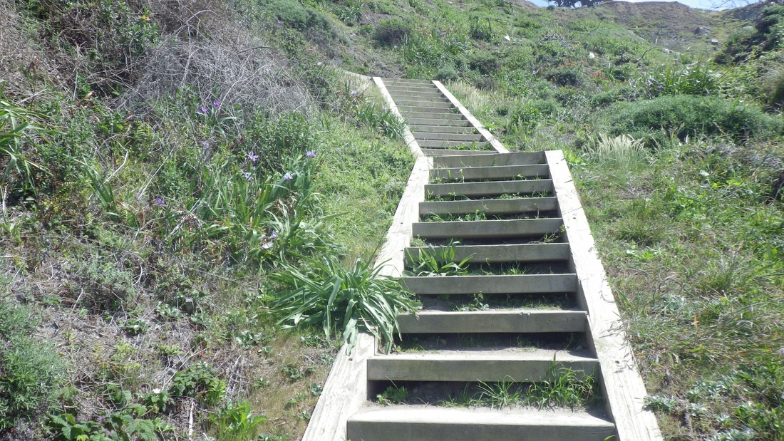
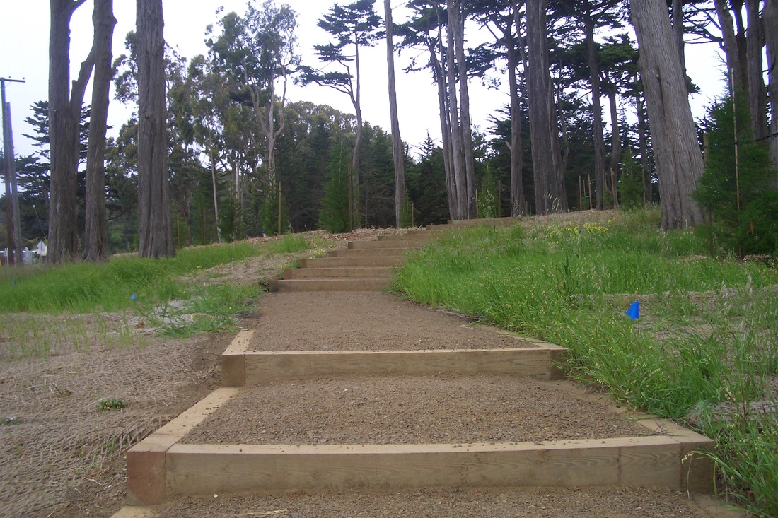
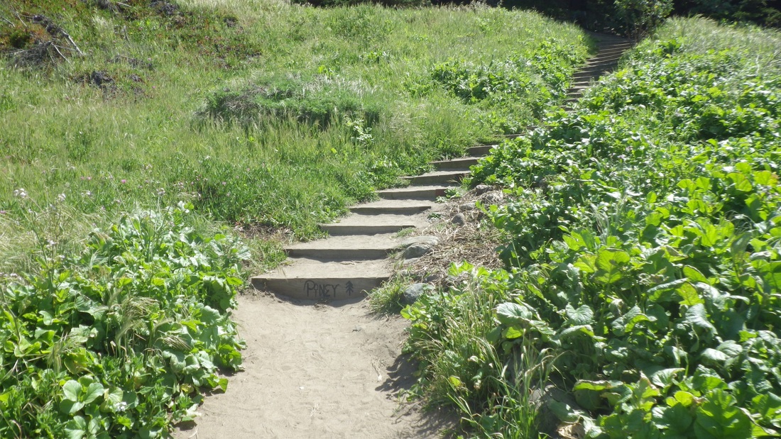
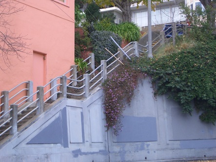
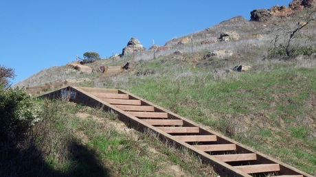
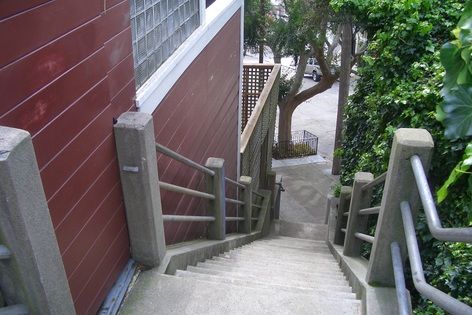
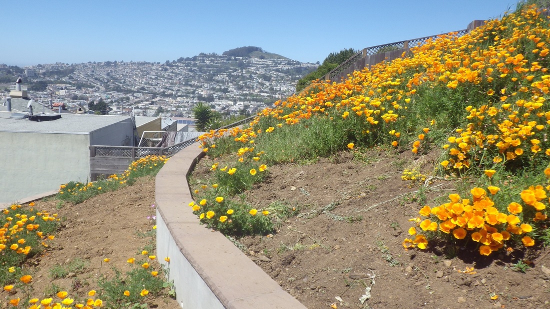
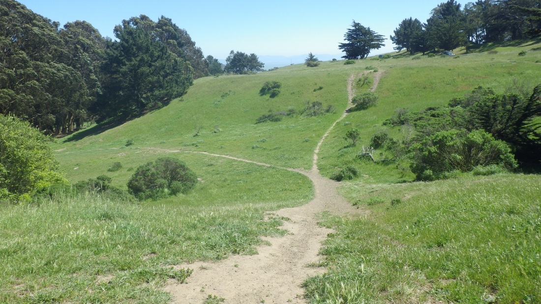
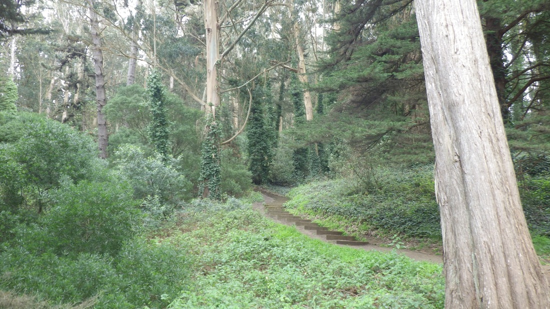
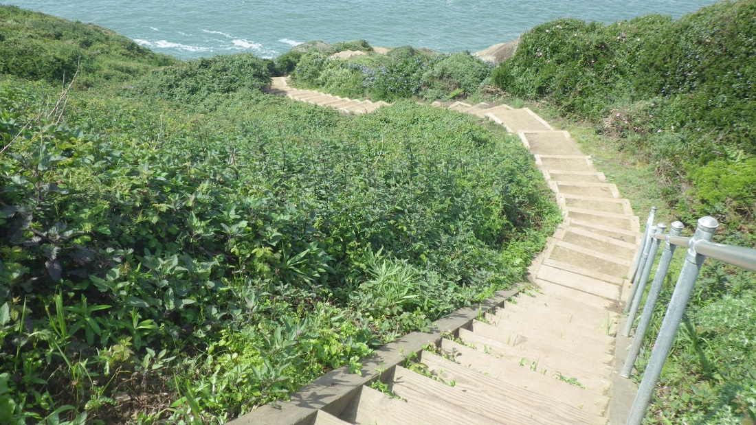
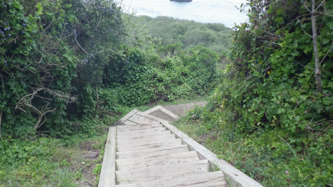
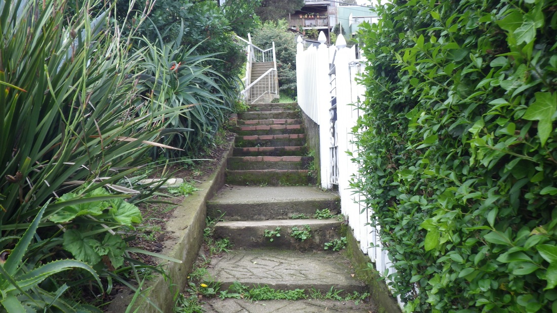
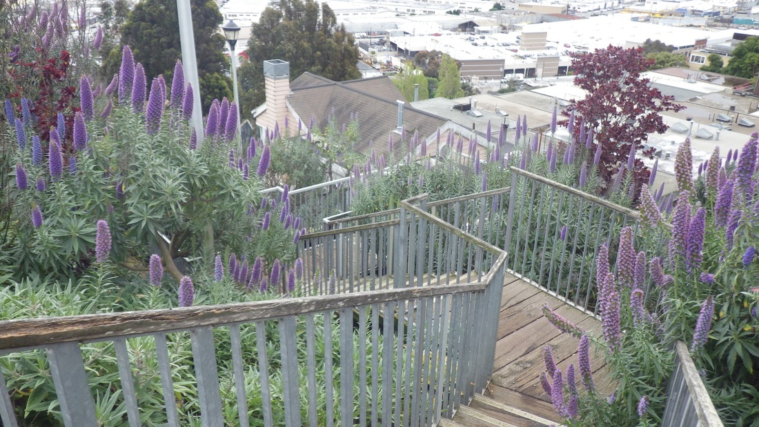
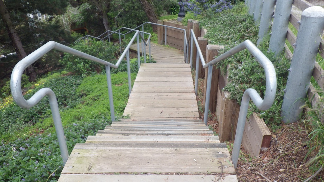
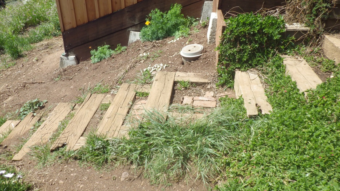
From the top of the stairway extension (seventh pic), looking down the other side of the rock before descending, discovered a brand new wooden stairway (68 steps, pix 8, 9, 10, 11). 

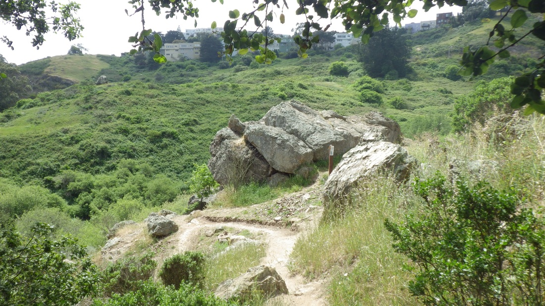
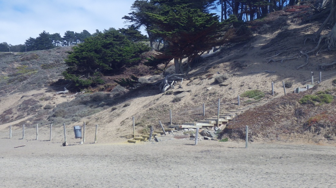
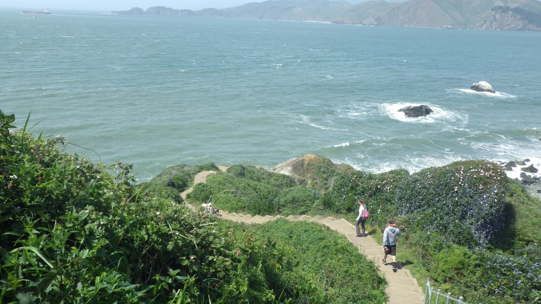
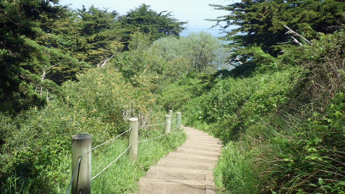
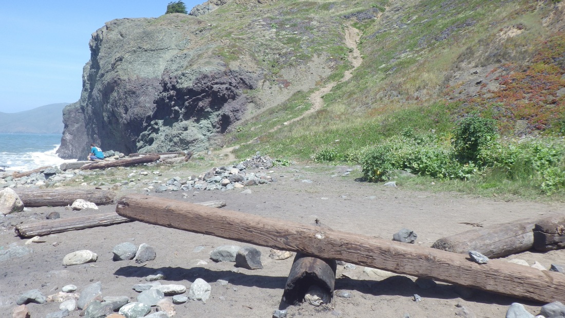
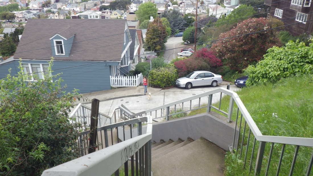
After you've crossed the footbridge over Islais Creek, you can't miss these two stairways with the rocks above centered between them.

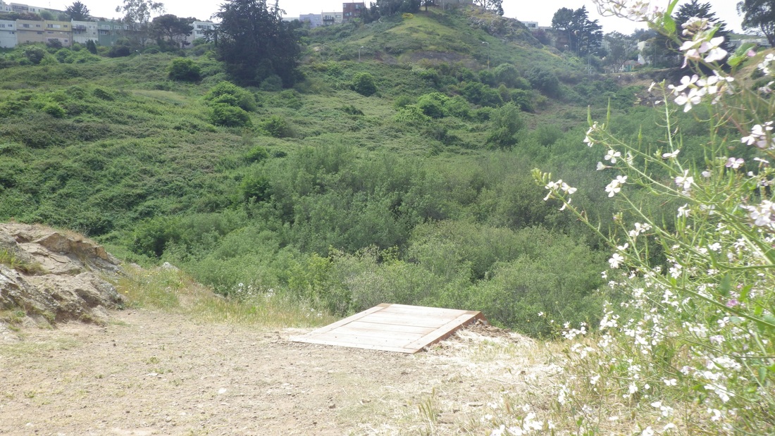
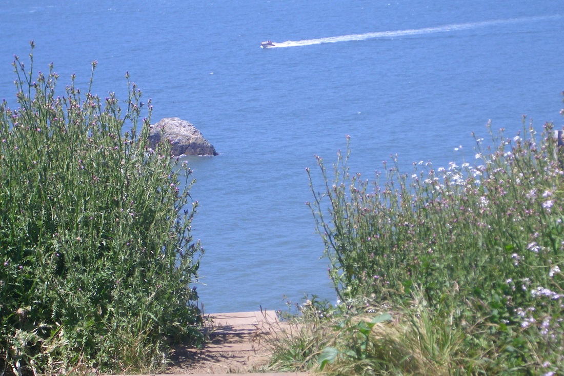
Continued north on the lower trail to where it ends and climbs into the open, noticing some flexi-plastic barriers and stacked tree limbs near the creek, hoping the trail down again wouldn't be blocked. It wasn't. Was able to step across the creek as usual but this time with a view of more of the creek than ever before. Lots of brush-clearing around here lately, with new planting-flags alongside the creek … a hummingbird, bees, plenty of damselflies. 

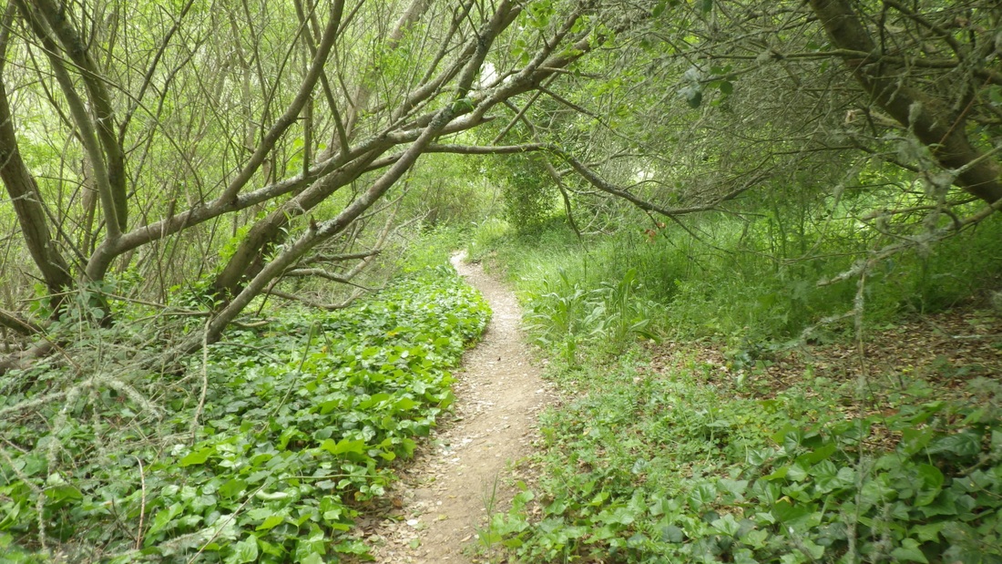
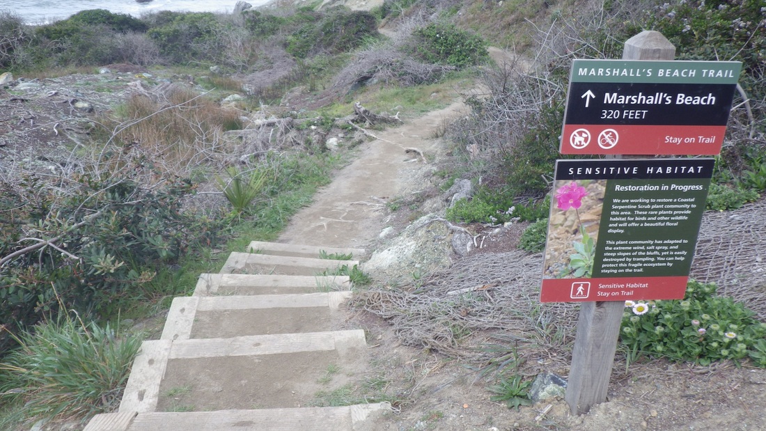
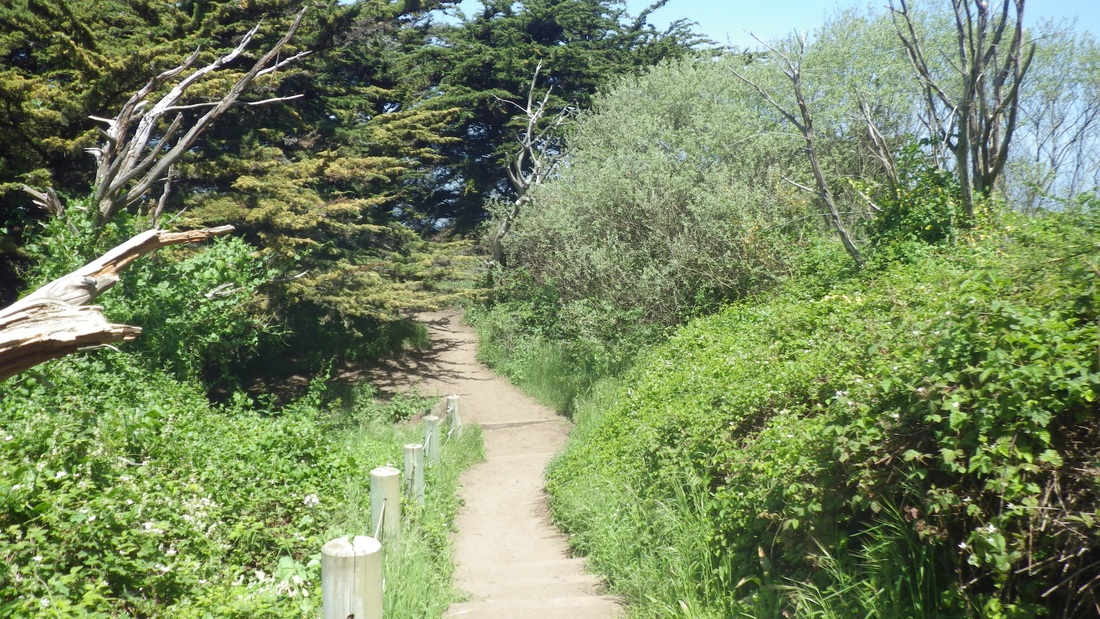
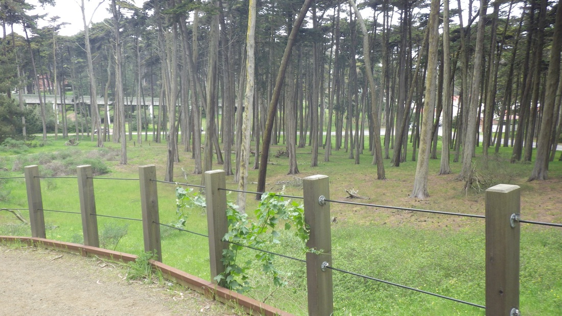
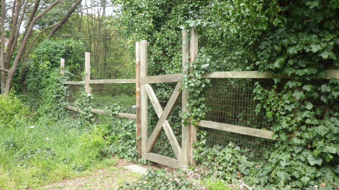
Easily found the "hidden" trailhead to what I call the "North Trail" or "Treelimb Trail," the latter appellation because to start, one has to climb over a few treelimbs that stretch across the trail (12th pic). I love this kinda thing and fervently hope they leave the trail this way. Moving north, blackberry bushes have been trimmed back, making the trail easier to traverse than before, this all the way to the school playing field's locked gate. But then, between the gate and the end of the fence, it was the same rough tangle as when last visited, where I'm obliged to crawl under a branch at one point or get attacked by brambles. 

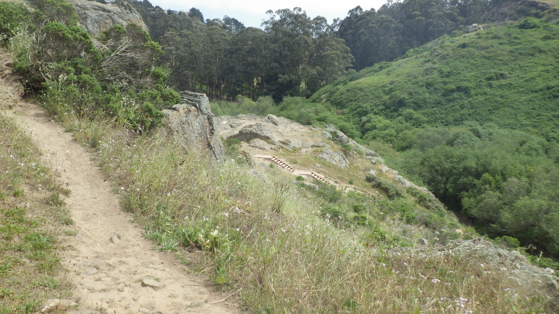
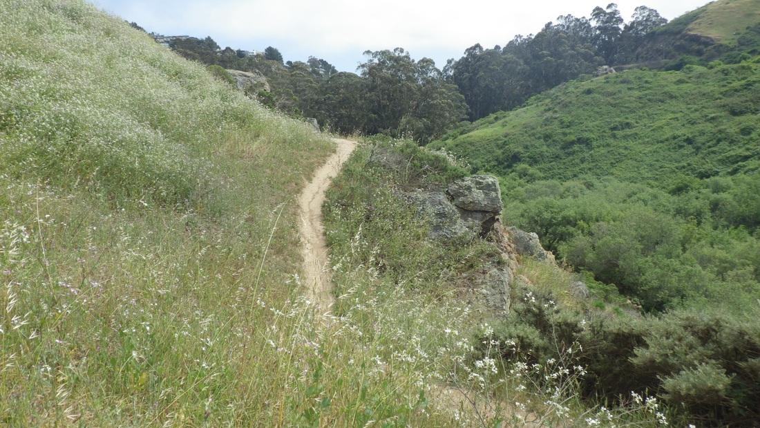
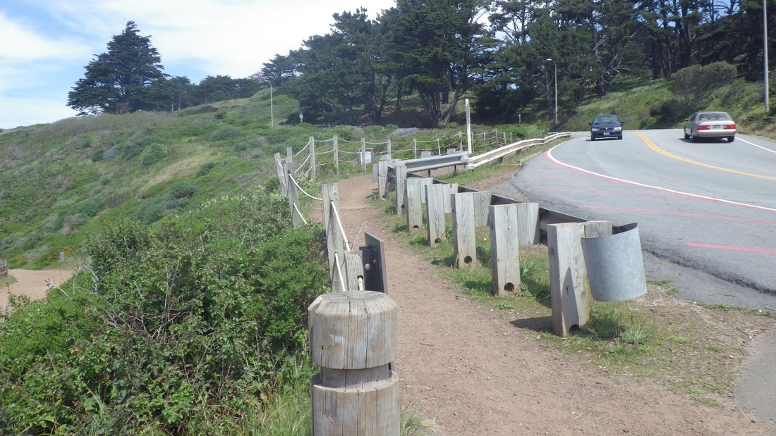
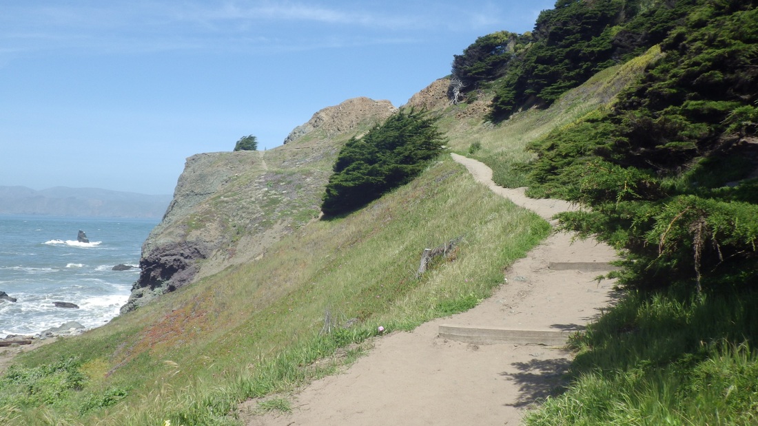
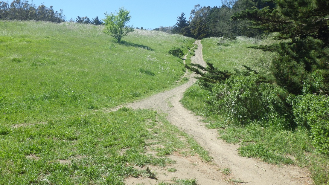
Back up again on a skinny high-trail above the two new stairways (pix 13, 14), picking my way around and down a roughish, rocky wild-radishy trail (pics 15, 16) next to a big round "mat" of green to a wider trail below, then back up the same trail I came down (last pic). 

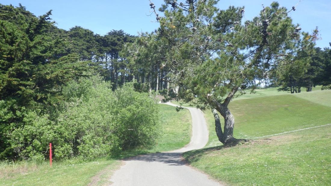
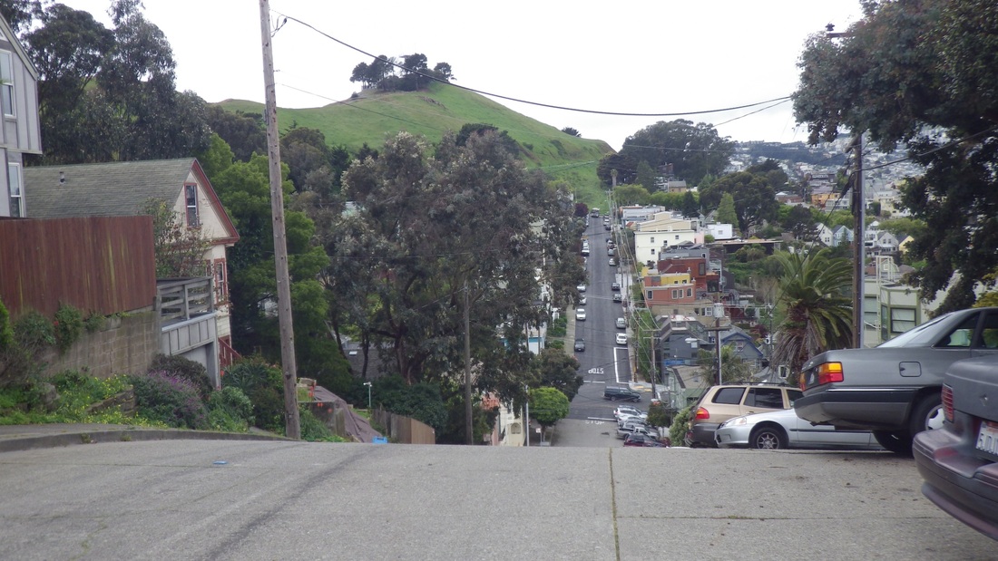
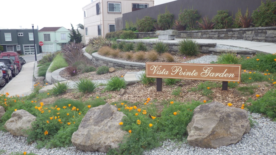
Turned left to take the short trail that's just below Christopher Park, coming out at Amber and Turquoise. From here turned right, uphill, to the top of Duncan, strolling appreciatively through the Police Academy's Little Red Hen Community Garden, out to Diamond Heights Blvd. and my starting point in front of the shopping center.

Picture
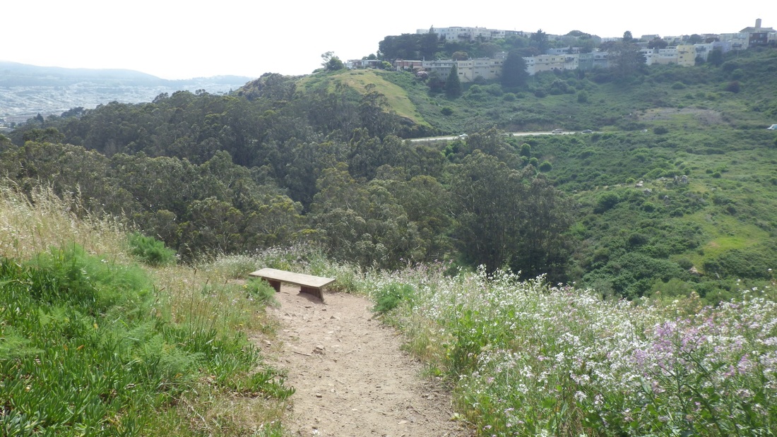
1. Viewbench down from west edge of Christopher Park
Picture
2. Long Canyon stairway/trail
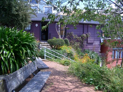
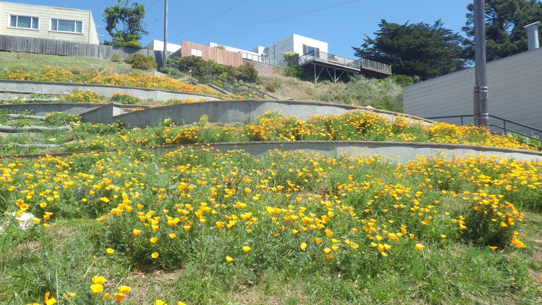
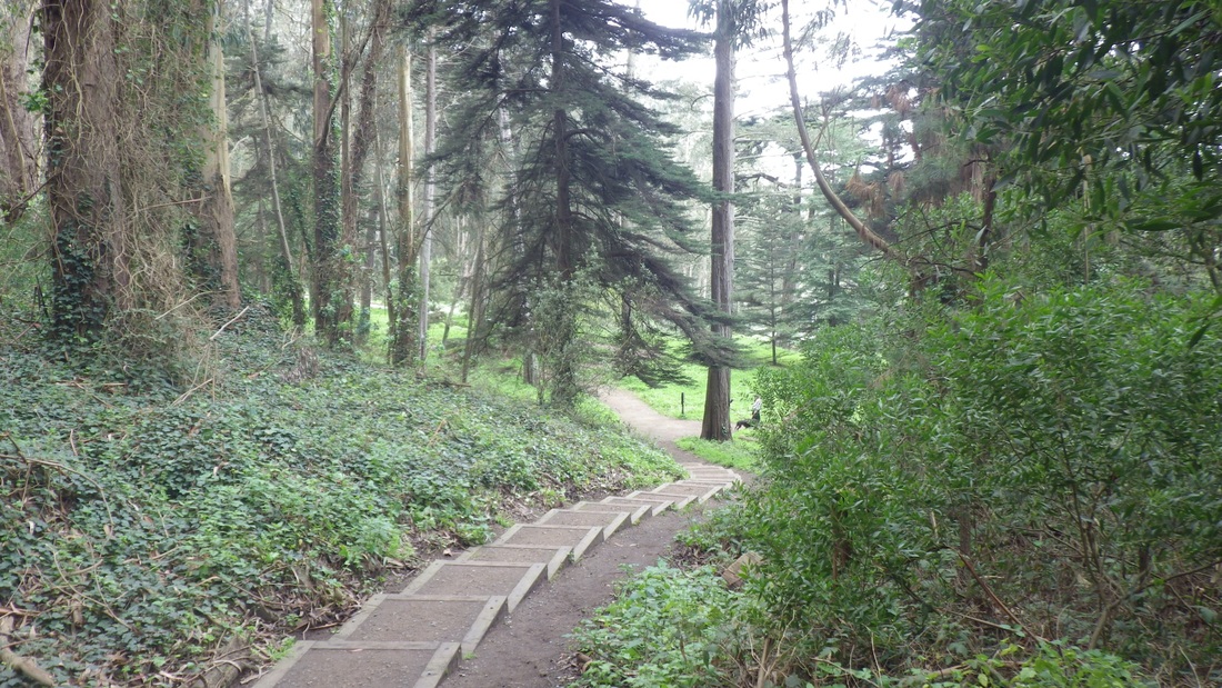
Picture
3. Continuing down
Picture
4. Midtrail
Picture
5. Extended stairway down
Picture
6. Trail extension up from Canyon depths
Picture
7. Stairways now on each side of these rocks
Picture
8. Top of new stairway
Picture
9. Foot of the new stairway
Picture
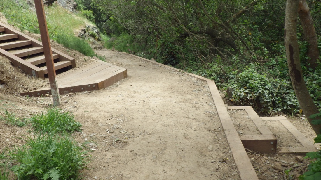
10. Foot of the new stairway
Picture
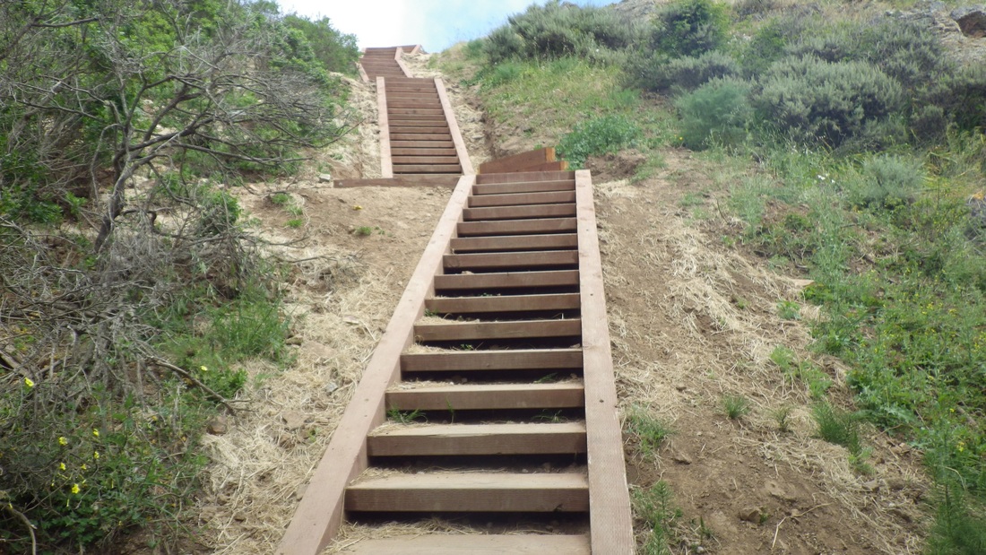
11. Up the new stairway
Picture
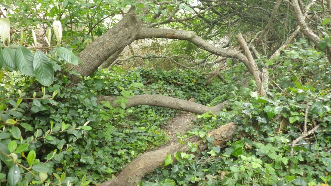
12. Treelimby north trail
Picture
13. Top of new stairway from a higher trail
Picture
14. Top of new stairway from a higher trail
Picture
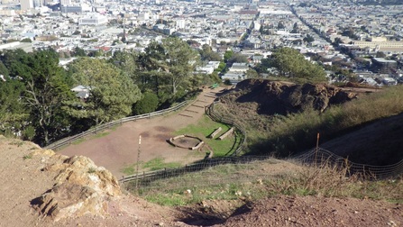
15. An upper Canyon trail on the east side
Picture
16. Rocky, steep and narrow
Picture
17. Back up to the west edge of Christopher Park
0 Comments

Happy Trails above Baker Beach

4/21/2013

0 Comments

 
Between the Presidio's Baker Beach and Lincoln Blvd. are lots of forested trails one can hike (first pic: starting off). Today was a warm, clear Beach Day with plenty of picnickers and nude/clothed people in/out of the water. 

Headed up from the picnic area where I could be alone beneath the trees and trek up 'n down the duney trails. Continuing to the east above Battery Chamberlin and over to the top of the first stairway (45 steps down to the beach, second pic) is but a short distance, then a short sand slog to the Sand Ladder's foot (258 steps counted today). 

After you've made it to the top of the Sand Ladder (pics 3, 4, 5, 6), just ahead, downhill a bit from the trail along Lincoln (7th pic) to the top of Battery Crosby, you've got the Batteries to Bluffs to look forward to for another good workout …473 steps counted today (pics 8, 9, 10, 11). Partway along the BTB is the offshoot downhill trail (48 or so steps, 12th pic) to Marshall's Beach. 

Out at the BTB's east trailhead (13th pic), it's an easy walk to the Golden Gate Overlook (37 steps for the main stairway, last pic).

Picture
1. Trails between Lincoln and Baker Beach
Picture
2. Down to Baker Beach, 45 steps
Picture
3. Up the Sand Ladder
Picture
4. Sand Ladder down to Baker Beach
Picture
5. Sand Ladder turns. Battery Crosby upper right.
Picture
6. Sand Ladder near the top
Picture
7. Hiking trail along Lincoln
Picture
8. Batteries to Bluffs swoops down from Battery Crosby
Picture
9. Batteries to Bluffs steep westside
Picture
10. Batteries to Bluffs Trail
Picture
11. Climbing up the east side on the Batteries to Bluffs Trail
Picture
12. Marshall's Beach Trail infosign: down from Batteries to Bluffs Trail
Picture
13. East trailhead for the Batteries to Bluffs. Westside steps center, distance.
Picture
14. Golden Gate Overlook. Across from Fort Scott.
0 Comments

Trail Aromatherapy

4/18/2013

0 Comments

 
About halfway along the main Lands End/Coastal Trail, a long flight of stairs (270 or so steps) descends to Mile Rock Beach (first pic). 

Around the 121st step (second pic), a sandy trail straight ahead will take you to the clifftop viewspot with the beach below (pics 3, 4, 5). If you continue all the way down the stairway (left turn: sixth pic), the secluded rocky beach offers large pieces of wood scattered about to sit on and watch the waves (pics 7, 8, 9, 10).   

You can also climb to the viewplace and the Labyrinth (a maze of rocks to walk) from another trail that's nearly to the foot of the stairs (pics 11, 12). 

Up at the Coastal Trail/Lands End Trail again, a paved trail here will take you up to one of the paved golf course walkways. There were no golfers anywhere near me and I followed this one (pic 13) out to the Legion of Honor parking lot's west end to descend the uppermost stairway (47 steps, 14th pic) to the El Camino del Mar Trail (pics 15, 16).

The whole Lands End area is a delight for the eyes and ears anyway, but especially right now with the scent of wildflowers and tall grasses. Especially on the El Camino del Mar Trail that will take you to the east end of the Upper Parking Lot Overlook. 


Picture
1. Mile Rock Beach stairway down from Coastal Trail/Lands End Trail
Picture
2. Straight ahead for the clifftop viewspot, left for the beach
Picture
3. View from the upper trail
Picture
4. Above Mile Rock Beach
Picture
5. View down from upper trail
Picture
6. Down to the Beach
Picture
7. Near the foot of the steps
Picture
8. Wildflowers and sand
Picture
9. Wood and Rocks
Picture
10. Foot of the Stairs
Picture
11. Up to the viewplace from a trail off the stairway
Picture
12. Trail to the Labyrinth
Picture
13. Lincoln Park Golf Course trail out to Legion of Honor parking lot
Picture
14. West end of Legion of Honor parking lot down to El Camino del Mar Trail
Picture
15. El Camino del Mar Trail footbridge
Picture
16. West end of El Camino del Mar Trail near Upper Parking Lot Overlook
0 Comments

Saturn Steps to Corona Park

4/18/2013

0 Comments

 
Another former 1906 earthquake refugee shack still being lived in was confirmed a few years ago, recently seen by me a couple days ago for the first time via a short Facebook video. 


This one's on Eureka Valley's Saturn stairway (a two-stairway minipark), but the first two houses up the steps have Ord St. addresses. This second one up has long been a favorite but I didn't suspect it was a former refugee cottage. "Then" pix from 2007 before it got a makeover: first two fotos. 

The greenery between the two minipark stairways has been trimmed since my last visit and it's now easier to see both stairways together. 

At the top of the stairway (118 steps) is the east dead-end of Saturn that will take you up to Roosevelt, or out to Temple/17th Street. To one side is an elevated sidewalk stairway: 41 steps (pics 3, 4, 5, 6). 

Out from this is Lower Terrace that curves around to Levant. At the end of Levant, 44 steps ascend to Roosevelt (seventh pic). 

From here it's a short distance to Corona Heights Park's west entrance where I saw another one of those colorful new park trailmap signs; and later another at the foot of the long eastside stairway. I guess all the parks are getting 'em. 

Ol' Rockytop has a couple of long stairways, a dog play area, viewrocks to climb around on, and the Randall Museum with various live critters (being cared for because they were found injured or otherwise unable to survive on their own in the wild). This is a great place to take little kids.  

The fenced ramp down to the playground, tennis courts, and community garden, and the States Street entrance below are both currently closed due to construction of a replacement restroom down here.

Today's staircount was 193 steps total for the steps starting up from the nature museum's east side to the summit rocks. Pix 8, 9, 10. 

Corona's westside stairway up from the Roosevelt side got extended several years ago. For the main one there are about 99 steps: 11th pic. 

Circling back down from the park and down Vulcan: 80 Vulcan (north stairway, through up to Levant from Ord), 12th pic. The north stairway is the one counted when doing a staircount (219 steps). One Vulcan (13th pic) starts up the south side from the 
landing that divides the two stairways. 

14th pic: Vulcan's foot at Ord. This stairway, one over from the Saturn steps minipark, is also a must-see. Note the pagoda up ahead between the north and south stairways, center. 

Vulcan is the only SF street to have the word "Stairway" after its name, as in Vulcan Stairway (not Place, Lane, etc.)

Down from Vulcan, onto Ord Court with 10 steps leading out to the north dead-end of Douglass. Another stairway here climbs from Douglass to States Street (States starts the Corona Heights 'hood), another way up to the park (last pic). 


Picture
1. THEN: Ord/Saturn steps 2007, former 1906 quake shack
Picture
2. THEN: Ord/Saturn steps, 2007, former 1906 refugee shack
Picture
3. Top of the main Saturn stairway/minipark
Picture
4. Saturn's sidewalk stairway
Picture
5. Saturn's sidewalk stairway
Picture
6. Saturn's sidewalk steps at Lower Terrace
Picture
7. End of Levant at States up to Roosevelt
Picture
8. Corona Heights Park: looking down from summit rocks
Picture
9. Fenced eastside stairway trail
Picture
10. Long eastside stairway starts up from east side of Randall Museum
Picture
11. Westside stairway up to summit rocks
Picture
12. 80 Vulcan Stairway down from Levant
Picture
13. One Vulcan Stairway up from Ord
Picture
14. Vulcan Stairway up from Ord
Picture
15. States to Douglass north dead-end steps
0 Comments

Rippling Sea of Green

4/17/2013

0 Comments

 
The #54 bus (I catch it across from the Balboa Park BART station as I do two other buses to points south from here) winds up through the Excelsior 'hood and stops at the Avalon/Athens stairway (99 steps). 

What a tail-waggin' delight to discover how the Athens Avalon Greenspace has been transformed: Tiers of golden poppies alongside the stairs. First pic is a "Then" pic from several years ago. Next four pics: April 2013. 

This hike was meant to check out this minipark's progress, a new McLaren Park entrance fountain, and then just random middle-ish trails until eventually meandering out to Mansell: no rush!

When able to tear myself away from the Greenspace, continued to the top of the stairway (at Valmar) and downhill a block to the foot of the Peru-to-Valmar stairway (pics 6, 7). 

At the top of this rustic delight (77 steps), continuing south a short distance took me to Burrows that runs E-W alongside the park. Here an area was fenced in with work ongoing so detoured east a few yards to the new flower fountain at the Gambier and Burrows entrance (eighth pic). Hadn't been to this part of the park in a while (ninth pic: row of low mosaic seats here). 

Behind me to the south beckoned sunny acres of forested and openspaced green rolling hills dotted with wildflowers, so off I went: sometimes minor trails not hiked in a while, other times hitting a main one.

Up-and-downed through exhilarating, wild, secluded forest trails and inviting openspaces (pics 10 through 14). As I paused atop one of the many unmarked dirt trails that wind through this breathtakingly gorgeous park, a refreshing breeze rippled the still-green tall grasses in a way that no mere photos could capture; ya had to be there… Do it!


Picture
1. THEN: Athens Avalon steps from several years ago
Picture
2. NOW: Athens Avalon Greenspace (4/2013)
Picture
3. Athens Avalon Greenspace
Picture
4. Athens Avalon Greenspace
Picture
5. Athens Avalon Greenspace. Mount Davidson in distance.
Picture
6. Peru up to Valmar steps
Picture
7. Peru to Valmar stairway
Picture
8. McLaren Park entrance at Burrows & Gambier
Picture
9. Entrance to McLaren Park at Burrows & Gambier
Picture
10. Bernal Heights from McLaren Park
Picture
11. McLaren Park
Picture
12. McLaren Park
Picture
13. Midtrail Uphill
Picture
14. Midpark Trailin'
0 Comments

BART to BTB

4/11/2013

0 Comments

 
I regularly hike both the Presidio's Batteries to Bluffs Trail and the Connector Trail between Immigrant Point Overlook and Lincoln Blvd. and like to vary the routes used to get there from various bus stops. 

The Bay Area Ridge Trail starts at the end of the golf course buildings (off Arguello Blvd.), continues past Andy Goldsworthy's Spire (first pic), and through the forest to the Cemetery Overlook's south entrance.


Down the 98 steps on the west side of the Cemetery Overlook (second through sixth pics) to the Park Trail (seventh pic), then under the Fort Scott overpass and to the backs of the residences for a walk through the Community Garden (pix 8, 9, 10).  From the garden onto a short trail that leads to Rob Hill Campground, noticed the tire swing on this trail was gone. Looks like the old rope broke as part of it's still hanging from the tree branch. 

Immigrant Point Overlook is at the north side of the campground (occupied today). The Connector Trail (208 steps, pics 11 and 12) descends to Lincoln Blvd. 

Crossed Lincoln to do the Batteries to Bluffs (Pics 13 and 14, 470-ish steps), its west trailhead a short distance downhill, accessed from atop Battery Crosby.


Picture
1. Andy Goldsworthy's "Spire" on Bay Area Ridge Trail
Picture
2. Top of steps at west end of Cemetery Overlook
Picture
3. Cemetery Overlook through the Forest to Park Trail
Picture
4. To Cemetery Overlook from Park Trail
Picture
5. Cemetery Overlook steps down to Park Trail
Picture
6. Cemetery Overlook stairway winds through the forest from Park Trail
Picture
7. Park Trail
Picture
8. Garden Gate, Fort Scott Community Garden
Picture
9. Part of Fort Scott Community Garden
Picture
10. Part of Fort Scott Community Garden
Picture
11. Top of Connector Trail. Immigrant Point Overlook to left.
Picture
12. Top of Connector Trail, Immigrant Point Overlook down to Lincoln
Picture
13. Down the west side on the Batteries to Bluffs Trail
Picture
14. Batteries to Bluffs Trail, east side
0 Comments

Beloved Bernal

4/6/2013

0 Comments

 
Visits to favorite streets and stairways in Bernal Heights gives me constant whiplash as I ogle cuuute smaller homes on both sides of this 'hood's narrow streets.

Over on the east side, the main Franconia stairway (extended 2004) is a well-cared-for must-see gardensite with about 103 steps down to Montcalm (first pic). 

After briefly admiring the view north from the bench at the Mullen-Peralta minipark (22 steps up the west side), it was up the 103 or so Peralta steps. This starts on Peralta just below Rutledge, crosses Rutledge and climbs to Samoset (pics 2, 3, 4, 5).

Here's one of the top of Esmeralda's southeast stairway, 105-ish steps (sixth pic).

Love Ripley's supersteep part (seventh pic), and the Harrison stairs minipark (Norwich up to Ripley, 60 steps, pics 8, 9). 

At the east edge of lushly green Bernal Heights Park, paused to check out the newly completed viewgarden at Bernal Heights Blvd. and Carver: Vista Pointe Garden, 10th pic.

Starting down the south side of the hill from the park: Rosenkranz stairway down to Mayflower (11th pic). The top of the older Chapman/Rosenkranz stairway that continues to Bernal Heights Blvd. is visible ahead (center, street sign, left of white truck).

Around 55 Prentiss steps (12th pic) descend from the edge of the park at Bernal Heights Blvd. to continue across the street with 27 more Prentiss sidewalk steps down from steep Chapman to Powhattan (13th pic).

On the SE side of the hill is the tall-grass-and-wildflowers Bradford stairway. Bernal's newest, completed in 2010 (78 for the main and 34 more sidewalk steps below that) zigs down to Tompkins from Jarboe (14th pic). This used to be a dirt path I'd take up from the Alemany Farmers Market.


South (800 block) end of Moultrie: A neighbor-created gardenspot at the mosaic wall here … and Guardian of a nearby house: pix 15 and 16.


More steps recently walked:

 
Peralta (near York) "hidden" gardenwalk up to Wright, about 19 neighbor-made steps and brick walk …


Shotwell stairs up from Bessie, 48 steps ...

 
Aztec steps down to Shotwell, 34 steps ...


Moultrie from Powhattan up to Bernal Heights Park, 20 or so …

Andover down from Bernal Heights Park to Powhattan (about 60 steps, last pic).

Bernal has the largest number of public stairways of all SF's neighborhoods; the above is but a partial list.

Picture
1. Main Franconia garden stairway down to Montcalm
Picture
2. Foot of the Peralta steps below Rutledge
Picture
3. Peralta steps up to Rutledge to continue across Rutledge
Picture
4. Peralta stairway above Rutledge up to Samoset
Picture
5. Peralta stairs descend from Samoset
Picture
6. Top of Esmeralda stairway, SE side
Picture
7. Top of Ripley, Bernal Heights Park beyond
Picture
8. Harrison Steps Minipark, Ripley down to Norwich
Picture
9. Harrison Steps Minipark, Ripley down to Norwich
Picture
10. Vista Pointe Garden, Bernal Heights Blvd.
Picture
11. Rosenkranz steps, Bernal Heights Blvd. to Mayflower
Picture
12. Prentiss stairs, down from Bernal Heights Blvd.
Picture
13. Prentiss sidewalk steps continue from Chapman down to Powhattan
Picture
14. Bradford zigzag steps (2010), Jarboe to Tompkins. Alemany Farmers Market in distance, center.
Picture
15. South end of Moultrie (800 block) with neighbor-made garden behind mosaic wall
Picture
16. Guardian of a home on Moultrie
Picture
17. Andover steps, Powhattan up to Bernal Heights Park
0 Comments

    Author

    I like meandering around on San Francisco's park trails and public stairways, sometimes taking photos, and enjoying nature and the outdoors.

    Archives

    March 2020
    February 2020
    January 2020
    December 2019
    November 2019
    October 2019
    September 2019
    August 2019
    July 2019
    June 2019
    May 2019
    April 2019
    March 2019
    February 2019
    January 2019
    December 2018
    November 2018
    October 2018
    September 2018
    August 2018
    July 2018
    June 2018
    May 2018
    April 2018
    March 2018
    February 2018
    January 2018
    December 2017
    November 2017
    October 2017
    September 2017
    August 2017
    July 2017
    June 2017
    May 2017
    April 2017
    March 2017
    February 2017
    January 2017
    December 2016
    November 2016
    October 2016
    September 2016
    August 2016
    June 2016
    May 2016
    April 2016
    March 2016
    February 2016
    January 2016
    December 2015
    November 2015
    October 2015
    September 2015
    August 2015
    July 2015
    June 2015
    May 2015
    April 2015
    March 2015
    February 2015
    January 2015
    December 2014
    November 2014
    October 2014
    September 2014
    August 2014
    July 2014
    June 2014
    May 2014
    April 2014
    March 2014
    February 2014
    January 2014
    December 2013
    November 2013
    October 2013
    September 2013
    August 2013
    July 2013
    June 2013
    May 2013
    April 2013
    March 2013
    February 2013
    January 2013
    December 2012
    November 2012
    October 2012
    September 2012
    August 2012
    July 2012
    June 2012
    May 2012
    April 2012
    March 2012
    February 2012
    January 2012
    December 2011
    November 2011
    October 2011
    September 2011
    August 2011
    July 2011
    June 2011
    May 2011


    RSS Feed

Powered by Create your own unique website with customizable templates.