Stairways are Heaven
  • Home
  • About Me
  • Stairways are Heaven

Mile Rock Beach

7/31/2012

0 Comments

 
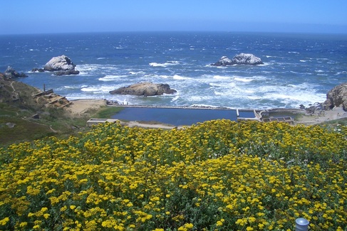
Access to Lands End's Mile Rock Beach is down a long stairway from the Coastal Trail: about 270 sand-covered wood steps. The secluded, rocky beach is also known as Lands End Point, according to one of those infomaps at the overlooks. 

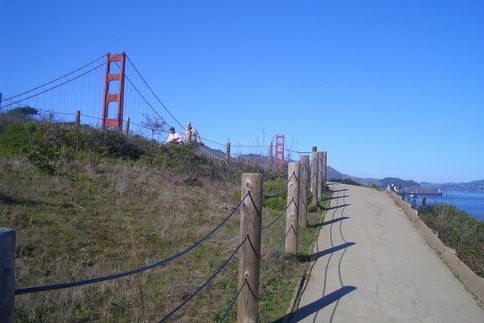
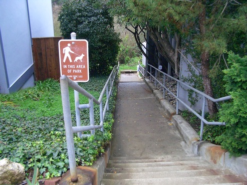
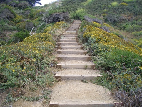
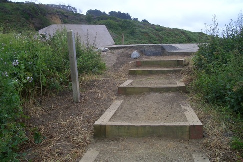
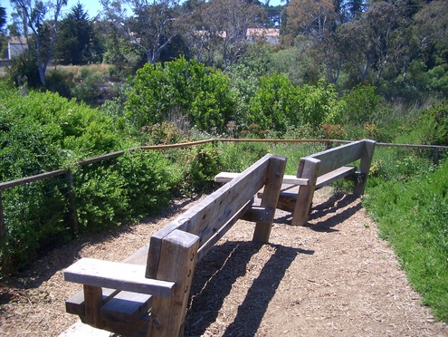
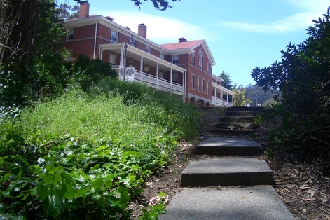
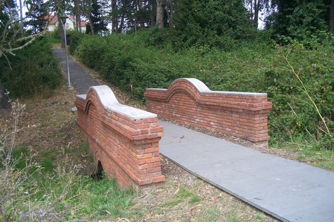
Upon entering the park at its southeast edge (across the street from the end-of-the-line #38 Geary bus stop), ascended 42 steps to a small overlook where there are a couple of benches. Across the street are signs for El Camino del Mar and Seal Rock. This vehicle street ends at the upper parking lot overlook.

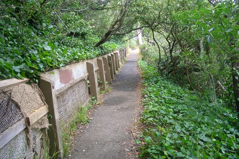
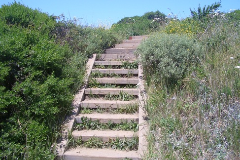
Along the walkers' trail are two more west-facing wood stairways up to the USS SF Memorial area and more overlook benches. 

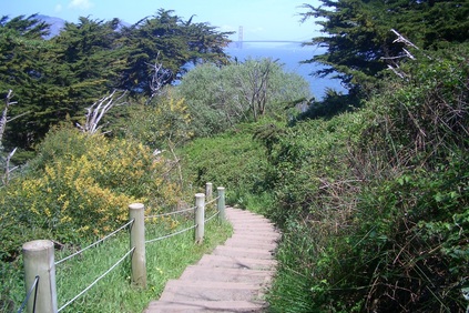
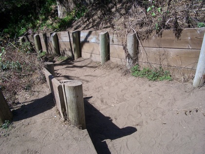
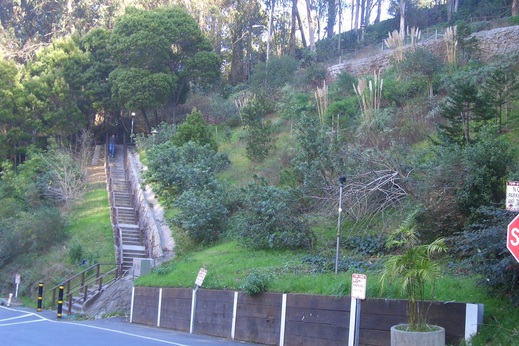
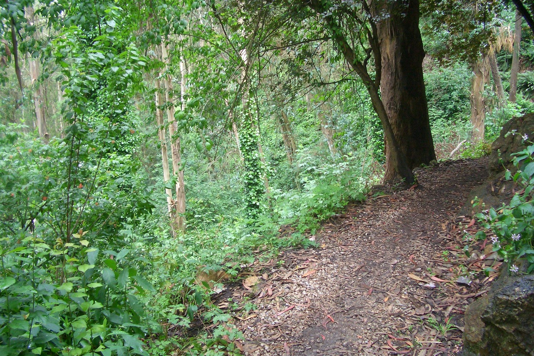
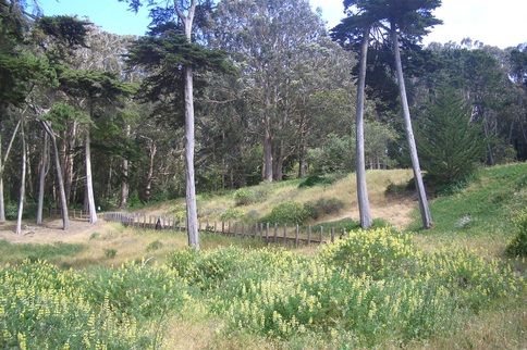
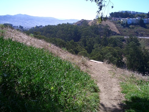
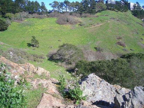
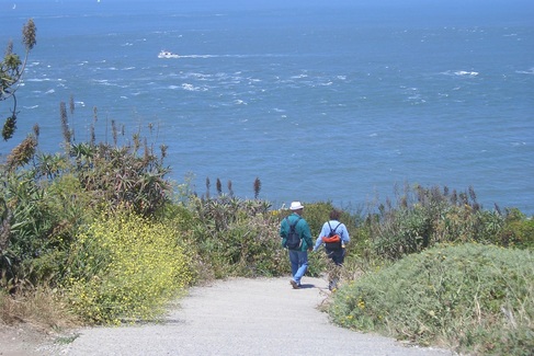
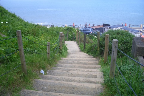
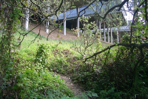
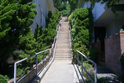
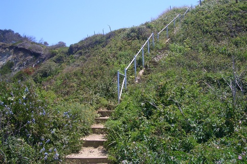
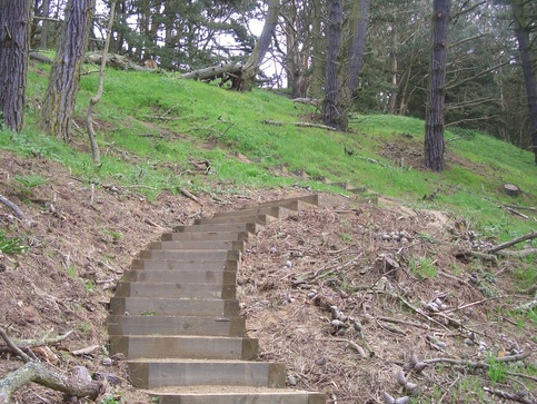
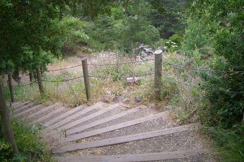
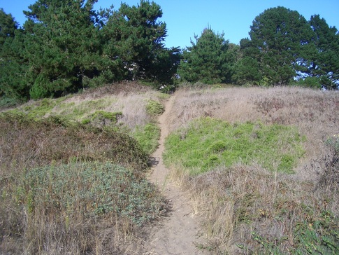
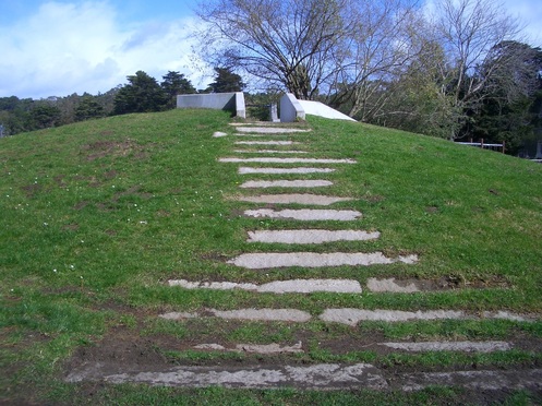
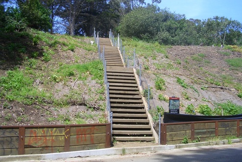
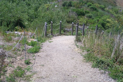
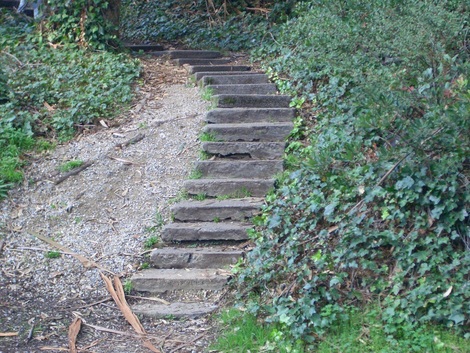
Headed "'round the horn" on the Coastal Trail between the upper and lower overlooks, continuing until I got about halfway along, where a stairway descends to Mile Rock Beach (first pic).

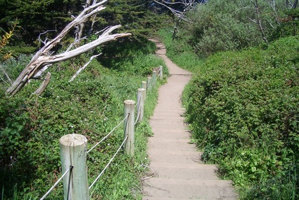
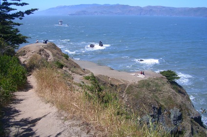
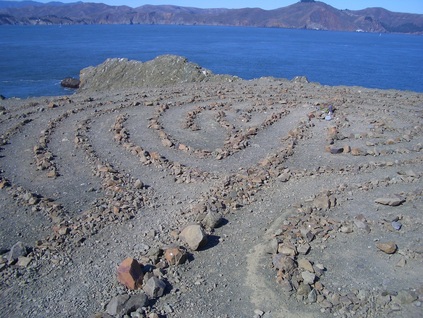
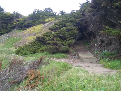
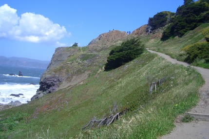
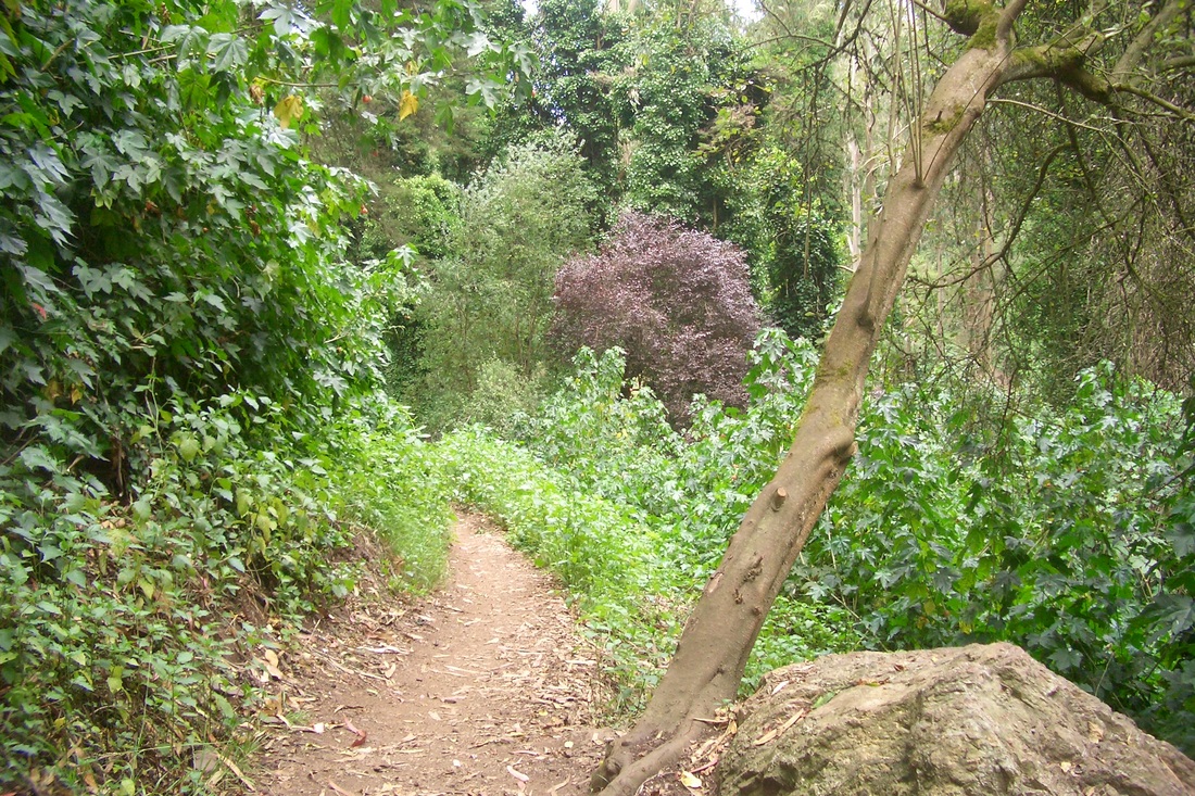
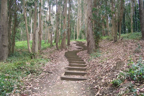
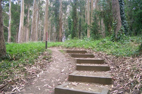
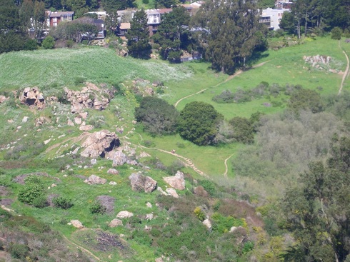
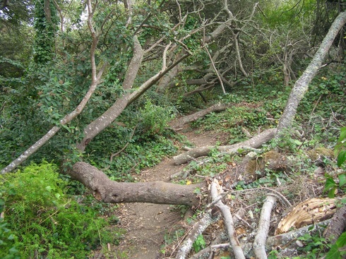
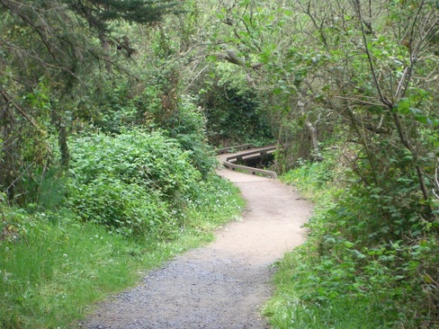
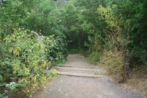
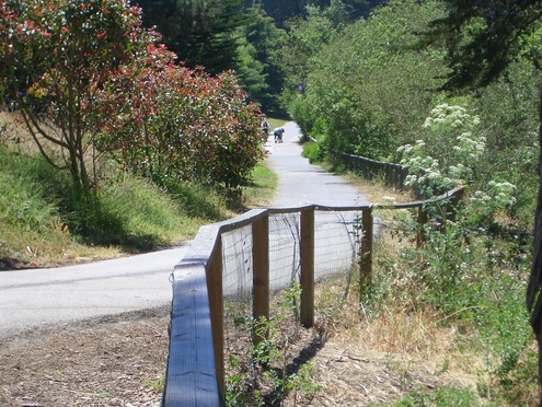
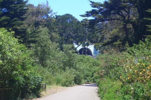
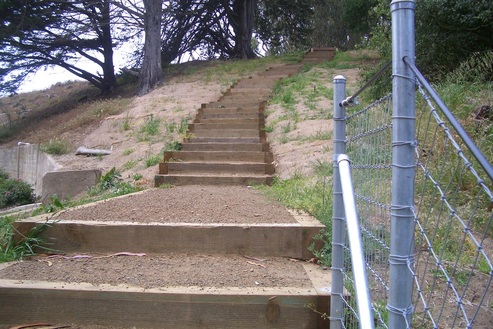
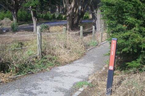
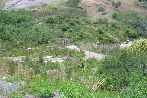
At the 121st step down, there's a sandy trail straight ahead (second pic). This is short and narrow, along the top of a steep cliffedge (third pic). Assuming the "Labyrinth" (fourth pic) is still here but couldn't see it from the upper east side trail where I was.

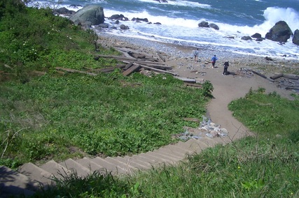
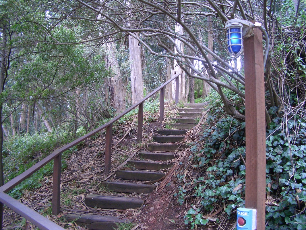
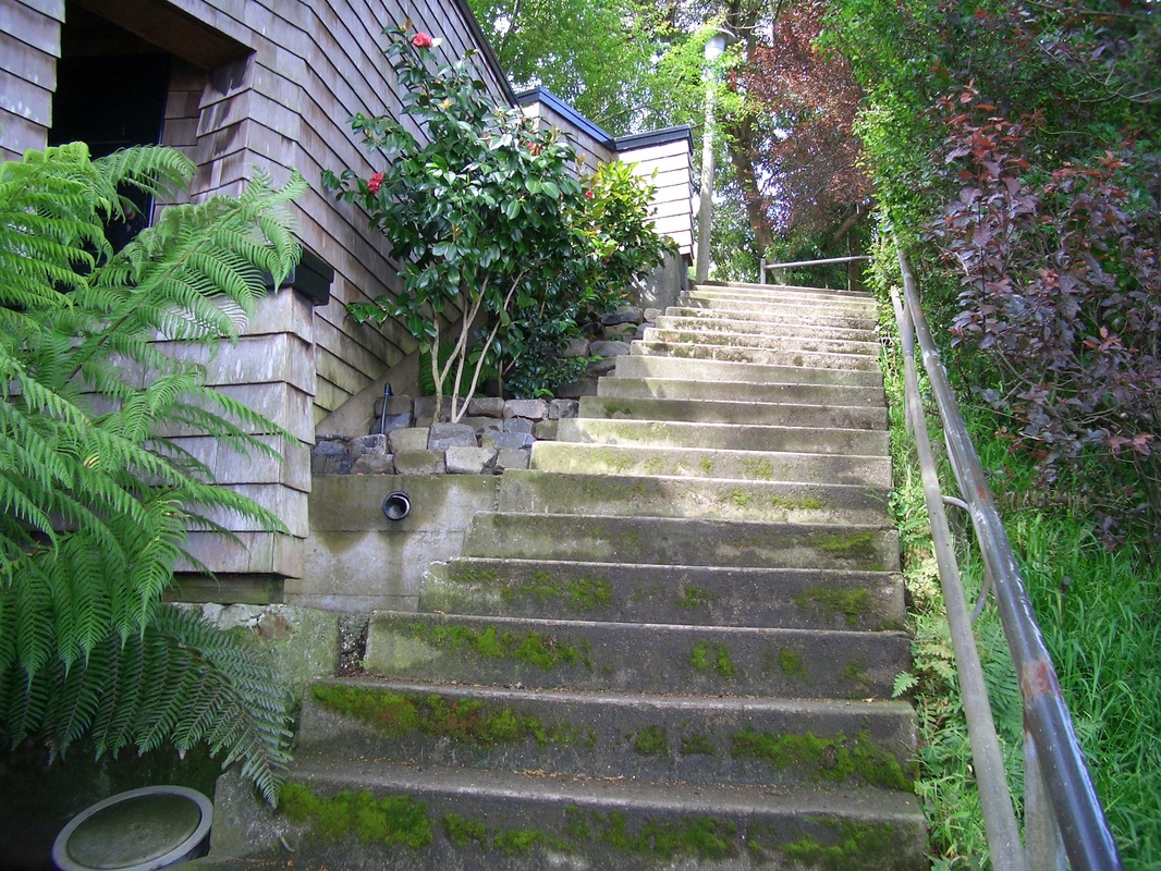
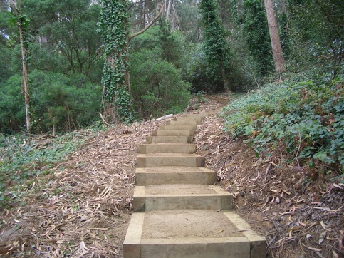
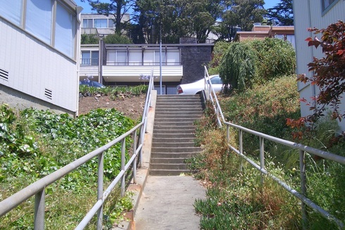
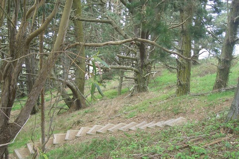
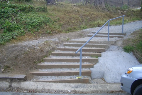
Turned back to descend the rest of the main Mile Rock stairway (fifth photo). At the 237th step, another trail steeply climbs to the part of the clifftop where lives the Labyrinth (next two pix). 

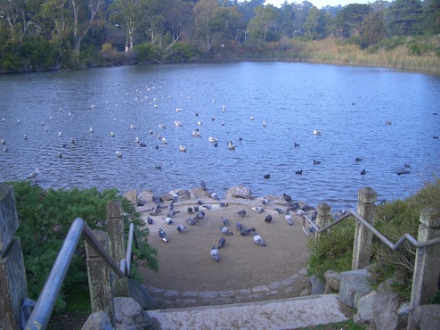
Continued down to the beach where large pieces of wood are scattered around, like from old shipwrecks. Someone recently tried to start a few fires down here: piled up rocks, ashes, and little pieces of charred wood.

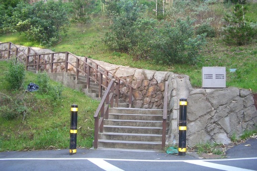
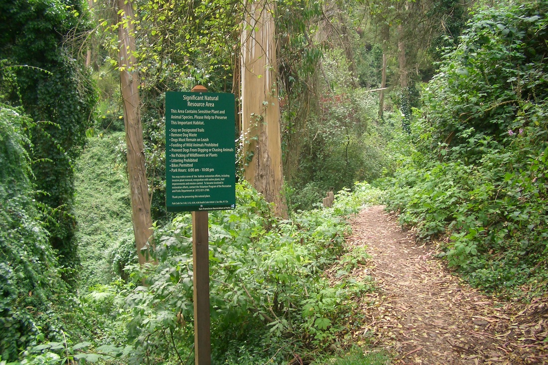
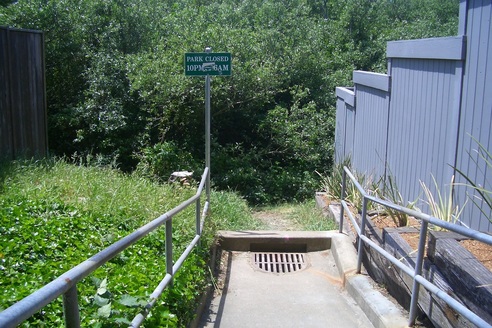
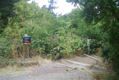
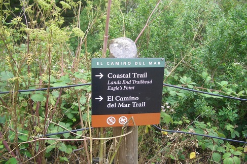
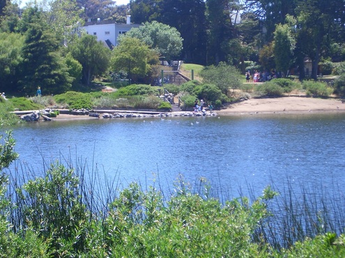
Back up the main stairway to the Coastal Trail where a nearby connector stairway (89 steps) will take you from the Coastal Trail to the El Camino del Mar Trail. From the El Camino del Mar, you can continue to the east over a shady wood footbridge and up the highest stairway that will take you to the west end of the Legion of Honor Museum's parking lot. 

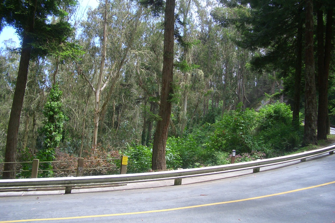
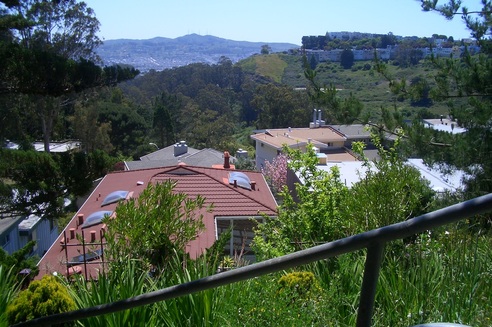
Continued back the way I'd just come from, but now on the El Camino and out to the upper parking lot overlook.
 
Picture
Picture
Picture
Picture
Picture
Picture
Picture
Picture
0 Comments

Two Long Stairways up Mount Sutro

7/30/2012

0 Comments

 
Was going to start a Mount Sutro Openspace Reserve hike at the Farnsworth stairway (149 steps), but the bus driver ignored my requested stop at Willard (Farnsworth's foot is at Willard), and the next stop was Hillway. 

So instead went around behind the UCSF hospital buildings to access another long stairway that climbs from the foot of Medical Center Way. This has around 136 steps (first two pics) and ascends to a parking lot. Before the top there's an offshoot short stairway that will take you to a trail behind the houses on Edgewood (third pic). 

From the top of the main stairway, continue to the west across the parking lot. To the left is another stairway that runs through along the side of one of the medical buildings (46 steps), at the top of which you'll see a shuttle stop up ahead on a higher part of winding Medical Center Way.

There's a walkers' trail on one side of the road (fourth pic), on which I passed the downhill trailmarkers for the Edgewood and Fairy Gates trails. There's been a new bulletin board addition in this area since my last visit with info about the park. Moving along, started up the East Ridge Trail, which trailhead is directly across from the Aldea Center building.

Up to the summit native plant garden (Rotary Meadow) on the East Ridge, where near the benches is another new informative bulletin board. 

Starting down from the summit on the west side, turned so was soon walking above the Quarry Road Trail and nursery area, now on Behr with residences on both sides. 

Down to Johnstone, returned on Medical Center Way to the Fairy Gates trailhead. Turned onto the Edgewood Trail since I hadn't enjoyed this one for a while, often instead choosing the (lower) Historic Trail out to Stanyan (at 17th).

The Edgewood Trail (next three pix) comes out at the south vehicle dead-end of redbricked Edgewood, the street. A couple of blocks north will take you to the top of the Farnsworth stairway (last pic), so just descended to Willard today instead of starting up from it. 

Picture
Picture
Picture
Picture
Picture
Picture
Picture
Picture
Farnsworth stairway
0 Comments

Presidio Promenade to Arguello Gate

7/28/2012

0 Comments


This hike, starting from the bridge bus stop, was to check out an area not visited in a while because of construction detours. Stopped to admire the Olds and News in the park, like the old stable buildings with the new bridge approach above and new tunnel in the distance (first two pics). 

From the Battery East Trail, a short trail between two vehicle streets will take you out to the Presidio Promenade (third foto). The trail (fourth pic) is mostly covered with small rocks and has to be rough on bicycle wheels. So most of them ride above or below. I call this the "Wild Rose Trail." 

From here to the Crissy Field Overlook. Not in the mood for downhill, crossed the wooden footbridge near the stables. Wanted to head uphill on the Park Trail (fifth pic) but looking for a shortcut this time instead of the longer wind-around.  Walked next to the stables (awwww: the horses!) and up to the next street layer. Continued, including offtrail a bit, but easy to see where I was going and a short distance to the part of the Park Trail I was heading for.

Up the 98 curvy wood Cemetery Overlook steps (last three pics) from the Park Trail, then out the Overlook area's south end (residences on one side). Soon you'll see a trail marker for the Bay Area Ridge Trail. Cross the street and go up. The road will be below you and the east edge of the golf course to the right (but hidden by trees) as the trail winds past the Spire sculpture. This delightful trail emerges at the golf course buildings and restaurant near the Arguello Gate. 

Picture
Old and New
Picture
New tunnel upper right
Picture
Presidio Promenade
Picture
Rocky trail between two streets
Picture
Park Trail
Picture
Park Trail to Cemetery Overlook
Picture
Park Trail to Cemetery Overlook
Picture
Top of stairway to Cemetery Overlook
0 Comments

Favorite Canyon Trails

7/25/2012

1 Comment

 
Needed to run an errand at the Diamond Heights Safeway and because my backpack was rather heavy, chose to wait for the #52 that stops across the street from the shopping center. Waited a longish time; if I'd continued walking up from BART would've beat the bus. But I love the #52, one of those hybrid electrics. This includes three neighborhood favorites, the #36 Teresita, #52 Excelsior, and #37 Corbett/Twin Peaks. These buses easily careen around the tight curves of narrow streets, the #52 zooming me to and from the Glen Park BART station without the jerking, long traffic lights, and frequent stops experienced on other lines.  

After the Safeway headed to the west end of Christopher Park. There's a short trail down to a bench where the longest of the Canyon trails starts its descent to the right (first pic), with an awesome vista of Mount Davidson across the Canyon (second pic). This one's my favorite upper trail: steepish, wood steps (about 86) and dirt trail, with a few turns (third pic). It continues to the Canyon floor (fourth pic: last steps down) to emerge just past the footbridge. Pics 5 and 6 are of some Canyon trails from O'Shaughnessy. 

Was sitting on a rock at the side of the main trail down here when I met a very nice couple with the seventh (most recent) edition of Adah Bakalinsky's "Stairway Walks in San Francisco" book. 

Continued on to "my" secluded northernmost trail for some juicy fat ones, my reward for climbing over tree limbs and getting pricked by brambles.  

After climbing out of the Canyon onto the walk that ascends to Turquoise (seventh pic), turned left to Quartz ... to Amber ... to Amethyst ... to Red Rock (last pic: a house I like on Red Rock). Then to Cameo (a few yards from the top of the Coralino stairway), Duncan, and the end of Diamond Heights Blvd. where it meets Clipper and Portola 300, with a stop for the #52 Excelsior. Across the street begins the Twin Peaks neighborhood. Right around here is this tall brown wood sculpture (on the Diamond Heights side) that's been here many years and I still have no idea of its history.  


Picture
Christopher Park into the Canyon
Picture
Mount Davidson across the Canyon
Picture
Starting down the East Side from Christopher Park
Picture
Picture
A View from O'Shaughnessy
Picture
A View from O'Shaughnessy
Picture
Up to Turquoise from the Canyon
Picture
Red Rock, Diamond Heights
1 Comment

Art at Fort Point

7/24/2012

0 Comments

 
Since I hadn't visited Fort Point in a while decided to do something different and check out For-Site's International Orange exhibitions (free admission).

See 
http://www.international-orange.org 


Quoting: "Celebrating the 75th anniversary of the Golden Gate Bridge, International Orange — named for the unique paint color of the span — offers fresh perspectives on an enduring landmark. This exhibition at Fort Point presents new work by contemporary artists responding to the bridge as icon, historic structure, and conceptual inspiration." 


Off at the bridge bus stop, started off on the Battery East Trail (down a short but steep slope: first pic), under the low-overhead walkers' tunnel (second pic), along the main Battery East Trail with its glorious views (pics 3 and 4), and down the curving wooden view-steps (153: next two pics). Then west on the vehicle street to get to Fort Point (seventh pic). Ugh. Too many cars. It was farther than it looked.

Since I hadn't been here in so long, forgot what was inside the rooms last time (pic 8: Fort Point was constructed between 1853 and 1861), so not positive if some of these new ones were actually ones I'd come across before back then. Remembered some period furniture and cannons. Most definitely I could've used a live tour here. From a small online pic, was expecting to see a bunch of B&W bridge photographs displayed amidst some orange draping.

Finally asked someone where the photography was. Since I only asked about the photography, however, I missed out on most of the rest of it. On the third tier are seven exhibits; on the second tier, eight; and two on the first floor. I still didn't see many old photos though.

Didn't even see the "International Orange" infobrochure until I'd walked around a bit. Inside is a map of the numbered exhibits on each of the three floors. I just could have used some big-lettered noticeable signage, like "This way to Exhibit…" and easy-to-notice brochures to take when I first got there so I could've looked inside it right away.  

So there are 17 artists in all exhibiting, with names, titles, and brief descriptions of each of their works in this brochure. Because I didn't study it ahead of time, only noticed or gave more than a passing glance to a few of these as I wandered around on each floor. 

Assumed the Fort Point Buntings exhibition, seen immediately upon entering, was put there as regular decorations for the bridge's 75th anniversary. Didn't realize until later that this is one of the installations (#2 in the brochure: "Fort Point Bunting.") There are 75 of them on the inner balconies. 

Of what I did see, I liked the little mag called "Average-The Golden Gate Edition" best. The author is offering a free edition of her magazine in which she interviews several people, including a Fort Point surfer and a ranger, who represent "daily life at and around the bridge."

Passed the "The International Orange Commemorative Store (A Proposition)" exhibit and assumed it was an actual little shop selling real bridge souvenirs but just not open at the time. None of the orange items in the tiny place are for sale. You can take a free postcard, however: "a reminder that there are many experiences money can't buy," so states the brochure. 

An exhibit on the ground floor is called "Sea Vision T.V." After a few minutes got too hyper sitting inside watching videos on such a nice day, but this media presentation apparently documents all the installations. Should've stayed to watch it all.

The International Orange artworks will be displayed until October 28. 

What was actually most interesting to me was to walk around in the old fort again after several years: on each of the floors, up and down its steep inner stairways, and around on the windy rooftop area to get different perspectives from my usual blufftop wanderings. 

Back to the stairway, the Battery East Trail, and up to the bridge area again, was pleased to see the wild roses on the trail are doing well. 


Picture
Down to the Battery East Trail
Picture
Low-Overhead Walkers' Tunnel
Picture
Battery East Trail
Picture
Battery East Trail
Picture
Picture
Stairway down to Crissy Field
Picture
Fort Point in distance to left
Picture
Fort Point Doorways
0 Comments

Canyon Depths

7/17/2012

1 Comment

 
Starting today's hike from the Canyon's lower, south, end at the Glen Park Rec. Center, to access the northernmost trail, crossed where the old tire is (first pic) and turned right to start making my way slowly so as not to get snagged by brambles. Upon reaching the first gate was surprised to see it propped open, but no one was around. This leads to a school playing field. There's then a rougher part of the trail between this gate and the gate at the end of the playing field. It's not very far, but rough going, more so now than last time. Pushed my way nearly to the dead-end, then back through the tangle, under and over tree limbs (second pic). 

More berries found here than elsewhere in the park. Ate some juicy ones out of hand and continued up the trail that's just below the stilthouses on Turquoise (third pic), so as to climb out of the Canyon via a short stairway to Turquoise: next two pix. This time instead of continuing up the 65 or so more steps to Amber, stayed on Turquoise all the way (maybe two blocks) to where the Coralino stairway starts up at Amber and Turquoise (this can all be seen on Google Maps). 

Could've turned right where there's a trail just below Christopher Park (sixth pic), and one can easily enter the park and Diamond Heights Shopping Center, but chose the Coralino steps (about 132) to see how the Police Academy Community Garden was doing these days. So turned left to the foot of Coralino (seventh pic).  

Coralino turns to the left partway with its top at Cameo near Duncan (eighth pic: view from near the top). Another right to the street sign for Amber and Duncan near Diamond Heights Blvd. took me to the Police Academy garden called "The Little Red Hen," open to walk through. Hadn't seen it since it was first starting (a little more than a year ago) and it's now got some of the most healthy veggies and flowers I've seen yet, including a bed of fat ripe strawberries.  

It's behind the very noticeable St. Nicholas Orthodox Church, with the Diamond Heights Shopping Center nearby. Usually climb up from the Canyon on its trail-with-steps (about 86) to Christopher Park near the shopping center, or else come up the hill from the south side through or past Walter Haas Park. 

A short but curvaceous route from Diamond Heights Blvd. (at Gold Mine) on the #52 Excelsior (since I only had a four-minute wait after I left the Safeway) down through Glen Park. Some streets on the way down: Diamond, Berkeley, Hiliritas, Conrad, Arbor, Sussex, Surrey, down to Chenery and the nearby Glen Park BART Station, my starting point today. 


Picture
Canyon trail
Picture
Picture
Houselegs on Turquoise
Picture
Canyon trailhead
Picture
Turquoise into the Canyon
Picture
Canyontop trail just below Christopher Park
Picture
Coralino's foot
Picture
View from near top of Coralino. Mt. Davidson to right
1 Comment

More of a Trek Today

7/13/2012

0 Comments

 
Off the #28 "bridge bus," instead of heading directly to the under-bridge Coastal Trail, wanted to get to the Batteries to Bluffs Trail as soon as possible today. So it was faster to pass through the walkers' tunnel and turn right at the corner where the sheltered bus stop is. There's a crosswalk just ahead. On the opposite side of the street is a very short trail between two busy vehicle streets. This comes out across from the main stairway up to the Golden Gate Overlook. You still have to use a crosswalk to get to either Fort Scott or the Overlook, but this way is much nicer than having to walk alongside a vehicle street, sidewalk or not. 

A new trail runs all around the south edge of the Golden Gate Overlook (across from Fort Scott) to the Pacific Overlook, with the Batteries to Bluffs east trailhead just before you reach the Pacific Overlook on Lincoln. No more walking along the street here either, but on a pleasant trail. An excellent way to access the Batteries to Bluffs or either overlook from the bridge area. 

At the BTB's View Point (first pic), its saggy fence has been fixed, a new no-hikers-here icon sign is just offtrail, and on a rock at my feet here was a plaque: "Thanks to Leslie and Andy Schilling and their families for their generous support of trails at the Golden Gate. 2011."

At about the 200th step (the BTB has around 474 steps total), where a short, regular trail winds, discovered some ripe berries. Pleased that there weren't many people on the trails today. It was quite cool, overcast, foggy (refreshing to me), and those who weren't doing strenuous exercise were probably freezin' their buns off. Gorgeous wildflowers along this trail these days (second pic).

Up to the BTB's west trailhead (pics 3, 4), Battery Crosby (and down its 16 steps: fifth pic), noticed that this old battery is getting a facelift.


To the top of the 208-step Connector Trail (last three pics) and downhill on Battery Caulfield, noted heavy machinery and stacks of huge logs: the Presidio Forest between the dunes area and Lobos Creek Overlook is also in the process of renovation.

Picture
View Point on the Batteries to Bluffs Trail
Picture
Batteries to Bluffs Trail
Picture
Batteries to Bluffs Trail steep west side
Picture
Batteries to Bluffs West Trailhead at Battery Crosby
Picture
Down from Battery Crosby
Picture
Connector Trail to Immigrant Point Overlook
Picture
Connector Trail, Lincoln to Immigrant Point Overlook
Picture
Connector Trail to Immigrant Point Overlook
0 Comments

First Coyote Sighting

7/12/2012

1 Comment

 
From the lower Lands End Overlook (first pic), up the usual 41 and 22 steps ascended the last time I hiked this park, the latter steps to the short trail above the Fort Miley ruins. 

For the first time saw someone else here: an older dude who appeared seriously drunk, wobbling about under a tree not far away. Homeless? Or maybe a resident of the nearby VA Hospital? 

Slid in the sand to the El Camino del Mar Trail, then, scanning the sides for berries, about halfway down the stairway that connects the upper El Camino del Mar with the main Coastal Trail (Lands End Trail). Back up again and onto the footbridge (second pic), then up the higher stairway (about 48 steps) that comes out at the west side of the parking lot for the Legion of Honor Museum, above the golf course (next four pics). There's a yellow auto barrier between the west end of the parking lot and the top of this stairway. 

Started walking east through the parking lot where a few yards ahead saw a coyote emerge from the golf course area, out between a couple of parked cars. In profile for an instant, he (or she-I wasn't that close!) paused to look around then quickly disappeared between two more cars and up the forested south slope where there's an openspace and trail behind the Legion of Honor (seventh pic). This was just before the trailhead (10 steps: eighth pic) for the Battle of the Bulge Trail that ascends to the VA Hospital parking lot. Unfortunately I've got the reflexes of a banana slug so didn't get a pic, but for sure this very skinny little guy was no off-leash ordinary pooch momentarily separated from his human. 

Walked very slowly, camera in hand, gazing up the slope, stopping at times, but noted no further sign of life. He probably felt like I sometimes do: "Far too many humans around here." I'm a midday hiker, not early a.m. or dusk, which is no doubt why I see few wild things other than birds, bees, butterflies and other flying daytime critters. 

Continuing past the Legion of Honor, now on a sidewalk, past a few painters standing at easels, a "Coyote Alert" sign, and a couple of rangers on horseback heading the opposite way. 

Got home to find a Presidio E-News containing info about the ongoing Mountain Lake animal relocation. Quoting the first part. For more, see:

http://www.presidio.gov/about/Pages/mountain-lake-remediation.aspx


"The decade-long effort to enhance one of the last natural lakes in the city is taking a big step forward. Later this month work begins to shore up the lake so that it can be cleaned and deepened beginning in fall 2012 … As a first step, non-native red-eared slider turtles … one-time household pets abandoned in the lake by their former owners, are being adopted by Sonoma County vineyards. Twenty-eight turtles and several species of fish have already been saved and relocated, allowing for the possible introduction of native species in the future. Next year, through a grant from the San Francisco International Airport, work will begin to enhance the East Arm of Mountain Lake."

Picture
Sutro Baths Ruins below
Picture
El Camino del Mar Trail footbridge
Picture
Steps from El Camino del Mar to Legion of Honor Parking Lot
Picture
Top of the higher stairway to parking lot
Picture
Top of higher stairway to parking lot
Picture
Trail sign at top of higher stairway
Picture
Trail behind the Legion of Honor
Picture
Lower trailhead for Battle of the Bulge Trail
1 Comment

Boats on Mountain Lake

7/11/2012

1 Comment

 
Entered the Presidio's Mountain Lake Park (first three pix) from the end of 10th Ave. today and noticed a small boat in the lake, which is not a recreational boating lake. A number of people were working here and I picked up an infosheet (Native Wildlife at Mountain Lake) and comprehensive brochure-with-map (The Future of Mountain Lake). 

A quote from the single sheet: "San Francisco Lakes were once home to a large diversity of insects, amphibians, and aquatic reptiles. These animals are not present in Mountain Lake today due to poor lake health and the prevalence of non-native species (red-eared slider turtles and six varieties of non-native fish). By restoring the lake and relocating the non-native animals to a special refuge, we hope to create an environment that will allow the native species to return and thrive."

For more info about the turtle and fish relocation, contact Jon Young at jyoung@presidiotrust.gov 


More about the lake:
http://www.presidio.gov/explore/Pages/mountain-lake.aspx

Hopefully they'll leave the blackberry plants alone as this is one of the best trails in the park to gather 'em. As I was approaching the walkers' underpass on the Mountain Lake Trail (next two pics), saw two women and a little girl with a plastic bag also collecting ripe ones. 

Took my time on a couple of offshoot trails. One took me to the foundation of a tiny building. Further exploration to the east, however, would've had me pushing through the bushes to emerge at the edge of the golf course, which of course I had no desire to do. The benches on the lake's east side (sixth pic) weren't occupied for a change. 

So all around the lake to emerge on the east side, passing the newer stairway that leads to the dunes overlook (last two pix: 104 steps if you count the wood-stepped boardwalk as well), still part of the Mountain Lake Trail, now with the lake directly across Park Presidio Blvd.

Just found out the date of the Bernal Heights Hillwide Garage Sales day: August 11. Definitely going to this one. 

Was wondering what was going on regarding the huge renovation at Pacific Heights' Lafayette Park. Looked like an overlook being constructed up there as I passed by on the bus. Go here for info: http://www.friendsoflafayettepark.com/park-renovation-project.html

Picture
Mountain Lake
Picture
Mountain Lake
Picture
Up to the Playground Slide
Picture
Mountain Lake Trail
Picture
Mountain Lake Trail. In view is the MacArthur Tunnel
Picture
Benches on the lake's east side
Picture
Mountain Lake Trail, up to the boardwalk
Picture
Up to the Dunes Boardwalk
1 Comment

SE Presidio Wanderings

7/6/2012

1 Comment


Trailin' in from Presidio Blvd. at Lovers Lane (first pic) and south of the Mountain Lake Trail, soon down 30 steps for the old stairway to El Polin Spring (next three pix). Amazing how this area has transformed from bare and newly planted to gorgeously green in such a short time. Birds and butterflies but no other humans down here when I was. Up 69 steepish wood steps on El Polin's west side (fifth pic) for this newer Presidio stairway to the Ecology Trail. 

Took a lower trail I assumed would merge with the main Ecology Trail, but it ended at a large, cleared-out, flattish area covered with netting and wood chips. At regular intervals were pipes enclosed in a kind of cage. No idea what this is supposed to become. Walked along the edge of this with the Ecology Trail just above. Picked a spot and slogged through thick ivy a short distance to the main trail, reminded of my offtrail wanderings before Mount Sutro's trail improvements began. 

The Ecology Trail curves around a short distance behind Main Post buildings. Followed it out to its east trailhead at Hardie, just across from the Inn at the Presidio's back patio. Down 36 steps to the next street level (pics 6, 7, 8), then onto a minor trail not hiked in a while. This, just below the street, led me to the Lovers Lane footbridge where a walking group was gathering (last pic).

Curved round to the #43 bus stop on Presidio Blvd. to take me out of the park. 


Picture
Lovers Lane Trailhead at Presidio Blvd.
Picture
El Polin Spring
Picture
Top of the Old Stairway
Picture
The Ponds at El Polin
Picture
The Newer Stairway up to Ecology Trail
Picture
To Presidio Blvd. from Funston
Picture
Main Post to Presidio Blvd.
Picture
Inn at the Presidio in View
Picture
Lovers Lane Footbridge
1 Comment
<<Previous

    Author

    I like meandering around on San Francisco's park trails and public stairways, sometimes taking photos, and enjoying nature and the outdoors.

    Archives

    March 2020
    February 2020
    January 2020
    December 2019
    November 2019
    October 2019
    September 2019
    August 2019
    July 2019
    June 2019
    May 2019
    April 2019
    March 2019
    February 2019
    January 2019
    December 2018
    November 2018
    October 2018
    September 2018
    August 2018
    July 2018
    June 2018
    May 2018
    April 2018
    March 2018
    February 2018
    January 2018
    December 2017
    November 2017
    October 2017
    September 2017
    August 2017
    July 2017
    June 2017
    May 2017
    April 2017
    March 2017
    February 2017
    January 2017
    December 2016
    November 2016
    October 2016
    September 2016
    August 2016
    June 2016
    May 2016
    April 2016
    March 2016
    February 2016
    January 2016
    December 2015
    November 2015
    October 2015
    September 2015
    August 2015
    July 2015
    June 2015
    May 2015
    April 2015
    March 2015
    February 2015
    January 2015
    December 2014
    November 2014
    October 2014
    September 2014
    August 2014
    July 2014
    June 2014
    May 2014
    April 2014
    March 2014
    February 2014
    January 2014
    December 2013
    November 2013
    October 2013
    September 2013
    August 2013
    July 2013
    June 2013
    May 2013
    April 2013
    March 2013
    February 2013
    January 2013
    December 2012
    November 2012
    October 2012
    September 2012
    August 2012
    July 2012
    June 2012
    May 2012
    April 2012
    March 2012
    February 2012
    January 2012
    December 2011
    November 2011
    October 2011
    September 2011
    August 2011
    July 2011
    June 2011
    May 2011


    RSS Feed

Powered by Create your own unique website with customizable templates.