Started off the new year with a Twin Peaks to Mount Sutro hike. Was thinking of doing one or both parks anyway. Then got further inspired by reading an interesting blog this morning that included mention of a certain trail that winds around the foot of Sutro Tower (posted on Sutro Stewards along with a good trailmap):
https://www.facebook.com/groups/315910737009
Mt Sutro | Running About Writing
runningaboutwriting.blogspot.com
First up to Crestline via the #37 Corbett/Twin Peaks bus that stops at the top of the Vista Lane steps (several connecting stairways covering maybe three blocks) and the trailhead sign for 93 or so steep, uneven wood steps to Twin Peaks Blvd. in the park. First two pics: Trail on the right with Twin Peaks Blvd. on the left.
Normally start off these park-connector hikes with a narrow trail down from Twin Peaks Blvd. on the west side of Twin Peaks Park that I call the "Marview Trail." Or an alternate name could be the "Wild Onion Trail." You step over a guardrail onto an unmarked trail alongside Twin Peaks Reservoir (third pic) that comes out at Marview in the Midtown Terrace 'hood.
This is how the other blogger started down from Twin Peaks Park also. However, I usually take a shorter trail from here that takes me to the dead-end (for cars) of Palo Alto. An opening at the fence here will take the hiker to La Avanzada, the road that leads to Sutro Tower.
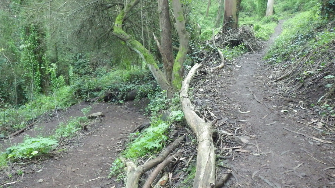
But today decided on the longer trail. Next two pix: just starting off above Farview, winding around on the south side (sixth pic). One of those not-done-this-in-a-while treks, this one is between Sutro Tower (seventh pic) and a residential street below, narrow and secluded, mostly forested. Shall we call it the "Tower Trail"?
Descended from the trail onto lower La Avanzada near Dellbrook. Crossed Clarendon here to Mount Sutro's Aldea Housing area.
Clarendon is another busy two-way street in need of a pedestrian overpass. There is the green-railed one a few blocks away (foot of Forest Knolls' Ashwood stairway into Midtown Terrace), but all along Clarendon traffic zooms around the curves and, like on Lands End's Point Lobos, mentioned the other day, drivers don't particularly enjoy having to slow down or stop for walkers. Today wasn't bad at all though and it helps that there are "islands" in the middle of Clarendon here.
Where Clarendon meets Johnstone near Adolph Sutro, headed uphill to the East Ridge Trail whose trailhead is across from the Aldea Community Center, switchbacking through the forest to the summit: Rotary Meadow.
Looping back down from the summit and a short distance on Medical Center Way (I like this street's older name "Upper Service Road" better) to the trailhead for the Fairy Gates Trail, the highest of the trails below the winding road. The other two lower trails are the Edgewood and the (lower) Historic. Took the Edgewood Trail (next two pics) out to the end of the street of the same name, then north two pleasant redbricked blocks to the top of the Farnsworth Lane stairway (149 steps): 10th pic. The swing is still here (last pic). Across from the top of the Farnsworth stairs is another trailhead into the forest.
https://www.facebook.com/groups/315910737009
Mt Sutro | Running About Writing
runningaboutwriting.blogspot.com
First up to Crestline via the #37 Corbett/Twin Peaks bus that stops at the top of the Vista Lane steps (several connecting stairways covering maybe three blocks) and the trailhead sign for 93 or so steep, uneven wood steps to Twin Peaks Blvd. in the park. First two pics: Trail on the right with Twin Peaks Blvd. on the left.
Normally start off these park-connector hikes with a narrow trail down from Twin Peaks Blvd. on the west side of Twin Peaks Park that I call the "Marview Trail." Or an alternate name could be the "Wild Onion Trail." You step over a guardrail onto an unmarked trail alongside Twin Peaks Reservoir (third pic) that comes out at Marview in the Midtown Terrace 'hood.
This is how the other blogger started down from Twin Peaks Park also. However, I usually take a shorter trail from here that takes me to the dead-end (for cars) of Palo Alto. An opening at the fence here will take the hiker to La Avanzada, the road that leads to Sutro Tower.
But today decided on the longer trail. Next two pix: just starting off above Farview, winding around on the south side (sixth pic). One of those not-done-this-in-a-while treks, this one is between Sutro Tower (seventh pic) and a residential street below, narrow and secluded, mostly forested. Shall we call it the "Tower Trail"?
Descended from the trail onto lower La Avanzada near Dellbrook. Crossed Clarendon here to Mount Sutro's Aldea Housing area.
Clarendon is another busy two-way street in need of a pedestrian overpass. There is the green-railed one a few blocks away (foot of Forest Knolls' Ashwood stairway into Midtown Terrace), but all along Clarendon traffic zooms around the curves and, like on Lands End's Point Lobos, mentioned the other day, drivers don't particularly enjoy having to slow down or stop for walkers. Today wasn't bad at all though and it helps that there are "islands" in the middle of Clarendon here.
Where Clarendon meets Johnstone near Adolph Sutro, headed uphill to the East Ridge Trail whose trailhead is across from the Aldea Community Center, switchbacking through the forest to the summit: Rotary Meadow.
Looping back down from the summit and a short distance on Medical Center Way (I like this street's older name "Upper Service Road" better) to the trailhead for the Fairy Gates Trail, the highest of the trails below the winding road. The other two lower trails are the Edgewood and the (lower) Historic. Took the Edgewood Trail (next two pics) out to the end of the street of the same name, then north two pleasant redbricked blocks to the top of the Farnsworth Lane stairway (149 steps): 10th pic. The swing is still here (last pic). Across from the top of the Farnsworth stairs is another trailhead into the forest.
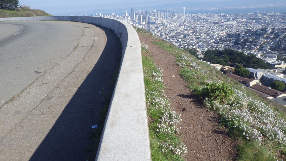
Twin Peaks Blvd. left; hiking trail right.
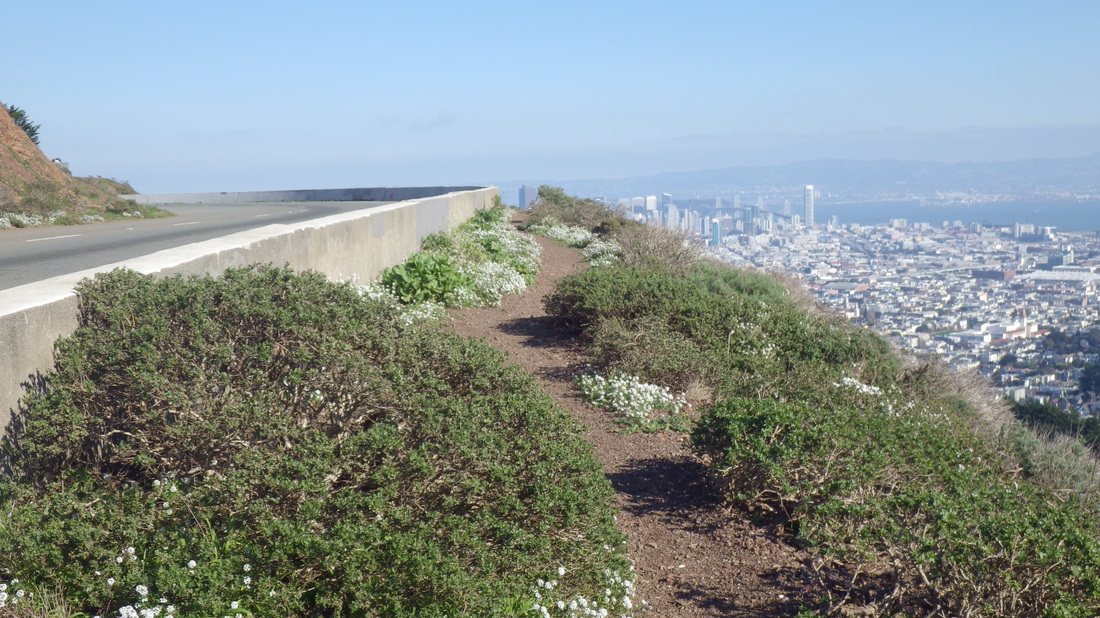
Trail next to Twin Peaks Blvd. Twin Peaks Park.
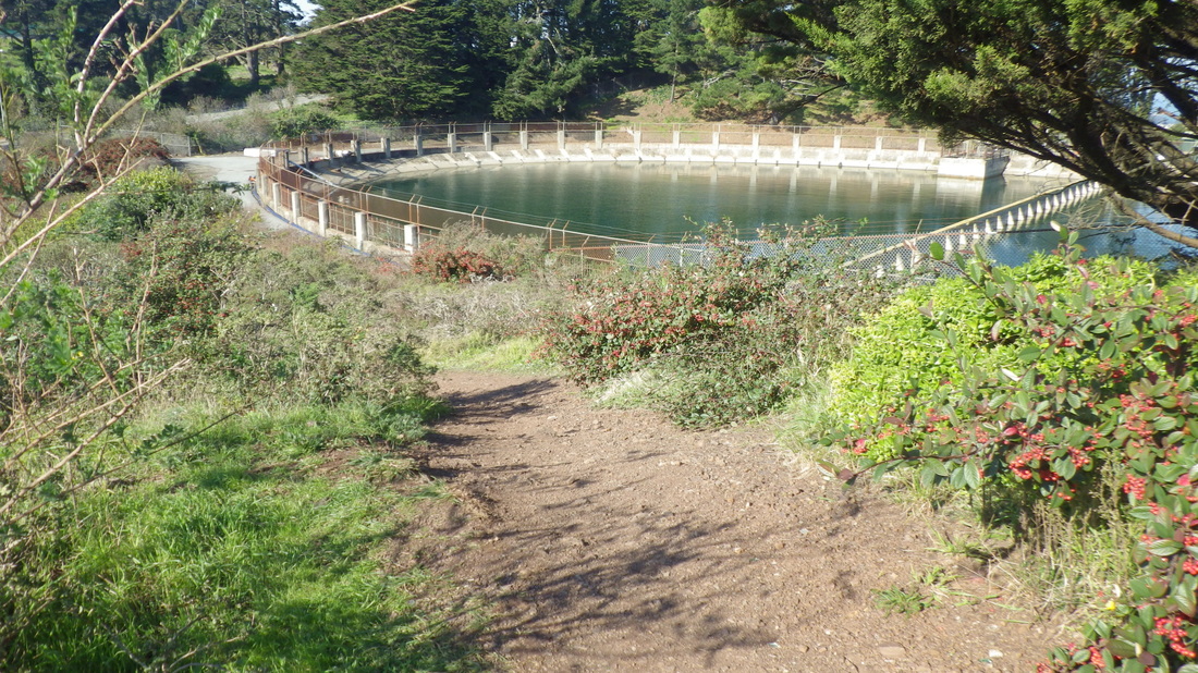
Twin Peaks Reservoir and trail down to Marview in Midtown Terrace
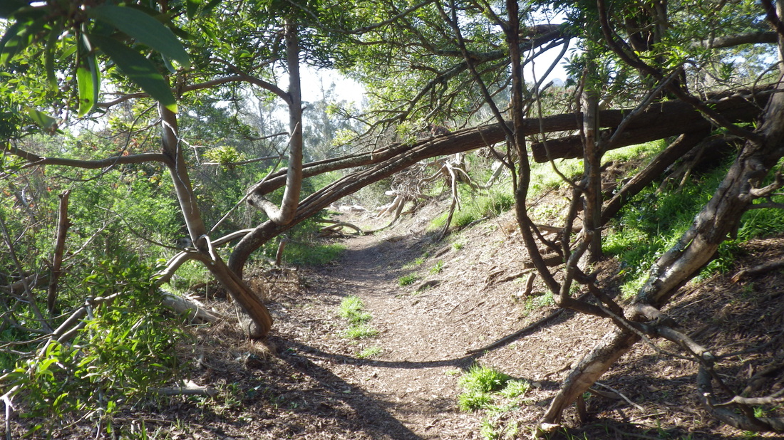
Up from Farview, trail around Sutro Tower
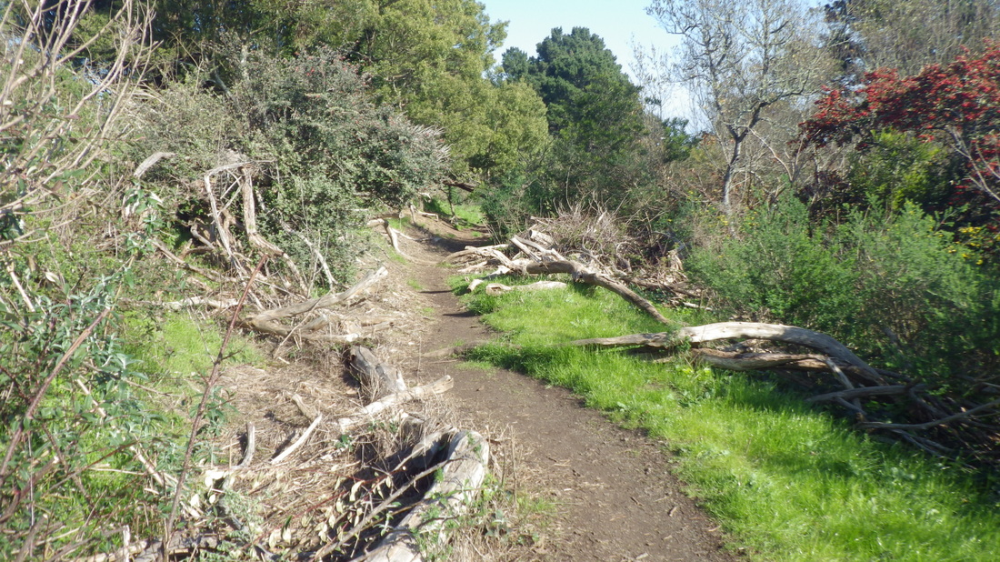
Trail around Sutro Tower, south side
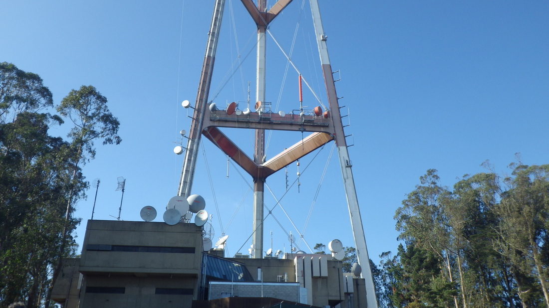
South side of Sutro Tower
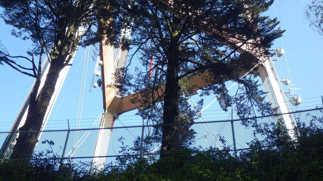
Sutro Tower's lower legs
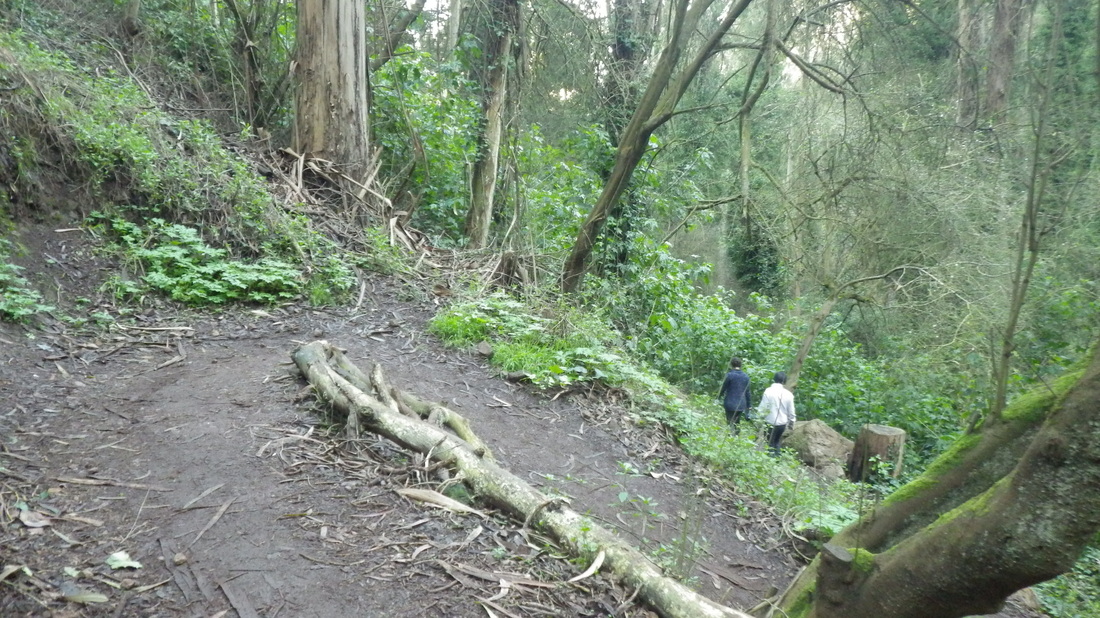
Edgewood Trail
Edgewood Trail
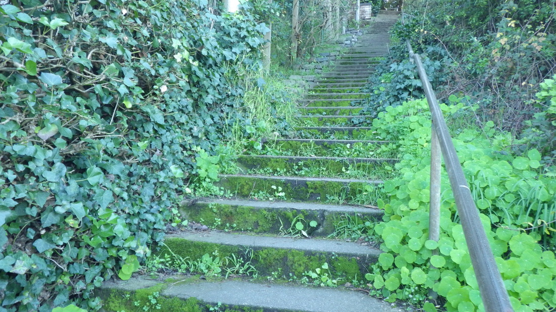
Farnsworth Lane, Willard to Edgewood
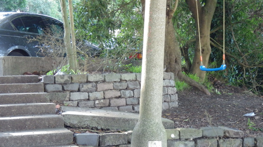
The swing at the top of the Farnsworth stairway
 RSS Feed
