McLaren Park is such a treasure that mere words do not do it justice; neither do pix. Go wander the trails, check out the public art stations, and do not rush: take your time.
I've always been especially enthralled with the trails south of divided Mansell (runs E-W through the park) with Visitacion Valley below and big sis San Bruno Mountain across. The steep, now velvety-green, slopes are crossed with multiple trails and wildflowers all over the place: First pic: One of my favorites. Can anyone tell me what flower this is? The trails are on the wild side and there aren't as many people over here as compared to other areas of this big park (318 or so acres).
While I haven't yet done the complete 2.7-mile Philosopher's Way loop around the park, did appreciate several delightful art stations on southside trails this time.
This is a public art project throughout SF's third largest park (after the Presidio and Golden Gate Park). I'd like to see all our larger parks follow this example. These "musing stations" are attractive granite markers about two feet high made from old city curbstones. The tablets atop the stands are beautifully etched with info, old maps, and photos relevant to the immediate area and are supposed to "encourage personal thought and contemplation." Took the nice clear cardboard map I got at the SF History Expo but didn't use it, preferring just to meander along and discover on my own.
Read more: http://www.sfgate.com/entertainment/article/Art-nature-converge-at-Philosopher-s-Way-4074553.php#ixzz2NSpk7gkQ
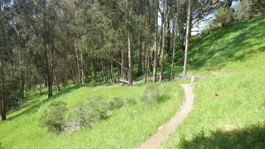
Off the #29 at Brazil, a short distance into the park's west side from the top of the Excelsior 'hood, and over the guardrail to descend from Mansell for one of the unmarked skinny-dirt trails, passing alongside the foot of the green tanks. Second pic: multiple forested trails.
The first of the musing stations seen was a photo of Martin Luther King's appearance at the Cow Palace (1961).
http://www.sfartscommission.org/pubartcollection/pubart-press-releases/2012/12/26/dedication-philosophers-way-a-new-public-artwork-in-mclaren-park
Quoting all of the entire second infoplaque admired:
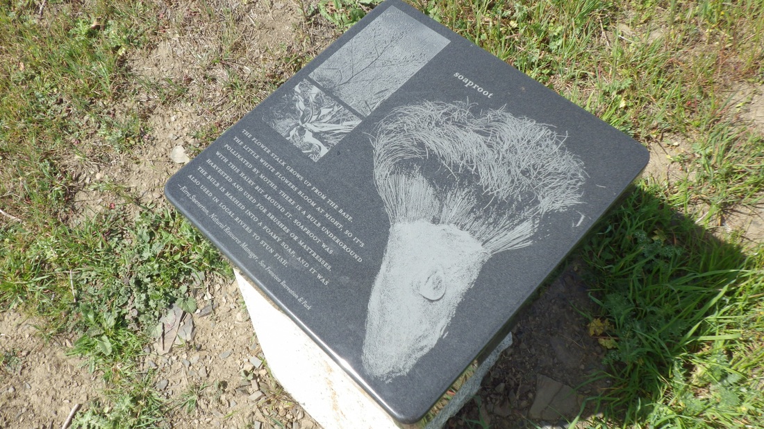
"The city is a kind of sea, with hilltop islands of wild space. The native grasses that survive in these harsh conditions are hundreds of years old, older than most of the trees in San Francisco. During the rainy season months the tops grow tall and in the summer they dry back to a little tuft. The roots, nearly 16 inches deep, don't die, they pull back and deposit a little organic material into the ground so over thousands of years they have built the rich topsoil." (Contributed by Kirra Swenerton, Natural Resources Manager, San Francisco Recreation & Park).
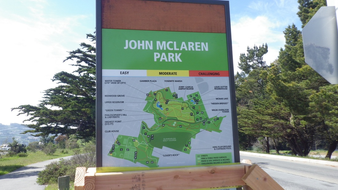
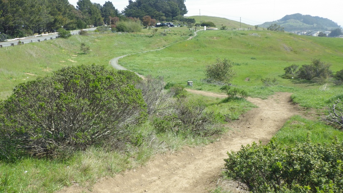
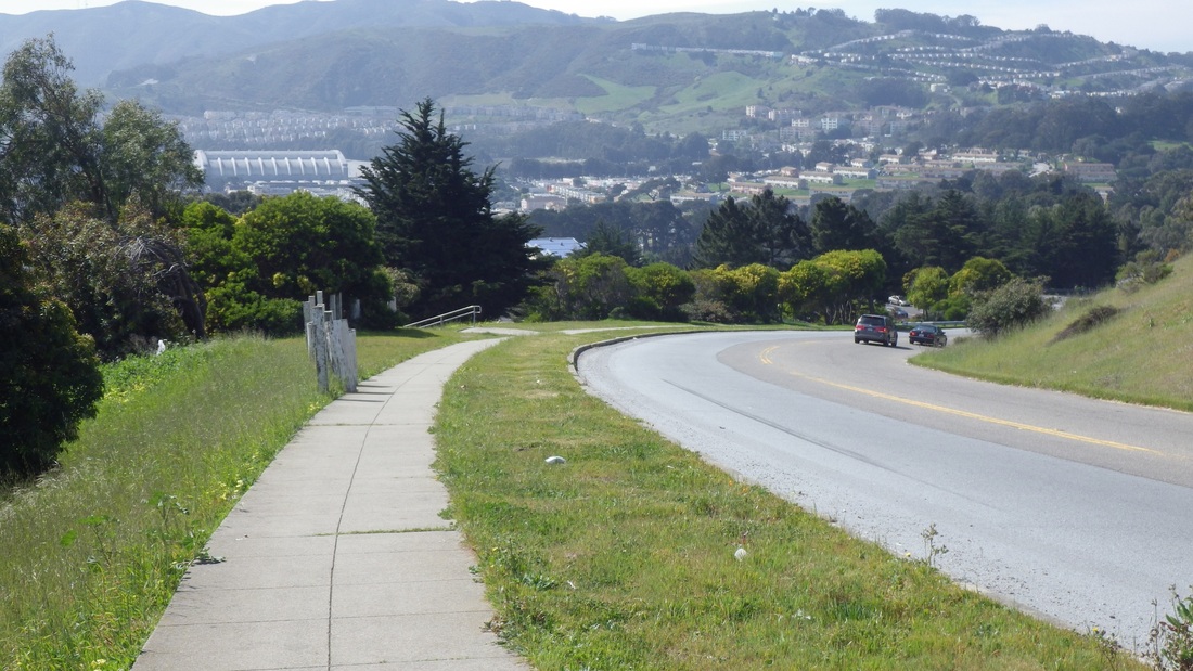
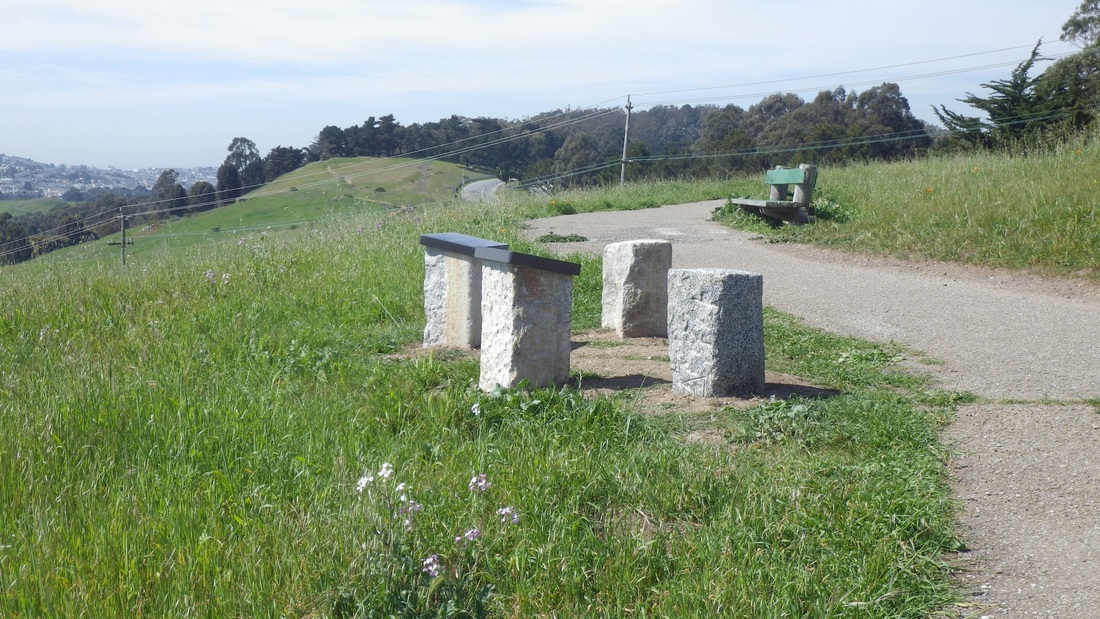
A colorful new trailmap (third pic) has been erected at Mansell and the Wilde Overlook parking spot at the top of Visitacion Ave. Coming into the parking area from the sunny openspace trail I was on is a larger Philosopher's Way infosculpture I hadn't seen before either. Fourth pic: Center, near top.
The third artstation passed provided info on the soaproot herb, a member of the onion family, for which the Ohlones had many uses, including brushes, soap, medicine, glue and food. Fifth pic.
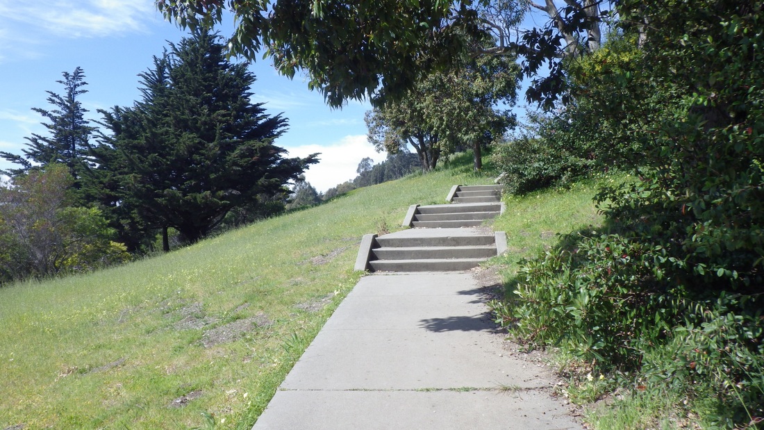
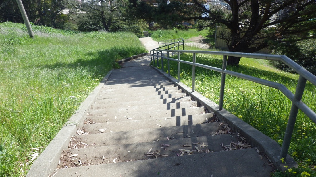
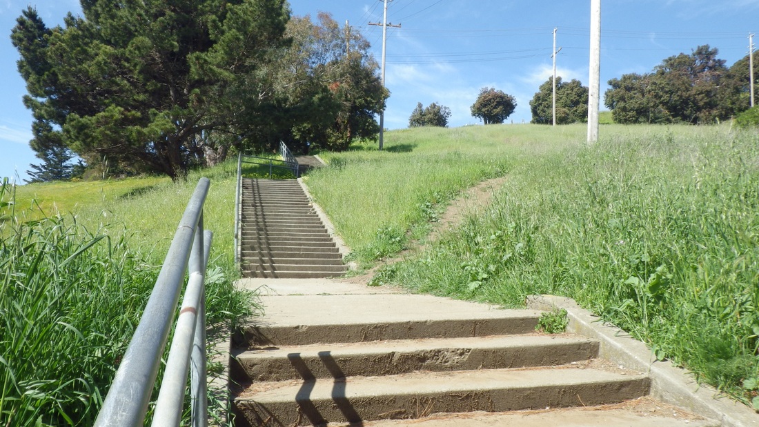
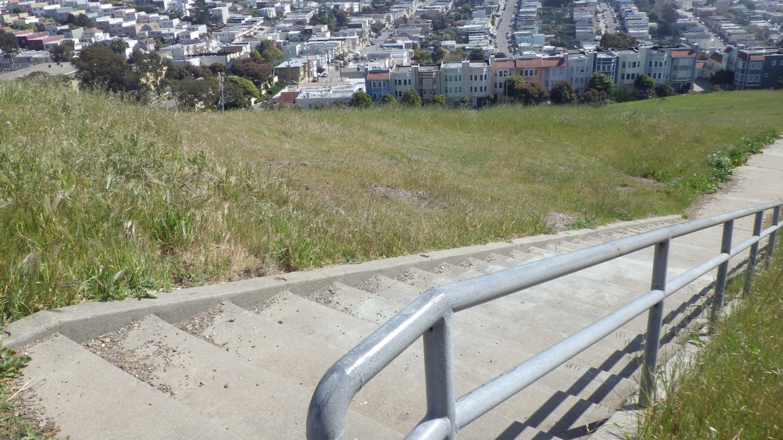
Naturally when I reached Visitacion Ave. had to do the long (195 steps: pics 6, 7, 8) stairway I highly recommend to everyone who'll listen that starts up from the west dead-end of Campbell in Vis Valley and comes out at Visitacion Ave. in the park.
I've always been especially enthralled with the trails south of divided Mansell (runs E-W through the park) with Visitacion Valley below and big sis San Bruno Mountain across. The steep, now velvety-green, slopes are crossed with multiple trails and wildflowers all over the place: First pic: One of my favorites. Can anyone tell me what flower this is? The trails are on the wild side and there aren't as many people over here as compared to other areas of this big park (318 or so acres).
While I haven't yet done the complete 2.7-mile Philosopher's Way loop around the park, did appreciate several delightful art stations on southside trails this time.
This is a public art project throughout SF's third largest park (after the Presidio and Golden Gate Park). I'd like to see all our larger parks follow this example. These "musing stations" are attractive granite markers about two feet high made from old city curbstones. The tablets atop the stands are beautifully etched with info, old maps, and photos relevant to the immediate area and are supposed to "encourage personal thought and contemplation." Took the nice clear cardboard map I got at the SF History Expo but didn't use it, preferring just to meander along and discover on my own.
Read more: http://www.sfgate.com/entertainment/article/Art-nature-converge-at-Philosopher-s-Way-4074553.php#ixzz2NSpk7gkQ
Off the #29 at Brazil, a short distance into the park's west side from the top of the Excelsior 'hood, and over the guardrail to descend from Mansell for one of the unmarked skinny-dirt trails, passing alongside the foot of the green tanks. Second pic: multiple forested trails.
The first of the musing stations seen was a photo of Martin Luther King's appearance at the Cow Palace (1961).
http://www.sfartscommission.org/pubartcollection/pubart-press-releases/2012/12/26/dedication-philosophers-way-a-new-public-artwork-in-mclaren-park
Quoting all of the entire second infoplaque admired:
"The city is a kind of sea, with hilltop islands of wild space. The native grasses that survive in these harsh conditions are hundreds of years old, older than most of the trees in San Francisco. During the rainy season months the tops grow tall and in the summer they dry back to a little tuft. The roots, nearly 16 inches deep, don't die, they pull back and deposit a little organic material into the ground so over thousands of years they have built the rich topsoil." (Contributed by Kirra Swenerton, Natural Resources Manager, San Francisco Recreation & Park).
A colorful new trailmap (third pic) has been erected at Mansell and the Wilde Overlook parking spot at the top of Visitacion Ave. Coming into the parking area from the sunny openspace trail I was on is a larger Philosopher's Way infosculpture I hadn't seen before either. Fourth pic: Center, near top.
The third artstation passed provided info on the soaproot herb, a member of the onion family, for which the Ohlones had many uses, including brushes, soap, medicine, glue and food. Fifth pic.
Naturally when I reached Visitacion Ave. had to do the long (195 steps: pics 6, 7, 8) stairway I highly recommend to everyone who'll listen that starts up from the west dead-end of Campbell in Vis Valley and comes out at Visitacion Ave. in the park.
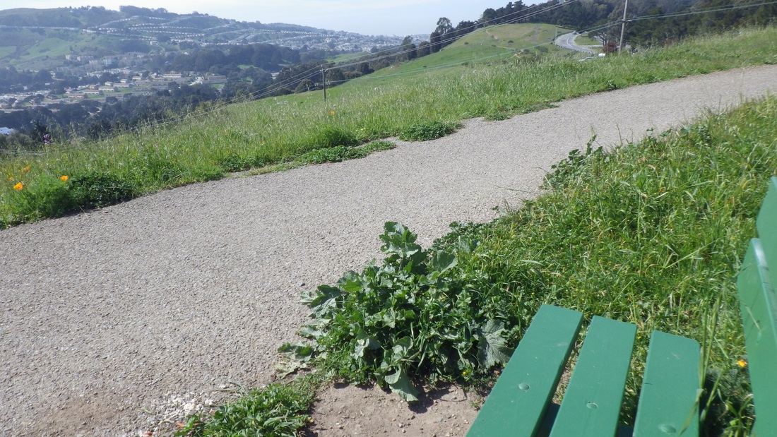
This time as I was heading back up the stairs veered off onto a supersteep unmarked dirt trail that's, to use a descriptive term from the new map, "challenging," to say the least: ninth pic. When I finally made it to the top of this, in the pleasing company of butterflies, bees 'n bumblebees, was greeted by a main trail with benches and a few more infoplaques to view: Pics 10, 11.
… "Valley from McLaren Park, 1910" by Frank Taylor, Visitacion Valley resident: "I was born in the Valley…"
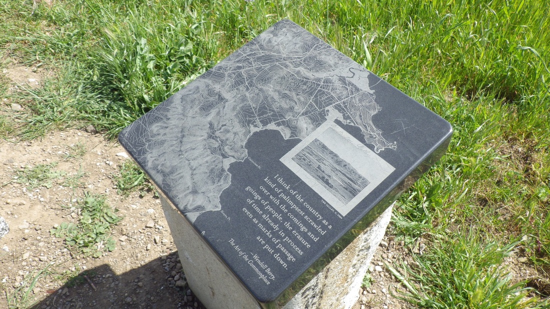
… "Visitacion Valley 1900" (Wendell Berry, The Art of the Commonplace), 12th pic, and
… "When Visitacion Valley was settled … Here at the top of the hill was the reservoir that fed the Spring Valley pumping station below on Leland Avenue …" (Betty Parshall, Visitacion Valley resident).
http://www.sfgate.com/bayarea/article/VISITACION-VALLEY-Neighbors-preserve-lore-and-2724252.php
Just past these is the top of the second southside stairway. This doesn't have as many steps (about 57) because the lower part, up from Ervine in Vis Valley, is a winding trail:13th pic.
Further along to the east were older, rustic benches, several picnic tables, and a critter sighting: a little lizard, last pic. This is near the old observation tower near the east edge of the park near University Ave. and the top of the Portola 'hood. (South of Mansell starts the upper Visitacion Valley neighborhood).
… "Valley from McLaren Park, 1910" by Frank Taylor, Visitacion Valley resident: "I was born in the Valley…"
… "Visitacion Valley 1900" (Wendell Berry, The Art of the Commonplace), 12th pic, and
… "When Visitacion Valley was settled … Here at the top of the hill was the reservoir that fed the Spring Valley pumping station below on Leland Avenue …" (Betty Parshall, Visitacion Valley resident).
http://www.sfgate.com/bayarea/article/VISITACION-VALLEY-Neighbors-preserve-lore-and-2724252.php
Just past these is the top of the second southside stairway. This doesn't have as many steps (about 57) because the lower part, up from Ervine in Vis Valley, is a winding trail:13th pic.
Further along to the east were older, rustic benches, several picnic tables, and a critter sighting: a little lizard, last pic. This is near the old observation tower near the east edge of the park near University Ave. and the top of the Portola 'hood. (South of Mansell starts the upper Visitacion Valley neighborhood).
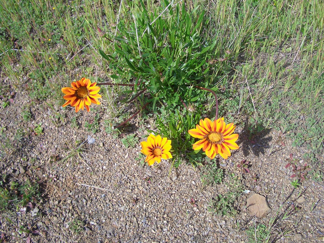
1. What is this flower called?
2. South of Mansell, west side of park
3. Park Map at Wilde Overlook, Visitacion & Mansell
4. Mansell left. Wilde Overlook Parking with new "Philosopher's Way" plaque upper, center.
5. Art station (Soaproot herb) along Philosopher's Way
6. Top of stairway left, off Visitacion Ave.
7. 195 steps from Campbell to Visitacion Ave.
8. Long stairway from Visitacion Ave. down to Campbell in Vis Valley
9. Steep trail up from stairway to a main trail
10. Top of steep trail at a main trail
11. Top of steep trail at a main trail
12. Another musing station on Philosopher's Way trail
13. Shorter stairway and trail down to Vis Valley 'hood
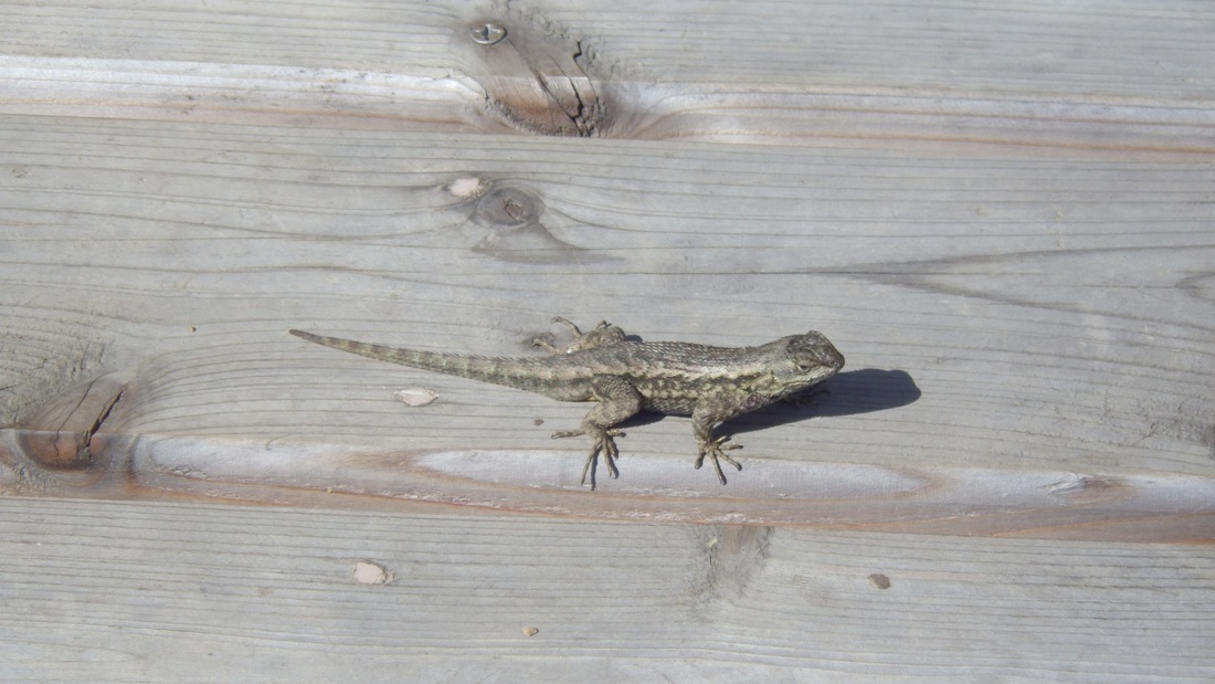
14. Benchlizard
 RSS Feed
